A previous article on this (see here) created a significant level of interest and useful feedback, including from BBC Rado Scotland Drivetime and Radio 4 researchers.
The message from the post above was that the pinewoods will grow back. The recovery may not be uniform, and there may well be areas of contraction or wider environmental degradation, but it is quite likely that much of the burned area may regenerate back better than it was before. Both pinewoods and heather moorland have evolved to cope with fire, and indeed, it is an essential tool in achieving their renewal.
But what to do between now and then until that happens?
In the very short term, after the fire is finally out, there is no doubt that the amenity of the area will have been very severely impacted, but as time goes by, and vegetation starts to come in again, that process will in itself be interesting to people. So, it is important to COMMUNICATE what is going on and to make a priority of doing this. Any dead or damaged trees near paths will need to be felled and made SAFE.
Beyond this, nature should be left to take its course, and people should not be spending money on little projects designed to make it look as though they are doing something. Maintaining deer levels at or around their current levels should allow recovery to take place, albeit with a bit of refocusing of effort as required when things start to grow. Then, allow for TIME to do its work.
The priority management consideration is in making sure all this simply cannot be repeated again in another 20-30 years. If the pinewoods are the signature habitats of the area, then regenerating them is inevitably going to allow the fuel load to increase again. We cannot deny them their right to exist, but we have to accept the hazard that we are creating as they develop. What we can do is divide them up in to management blocks that are separated by appropriate fire breaks, so that if an area burns again, the extent of the fire can be restricted to a few hundred hectares at maximum, and that we do not see big 2500- 3000 ha fires as we did this time. We were lucky it was not much bigger.
Many people looking at the most recent fires acknowledge that this could have been much worse. The wind direction could have been different, and we got rain at key times. This is simply down to luck. It was also the case that while it was burning, that this was the only significant wildfire in Scotland. If we had multiple fires in different locations around the country, it would have been much more difficult to deal with. It could have been the case that helicopter priority was needed elsewhere. Eg If houses were at more immediate risk. We cannot assume that the Cairngorms would take priority over somewhere else.
The surprise that arose to me from this fire is that in the Cairngorms Connect area which defines the core of the park, you have Scotland’s largest landowner (FLS, also our best resourced public landowner), Scotland’s largest private landowner, one of Scotland’s largest and richest NGOs (RSPB) and the regulator, NatureScot, also owning land there. You also have the UK’s largest national park, overseen by an authority who see land management and woodland regeneration as being core to their very being. And yet, the co-ordinated response was poor. Obviously, people got there in the end and we thank them for that, but managers were not ready for this, and that has been exposed very effectively and brutally. Fire is brutal. It does not care about your opinions or feelings, or your hopes and aspirations. Fire will take everything you present to it. There is no sentiment about it. It must be recognized as a dangerous threat.
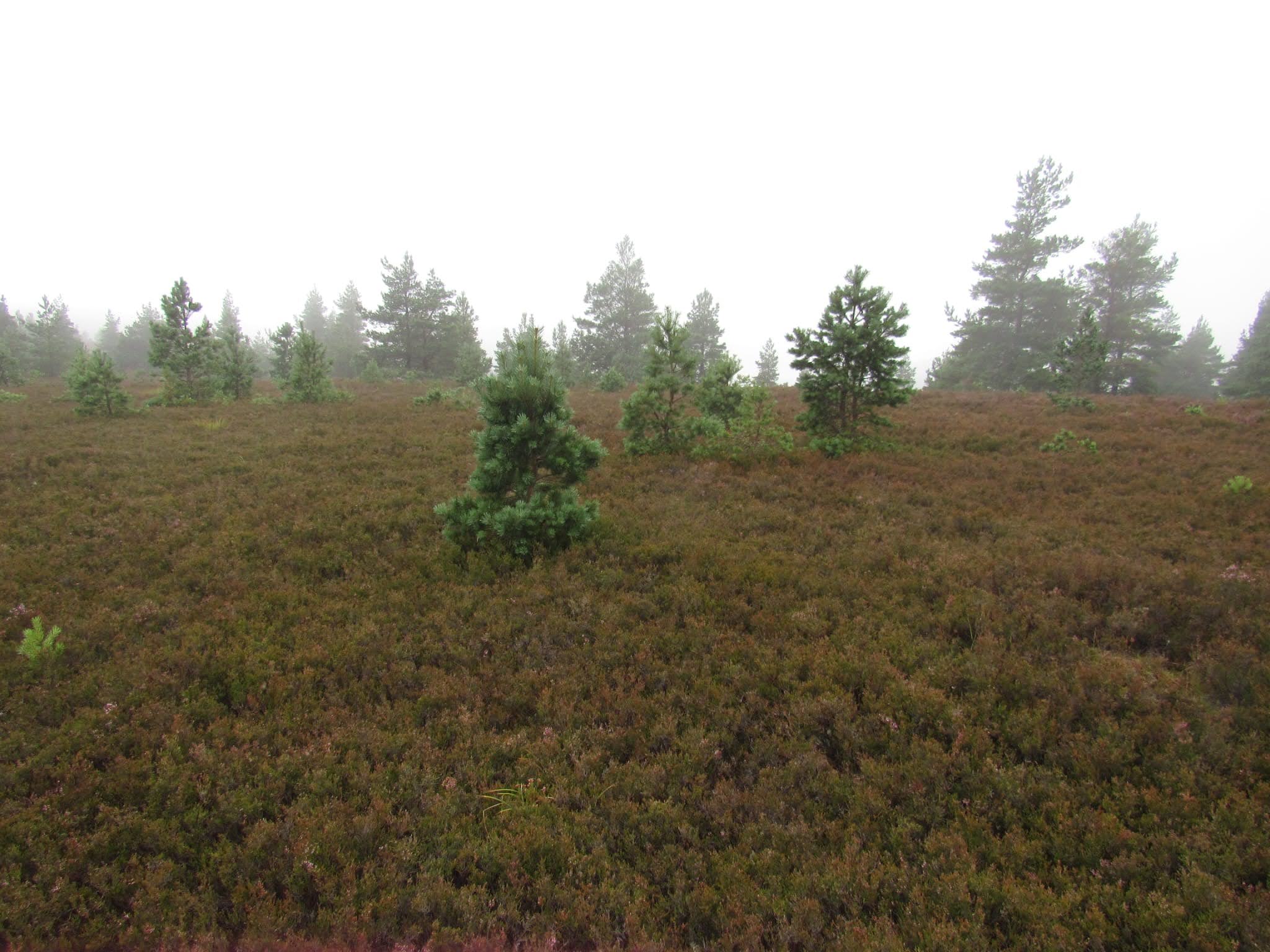
Fire breaks are areas that are wide enough to either prevent a fire from crossing, or where the vegetation is short enough so that a fire can realistically be controlled, or where staff can access quickly to back burn in to. Such areas can be maintained by burning, swiping or grazing. Obviously, burning creates a hazard in itself, and requires the skill set to do it. Swiping may be possible, but it depends on terrain. Grazing is probably more versatile, but animals need to be sourced and managed. With burning and swiping, you are trying to keep heather at 7- 10 years old maximum, so that any flames are not above head height. These areas need to be kept free of trees. With grazing, you are deliberately over- grazing the area, turning it to grass, and keeping it short and green to prevent a fire passing. You may need a combination of sheep and cattle to do this. It is possible that wetland areas can help as well, but only if they sustain vegetation that does not burn.
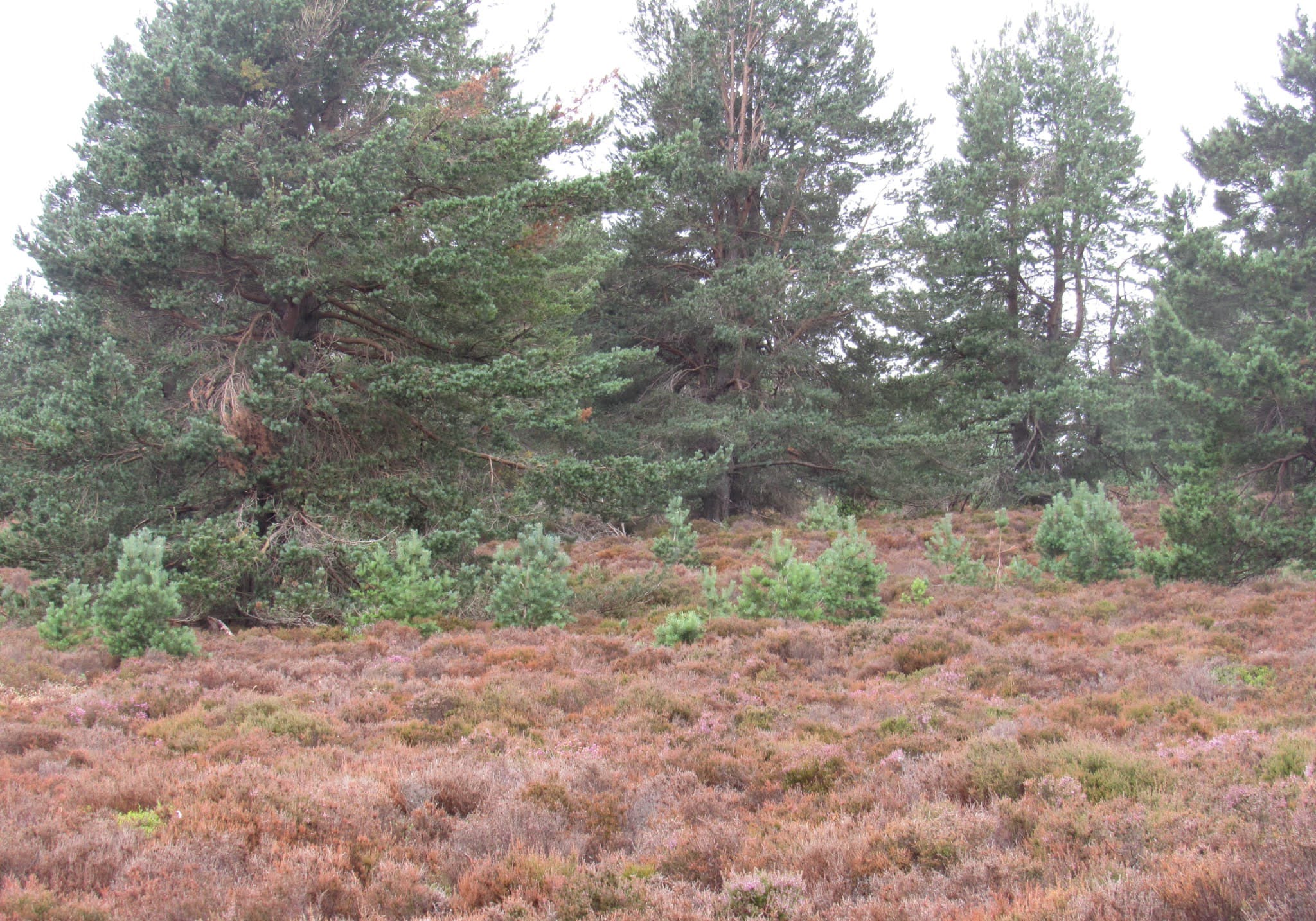
Fire breaks do not need to look unnatural within a landscape, but they do force you to examine your overall ethos of managing land, and compromise a bit to make safe the pinewoods that you do have. With very large areas of land that are not broken up in some way, there is nothing that you can do. With at least some areas of less flammable vegetation within the landscape, you are giving yourself a chance. You do have to be able to access these areas, so maintaining hill roads to allow people to get there quickly is essential.
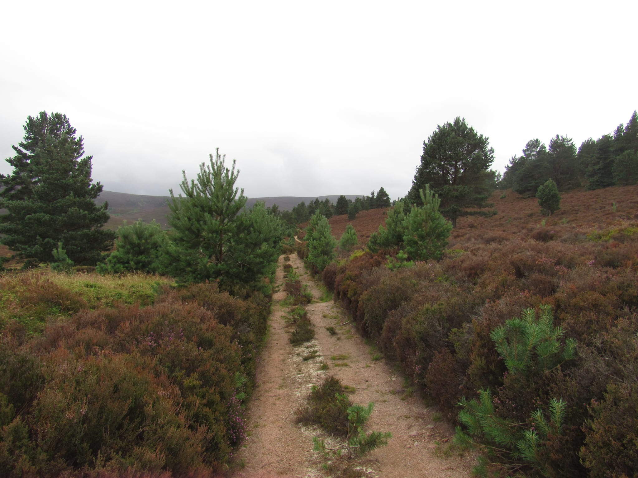
Fire breaks can add diversity to a landscape. They allow for easier access, and better deer control. They can help frame views, and they can help maintain species that require shorter vegetation. If grazing is used, then they allow for production, which helps with longer term sustainability.
It should be said with all this that many people will give you the impression they know what to do when a fire breaks out, and then things look very different when something actually does happen. In my experience, the level of urgency given to planning around this is very low, and often very superficial. The urgency is only there when it happens, but by then it is too late. Only then do you find out if you were really prepared or not.
What to do?
It is inevitable that we will see more fires in the future. Within the Cairngorms, we can educate people and provide a ranger service, but over a 30-40 year period, the risk of a fire happening in a given area is high. So, we cannot just assume that we can prevent all wild fires. What we can do is break an area up so that fires can be contained and do not become genuinely landscape scale. In the cold light of day, we have been very lucky that this one was not a lot larger than it actually was.
Taking the Cairngorms, that thinking needs to be applied to the whole park area, not just the area that burned this time. It needs to be done quickly now, or the conversion process at least started quickly.
Appropriate levers must be used. The most obvious of these would be to deny all properties (public, private and NGO) access to public funds for land management until proper wildfire plans are in place in high risk areas. That is something that government can do now.
I am not sure what the set up in the Cairngorms is now, but when I worked on Deeside, we had the South Grampian Forest Fire Protection Group. An important element to that was that all personnel attending a fire response would do so at an agreed hourly rate for staff of different types, and for different equipment. If this does not already exist, we need an agreed list of rates across the park area. What this does, in my opinion, is that it then treats everyone as professionals with an acknowledged value. It also allows us to see what fighting a fire has truly cost, and it focuses the minds of land managers on that cost. Doing so might then force them to take the necessary steps that would allow some-one in the future to keep a fire constrained within acceptable boundaries.
Finally, there is a role for government in all this. It is a matter of national importance, not just an inconvenience that takes people away from something more critical. The USA, Canada and most EU countries have a capacity for effective wildfire response from our public authorities. We do not. There needs to be a way of maintaining helicopters and other necessary equipment, available for lease or use for other purposes, but where the default function is wildfire suppression as required. We need a capability to tackle multiple fires around the country, not just individual incidents. There will be a cost to doing this, but the investment in woodland creation is massive, and the carbon cost of getting these things wrong is also huge. We do need to protect the resource we have.
If we do not address this, multiple fires over time will simply erode our confidence that we should be growing these forests at all. Insurers will conclude it is too risky. Government will conclude it is too risky. Many owners and perhaps the public will conclude it is too risky. The balance will tip back towards a more open landscape, and then people will recognize something that they perhaps had never thought of before. It is not just grazing that maintains our open landscapes, but fire is a big part of that too, and perhaps even more so.
Imagine you are a land manager who has spent a significant proportion of your working life in a given area, and invested much of your energy and aspirations in to achieving pinewood and wider habitat recovery. Would losing it all be too much of you to bear? If so, then you need to use your position to do something about it. Assume that the worst could happen to you. It can happen at any time, and you have to be ready for that. You do not have to compromise your pinewood vision, but you do have to adapt a bit so that you do not lose it all.

great article: loads to agree with, and loads to pick apart….
Quite a lot to consider there. It’s amazing how few sheep can decimate tree regen, especially broadleaves. Cattle less destructive, but at what density to preserve regen? Hope there won’t be too much preciousness if/when there’s mass regen of willow instead of the expected pine and birch. With such warm summer and now wet bare ground, we might even get some aspen regen. Here’s hoping
Sheep would have to be actively managed and kept within certain boundaries……. temporary fencing or whatever. Nothing wrong with plenty of native broadleaves in a pinewood. Been saying that for 40 years now.
there is absolutely no place for sheep in the ecology of a native pinewood and certainly not in a national park, but of course it’s not a real national park in the first place. Cattle, pigs and deer are of course a different story. However, as you know I have shared similar views to you on broadleaves for at least as long as you will be aware from my participation with the Loch Garry Tree Group and Scottish Native Woods.
There may be a role for sheep if we dont want the pinewoods to burn again, by keeping certain areas grazed down to the ground so that they cannot transmit a future fire.
as Andy Amphlett has pointed out even a public road with no vegetation growing on it failed to act as a firebreak, so I don’t see how sheep nibbling is going to do any better. Now, beavers , there’s a different prospect.
Nick has now picked up on the potential for beavers in creating riparian firebreaks. I’ve posted photos from American examples on Twitter X. Needless to say some of the riparian section of the land monopoly cabal will not sit easily with this concept, but I won’t shed any crocodile tears over that.
Informative article, excellent analysis, and robust suggestions/recommendations. Hope Victor is on any Independent Inquiry team, or certainly a consultee, when it comes to putting the Lessons Identified and Recommendations together following this catastrophe. These Lessons must be embedded in current landowners’ and other estate plans so that they can be implemented when the next conflagration flares up in the Highlands, as it undoubtedly will. Cairngorms Connect partners number several multi-million pound businesses, underwritten by the odd billionaire or two. Between them they undoubtedly have the wherewithal to invest, collectively, in more firefighting resources and training. Moreover, their firefighting plans clearly need to be closely coordinated, so that cross-boundary wildfires can be tackled in the most effective and efficient fashion, and in the most timely manner, irrespective of cause or geographical location. With stewardship of such precious landscapes comes responsibility. We owe it to the local community, all those emergency services personnel, volunteers, estate workers, gamekeepers, contractors and other members of various organisations who helped tackle the inferno, and to those who supported them, to give them all the most effective tools, training and future support that is available. (Please delete the previous 2 attempts to get in a readable format)
We can only imagine, since we don’t have one, if this had happened in a real national, instead of an ersatz one and there was a single organisation ie National Parks SERVICE responsible and accountable for the before protection and aftermath reaction.
Good stuff Victor, I have only read through it once but will again. First impressions were for sure burning to create grassy areas would be a good thing. I am sure these grassy areas would help to take the pressure off the regen’ areas, with ongoing deer control. It would also provide areas that would attract deer and therefore make it easier to control deer.
Ultimately they would stop or help to stop a wildfire.
Thinking along Commercial Forestry plantations rather than the regeneration areas we see burnt to a crisp in the many photos from the fire. Something in my forestry career I used to constantly request from Foresters in charge of various plantations I looked after was deer lawns. Often falling on deaf ears.
Also wider firebreaks between stands, that should be mowed, with ATV access and trees not planted too close to the deer fence that the branches often reached not long into its life. But again everything was planted to the max in my day.
Maybe there will be a new thinking after this fire, I hope so.
Last thought, in the pictures from the fire, I see whole trees burnt out, instead of the fire ‘ripping’ through which it did, it tells me that the fuel load must have been great to have caused old Pines to burn in such a way.
Heat seeking binoculars have made the need for Deer Lawns for Deer Stalking redundant – now, people are forgetting the purpose that Deer Lawns & forest mosaics (grazing and water next to shelter) actually served, including fire breaks.
Thanks Victor. A few thoughts:
1). “as time goes by, and vegetation starts to come in again, that process will in itself be interesting to people. So, it is important to COMMUNICATE what is going on and to make a priority of doing this”. I wholeheartedly agree. So what should future communication encompass? Well, more than 3 weeks on from the start of the fire there is still no publicly accessible map that shows the extent of the fire. The Glenmore corridor reopened on Friday 7 August, and the CNP have made available a map – https://cairngorms.co.uk/news/glenmore-corridor-to-reopen – showing areas where access is still restricted. This covers a much larger area than the area burnt. A map should be prepared and published similar to this one for the Carrbridge / Dava Moor fire in 2025 – https://www.scottishwildfireforum.co.uk/newspost/swf-statement-on-morayshire-wildfires. Once a map of the burnt area is available, an objective assessment of the impacts on habitats and species should be made. Currently no one who has not been directly involved in tackling the fire has any sort of overview of what the impacts have been. I am sure RSPB and FLS will be doing this work, but they need to remember to make the detailed results available to all interested parties and individuals.
Graham Niven (freelance photographer from Nethy Bridge) has posted 65 photos of the Abernethy / Glenmore fire on his Facebook page – https://www.facebook.com/nivenphoto/photos. Yes, some show the devastating impact of the fire on old pines and tree regeneration, with likely very high mortality. But other photographs show the opposite with many mature trees in burnt areas with most or all of their crowns green. However, it must be remembered that these photos are not a representative sample of the whole burnt area.
It is no surprise that areas of tree regeneration (mainly Scots pine) have been severely impacted. Forest expansion in some areas will have been set back several decades. The loss of mature pines outwith the core forest, key seed sources for forest expansion, is a significant loss. In contrast it appears, from the limited photographic evidence currently available, that loss of mature trees in woodland is patchier, and many appear to have survived. Hopefully that is the case.
2). “Any dead or damaged trees near paths will need to be felled and made SAFE”. Ideally trees would be pulled or pushed over, rather then felled, but that work will no doubt be carried out as quickly as possible. Away from the vicinity of well used tracks, leave well alone.
3). “Beyond this, nature should be left to take its course, and people should not be spending money on little projects designed to make it look as though they are doing something. Maintaining deer levels at or around their current levels should allow recovery to take place, albeit with a bit of refocusing of effort as required when things start to grow. Then, allow for TIME to do its work”. In an area of such high nature conservation value this is an important message. It will take several years to gain a proper understanding of the fire’s impacts on species and habitats, and to make even a provisional assessment of how the habitats and species are recovering.
It is reasonable to expect significant regeneration of Scots pine, but that will take time. Any conclusions as to the density and distribution of pine regeneration in less than, say, 20 years would be premature. Within the burnt area at Abernethy there has been planting of broadleaf tree species in recent years. We don’t know if any of these have survived the fire, or will regrow. Planting here is controversial, and there are arguments for and against this type of intervention. A much less interventionist approach would be spreading locally collected seed of wind-dispersed tree species, eg. Downy Birch, over some of the burnt areas, where remote from seed sources. There are already trials elsewhere using drones to disperse tree seeds.
Victor discusses firebreaks at some length. I don’t have the on the ground experience to critique this in detail. But, each time I drive from Strathspey over Dava Moor to Nairn or Forres, I am struck that the 2025 wild fire swept across 3 main roads, that should have been (I’d have thought) perfect firebreaks.
The experience on Dava, and at Abernethy / Glenmore shows that most moorland and woodland in the CNP has the potential to burn, irrespective of management history, and that at risk areas extend above the potential natural tree line, with serious implications for development of subalpine scrub and not just woodland.
great post Andy
Victor, might you have further intelligence on the status of wildfire fire risk modelling in Scotland?
Nations like Canada appear to have well established wildfire modelling built on a set of national criteria that integrate elements like fire weather, fuel conditions, and ecological effects, To these indices they can add terrain and around 15 -20 types of fuel mix. Relative to Canada, Scotland and the CNP is a much smaller area which could make modelling more precise and pontentially more effective I would suggest.
For the CNP there is already a mass of open source GIS based data on vegetation (fuel) types, soils ( organic /peat) , terrain, weather records ( Met station at Achantoul I think) etc. Daily checking of snow state is applied in Scottish avalanche forecasting, In the CNP and other locations, vegetation and soil dryness and moisture levels could be collected almost daily at certain times and fed into the model. Under the new licencing muirburn and peat depth will have to be mapped and recorded too. We have other boundaries and jurisdictions that can be mapped to involve land owners and public bodies. Like as avalanche forecasting has demonstrated, this could enhance public messaging. More businesses may need to take out business continuty insurance if they are in higher risk zones. I’m sure some will already be checking their property insurance against fire more closely now! Job descriptions may also be ammended.
Running different scenarios and predictions through the model with different variables would highlight landscape level risk components – hazard, vulnerability etc. Factor in recreational pressure ( ignition potential) and settlement/property fire break proximity and effectiveness (width, fire intensity, speed etc) . And increasingly carbon and particulate matter emissions simulations ( down wind public health concerns were evident during the Abernethy fire). For a given set of variables this would then allow for the triage of both fire prevention patrols (in key places at key times) and in the event of a fire – faster resource response and priority allocation. All assuming a more integrated command and control system is worked out!
Mapping appears to show that Dava and Abernethy fires both followed tear drop type patterns with stop lines and a peripheral squeezing being applied. Although, intially, the Abernethy fire burned west – up and out of Strath Nethy over the ridge into Glenmore before the wind picked up from the west and drove it to the east. Dava was two separate fires that joined to make the mega one – mostly burning south west to north east. . More than one fire point in the CNP and others wider afield at the same time, would really stretch available resources.
Post fire recovery monitoring may also benefit from some kind of modelling too and this could be incorporated as burnt sections will, intially at least, have a smaller fuel load, although that could change quite quickly dependent on regeneration rates.
We will never have enough resources once a fire or fires are established and winds picks up so, after resilience and prevention – speed of response, targetted resource deployment and intelligent use of dynmaic modelling to contain or extinguish has to be fore most in my opinion.
Since this national park is not actually national and there is no real equivalent to the national park SERVICE found in other boreal countries to carry out the worthy suggestions you’ve made, we instead rely on an eclectic mix of private sectional vested interests and the NGO-Quangocracy
Yes Duncan – this work is being done by Rory Hadden of the James Hutton Institute- comparing the Canadian Model with British Soil/ Vegetation/ and Fuel types. Google Fire Danger Rating System James Hutton Institute. 2021.
Yes Duncan – this work is being done by Rory Hadden of the James Hutton Institute- comparing the Canadian Model with British Soil/ Vegetation/ and Fuel types. Google Fire Danger Rating System James Hutton Institute. 2021.
Yes Duncan – this work is being done by Rory Hadden of the James Hutton Institute- comparing the Canadian Model with British Soil/ Vegetation/ and Fuel types. Google Fire Danger Rating System James Hutton Institute. 2021.
For particularly precious areas, I suggest we really need wet firebreaks, rather than just dry ones. There are such (very unobtrusive) fire mains pre-installed in the old-growth remnants in Yosemite for example
It would be relatively straightforward and cheap to lay HDPE fire mains along critical gravel roads – just trench and bury the pipe. At intervals, pre-install take offs where agricultural field watering sprays could then be installed. If/when incident occurs, install the spray nozzles, connect emergency pump at pre-planned water location(s) and switch on. Very rapidly you could then saturate and create say ~50m wet corridor along such the road. Such a main could also supply water to support mobile fire fighting supply without tankering from distant water sources.
Imagine the operational difference if say the Glenmore – Ryvoan – Forest Lodge road had had such a system installed and ready on the day the fire started?
This is all about realistic and professional preparedness to protect precious environments. I do not believe we necessarily need to, or should, revert to previous practices of muir burn and/or extensive additional firebreak networks. As argued by Duncan up-thread, what is required is proper modelling, planning, risk assessment and preparation.