“Our landscape is a national asset and we believe that it should be treated with care and respect so that future generations have the opportunity to enjoy it. We encourage the Highland Council to help protect the wild nature of the glen and reverse the decision to approve these three hydro schemes.” (Mountaineering Scotland see here)
The central planning issue at stake with the three Glen Etive hydro schemes which will be decided by Highland Council on Wednesday is what weight should we give to landscape, including wild land.
While public opinion is now very concerned about the impact these hydro schemes would have on the wild and unspoilt side of Glen Etive, in planning terms Highland Councillors face a major challenge. The public authority with lead responsibility for evaluating the landscape impacts of developments outwith National Parks, Scottish Natural Heritage, believes the schemes were acceptable. Normally, their opinion carries great weight and the Scottish Government is only likely to call-in planning applications on landscape ground if SNH has objected. What though, if SNH has got it totally wrong?
That they have was put extremely well last summer by John Mackay, a former SNH member of staff and landscape expert (see here). While his argument covers all seven schemes, its even stronger when applied to the wild landscapes on the east side of the glen. This post takes a more detailed look at SNH’s advice as it applies to the three hydro schemes on the east side of the glen.
Highland Council’s response to SNH’s advice
It appears that Highland Council officers partly agreed with John and others who argued SNH’s advice was wrong. After SNH had responded to the Council back in July stating that they thought the impacts of all seven hydro schemes were acceptable, Council officers negotiated a number of significant changes to the schemes on the wild east side of the glen with the developer. This is clearly referred to in each Committee report:
Allt Chaorainn
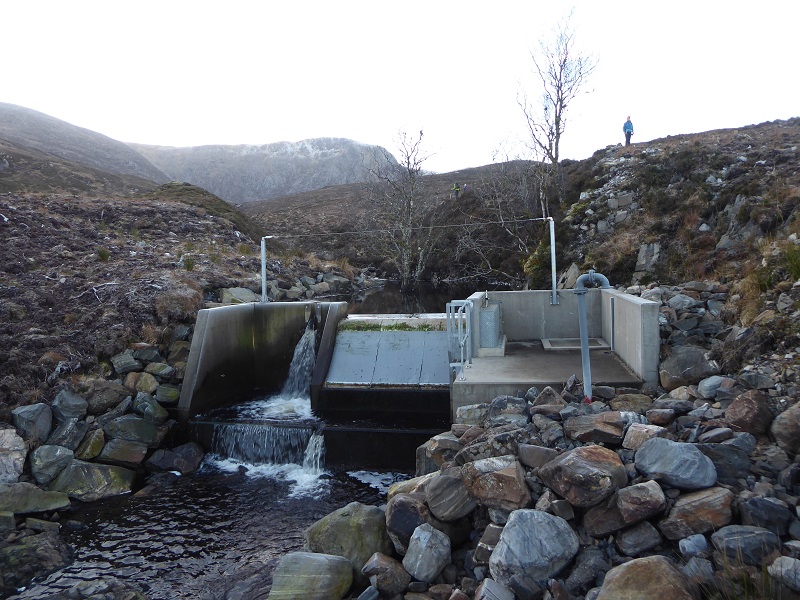
Since the original submission of the application the powerhouse has been repositioned closer to the bank of the rising ground, proposals to upgrade the existing footpath as a construction route have been deleted, the penstock route and temporary construction track have been combined, the construction track is to be completely reinstated and a new section of walkers track has been included.
Allt Ceitlein
“Since the original submission of the application the powerhouse and outfall have been relocated to the east of Ceitlein bridge in response to SEPA issues and one of the secondary intakes has been removed from the scheme. The width of the reinstated track has been reduced.
Allt Mheuran
The original submission (application 18/02741/FUL) has been withdrawn and replaced with this current application following concerns raised by the Planning Service. The intake has been moved approximately 550m downstream of the original position and is limited to a single intake. The
construction track has been combined with the penstock route and will be completely restored on completion.
That’s a large number of significant changes. Almost all appear to have been driven by the concern of planning staff for the landscape and people’s ability to enjoy it (as evidenced by their concern to protect footpaths). Note how is was planning staff and NOT SNH who got the original planning application for the Allt Mheuran withdrawn.
Without saying so explicitly, planning staff in effect decided SNH had got it wrong. It would have been an enormous step, however, to move from trying to reduce the landscape impact of the schemes to refusing them completely against the advice of the Scottish Government’s statutory landscape adviser. Only elected Councillors could take such a step.
SNH response to the Planning Applications
SNH’s original response to the Glen Etive hydro application in July was brief and in the form of a pronouncement, not an assessment (see here):
– Ben Nevis and Glen Coe National Scenic Area (NSA)
The proposal will not have an adverse effect on the integrity of the NSA or the special qualities for which it has been designated.
– Loch Etive Mountains Wild Land Area (WLA).
The proposals will have a localised effect on the sense of wildness but will not affect the experience of wildness or result in significant effects on the wider appreciation of the WLA or the qualities of the area. These impacts on the Wild land area can be further reduced by implementing appropriate mitigation measures in the CMS as outlined in Annex C.
The suggested improvements in mitigation measures were about improving construction and restoration techniques rather than more fundamental changes such as those subsequently instigated by Planning Officers.
Assessment of impact on National Scenic Areas
In a welcome attempt to improve landscape assessment, a few years ago SNH undertook work to try describe all the special qualities of Scotland’s National Scenic areas. They identified three for Glen Etive. Now, these aren’t everything, but usually form the basis for Landscape Visual Impact Assessments. Here is what SNH said about them in Appendix B of their response:
It is unclear why table 5.13 (in all available LVIAs) only assesses the effects on one special quality; Long and green Glen Etive; rather than the three; A land of mountain grandeur; A land of classic highland vistas; and Long and green Glen Etive; which are have been identified as likely to result in some effects. However, in our opinion this does not change the overall conclusion in the report.
So, the developer failed to assess the impact of the hydros on all the special qualities but SNH said that even if they had, it would make no difference! In Appendix B they go on to say:
“Special qualities which have been scoped out relate to landscape characteristics and features which are locational and are not experienced within the areas likely to be affected by these proposals”
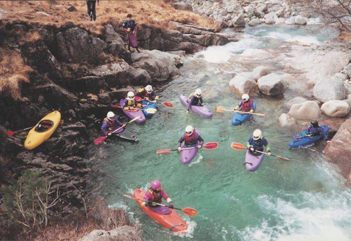
This is just wrong. Anyone walking up into any of the three side glens where these schemes would be located can see the vistas and mountain grandeur and that these are currently unspoilt. If you have not been (or even if you have) take a look at all the other photos and videos on the new Save Glen Etive website (see here).
There is also muddled thinking as demonstrated by this extract from Appendix B of SNH’s response:
Locations of the powerhouses may affect how part of the Long and green Glen Etive Special Quality is experienced as currently single buildings are sporadic and located along the glen floor adjacent to the road. In particular the following schemes have powerhouses which lie away from the road; Allt Ceitlein and Allt Mheuran
The implication, as I read it, was that powerhouses away from the road might be an issue but those near the road wouldn’t be.
SNH did not comment on the location of the Allt Chaorainn powerhouse. This was close by the River Etive and clearly visible from the Skyfall layby. It would have been the first building you saw as you came down the glen. Unlike SNH Highland Council officers rightly decided in my view it would have too great an impact. Their solution has been to move it.
Assessment of impact on the Wild Land Area
SNH’s assessment on the impacts to the Wild Land Area is no better than that for the National Scenic Area. The former is, in planning terms, the stronger designation. After clearly setting out the wild land qualities there is NO assessment of whether the developments would impact on these:
This WLA is recognised for three wild land qualities (not to be confused with special qualities, which is a term reserved for designated landscapes) which are:
Quality 1: Arresting, steep, high mountains with precipitous rocky tops and ridges that offer panoramic views of elevated tops continuing far into the distance
Quality 2: A series of deep glens carved through the mountains, with arresting side slopes and spectacular geological features that contribute to a strong sense of naturalness
Quality 3: A high number of visitors that seek different wild land qualities and are able to experience a wide range of remoteness, risk and physical challenge
The landscape consultants have referred to the SNH (2007), ‘Assessing the impacts on wild land’ guidance (ES para 5.2) however since SNH consulted on the draft guidance in 2017 we consider that this is more appropriate as it referred directly to the now published wild land descriptions. However within table 5.14 of the LVIA there has been an assessment of effects on the three individual qualities (as advocated by the 2017 guidance).
And there it stops. So what is SNH’s conclusion?
The underlying problem in SNH’s assessments is that they are based on the Landscape Visual Impact Assessment that was developed for windfarms. That fine’s for assessing impacts of 150m high towers on iconic views from the summits of hills, but not much use when it comes to assessing the impact of hydro schemes on deeply incised glacial glens in the west Highlands.
All seven proposals lie within the Mountain Massif Landscape Character Type (LCT) and although there is some limited predicted visibility into the adjacent High Tops to the west, this is not considered to result in a significant effect. The effects (singularly and cumulatively) on landscape character will therefore be limited to the Mountain Massif LCT. We agree that the sensitivity of this LCT would be high to these proposals. We also agree that although the effects on this LCT will be significant (as illustrated at VPs 2 and 5) these effects will be localised due to the nature of the change proposed.
For the Glen Etive hydro schemes, its almost completely irrelevant that it will be hard to see them from the high mountain tops. The local impact, the impact on the experience of walking up alongside or paddling down the rivers is in Glen Etive far more important. The assumption behind SNH’s opinion appears to be that these hydro schemes, give or take an ATV track or two, can be fully restored and therefore will not impact on nearby views or the experience of wild land.
The landscape impact of the intakes
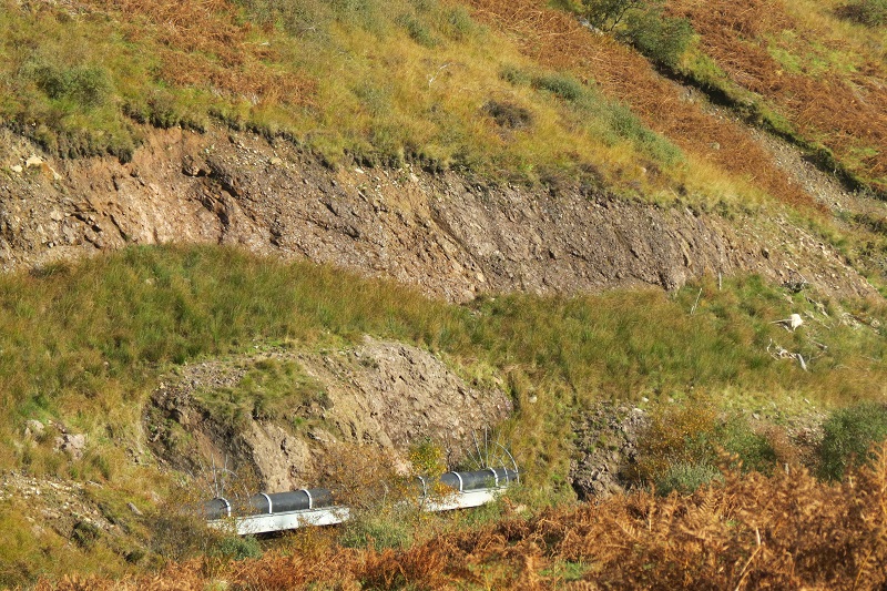
While SNH’s advice makes various positive and sensible recommendations in relation to restoration, it says almost nothing about the intakes. So, lets assume for a moment that the “restoration” of these three schemes was world class: that the powerhouses were buried and appeared as natural landforms; that the pipeline was fully restored; that Highland Council goes further than SNH and requires removal of all access tracks to the intakes and narrows any roads to the powerhouses to quadbike width. That leaves the intakes. There has been no proper assessment of their likely impact on the landscape or wild land experience.
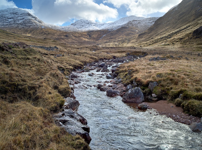
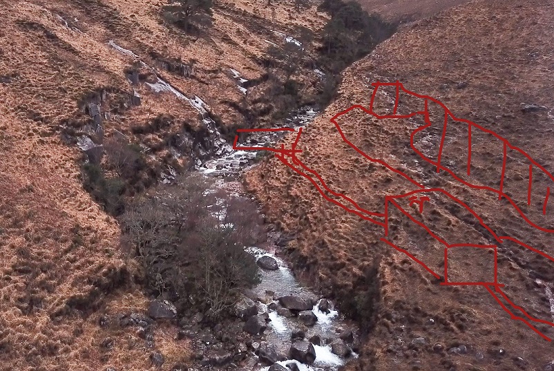
The intakes for the Allt Chaorainn and Allt Ceitlein would both be located in wide open glens. There are two for both, although in the case of the Allt Ceitein the second is much smaller (on a subsidiary burn to the right of the photo above).
At the Highland South Planning Committee where these schemes were first discussed, one councillor asked how much of the concrete intakes would be visible above ground and what could be done to mitigate this. The Officer responded that they would be looking for ways to get the intake to blend in. The experience of other intakes in Scotland is that they don’t.
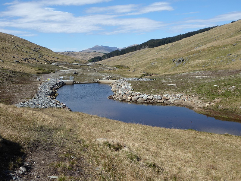
While with good design the pool could be avoided, almost all intakes require rip rap bouldering above and below to secure the flow of the river over them and leave areas of bare concrete. In open locations, like on the Allt Ceitlein and Allt Charain the visual impact will be considerable.
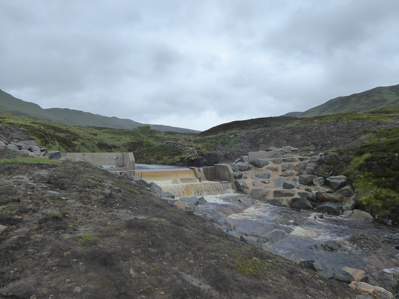
Even where located within folds in the landscape, intakes have a significant impact from close up. In the case of all three Glen Etive schemes being considered they are right by the main path.
There is no getting away from the concrete and boulders. The impact of this, however, is much less where intakes are hidden away from view (as above) than in open settings.
But, you might say, isn’t the proposed location of the Allt Mheuran tucked away in a gorge?
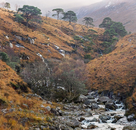
The intake would still be visible from the path above. Unless set very low, which would entail excavating well below the current base of the river, it would impound it, creating a lochan. That would totally change the character of this section of the Allt Mheuran from a wild river to a smooth pool.
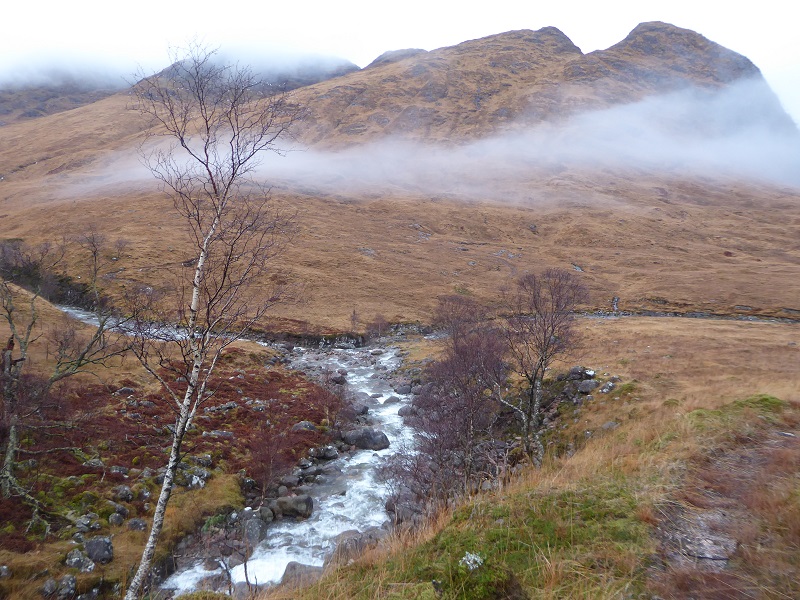
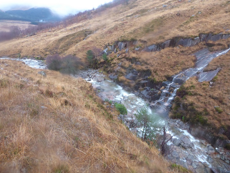
The engineering challenges of installing an intake here would be immense and have not been addressed in the Construction Method Statement. The challenge is how to construct and restore an access track and pipeline first over rock slabs and then ALONG a very steep bank (see top photo). I know of only one scheme where this has been tried in Scotland – I am sure there are more – and its been a disaster.
Whatever the rock, where the ground is this steep, its almost impossible to restore.
SNH’s view and the Glen Etive hydro applications
It is important to understand that SNH assumption that hydro schemes can be restored is driven by politics than the views of individual staff. SNH is under pressure not to object to developments except of the limited case of windfarms in National Scenic Areas which the Scottish Government agreed as an exception. They have responded by producing good practice advice on siting hill roads, hydro schems etc.
However, even if ALL the other aspects of these three hydro schemes could be fully restored as SNH staff are forced to assume, the intakes and associated engineering are such that they would have a significant impact on the landscape and experience of wild land. I believe SNH has failed to consider that properly at either the local or strategic level. On those grounds alone, Highland Council would be justified in rejecting these schemes.
In practice, of course, and given the experience of other hydro in the Highlands, there are serious doubts that other aspects of these schemes could and would be fully restored. In a setting like Glen Etive we should not be taking those risks. I hope Councillors at Highland will, like their officers, discount SNH’s advice. In doing so they would need to go a step further and articulate why these three planning applications would have an unacceptable impact on people’s ability to enjoy our most important wild landscapes.

A very thorough analysis, Nick. Good to see SNH’s woeful approach pinned down. “In a setting like Glen Etive we should not be taking those risks.” That says it all. Will THC listen tomorrow?