Following my post (see here) on the revisions to the Glen Etive hydro schemes, on the shortest day I went to take a closer look to compare what is being proposed compared with what is on the ground. I walked over the land included in four of the seven schemes, including the two subject to new Planning Applications, the Allt Mheuran and the Allt Fhaolain. This was well worthwhile and not just because it took me up a couple of unfrequented rivers, hidden gems within industrial forestry. What it showed that Dickins Hydos plans raise serious issues whose impact has not been properly evaluated in either the first round or the revised Planning Applications. This post takes a look at the Allt Mheuran scheme.
The revised Allt a Mheuran Scheme
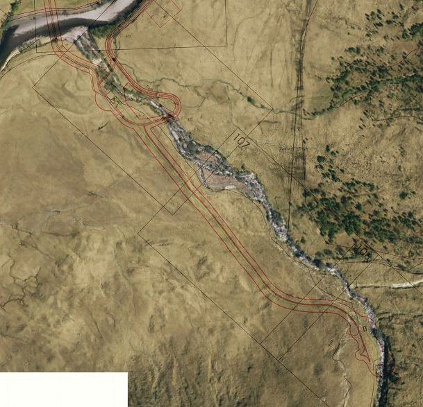
The Allt Mheuran scheme has been significantly amended, with the intake being brought downhill and the scheme reduced in size from 1540 to 885 kilowatts. As Tim Parkin’s overlay shows, however, its in a very open location and except, where the ground can be restored perfectly, would have a permanent landscape impact. My walkabout identified several specific reasons to object.
The bridge
The proposal is to build a new bridge at Coileitir on the north side of the existing bridge. Following objections from SEPA, the revised plans now state the old bridge will be demolished and totally removed from the site. I can find nothing in the plans to say how many trees would need to be felled, how the new bridge abutments would be constructed, their appearance (concrete?) or how the design of the bridge will fit the surroundings:
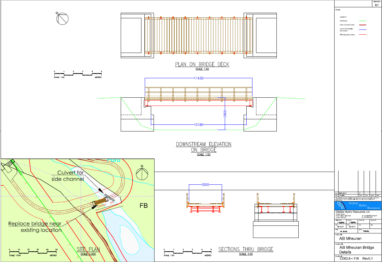
That is not acceptable for a signficant new structure in a National Scenic Area.
The new bridge would be used in the construction of both the Allt Mheuran and Allt Ceitlein hydro schemes. Once a bigger bridge is put in place however that provides permanent access for larger vehicles to much of the ground on the east side of the River Etive. It creates the potential for further development and larger vehicles to be used in future.
The permanent new access track from Coileitir to the Allt Mheuran
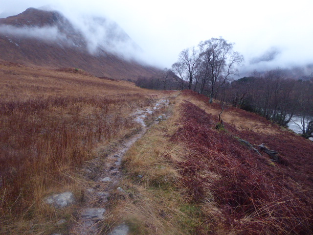
The Allt Mheuran Planning Application is dishonest when it claims that “the access track along-side the River Etive is an existing old track that will be upgraded”. The existing vehicle track ends at Coileitir. What is actually proposed is over a kilometre of permanent new road skirting round Coileitir then following the River Etive to the Allt Mheuran.
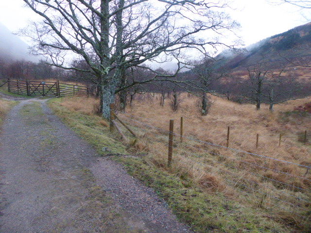
A number of native trees will need to be felled to construct the new road and Highland Council’s forestry officer has, as a consequence, recommended compensatory planting. South of Coileitir and out of the trees the landscape impact of any new road would increase significantly.
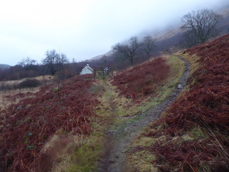
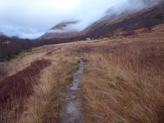
Dickins Hydro want to construct a permanent road along this route. It will destroy the whole character of the approach to the Allt Mheuran and, being in an open location, will be highly visible from all the higher ground around.
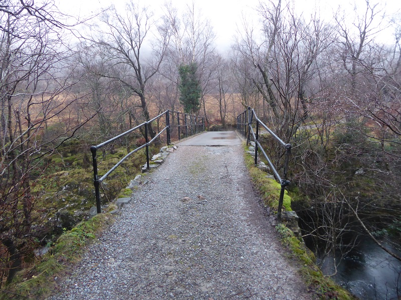
Besides the new road, three new borrow pits would be required to construct it, which would add further to the landscape impact. Once the road reaches the Allt Mheuran it would head up the burn to the existing footbridge, cross the burn, and then run down the other side to the powerhouse (the plans are not entirely clear whether this last section of the road will be permanent or not):
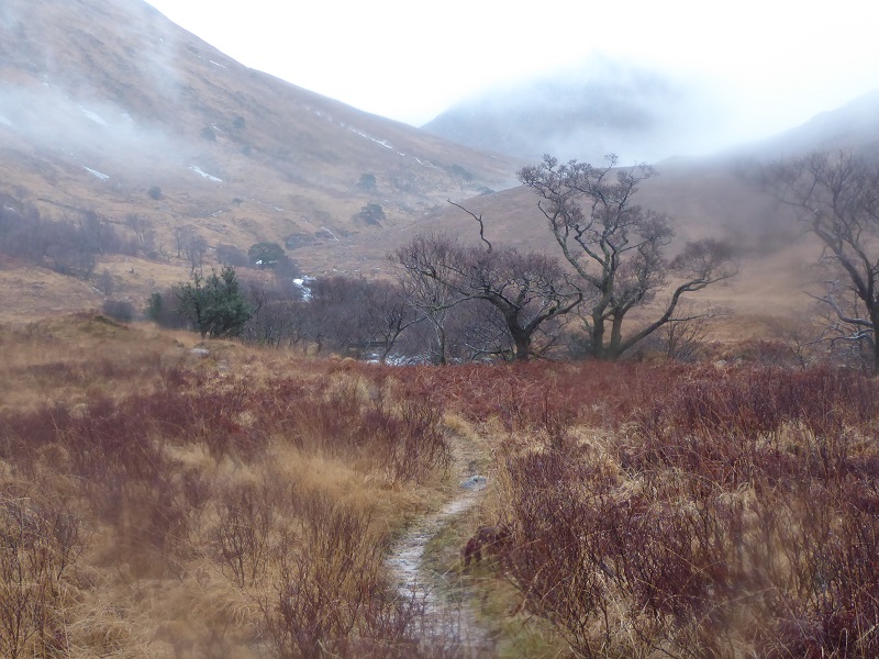
The new road is likely to obliterate the existing footpath and completely change the recreational experience.
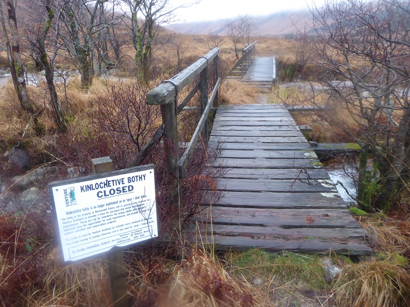
The footbridge over the Allt Mheuran will be replaced by a vehicular bridge, which will not only change the character of the experience, it will open up a much wider area to vehicle mis-use.
Dickins Hydro have almost completely failed to assess the impact of the proposed new road on the landscape or the recreational experience, including the impact on Wild Land. (The zones of Theoretical Visibility Assessments have not been revised to take account of the change in plan or past deficiencies). This in itself should be sufficient for Highland Council to reject the application.
The power house
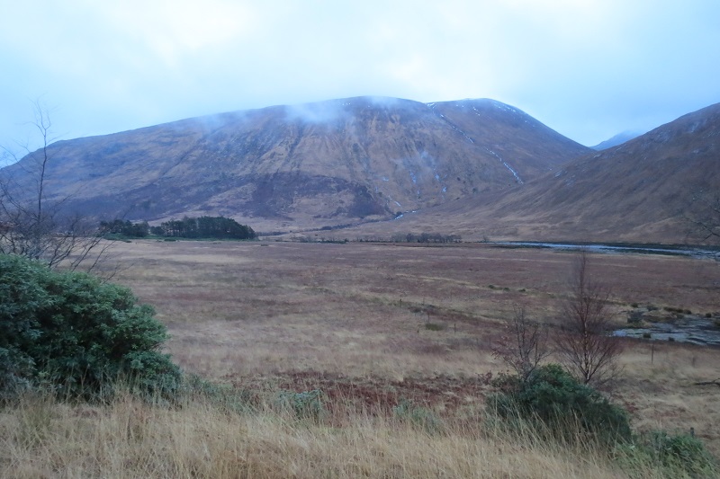
The power house is in a very open location and will be clearly visible not just to walkers but to people driving along Glen Etive in what is at present an unspoilt and undeveloped part of the glen.
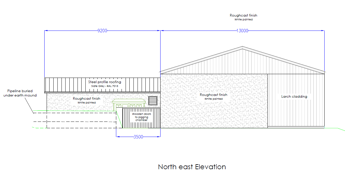
Are roughcast and steel roofs really appropriate here? Does a National Scenic Area not mean anything to this Developer?
The pipeline
While you might have guessed many of the impacts I have described so far from just looking at maps – the Planning Application is notably lacking in photos – what you could not ascertain without a site visit is the likely impact of the pipeline or the construction track.
The Application is vague about the route of the pipeline:
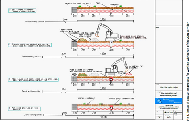
“The exact pipeline route would be determined following site investigation as part of the detailed design process. Consequently, the final position of the pipeline may vary by up to 25 m but once the exact route has been determined, the working corridor would be restricted to a width of approximately 20 m (reduced where necessary in sensitive areas and increased where necessary for safe working). This working corridor would accommodate the pipe trench, the excavated material and a running track for construction vehicles.”
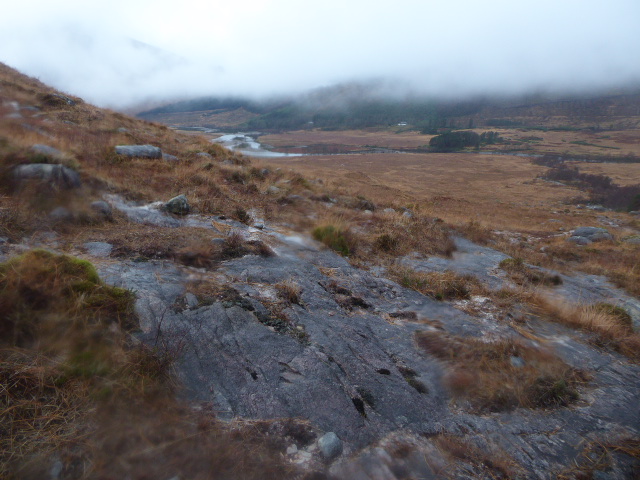
That vagueness may be all very well in areas of deep peat or glacial till, but that type of terrain does not exist on the south side of the Allt Mheuran:
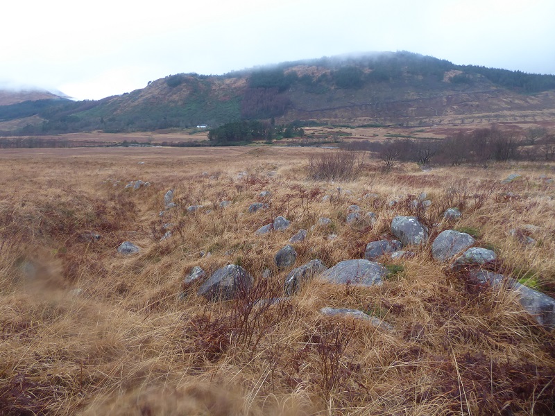
Much of the south side of the Allt Mheuran is boulder field and rather special boulder field at that. The boulders have been moved and shaped by the Allt Mheuran and its not difficult to detect a number of previous courses taken by the river. Neither the Environmental Impact Assessment or Dickins Hydro’s new construction method statement say anything about this “fossilised landscape”. Their proposals for excavating and restoring the pipeline are completely inappropriate here:
Dickins Hydro will NEVER be able to bury the pipeline here in the way described on this type of terrain.
Whatever route the pipeline takes will require boulder fields to be shifted. The Planning Applications mentions scattering boulders on top of whatever surface they create. Restoring the boulder formations properly would require every single boulder to be marked and replaced by hand. . Unless that is required by Highland Council – and it would be phenomenally expensive – constructing a pipeline here will leave a permanent mark on what is a very special landscape.
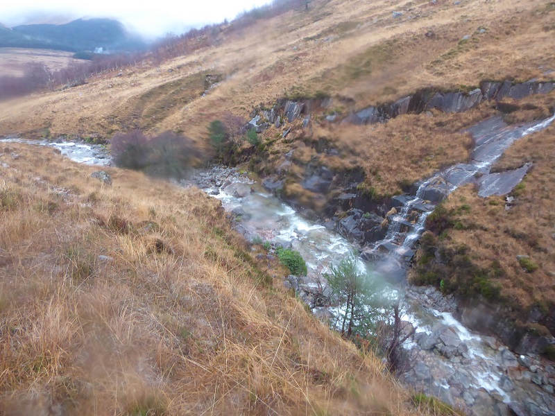
Higher up, the vegetation and river/glacial debris thins until there is just bare rock. The Construction Method Statement says nothing about how trenches would be dug here but if the pipeline is to reach the river as depicted on the plans its needs to cross areas like this. I can find NOTHING in the plans that mention excavating trenches through rock and how Dickins Hydro propose to restore it. I don’t believe they can. (There are similar issues with the Allt Chaorainn scheme higher up the glen which are not mentioned in that planning application either).
The plans then show the pipeline following the bank of the river after it bends almost due south.
How Dickins Hydro propose to bury the pipeline along this steep and bouldery bank is not explained. Again, a fundamental omission from the plans.
The temporary construction track
One of the biggest changes in the new Planning Application is is that it now proposes that the construction track between the bridge over the Allt Mheuran to the intake should be fully restored. That sounds promising until you consider that if burying a pipeline here poses enormous challenges, creating and then fully restoring the construction track will be even more difficult. The revised application makes light of this:
Issue: public concerns permanent access tracks at Mheuran Hydro in regard to the initial planning application.
Solution: We have considered the objections posted regarding access tracks to the intakes. As previously mentioned in the constrains (sic) plans and CMS [construction method statement] which indicated that these tracks would be reinstated to ATV access tracks post construction . With the exception of Mheuran Hydro where the access track to the intake will be fully restored to the previous landform…………………………. This means that once fully reinstated it will leave the access similar in appearance to what is there at present, once regeneration has taken place. The appointed LCoW [landscape clerk of works]will lead a specialist qualified reinstatement team ensuring that reinstatement is carried up to the highest standards.
This is either a deliberate attempt to mislead or wishful thinking based on a failure to look at the terrain properly. Highland Council should not accept this but instead demand detailed plans showing exactly where the track will go and how Dickins Hydro’s specialist re-instatement team propose to restore the ground before the application goes any further.
The Intake
Nothing is said, so far as I can see from the revised documents, about the size of the pool to be impounded behind the intake or about how its design would mitigate its impact on the landscape. From the plans it appears more concrete is proposed:
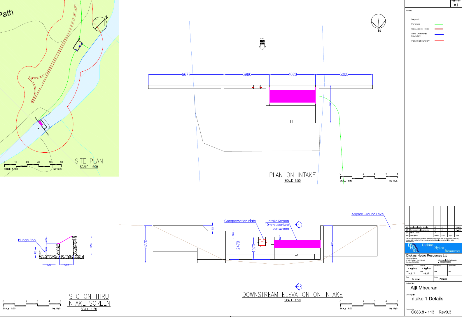 That is just not good enough for a National Scenic and Wild Land Area.
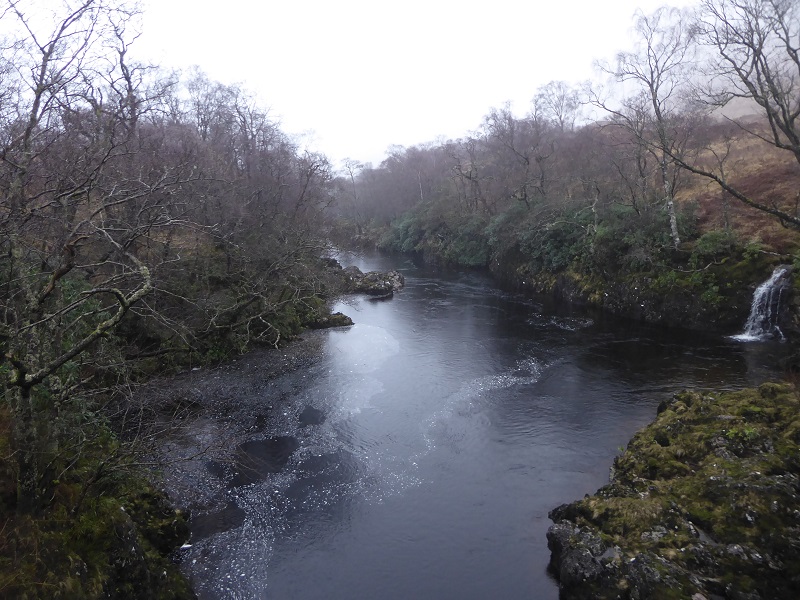
The landscape setting
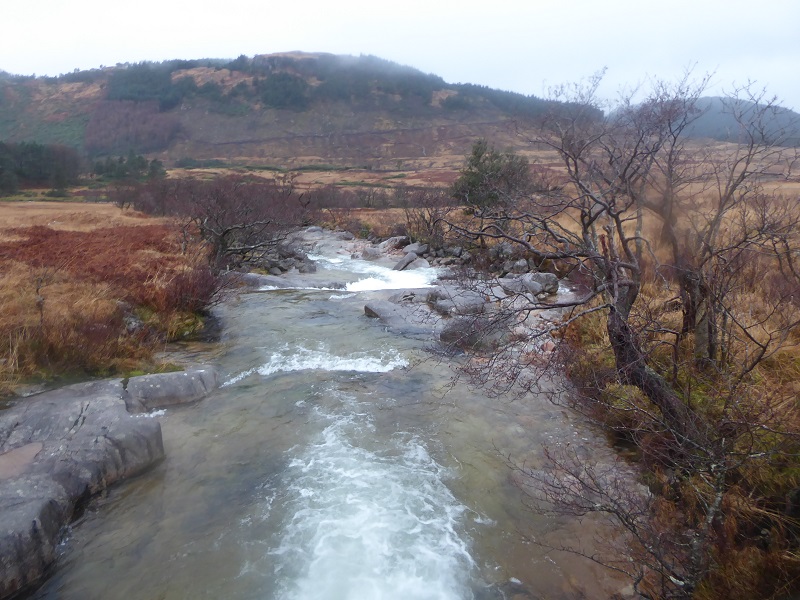
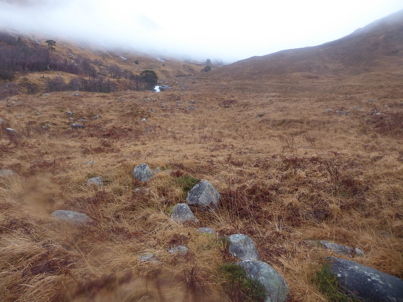
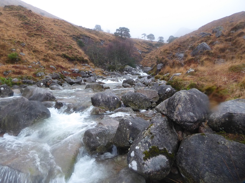
While the revised scheme is now below the famous Robber’s Falls, the lower falls on the Allt Mheuran are also spectacular and popular for extreme paddling.
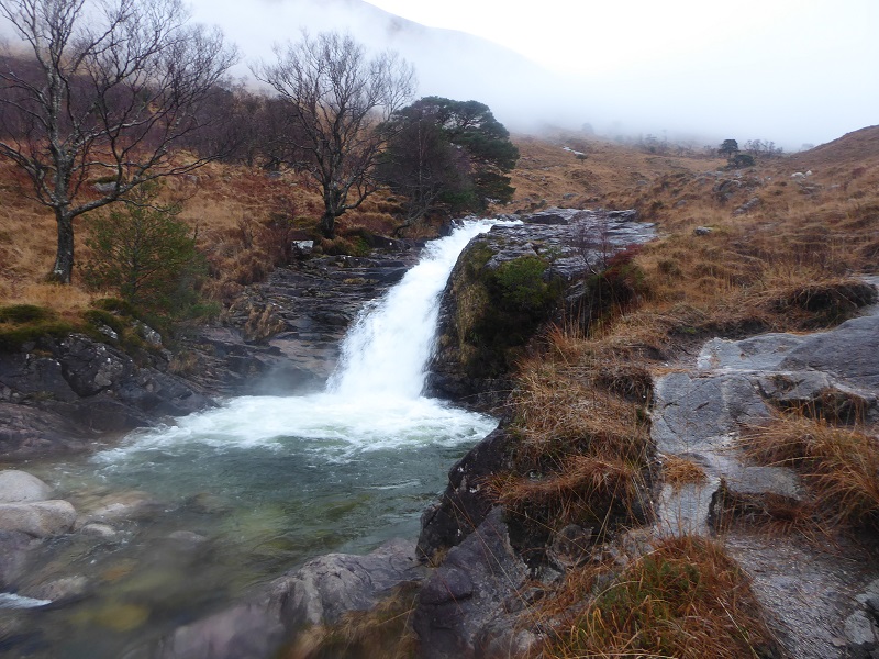
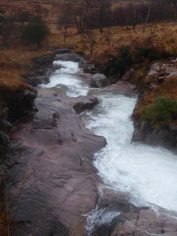 This is a beautiful place, sculpted by water but now threatened by mammon. Why would anyone who cares anything for our landscape even contemplate a hydro scheme here? Its time for Highland Council to say no.
What you can do
You can comment on the revised Planning Application on the planning portal using the comments tab here. Remember if you commented on the previous application those comments are no longer valid as its a new application. The consultation formally closes on Wednesday 2nd January.
If you live in the Highland Council area you can also raise concerns with your local Councillors and MSPs about this application, for example about the lack of detail on the impact of the proposals, and asked them to help ensure this application is assessed as rigorously as possible.

I urge Highland Council not to spoil this unique area. Once it has been done it would would never be the same . This is my favourite spot in Scotland & I would be gutted if this went ahead
Why is this necessary? Is it to supply electricity to local habitations. If so, what do they use now and why isn’t it sufficient. Is it a precursor to new housing? If so, why is new housing needed in this remote location? Isn’t tourism of a wild area more valuable? Is it for industry? OUCH!