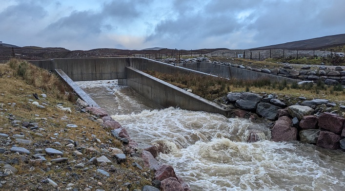
Hogmanay was forecast to be a wet day and Strathspey was flooded so I thought I would take a look at the River Gynack overflow, which had been reconstructed after being almost washed away in 2017 (see here), to see if it was operational and, if so, how the revised design was working.
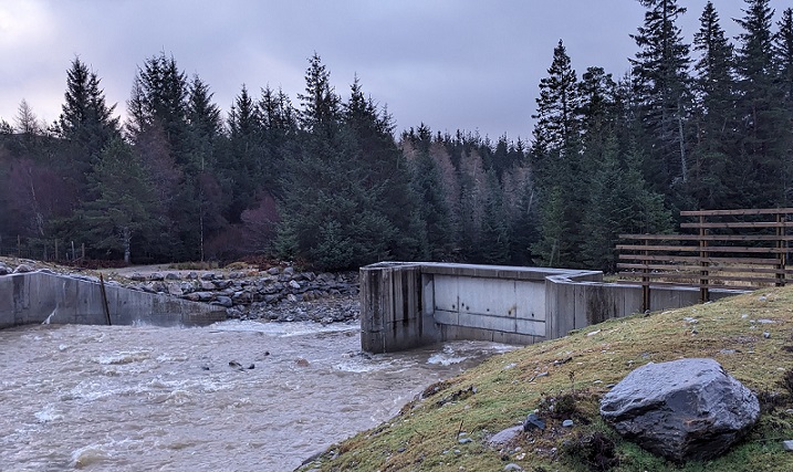
My estimate from looking at the volume of water flowing through the intake was that the overflow was working at less than half of its maximum capacity. Even so, around the time I visited, the level of water in the River Gynack was sufficiently high for trains on the Perth-Inverness line to be cancelled because of the risk to the railway bridge in Kingussie below (see here).
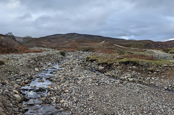
The overflow diverts water from the River Gynack when levels are high to Loch Gynack before it flows back into the main river. The overflow serves to delay/reduce the flood risks in Kingussie not to solve them. The only way for that to happen would be to ban the extensive muirburn undertaken by the Pitman Esate within the Gynack catchment and reduce grazing levels so that vegetation holds back water on the hillside instead of it rapidly draining into the river system as it does at present.
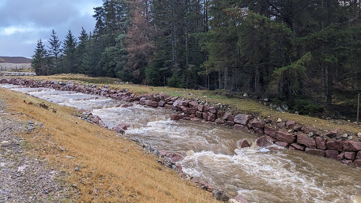
The top part of the re-designed overflow appeared to be working more effectively. The rock steps were directing the main flow away from the banks while the much larger replacement rocks used for the rip-rap bouldering appeared to have been unaffected by the flood.
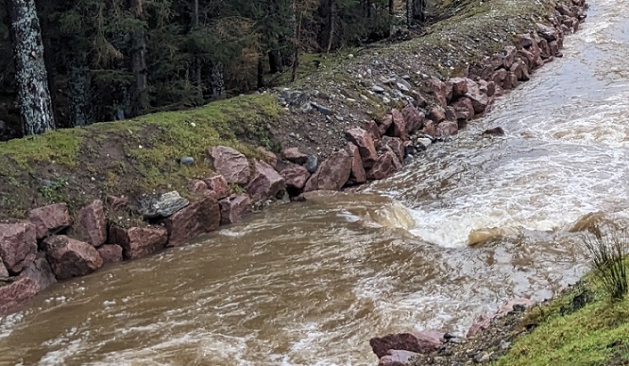
The embankment at the bottom of the stepped section appeared far more vulnerable, being narrower and there were a couple of places with exposed soils 18 inches or so above the water. Indeed, looking at the photo – I did not spot this when out – it looks as though a boulder may have been dislodged from what is now the lowest point of the rip rap bouldering just to the right of the tree. If the overflow was to operate full capacity these weak points look extremely vulnerable to erosion which could potentially result in the channel failing catastrophically.
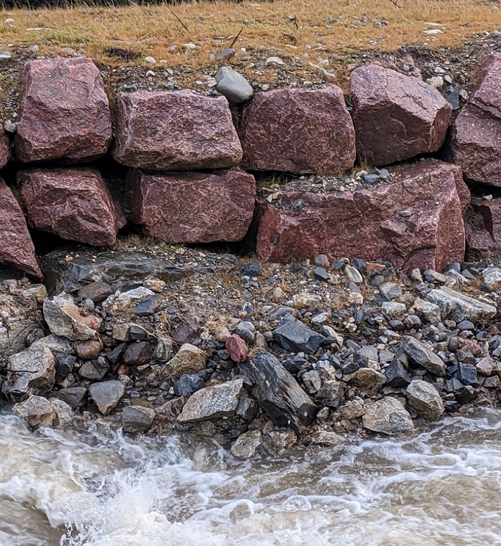
Since returning to use, the force of the water in the overflow channel has redeposited rocks large and small. This has strengthened the embankment at some points but could potentially undercut it in others.
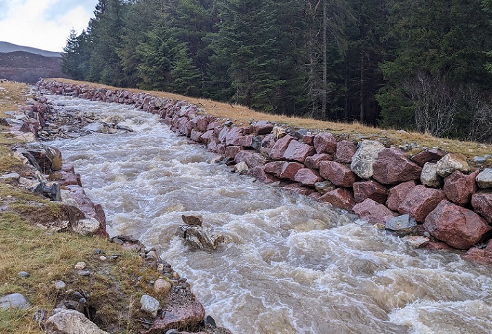
As it flows down and across the hillside the channel narrows significantly constraining the water and increasing its force. While the rip rap bouldering on the right appeared to me quite robust again I wondered what would happen if the overflow was running at full capacity?
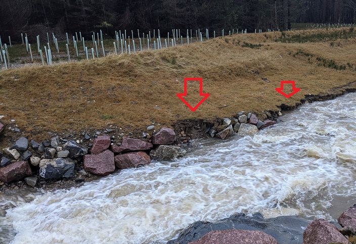
The one clear example I observed of a failure in rip rap bouldering was at the very bottom of the steep section of the overflow where the embankment changes from rock to earth. Some of the smaller rocks used for the rip rap bouldering had been swept away just as happened with the first version of the channel. The trees planted behind will do nothing to strengthen it.
The lower half of the new channel and its earth embankments are designed differently from the old one which was seriously damaged as soon as flood water flowed it (see here). The channel is much broader while the main earth embankment only runs down one side and is stepped in places.
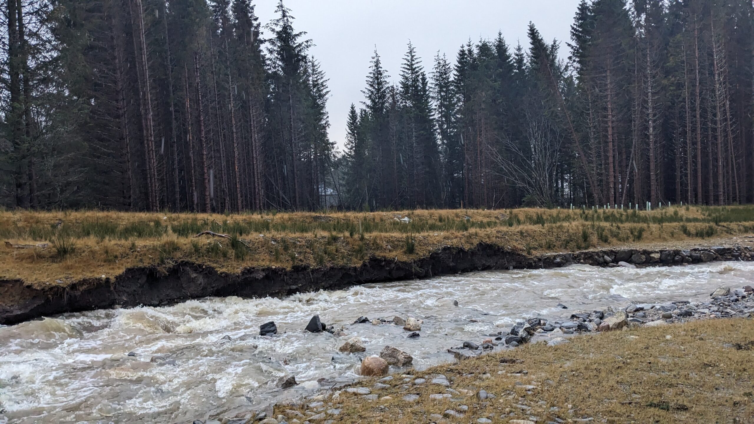
Despite the reconstructed overflow being blocked initially to allow time for grass to cover the exposed earth it has already started to erode away. Once this erosion process has begun it is difficult to see why it should stop unless there is a hidden line of boulders within the embankment.
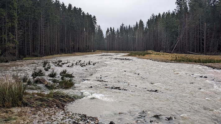
Along the broadest section of the channel the earth embankment is very low. At present the water is eroding a course away from the embankment to the edge of the trees but the question is what will happen when it starts to meander? That process might be accelerated if the water undercuts some of the trees causing them to fall into the channel and diverting the flow. Will the bank then be sufficiently covered in vegetation to withstand the flow of the water or will it too start to erode?
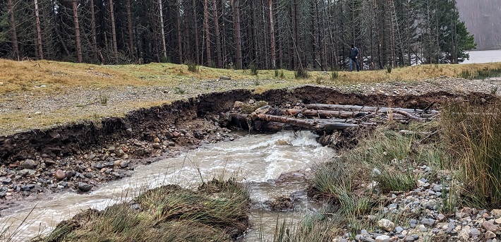
Near the bottom of the channel trees had been placed across the other side, possibly in an attempt to reduce erosion The shingle section of the embankment is broad enough that it is unlikely to fail catastrophically but again the question is why should the obvious erosion processes stop this time?
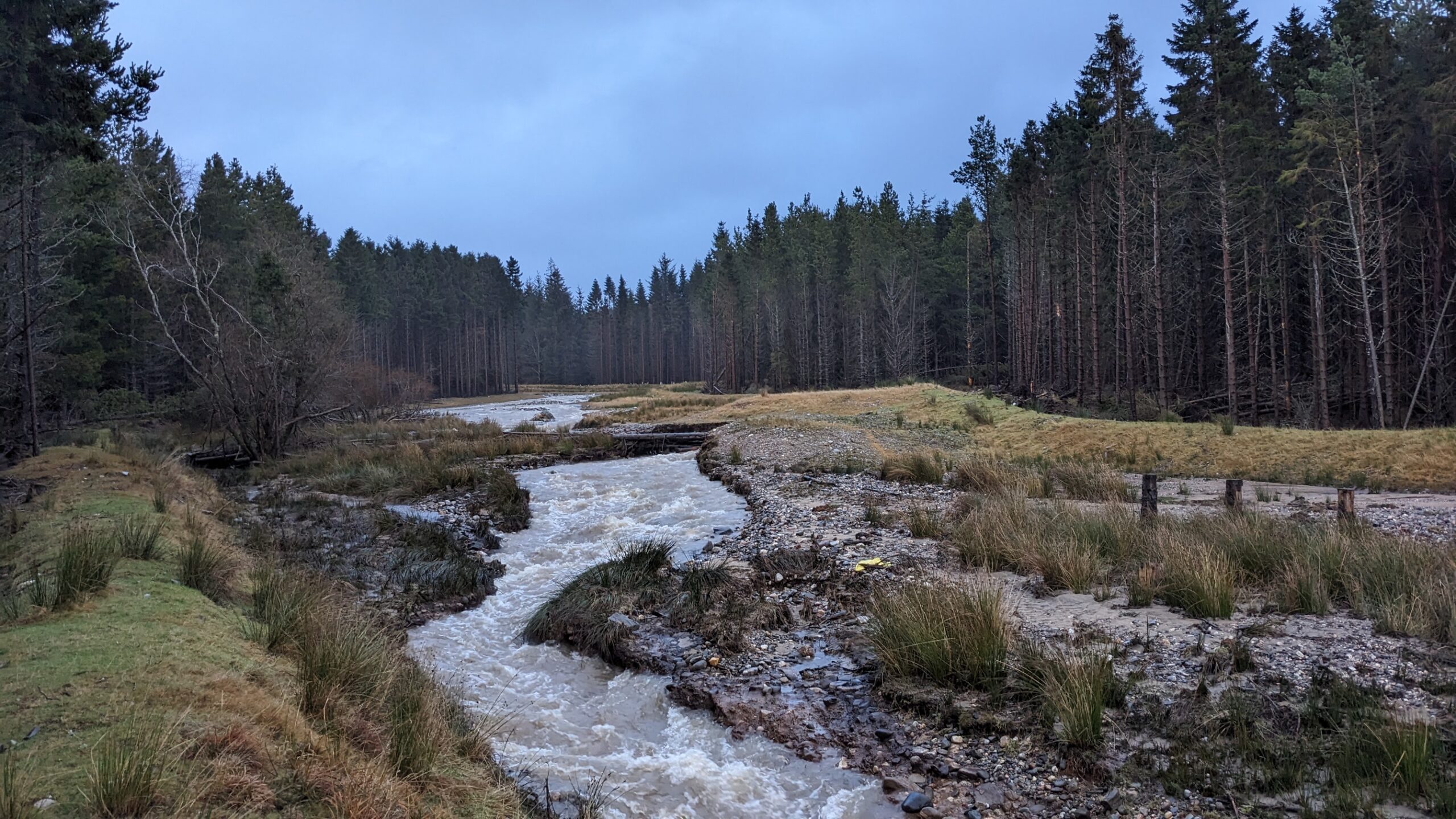
One wonders too what will happen to this channel if the beavers, released into the Spey, start to work their miracles. Along natural watercourses that normally holds back the flow and reduces flood damage but in the overflow channel it could direct the water to the vulnerable earth embankments
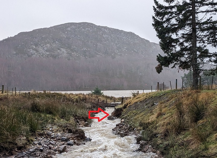
Rush had started to colonise both sides of the lower part of the embankment. That is likely to offer better protection against erosion than the bare section of bank.
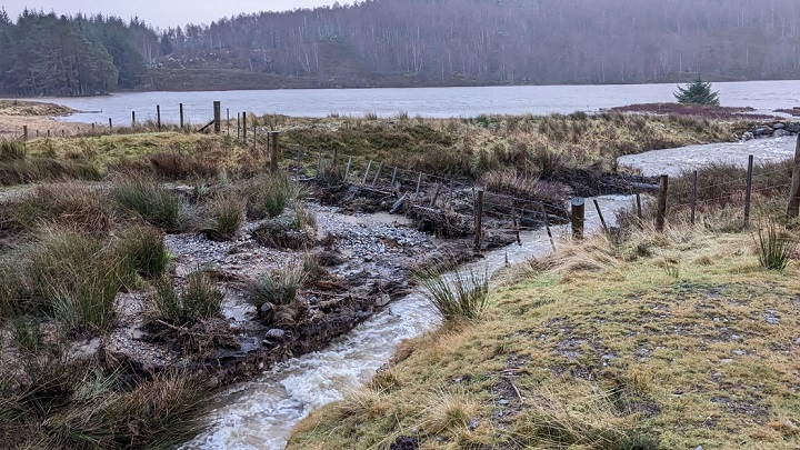
Perhaps the upper section of the earth and shingle embankments should have been left another couple of years to allow more profuse protective vegetation to develop?
Unfortunately the Cairngorms National Park Authority (CNPA) decided to classify the extensive construction works which were required to fix the failed overflow channel as “repairs” and did not require a new planning application. As a consequence the plans for the re-engineered channel were never subject to any public scrutiny. Having originally agreed that the overflow channel was needed in the public interest to protect the village of Kingussie from flooding – the original construction was partially funded by Highland Council – they left the revised plans to fix the channel to the landowner and their agents. From the evidence I have seen the likely consequence is the overflow channel will require further extensive work to prevent it failing or may need to be abandoned entirely.
I have now considered the Gynack overflow affair several times on parkswatch. What has been striking is the complete inability of the CNPA to act like a National Park, whether to ensure that a flood prevention channel intended to mitigate the effects of climate change was designed appropriately and lessons learned after its original failure that could be applied elsewhere in Scotland or to take wider action to change land-use to reduce the flood risk to local communities. It is because of failures like these, which includes a total inability to learn from mistakes, that we need a full independent review of our existing National Parks and why they have achieved so little before we create any new ones.
One of the four statutory duties of Scotland’s National Parks is to promote the sustainable development of local communities. The only consolation for the people of Kingussie, who continue to be vulnerable to flood risk and to be let down by our public authorities, is that it would be poetic justice of a kind in this case if the earth embankments were to fail catastrophically and Pitmain Lodge, which is located below, flooded. The Pitmain Estate is apparently owned by Majid Jafar, the Chief Executive of Crescent Petroleum, the largest private oil company in the world which is helping to drive climate change and more extreme weather events.
Why Scotland allows such people to own land n our National Parks and to manage it as they wish is another moot questions which needs to be settled before we create any new ones.

Can you please leave these assessments to the experts?
If the CNPA were doing their job and publishing expert assessments of why the design would work and then commission reassessment when concerns were brought to their attention I would be very happy to do so. Unfortunately at present people with real expertise are being sidelined.
Very well said Elon you don’t have a clue nick you dafty