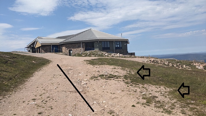
A couple of weeks ago Dave Morris and myself met with Mike Gifford, the Chief Executive, and two of the new directors of Cairngorm Mountain Scotland Ltd (CMSL) at their invitation. Among the subjects we discussed were the proposed mountain coaster, which CMSL has called a toboggan run, but in fact has nothing to do with snow or snowsports. Proof of that is Landmark, down in the woods at Carrbridge, which already has water coasters is now proposing to build a similar coaster on rails to replace its timber train (see here).
CMSL helpfully clarified that the proposed access track, described in the planning documents as being for ‘maintenance and emergency’ purposes, is in fact intended for operational purposes. Its to save staff having to walk up to the top of the coaster. They also explained the proposed line of the track, almost straight up the hill by the Day Lodge poma, was chosen to reduce the visual impact.
In theory this could make it easier for the Cairngorms National park Authority (CNPA) to approve the planning application on landscape grounds – but see below! The line, however, is far too steep for a track and is likely to erode away sooner rather than later (see here). The result will either be a bigger eyesore or the gravel surface of the track will need to be continually replaced.
Unfortunately, I don’t think we persuaded CMSL of the need to get a second opinion on the Construction Environment Management Plan provided by McGowan and CNOCLEE but we were pleased at Sandra Dick’s coverage of the issues in the Herald (see here).
The erosion of vehicular tracks at Cairn Gorm
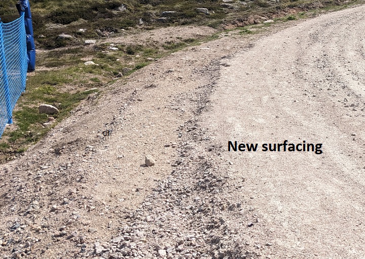
Track erosion has been a longstanding problem at Cairn Gorm that was first documented by Adam Watson over 45 years ago. As a result of climatic factors (such as freeze thaw, precipitation, and wind), along with poor design, the materials employed and human use, the surfaces of tracks at Cairn Gorm rarely last for long as I witnessed when descending from the Ptarmigan last year.
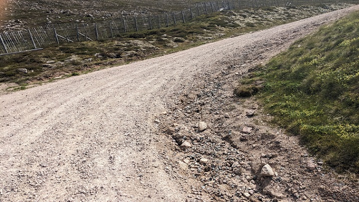
The finer materials in the granite aggregate are the first to be washed out:
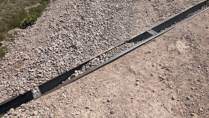
Some of these washed out materials had accumulated in the drainage ditches on the uphill side of the Ptarmigan vehicular access track:
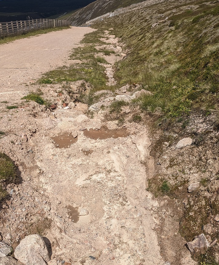
On the downhill side of tracks, washout spreads material across the hillside covering vegetation. As an example of the short time this process takes, compare the washout in the top photo of this post with these from the 2022 planning application to ‘improve’ the area around the Ptarmigan (see here):
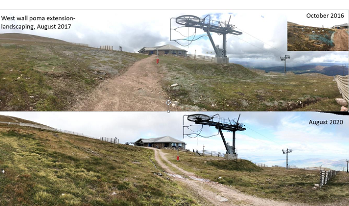
The 2016 photos shows a bare track with re-seeding of bare areas of ground on either side (the bluish areas); the 2020 photo shows vegetation recovery including a grassy strip down the middle of the track; my photo shows how in 2025 nothing remained of the grassy strip at the top of the track and how material had spread over vegetation on the downhill side.
Adam Watson’s book, ‘Human impacts on the northern Cairngorms’, (2012) describes:
‘burial of topsoil by coarse infertile granitic grit granules due to severe water erosion leading to transport of grit downhill and its deposition on top of existing vegetation and topsoil. This was observed to occur in heavy rainstorms in all seasons, but was especially frequent and severe during rapid thaws and in autumn rainstorms’
Poor track design increases the impact of these processes further:
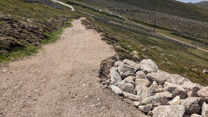
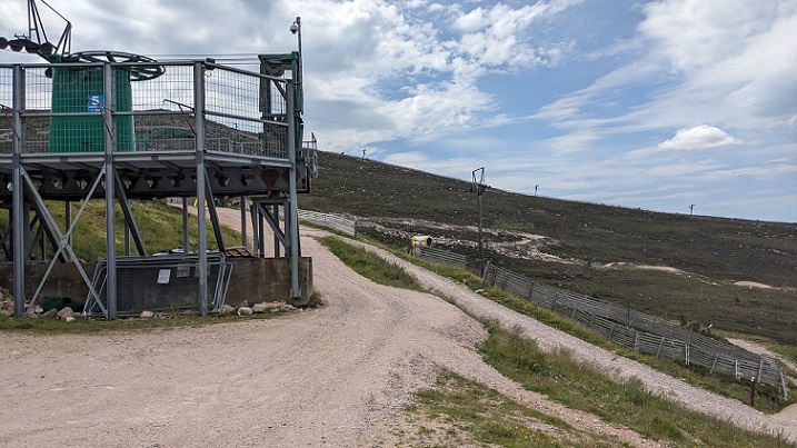
My understanding from our meeting with CMSL is that their staff clear the wash out from the drainage ditches and put it back on the tracks. This recycles part of the aggregate that has been eroded away but does not replace that washed over more open ground. As a consequence fresh aggregate, as shown in the two photos above, still requires to be imported from elsewhere. The environmental and financial costs must be significant.
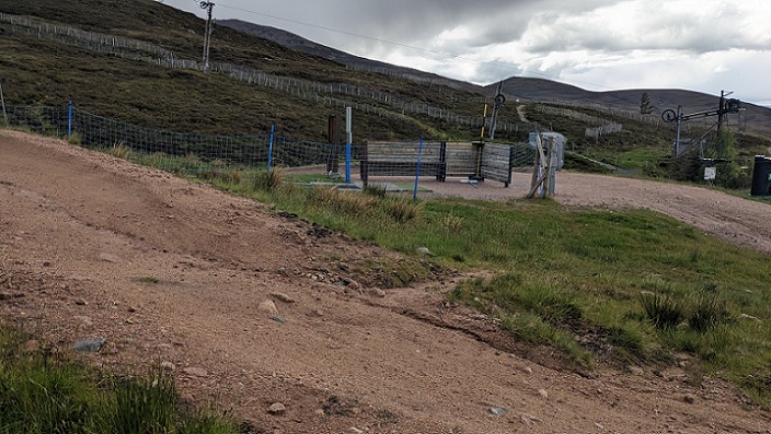
After our meeting with CMSL we took a walk around the area by the Day Lodge where we took a look at the bottom of the mountain bike tracks. They, like the vehicular and the karting tracks, show clear signs of erosion.
A different approach is needed at Cairn Gorm
It has taken me a long time to reach this conclusion but I now believe inclined gravel tracks are completely inappropriate for Cairn Gorm, whether for vehicles or for recreational purposes. The erosion of such tracks is both damaging to the environment and unsustainable. If a gravel track needs resurfacing a dozen times in a 50 year period it clearly either shouldn’t be there or a different type of track is needed.
Paved tracks, which used to be built in the hills prior to the advent of bulldozers, would be more sustainable but far more expensive. And the paving would need to be of granite to fit the landscape making it even more expensive. Such tracks probably wouldn’t be suitable for karting and would need to be designed very differently for mountain biking to the current ‘family’ offering in Coire Cas.
The basic mistake that CMSL are still making is that instead of starting with the environment and using that to set parameters for all that happens at Cairn Gorm, they have started with an idea for a business venture and then are trying to impose that on the environment. That is not the way to operate in what is supposed to be a National Park.
The day after we met CMSL, the CNPA published their landscape adviser’s response to the coaster proposal on their planning portal was published on their planning portal (see here). I was fearing the worst, as the CNPA had agreed the viewpoints used in the Landscape Visual Assessment for the coaster, but the response to the proposed access track was robust:
- the viewpoints ‘have been photographed in mixed snow and moorland conditions which reduces potential visibility of the ATV track in particular’.
- ‘The ATV track, the bridges and the top hut would be particularly prominent in some views. The
construction period would also cause some significant effects.’ - ‘The ATV track would also be prone to erosion given its gradient.’
- ‘the scarring left by disturbed ground would take many years to revegetate given the hostile mountain environment’.
As Dave Morris was quoted as saying in the Herald article, CMSL needs to withdraw the coaster planning application and think again. If not, the CNPA needs to make a stand and use their planning powers to force HIE/CMSL to manage Cairn Gorm differently. Addressing the track erosion on the mountain would be a good place to start.
Addendum

On a visit to west coast North American National Parks in the 1990s I noticed that at high level sites – 9000′ on the edge of the treeline – close to high wear visitor sites – bitmac type material was used on paths to key viewpoints. Whilst intially intrusive, I noted people kept to the path and alpine vegatation thrived right up to what was a ‘sharp’ edge and willow grouse could be seen feeding along the path fringes.
In a Scotland experiencing climate change effects, upland path and track projects need to be planned with maintenance starting immediately. Finer material is now much more vulnerable to wash out until it beds in. Finance wise this means as soon as the path/track is complete – more funds are needed to safeguard the initial capital investment. Maintenance lacks the glamour of new. It’s more difficult for economists to measure.
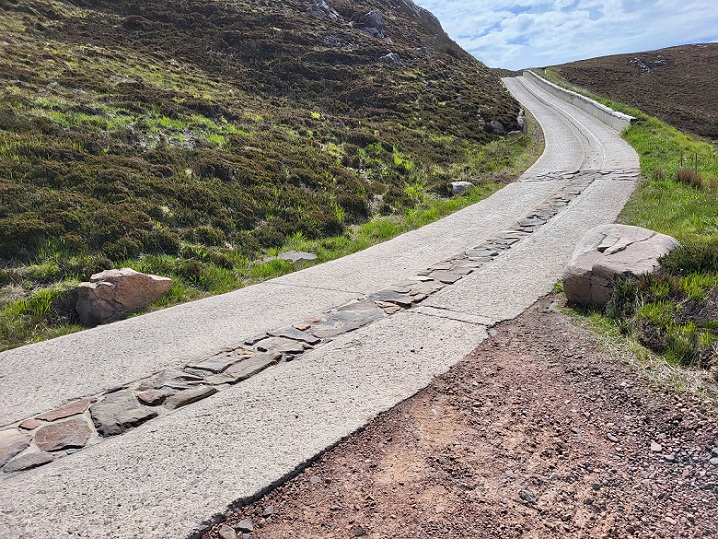
On a recent estate visit I noticed hill roads with concrete ‘tramlines’ on corners and slopes. Concrete batched on site with local quarried stone. Expensive and carbon heavy? Probably. Visually impactful ? Probably. Alternatives? Washed out hill roads, gravel spread and repeated repair? Spend on fighting decay, visual impact and local biodiversity impact? High?
Land is a fundamental asset for the people of Scotland. Should they demand obligations to repair along side rights to use?
It is perhaps of note that the ‘competitor’ mountain coaster at Midlothian Ski Centre appears to have been constructed and serviced without any permanent track being required. In fact I don’t recall a temporary one being required either. As photos of it on the previous articles show, the visual impact is limited to the structure itself.
The erosion shown in the photos demonstrates the problems clearly. However, I recall examining Coire Cas with Adam Watson and Friz Schwarzenbach – a witness for the North East Mountain Trust at the 1981 public inquiry and then the foremost expert on ski development. He pointed to upwellings of water scattered over the slopes. He pointed out that much subsurface drainage of water took place in well defined channels and that, in erosion of surface layers, an important result was the fines got washed down into these flows and blocked them – forcing more surface flows.
I recall also that Adam did research then comparing the frequency of flash floods on the Nethie, Feshie and the Allt Mor off of Cairn Gorm and concluded that the frequency was stable on the Feshie and but had doubled every ten years up to 1981 on the Allt Mor.
This is just one of the more obvious problems with the planning application for the Cairngorm mountain coaster, but this article well describes and illustrates the problem. This issue on its own should be enough for CNPA to reject the application.
HIE/CMSL have a disgraceful track record of wasting tens of millions of ££ of public money on Cairngorm Mountain. There is no published business plan for this project, only some customer user figures which seem to have been plucked out of thin air. The economic impact report included in the application is in its own way robust, but, as the writers point out, is based on customer user figures given to them by CMSL.
The application has the feeling of HIE/CMSL yet again ‘flogging a dead horse’.