Following my last post on the impact of the river hydro schemes in Glen Etive (see here), I have been sent photos of the work taking place to construct the Allt Chaorainn, the first scheme you encounter when coming down the glen, together with some commentary (in italics to distinguish it from my own).
“I had a lovely walk in and around Glen Etive today [Ed, I received the photos c10 days ago]. Whilst there, it was too good a chance to walk up and see the progress they were making on the hydro on the Allt a’ Chaorainn. Whilst on the site, I spoke and chatted with the contractors who were very kind and explained what was going on. They were also cool with me taking pictures. Thanks to them!”
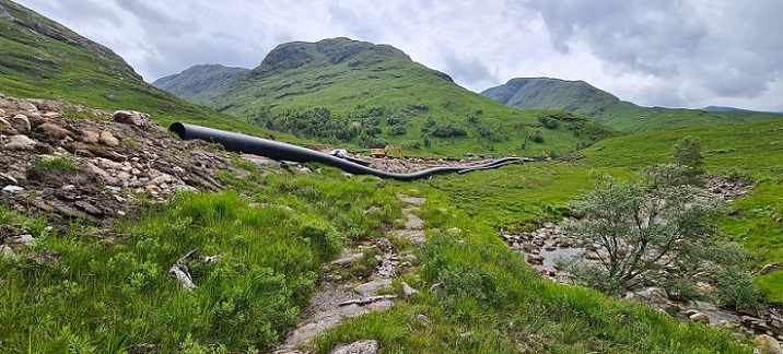
The area of ground affected by the construction is extensive and has wrecked the approach to what was once a beautiful gorge. The work is not yet finished but at present the bed of the re-engineered watercourse appears at high risk of being washed away as happened with the Gynack overflow above Kingussie (see here), a problem that has still not been solved five years later.
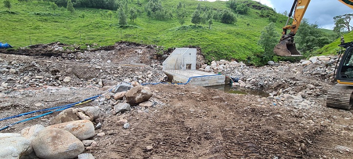
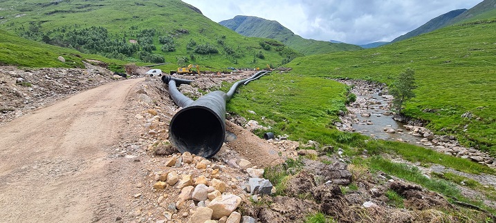
“They had said that the works were due to finish mid August, however they are well behind and completion could well be some more months away.”
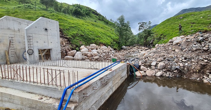
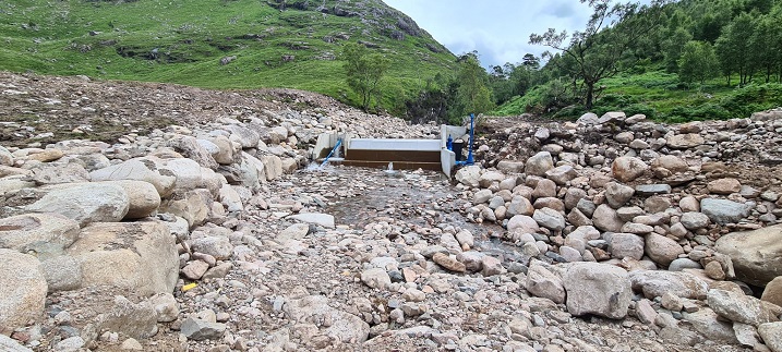
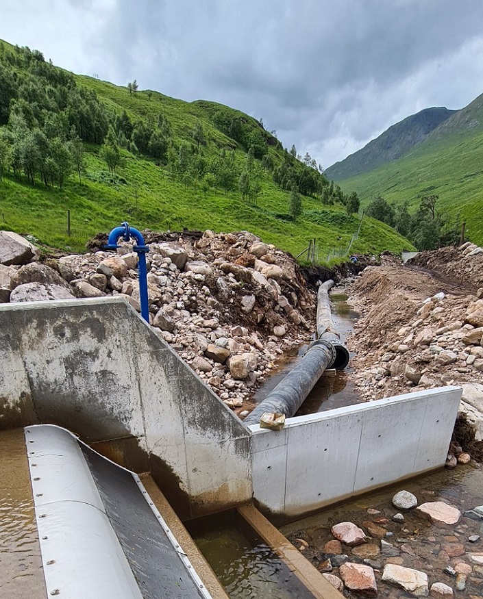
“They said that the water levels will reach as high as the re-bar on the wall, roughly where the circle is cut out. Roughly, to give you an idea.”
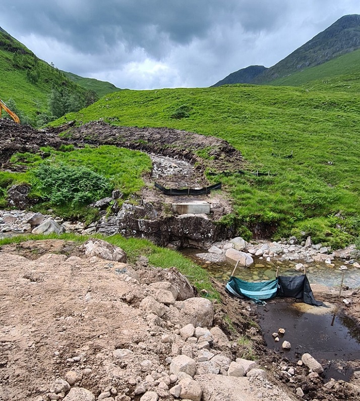
“The minor extraction point. Water flows over the ‘weir’ into the capture and down through the black pipe to the main extraction, then down hill to the station. There are temporary works still in place and will be removed when the pipes are connected.”
And as for the restoration work
According to the planning consent issued by Highland Council the trenches for the pipes are supposed to open for only a short-time to promote effective restoration of the ground while the construction tracks are to be removed entirely..
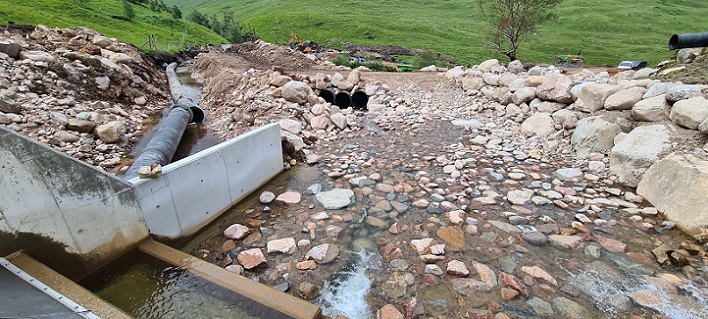
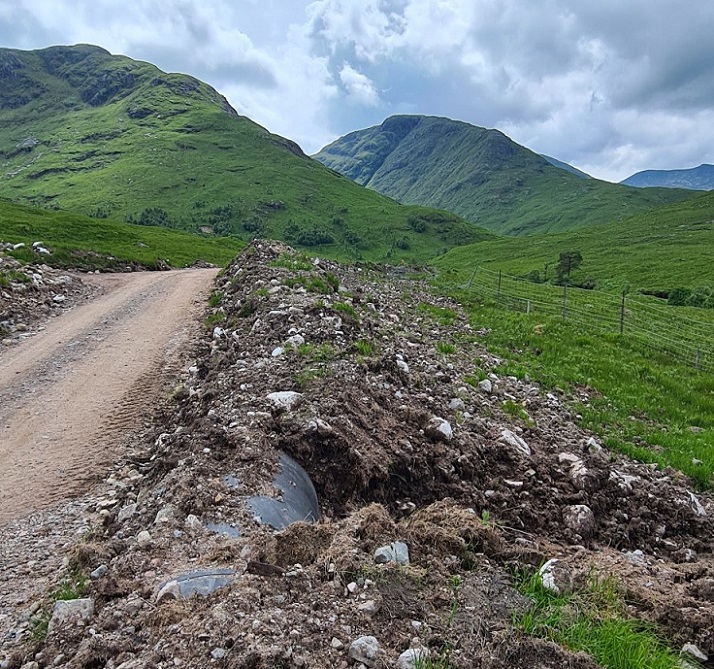
The short section of exposed pipe in this photo illustrates that sections of the pipeline have not been buried deep enough. Because of this the line of the pipe will form a new ridge across the landscape while its smooth surface is likely to shed any turf and vegetation placed on top (as in the photo). The result is likely to be a highly visible half buried pipeline, worse than a properly buried pipeline and probably worse than leaving it in the open air on a less conspicuous line (see here).
Moreover since material that was lifted from above the line of the track appears to have been used to cover the pipe there looks like a shortage of vegetation to cover up the new road.
The Allt Chaorainn is going to be a major restoration challenge. Our public authorities need to be reminded that consent to this disaster was their responsibility and shamed into action. Please considering taking photos and sending them in to parkswatch if you are in Glen Etive.

The same mistakes being repeated over and over again by all involved. Very sad. Presumably Dickins hydro were the only ones who would tackle the project because they had insufficient previous experience to know what they were doing.