I had been wanting to visit Glen Etive to take a look at the seven hydro schemes being constructed there since John Sinclair, a local resident, had alerted me to the environmental damage that was being caused before Xmas (see here & here)
This post takes a look at the landscape impact of the hydro access tracks, which I first considered in August 2018 (see here), based on what I saw last weekend.
The current state of play with the Glen Etive hydro construction
All seven hydros granted planning permission in Glen Etive should have been completed by now, a standard condition of the planning consent for each scheme being:
“Construction activities shall be completed within a one year period from the commencement of the development unless otherwise approved in writing by the Planning Authority. All reinstatement works shall be undertaken within three months of completion of all construction work and in accordance with the approved Construction Management Plan and associated Construction Method Statement.”
Work on the Allt Mheuran hydro, for example, started on 1st December 2020, 18 months ago. The various schemes are at different stages of construction with the Allt Charnan appearing almost complete, while at the Allt Chaorainn they are still working on the intakes and the burying the pipeline.
There is no information on the planning portal as to whether Highland Council, as planning authority, has agreed to an extension to the construction period for the various schemes and if so when either the construction or restoration will be complete. This means the landscape impact of the hydros and their tracks may end up less than shown in these photos. On the other hand the delays raise further concerns (see here) about the competence of the developer, William Dickins, to deliver the consented development and thus how the “final product” may look.
The current impact of the tracks on the landscape
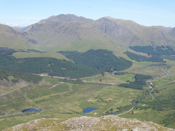
Our walk was over two days, starting and finishing at the bridge near Coileitir, and taking in the five Munros from Ben Starav to Meall nan Eun and Stob Dubh beyond, with an overnight stop on the col between Stob Coire nn Albannaich and Meall Tarsuinn, a fine place to camp. The route gave good views of the access tracks to six out of the seven hydro schemes, the exception being the Allt Chaorainn, the first scheme you see when coming down Glen Etive.
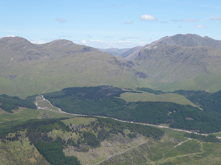
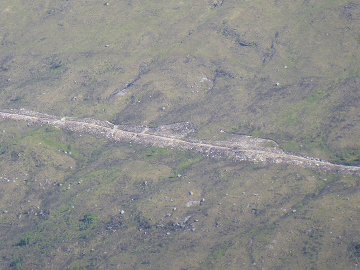
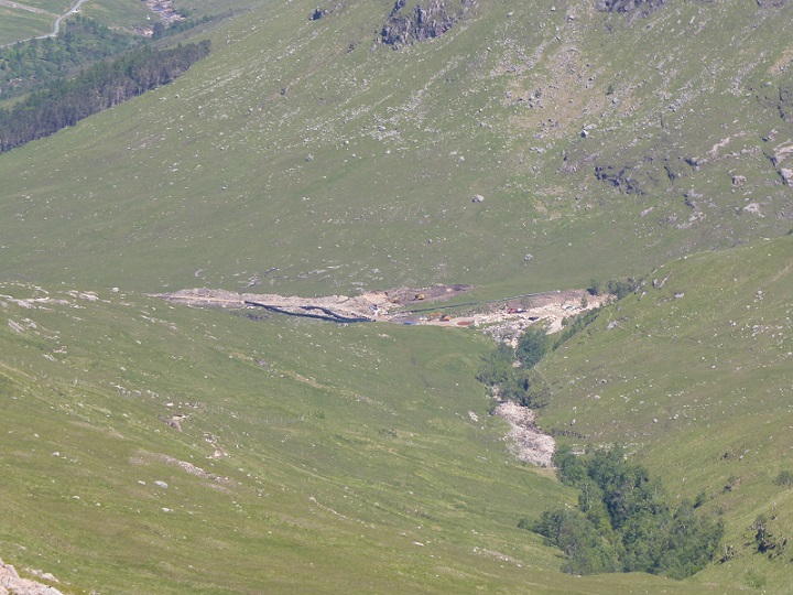
The old bridge over the River Etive at Coileitir has been replaced and the road to it (2 in top photo) enlarged to provide access for construction traffic to the Allt Mheuran and Allt Ceitlein schemes.
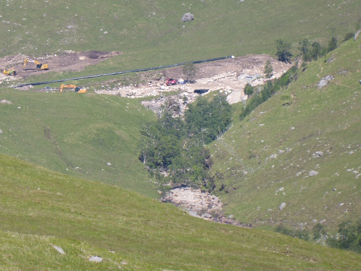
Unfortunately, it is impossible to tell from the information on the planning portal whether this is the finished product or not. Apart from the planning consents for the Allt Mheuran and the Allt Chaorainn, which required the access tracks above the power houses to be fully restored, and that for the Allt Ceitlein, which required the new track above the power house to be reduced to 1.5m width, there is very little in the documentation to specify how the tracks, whether new or enlarged, should be finished. The access track in the photo above, for example, is a problem waiting to happen with the left side poorly finished and nothing to prevent water running down the line of the track and eroding the surface away.
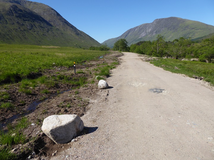
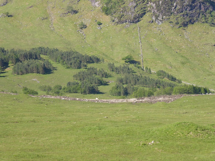
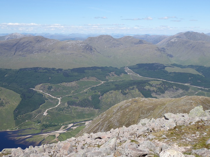
From a wider landscape perspective, the width of the tracks has a crucial bearing on their landscape impact. I can find nothing in the final planning documentation to indicate whether the new access road to the Allt Mheuran, which I estimated to be over 4m wide, is to be narrowed or not. The Construction Method Statements for some of the schemes on the west side of the glen state that new and enlarged tracks will be restored to resemble existing forestry tracks, without specifying what that is or giving any consideration to their visual impact. Unless the tracks that Highland Council have agreed should remain are narrowed, their visual impact in the long-term is likely to be similar to the photos that follow, whatever the quality of the restoration round about.
One would hope that the final restoration work of the construction track to the Allt Mheuran intake will look better than this but nevertheless it appear the remaining section of access track, c1km long, will now dominate the landscape.
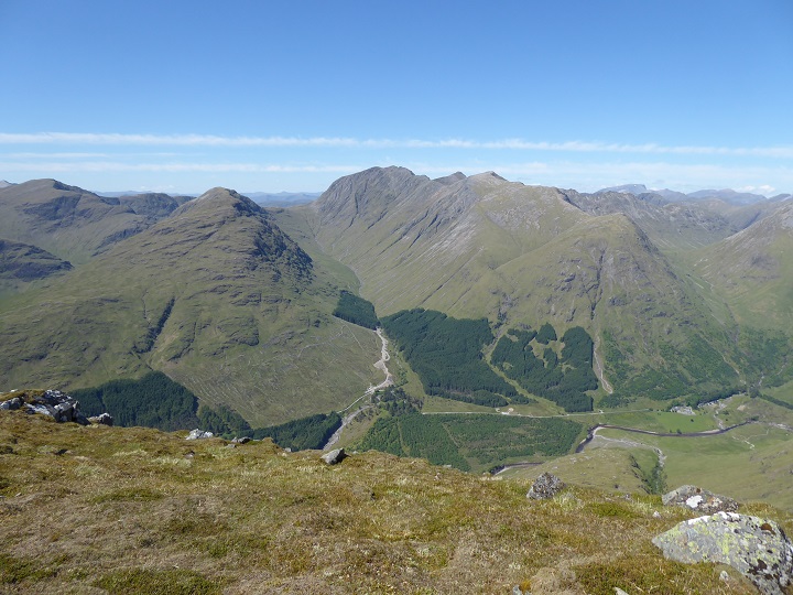
The higher we walked, the greater the landscape impact.
The Allt Bhiorain track clearly hasn’t (yet?) been restored to resemble the existing forest tracks below and to the right of it. Most of the conservation and recreational organisations, including the John Muir Trust and Mountaineering Scotland, only objected to the three Glen Etive hydro schemes on the east side of the glen that are in the Glen Etive Wild Land area. I argued at the time that that was a mistake (see here) and the wider landscape impact – both sides of Glen Etive are designated a National Scenic – needed to be considered. As we gained height the Allt Mheuran dropped out of sign and it was the visual impact of the hydro tracks on the far side of the glen which provided the main detractors from the “wild land experience”.
The existing forestry tracks on the west side of the glen were already quite prominent, but why make the landscape impact worse?
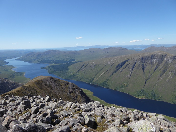
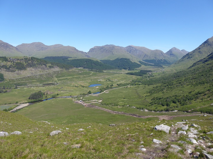
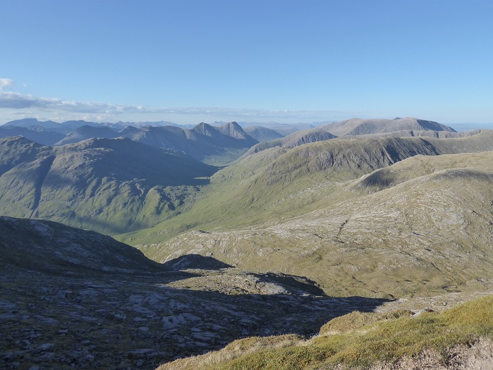
Thankfully there are still some unspoiled views to be enjoyed from Ben Starav but at the summit of Beinn nan Aighenan, a hill which I hold in some affection as it was my final Munro first time round, there was a further shock:
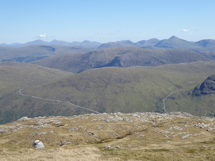
The Glen Kinglass hydro schemes are more remote, at the heart of the Etive Mountains Wild Land Area but much higher up than those in Glen Etive. Clearly being in a Wild Land Area offers little or not protection against developments in our mountains.
The visual impact of the Glen Kinglass tracks is worse than it might be due to little or no attempt having been made to repair the construction damage but however well restored a scar would remain across the hillside. How did government – by which I mean the Scottish Government, local government, NatureScot – allow developers to sandwich what should be one of the finest ridges in Scotland between these hydro track scars?
Raise your eyes, avoid looking down into the glens and look in the right direction and the scenery is still magnificent.
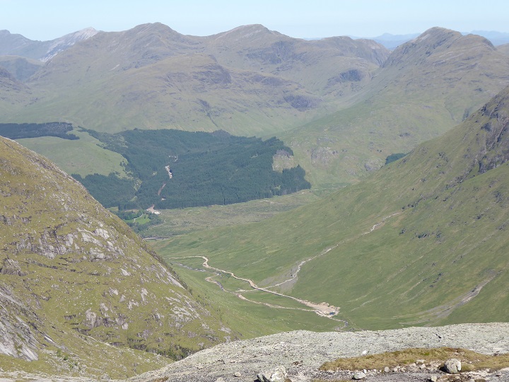
Step a little further, lower your eyes and seek out the glens and lower ground and its the hydro tracks which really catch the eye, even in blanket blocks of conifers. We have been left with half a wild land experience.
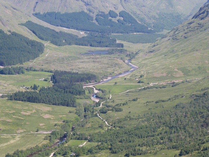
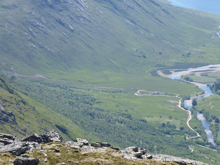
Once you return to lower ground, the hydro tracks dominate the landscape. As the Allt Charnan (7) on the far side of the glen disappeared behind Stob Dubh, so the Allt Gaoirean (4) and (5) appeared
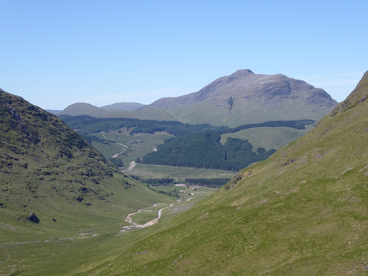
The summit of Stob Dubh, a hill that is rarely ascended compared to it companions around Glen Etive due to its lower height, is an extremely fine viewpoint. While the Allt Chaorain scheme is tucked away out of site below its steep northern flank, the last of the seven Glen Etive hydro schemes comes into full view:
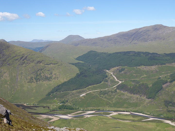
Stob Dubh also gave a bird’s eye view – nesting eagles didn’t stop the hydro construction – of the Allt Mheuran track:
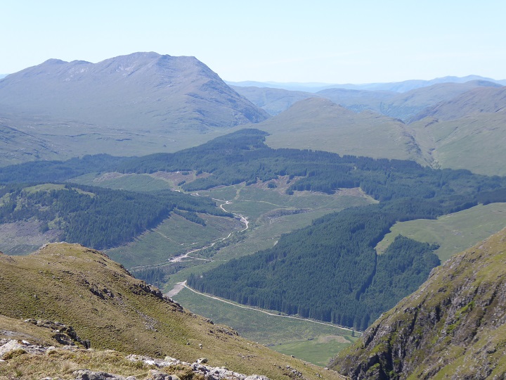
And good views over the forestry around the Allt Gaoirean:
The fact that forestry tracks have long marred Glen Etive does not seem to me justification for adding more. Rather they illustrate the need for forestry tracks too to come under the planning system and the desirability of continuous cover forestry, as practised on the continent, which would result in most forestry tracks being hidden away behind trees.
A proper National Park for Glen Coe and Glen Etive could have restored over time the past landscape damage that has been in the glen instead of adding to it.
The photographic evidence and the Landscape Visual Impact Assessment (LVIA)
Highland Council summarised the LVIA conducted by the developer as part of the planning application as follows:
“The LVIA has considered the cumulative effects on the special qualities of the NSA [National Scenic Area] as a result of all seven schemes proposed. The LVIA concludes that the combined construction activity of the seven developments would be limited to a very small part of the NSA in the context of the entire 1000km2 and any effects would be localised. Within the localised context of Glen Etive, cumulative landscape effects from construction works would be experienced across a large part of the Glen, and will be significant in places, particularly from the works associated with the Allt
Chaorainn, Allt Mheuran and Allt Ceitein schemes which are on the more open glen sides and incorporate construction works along the side of the River Etive. However, as these effects are over a small part of the overall designation, and will be temporary, the overall cumulative impacts on the special qualities of the NSA are not considered to be significant.”
The visual impact of the new hydro tracks don’t look temporary to me. To be fair to Highland Council they had their hands tied because SNH (not NatureScot), the public authority responsible for protecting the landscape and wild land areas advised:
- that it agrees with the conclusions of the LVIAs that the effects on the special qualities of the Ben Nevis and Glen Coe NSA will not be significant; and
- it considers that the proposals will have a localised effect on the sense of wildness but will not affect the experience or result in significant effects on the wider appreciation of the WLA or qualities of the area.
My photos suggest that assessment was totally wrong. Walking the south Glen Etive ridge is now a very different and much poorer experience than it was prior to the construction of the hydro schemes.
It was Highland Council staff, not SNH, who as a result of representations by the public forced the developer to agree to restore the tracks between the power houses and the intakes on the Allt Mheuran and Allt Chaorainn schemes and reduce the width of the Allt Ceitlein tracks. Unfortunately, however good the restoration, the creation of a significant network of new and access tracks appears likely to have permanently damaged the landscape in Glen Etive, just as it has done in Glen Falloch in the Loch Lomond and Trossachs National Park.
This post has focussed on the visual impact the access tracks associated with the Glen Etive hydro schemes have had on the wider landscape. A number of other adverse impacts were evident from my visit, which I hope to consider in further posts.

beware, they are coming for the corries for pump storage reservoirs
I see this as yet another example of the failure of local government to enforce the requirements of planning consents. When, if ever will a planning department actually have the balls to enforce. The reinstatement issue is a long standing one and for the developer there is NO money in it for them. So perhaps planning should only be granted on the deposit of a sum sufficient to complete the reinstatement before ANY works commence. I suspect these scars will never be removed.
I would take it further when we look at developers across Scotland from the Lowlands and into the Highlands. To me it’s one of deliberate collusion with estates and the moneybags. Our current Govt. can’t afford to lose the political support from the minority who own the majority of land and it seems the Scot.Gov. has simply turned its back on their real responsibilities so much so that in Central Scotland, ONE minister overruled 20 years of protection for a piece of greenbelt which had been denied to developers by successive Local Authority planners, the Council’s members and two Public Enquiries. If this can happen in the full glare of a major centre of populating North of Stirling then the glens are not going to remain secure from the rampant destruction Nick so ably describes and illustrates here…especially when Govt. agencies seem to add to the collusion.
Quick comment, google mileage from Glen Etive to Glasgow and Inverness (Glasgow is nearer both mileage and travel time). “My sources at The Highland Council tell me that during the induction of new councillors they were told by a senior bureaucrat that they were “employees of the council” (Lochaber Voice FB page). All the issues I have tried to flag up, the failure to acknowledge them and find a solution can be traced back to lack of governance by the Highland council, many good people work there, without integrity and leadership by senior bureaucrats (servants to the people) grifters operating in the Highland community will keep profiteering at the cost to the people in the Highlands.
The lack of governance and sound direction within the Highland Council Chamber see John Sinclair’s post) can in part be turned straight back to who controls the source of so much essential “Funding” . There simply are not enough people / local tax payers in Highland region to fund the huge networks of infrastructure and health care the widespread communities require . So the council has – in clear desperation – adopted a policy of attempting to expand the number of rateable properties within their “domain” by relaxing diligence towards suitability and need within all planning consents. They now rush to say “yes” -perhaps with a few unenforced pre conditions Anything is possible..and never inspected again..
The impact on scenery and “wildness” of inappropriate development to suit short term budget expediency across the region is massive.The lack of effective planning enforcement teams is woeful ( due to staff and office budget constraints). Developers know this. Homes are soon altered without controls enforced etc. Roads are driven into “wild areas” and so on. It would be instructive to compare aerial images of various districts 20 years ago, to note how these same remoter districts look today from space.
In our one Community Council area there have been scores of new “holiday” houses built, everywhere. Down this small byroad the number of houses has been allowed to double and roadways to sites for more have been cleared (“for agricultural reasons” ! ) . Many new-build are suburban dream houses eyesores wholly inappropriate to their Highland setting. 75% of the new build are short term holiday lets or sit empty for months..and yet the children of local people urgently needed to build service and maintain such ‘palaces’, still cannot find anywhere in these communities to live. The blame for this goes right back to the tax money squandered to operate so many useless and fully staffed committee rooms at Holyrood.
We visited Coire Hallater, running towards Ben Starav in 2019. They were just about to start the hydro there. Truly beautiful. Dropped down from Beinn nan Aighenan that way last month, sad to see the hydro vandalism in the lower Coire.
Instructive that off the radar Glen Kinglass caused not a whimper of protest, despite being far “wilder” than Glen Etive. No-one cares unless you can drive there.
The Kinglass area is a bit of a mess now, glad we saw it a few times before this.
As someone who spends a lot of time whitewater kayaking it doesn’t look that bad to me. Certainly better than a forest of wind turbines. It may also provide access for mountain bikers and more elderly / less fit electric mountain bikers to landscapes that would otherwise be off limits.
We’re not going back to the caves and our existence will have an impact on the land we inhabit. Can’t get too excited about this.
Harry, yes development is a necessary part of ‘not going back to the caves’ but it should at least be the right development in the right places. These schemes are not an efficient use of resources for the amount of electricity they will generate and are not close to people that will actually use the electricity (permanent population of GE – nine people). Access for mountain bikers / people that don’t much care for natural landscapes, is a pretty poor reason to carve roads up hillsides and dam all the rivers.
People who live further down within the river catchments into which these small scale Hydro schemes are being sponsored are learning to be very wary. Facilitating rapid flow of water down the hillsides to valley floors to generate power is only one aspect. Creating fresh roadways and ditches and laying pipestock across peat bogs, sometimes trenching and tunnelling through hard rock barriers that have existed for millennia, high on hillsides creates fresh watercourses. Across newly loosened soil water will carry material off the higher slopes. Those further downstream already experience greater deposits of silt. When river systems clog up massive floods will occur far more often.
Submissions to the huge consultation surrounding the Glen Etive proposals raised this alteration of natural drainage concern. It was ignored.
Officials of the same local authority – tasked with funding and maintaining other essential infrastructure, at risk of damage by “freak” flood water across the highlands – lack sufficient imagination.
I was there today (28th July). It’s pretty clear that the developers have made a pretty half hearted attempt to reinstate the landscape. They’ve chucked blocks of peat and some gravel over the pipeline and just left it, hoping that something will grow. Of course, nothing is growing because the peat areas are soaking wet and the gravel is suffocating the rest. There have been some attempts to landscape part of the track by excavating lumps of grass but this has left great wet holes where the grass has been removed. It’s hideous. They seem to merely be hoping for the best. Has anyone contacted Highland Council to ask if they have checked that the developers have complied with the planning consent in reinstating the landscape? I will certainly do so, but would suggest that it would be more effective if lots of us do so. As for the Kinglass schemes…