At the end of September, almost three years after I had first seen it, I went back to look at the River Gynack overflow (see here) for the fourth time. It was still not functioning and since my last visit it appeared rocks had been bulldozed from the bed of the river against the stone filled sacks to re-inforce them further.
Afterwards I checked with the Cairngorms National Park Authority who helpfully confirmed that the River Gynack cannot be allowed to enter the overflow without risk “of extreme damage”. The CNPA informed me they understand the Pitmain Estate have appointed new engineers to review the design. Extensive work, requiring a new planning application, is likely in due course. Meantime, parts of the village of Kingussie and the railway remain highly vulnerable to serious flood damage.
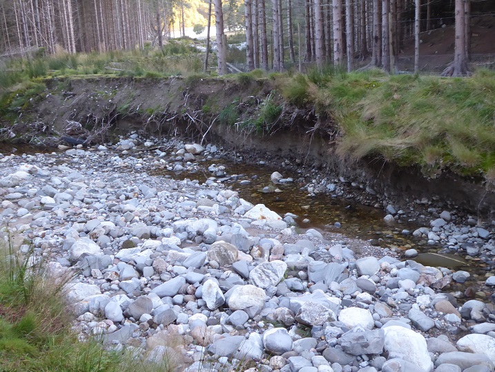
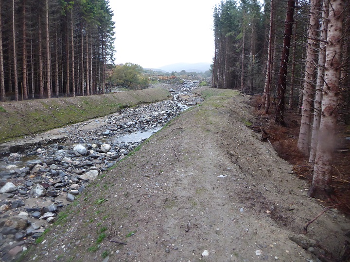
 The design flaws and the problems they have caused are only two apparent as soon as you look beyond the rip rap bouldering below the entrance to the overflow. A shortish section of bank has collapsed, leaving earth vulnerable to erosion.
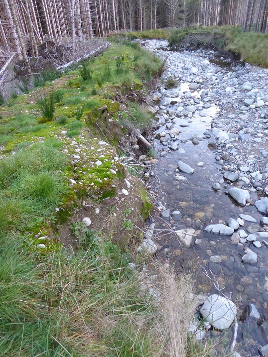
Just beyond is a longer section of collapsed bank, now so narrow that one flood could breach it. This would allow any diverted water to return rapidly to its original course, but in doing so it could convey tonnes of earth into the protected waters of the Spey. Note how nothing has been done to restore vegetation to the undamaged bank on the right hand side of the overflow, leaving it too prone to erosion.
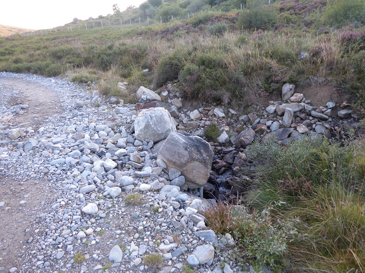
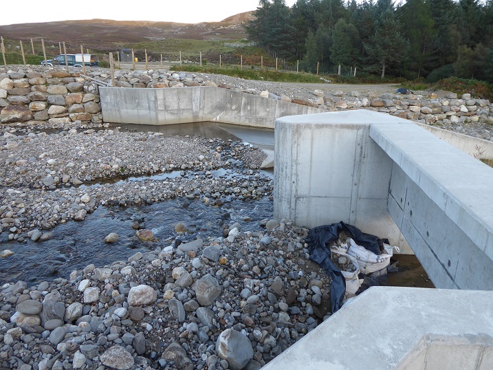
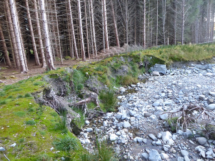
Below the bridge a burn flows under the road and into the overflow, another example of seriously flawed design. The culverts are too small for the volume of water carried by the burn in flood, with the result that it has flowed over the track and come close to washing it away.
It appears that in flood conditions that water from this small burn feeding into the main overflow applied additional erosive forces to the short section of bank opposite that it was almost breached. The bank has now been reinforced with five boulders, but if the water had broken through here it would almost certainly have flooded the estate buildings below. This risk should have been considered at the design stage.
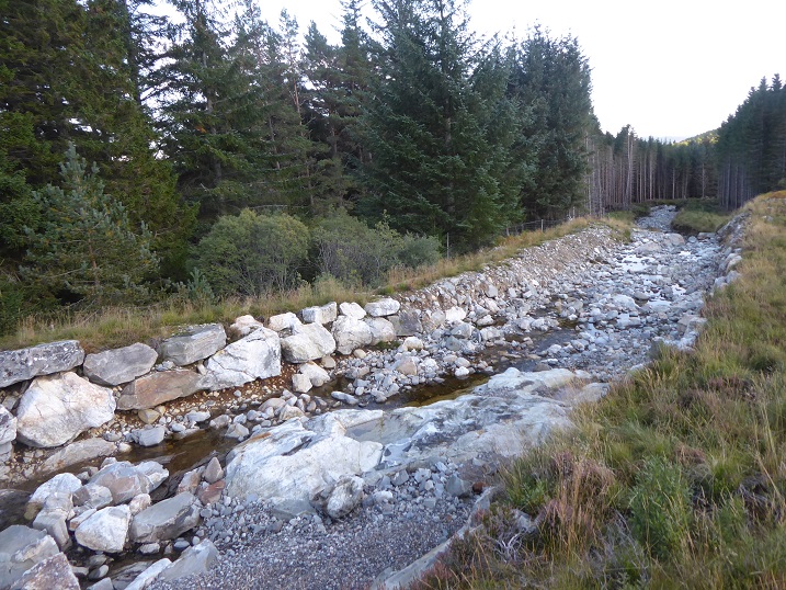 Some sections of rip rap bouldering appear poorly designed, with giant boulders sitting on earth vulnerable to erosion. It seems that almost the entire overflow channel will, if it is ever to function properly, require to be re-built. Highland Council contributed £135k to this project – for what?
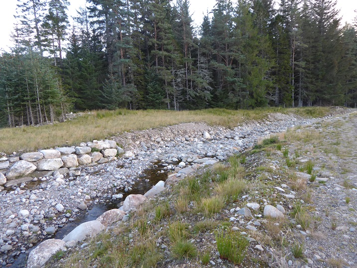
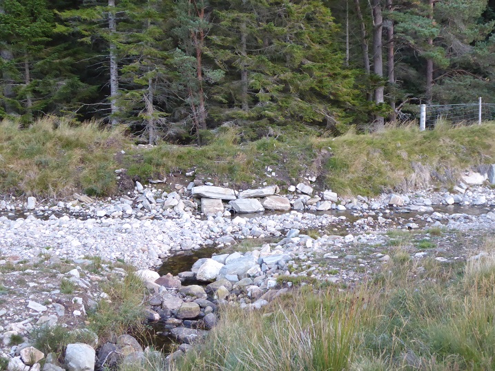
Lower down, what were bare earth banks have greened up slightly. But take a careful look and you can see how they are continuing to erode. If any volume of water was to run down the overflow, these banks would be swept away in no time at all.
The little water still flowing is still sufficient to continue to undercut the banks in places.
How long would this section of bank last? If it went it could flood a large area of land and threaten the lodge on the far side of the plantation.
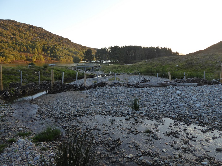
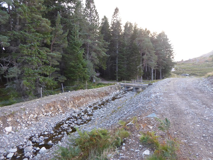
The area around Loch Gynack is now completely segmented by fencing. It appears this fence was erected after the overflow was shut off, sometime in 2019. The debris caught in the short time since, shows just how much water still enters the overflow from the small tributary and other sources in times of high rainfall.
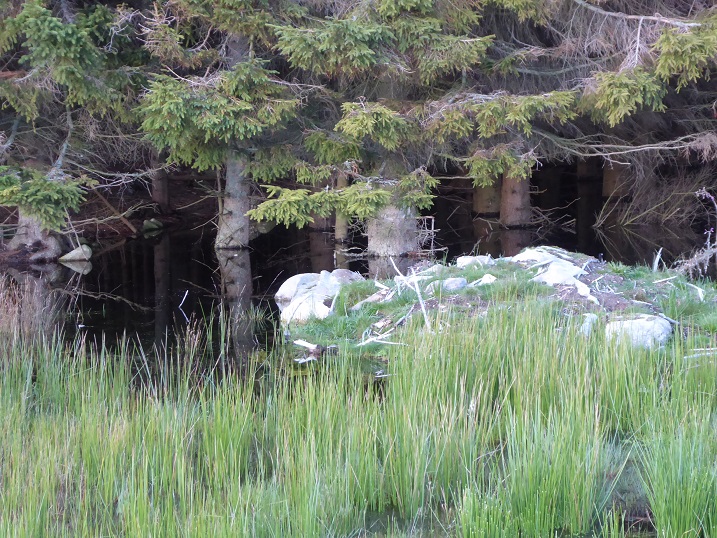
The edge of the plantation on the downside of the overflow was drowning in a large pool of water when I visited. I don’t recall seeing this before. Could it be that some of the water that is still channelled down the overflow has found its way UNDER the banks and collected here? If so, the problems are even more serious than I had thought.
My first visit was during construction in 2017 and by the time I next visited there were already signs of serious damage. I would contend, however, that almost anyone looking at these banks on completion could have told those responsible that this was a disaster waiting to happen. The question therefore is how was the construction ever allowed to get this far?
- Did the people working for the contractors, McGowan, ever question their bosses about the work they had been asked to do?
- Did McGowan, when bidding/negotiating to do this work, ever say to the Pitmain Estate and Highland Council who were paying for it, hang on a moment we have serious concerns about whether what we have been asked to do will work?
- Did Adrian Laycock Ltd, who appears to have designed the scheme, ever assess whether earth banks could withstand a flood?
- Did Savill’s Smith Gore, the factors for the estate who appear to have commissioned the work, ever scrutinise the design and assess whether the banks were sufficiently robust to protect their client’s lodge?
- Did the owner, Abdul Majid Jaffar, ever ask his factors if his financial contribution (50% or more of the costs) would be well spent?
- Did Highland Council ever scrutinise the design and satisfy themselves that the money they were contributing would be well spent?
- Did the Scottish Environment Protection Agency, which knows a thing or two about flooding, ever consider whether the banks of the overflow met the requirements for flood defences elsewhere?
- How far did National Park Officers consider the risks?
- Did no-one on the CNPA Planning Committee, which took the decision to approve the application in 2016, ask the right questions?
The list of questions could go on.
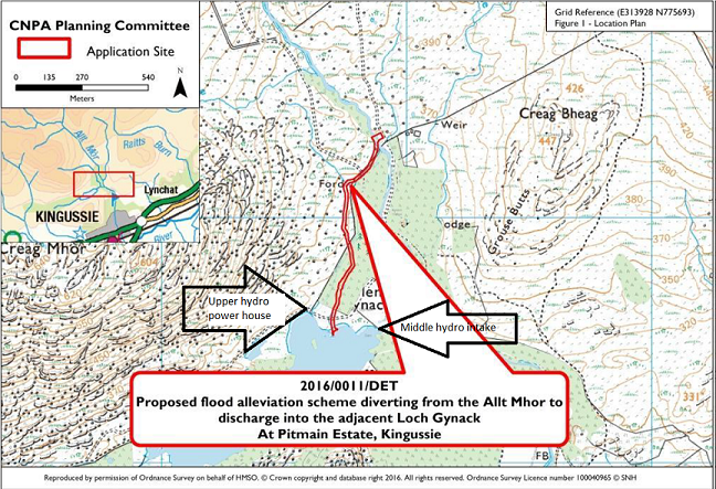
Unfortunately, it is not possible to tell the answers to most of these questions from the documentation on the CNPA’s planning portal (see here). The minute of the Planning Committee suggests that members did scrutinise aspects of the application, including the landscape impact, but not whether the design was fit for purpose. As part of the Decision Notice, the CNPA did require “details of measures to stabilise vegetation along the channel banks to ensure this is not washed away in the event of flooding;”. This suggests that the Planning Officer, to their credit, realised there might be an issue, even if they did not appreciate how serious it might be. Unfortunately it is not clear whether those details were ever supplied, as the Construction Management Statement has not been uploaded to the Planning Portal (I will ask) However, at the time of my visit in 2018 there was no evidence of any attempt to re-vegetate the banks.
In a sense, however, this is not the main issue. Even if covered in a luxurious growth of grass, the earth sections of bank were never going to be strong enough to withstand the force of a flood. The real problem is system failure. As a consequence, as I suggested a year ago, I believe the CNPA Board should be holding an inquiry into what has gone wrong, not to blame anyone but rather to ensure that similar failures cannot be repeated in future.
To my mind, besides asking all the parties to discuss openly what part they could have played in preventing the flawed design from going ahead, the CNPA needs to look at the underlying issues that could have contributed to the system failure. These include:
- How far did financial and budgetary considerations result in the flawed design? For example, were the engineering design team and contractors constrained by having to work to a budget and left in an impossible position as a consequence?
- How far was lack of time an issue? The overflow scheme was developed after a serious flood in 2014 which caused extensive damage and there was public and political pressure to sort this. How far did that result in pressure on the various parties to the design process taking short-cuts?
- How far was lack of expertise responsible? As I have highlighted in my coverage of damage around hydro schemes, there seems to be a serious lack of know-how in Scotland about how to channel/engineer sections of upland rivers in Scotland according to ecological principles.
Addressing these issues would help to assure the residents of Kingussie and the general public that any redesigned overflow will be fit for purpose but could also help improve our response to the Climate and Environment Emergencies across Scotland. In other words this is an opportunity for the CNPA to admit mistakes and lead by example.
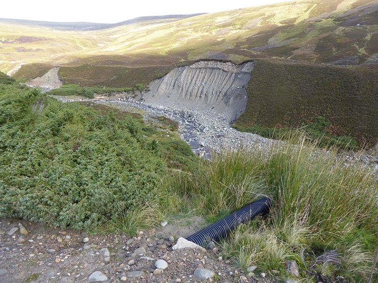
Meanwhile, a wall of water carrying a mass of boulders could destroy parts of the village and the railway at any time. In my view a significant part of the flood risk to Kingussie has been caused by the way the land above has been managed by the Pitmain Estate. Muirburn speeds up run-off into the river and its tributaries. On sections of the river, there are huge quantities of debris which risk being washed into the river whose bed comprises large quantities of large boulders. If these were all to start moving in a massive flood, the destructive potential would huge.
The photo also photo shows part of the solution. Juniper and other trees that would help retain the water and slow the rate it drains into the river system would flourish here, if given the chance. The problem is they are burned for grouse.
The Scottish Government is due to respond to the recommendations of the Werritty Review of grouse moor management in the Scottish Parliament tomorrow. One indicator of the effectiveness of the Scottish Government’s response will be whether it creates legal powers for our public authorities to control muirburn and put the interests of local communities, like Kingussie, before those of grouse shooting. Just as the Scottish Parliament banned muirburn during the lockdown earlier this year, so should public authorities be able to issue emergency orders to stop muirburn and require landowners to develop longer term plans so that land is managed in the public interest.
