Eighteen months ago I blogged about the Keltie Water hydro scheme north of Callander based on photos supplied by Derek Sime from the Munro Society (see here) concluding that it was one of the better hydro schemes I had seen in the National Park. I found out last week that it has now been shortlisted for the Scottish Planning Awards which are due to be announced at the end of September, under the Partnership category. So, on Saturday, I went out to have a look myself as part of a longer stravaig from Callander to Beinn Each returning by two hydro schemes above Loch Lubnaig (which I will consider in a further post). Its worth contrasting the commentary which follows with the Park’s highly selective promotional video which has no doubt been shown to the award judges.
Background to the Keltie Water hydro scheme
First, its worth saying that I believe the Keltie Water is a good place for a hydro scheme and, as the Park’s Director of Planning Stuart Mearns says in the video, its location posed far fewer challenges than other hydro developments, particularly in terms of the landscape:
- there were already tracks in place up the glen and eventually only three short lengths of track were required, all at a gentle angle;
- the main intake has utilised an existing dam and reservoir reducing the need for new infrastructure;
- and the topography is such that, while generally the landscape is quite open, both power house and the secondary intake could be hidden behind landforms and are not visible from any distance.
The original plans approved by the LLTNPA in 2013 however did not make the most of this existing infrastructure and involved the creation of a new construction track along the length of the glen (see here) and a large new structure at the reservoir. Drummond Estates then submitted significantly revised plans in 2014 (see here) which were, in my view, a significant improvement:
More specifically the new plans relocated the pipeline close to the existing tracks, removing the need for a new parallel construction track, and redesigned the main intake so that almost no new structures above ground level were required.
The significant improvements in the revised application rather begs the question of why the LLTNPA approved the first planning application and why there had not been a dialogue with Drummond Estates about better options – which really would have been an example of partnership working – at the time of the first application. It appears that the improvements were completely down to the developer, Campbell of Doune, and Drummond Estates and NOT the LLTNPA. Stuart Mearns, in the video explains why when he states that the LLTNPA was required to support the Scottish Government on delivery of targets for renewable energy generation (and in its rush to meet targets has not paid any attention to the appropriateness of schemes or whether they could not be better designed)..
Luckily, at Keltie Water, as a consequence of both topography and Drummond Estate’s revised design, the large scale landscape impacts have been much smaller than in other hydro schemes approved by the LLTNPA planning staff (e.g Glen Falloch (see here)).
At a local level, however – and that is also very important for landscape and recreational experience – the impact of the Keltie Water scheme has been significant and the restoration of the construction work leaves much to be desired .
The superficial plukes in the landscape are many
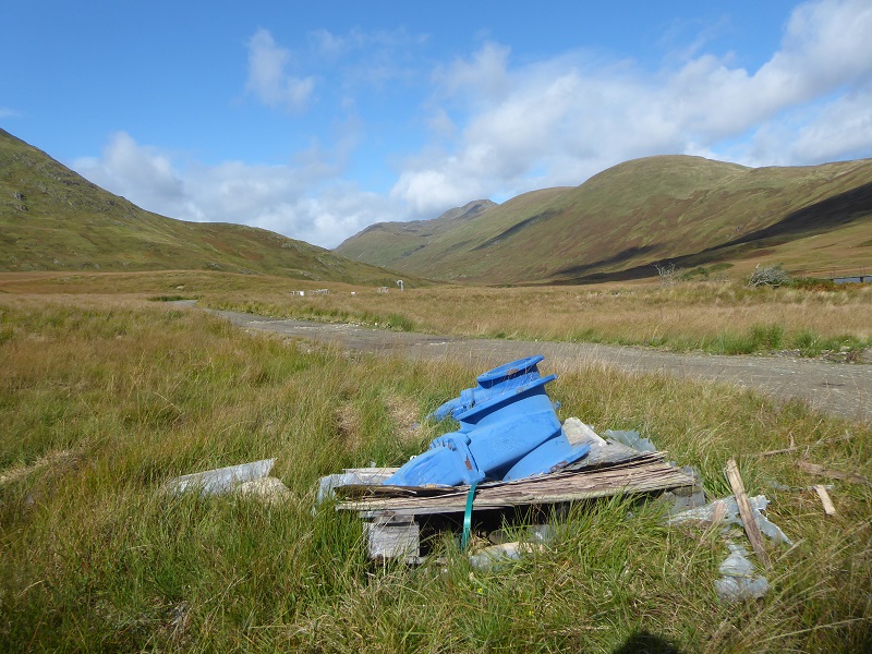
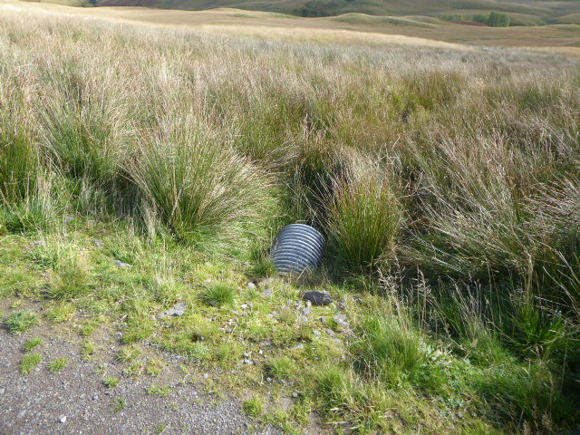
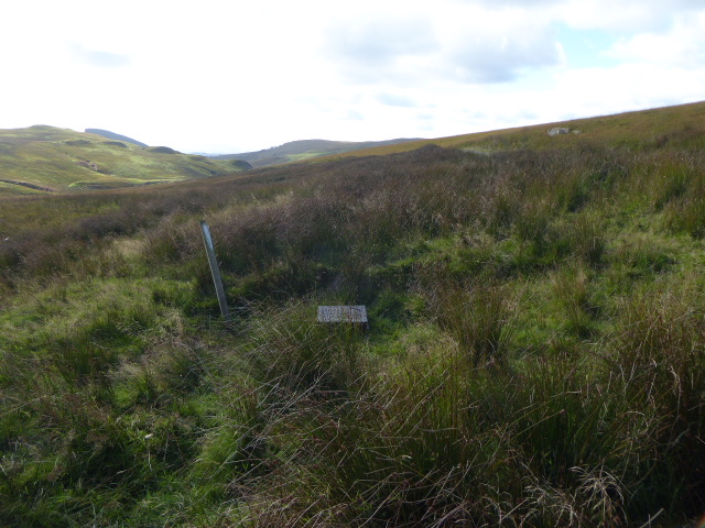
Sections of abandoned pipe are fairly typical for hydro schemes and Derek Sime had provided a photo of one at Keltie which I commented on 18 months ago.
They are still there! What’s more LLTNPA Park staff must have passed them while filming the video and turned the camera the other way!
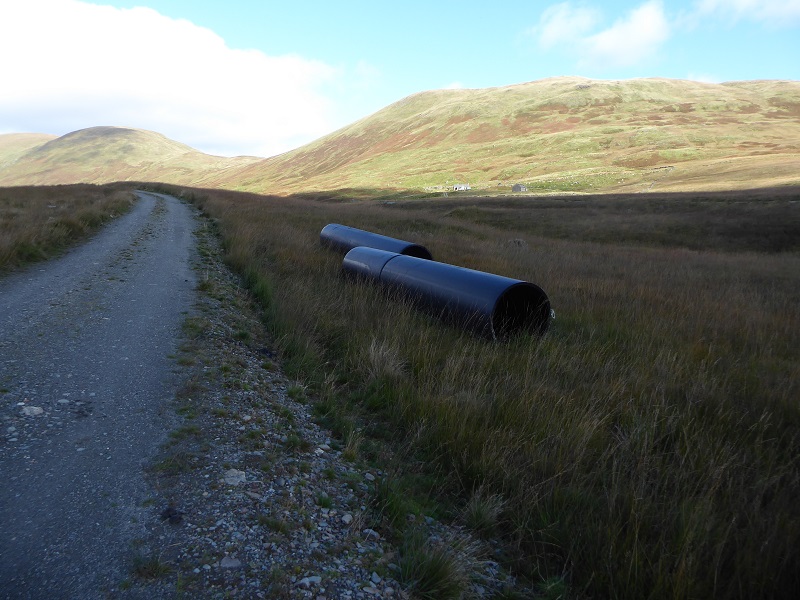
Two years after the hydro opened in 2016 maybe this section of pipe is still work in progress?
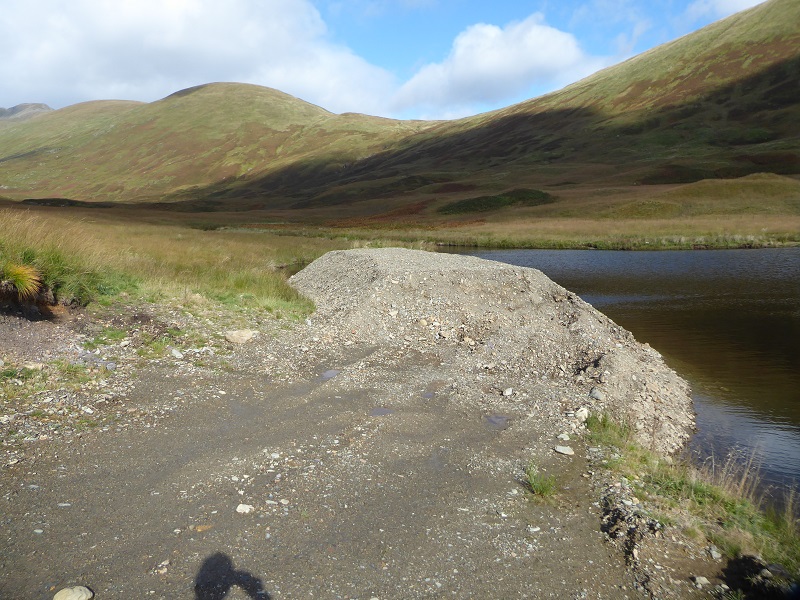
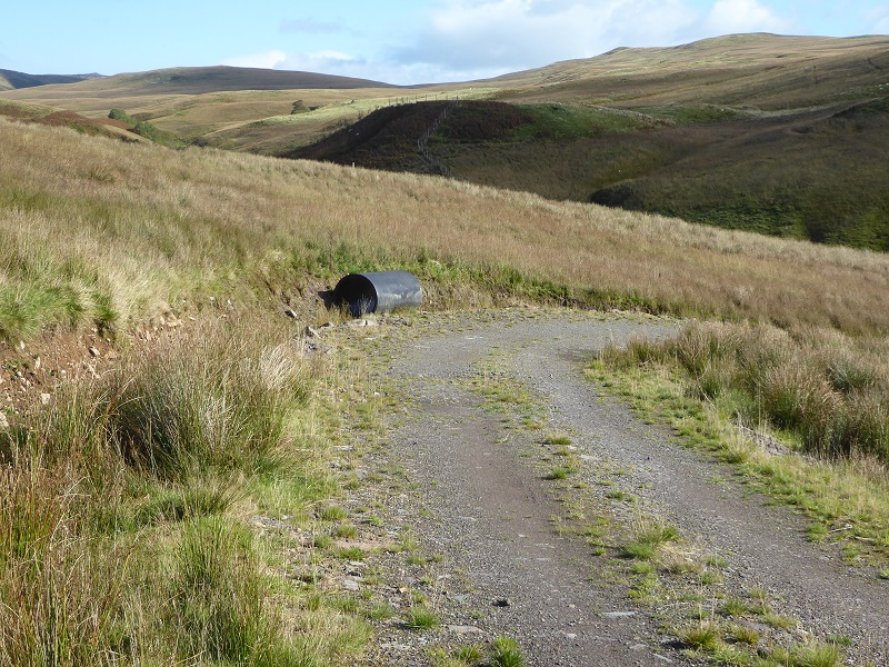
Or if you want something different how about this large heap of gravel and extension of track beyond the dam which has this been allowed to remain by the reservoir?
This is all relatively small stuff, snagging if you like, but should have been very easy to sort out. If this is such an excellent example of partnership working, why hasn’t the LLTNPA lifted the phone to the Drummond Estates, who own the land, and the developer and got them to sort this out? If I had been the Director of Planning I would have damn well made sure it was all sorted BEFORE the submission for a planning award. Its typical of the brass neck of those in charge of the LLTNPA that they put themselves in for this award without bothering to sort any of this – its very hard not to draw the conclusion that they simply don’t care. That’s not good for people who are supposed to be the custodians of our National Park.
The evidence of more serious failures in restoration
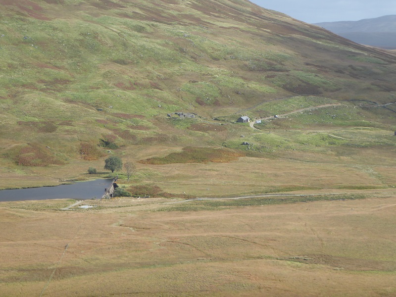
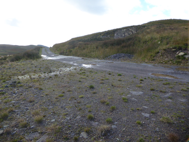
Approaching the scheme from Bracklinn Falls, I was heartened to find that the track past Braeleny Farm did not appear to have been massively enlarged to construct the scheme. It did not take long however to find an example of destruction caused by the creation of a section of new track and poor restoration.
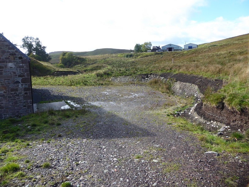
The LLTNPA has quoted the location and construction of the power house as one of the quality aspects of the scheme. There is no argument about the power house itself which is beautifully built – like many in the Park – the issue is the surrounding area. While the LLTNPA required trees to be planted round the powerhouse to help conceal it, the turning areas itself appears to have just been left without any thought about what space was required or how its appearance could be improved. Why is it that our planners and developers can produce good looking buildings but are often so poor at restoring the landscape around?
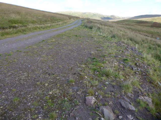
In my first post, I had commented how Drummond Estate had applied for the track to be 2.5m wide but the planning officer had required the tracks to be kept to 2m, except on the bends (in line with LLTNPA policy – although its not clear from the consent letter if this condition applied to sections of track which needed to be upgraded to take the construction vehicles):
“Track restoration plan for temporary tracks and track reduction plan for permanent tracks to the intakes. The permanent tracks will be reduced to 2.0m and 2.5m where it is necessary (turning areas).”
At first, heading up the track, I thought maybe this condition had been enforced. Unfortunately, as I went further up the glen it became clearer and clearer that it hadn’t.
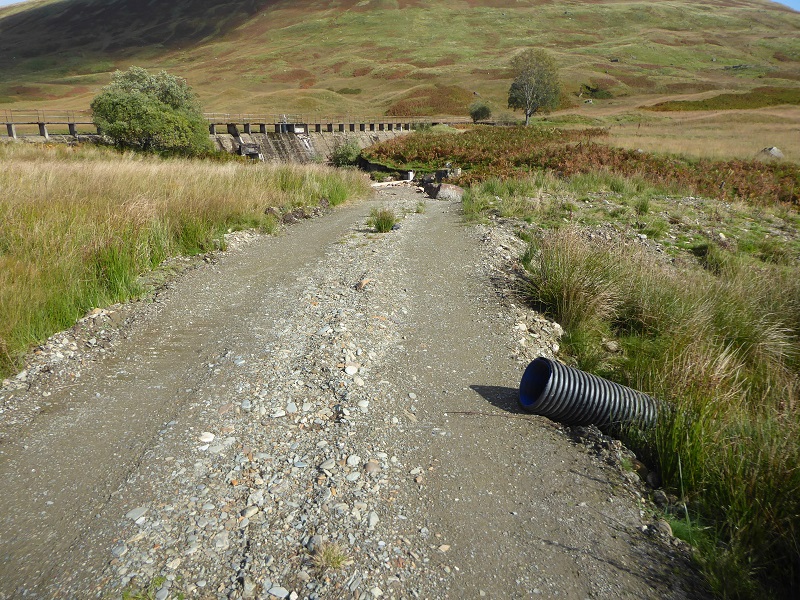
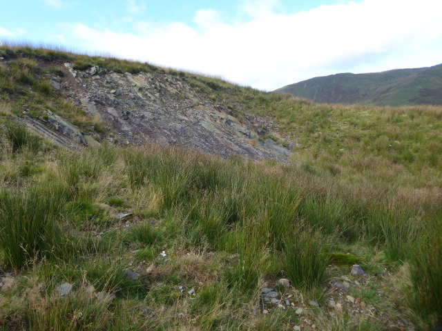
One of the worst sections of upgraded track was by a borrow pit, which also had not been restored properly:
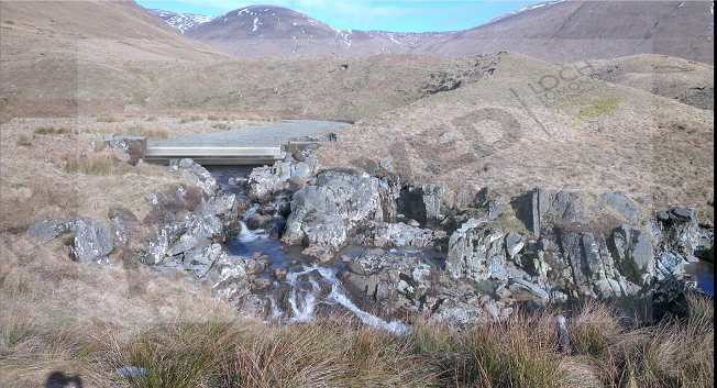
The problems are more extensive by a new section of “floating” track leading to the reservoir (again not featured in the awards video):
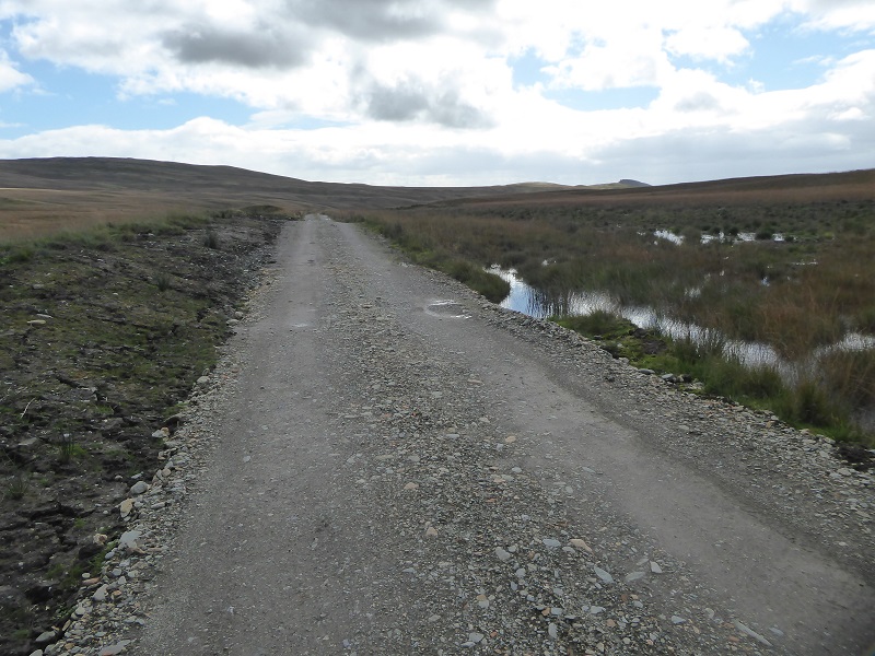
Its not just that the new section of track is more than the 2m stipulated, the track itself appears to have altered the drainage, making the area on the right where the pipeline is buried even wetter, while rush now dominates the vegetation.
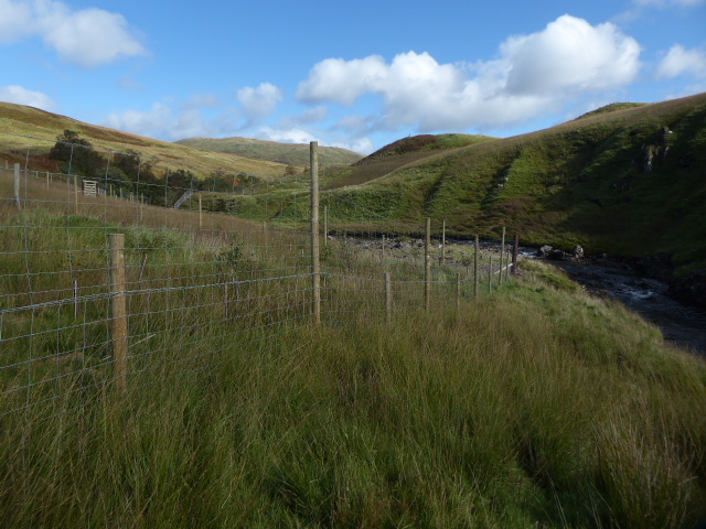
While the promotional video contrasts the bare ground during the construction with the vegetation that has now re-established itself, it is silent on the ecological impacts of the work. I have for a long time been aware that the best way to spot a buried hydro pipeline is to look out for a broad swathe of soft rush (evident in many of the photos here) but it was not until Saturday that I appreciated that this is more than just a temporary impact.
On Saturday I was puzzling about how the band of soft rush marking the new pipeline fitted with other areas of rush and then it clicked: the other areas of extensive rush below the new pipe mark the construction of the former Scottish Water pipeline. The rush therefore appears likely to become a more or less permanent landscape and ecological feature. It really is time that that some proper research on the long-term vegetation impacts of hydro schemes was commissioned and our National Parks could be taking a lead on this.
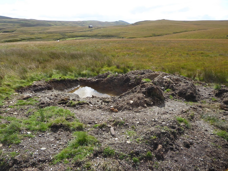
Also evident are the usual problems of poor landscaping around new intake dams. The actual landscape impact at the secondary intake is far greater than suggested in the plans:
The original photomontage failed to show either the new section of access track or the rip rap bouldering which is unlikely to revegetate
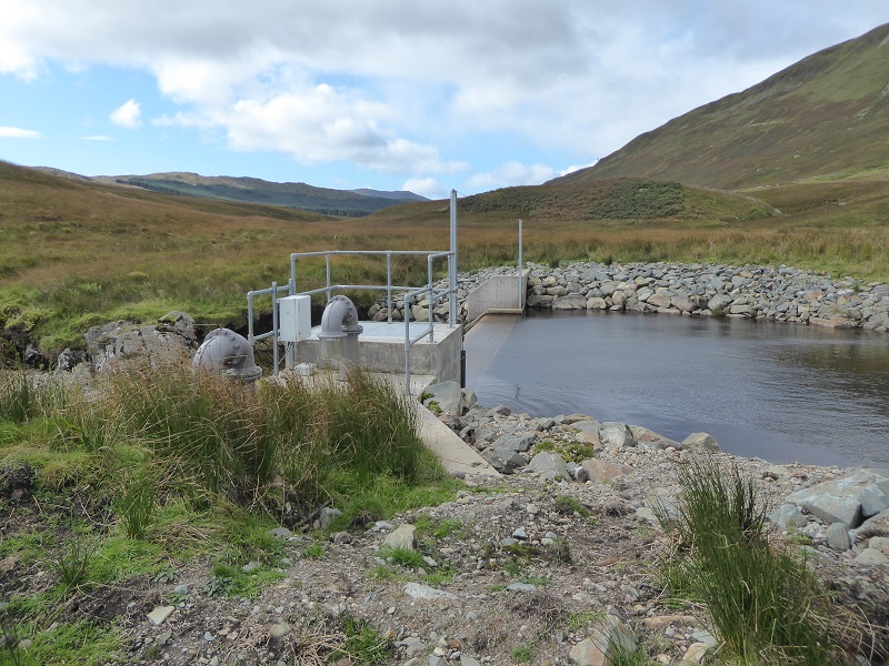
The planning consent rightly required “Landscape mitigation measures proposed at the intakes and outfall (this should include details of ground profiling to screen higher areas of the wing walls” but the result, as in most other LLTNPA hydro schemes, leaves much to be desired. Had the LLTNPA and Drummond Estates worked out a solution which would avoid the need for these artificial banks of boulders that might have been a step forward justifying a quality award.
So, is any of the Keltie Water scheme worthy of a planning quality award?
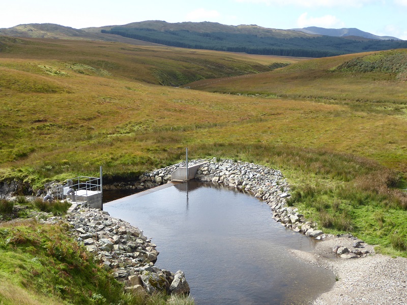
From a renewable energy perspective the use of the secondary intake to top up the existing reservoir at times of low demand makes sense. The big challenge with renewables is storage and the revised scheme as designed by Drummond Estates and Campbell of Doune makes far better use of the existing reservoir.
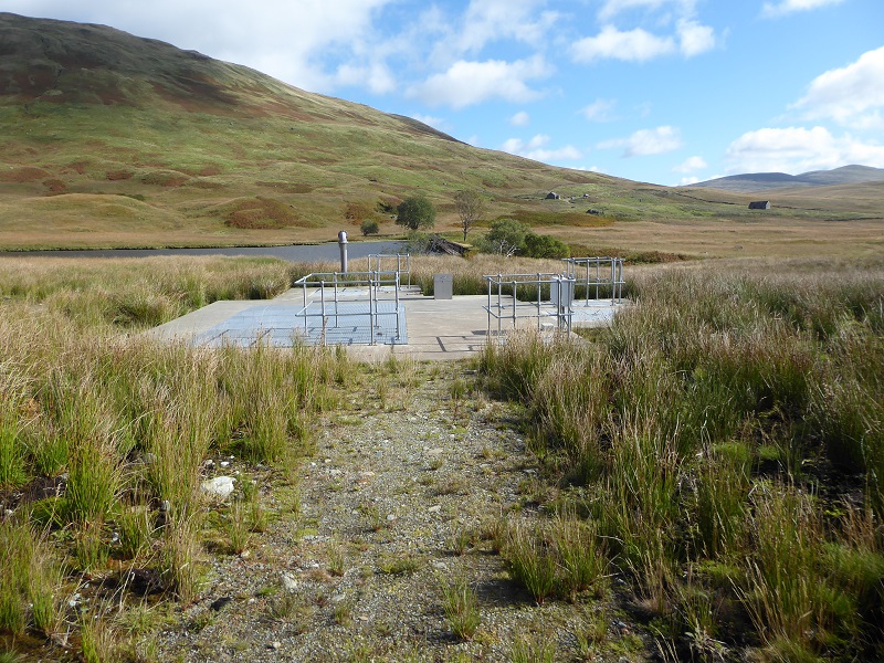
While the buried intake tank at the main intake is ugly from close up (could it not have been screened by a stone wall?) the new structure is far less intrusive visually than the original plans as a result of the water being abstracted by a pipe from the middle of the reservoir. An innovative solution that could possibly be used in other cases where there are large intake pools.
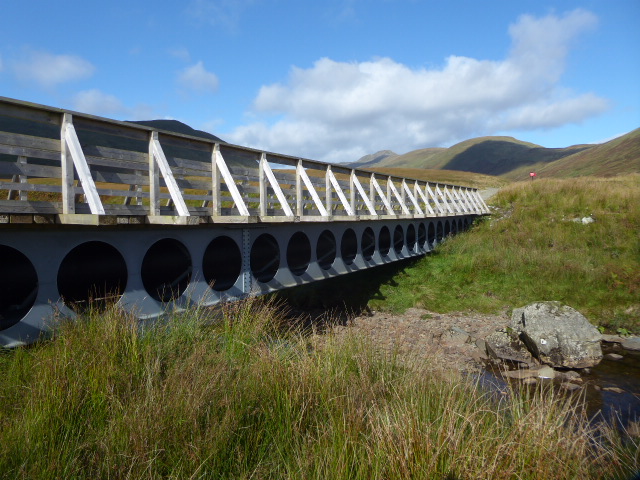
It was also good to see the Park’s own guidance being followed with the pipeline well concealed below the first bridge. While this and the second bridge which replaced the one swept away in 2004 has made access easier for walkers – the track is part of the core path network – I am sceptical about the LLTNPA’s claims this was done for walkers. On my visit I spotted six estate vehicles which had used the bridges – the most I have ever seen – and I suspect the estate’s primary motivation for installing the bridges was for estate management rather than recreational purposes.
As for the small fenced enclosures of new native woodland, which the LLTNPA claims as a success, well that is pretty common in hydro schemes and I think the question the LLTNPA should be asking is whether this is sufficient to justify/compensate for all the rush?
And as for partnership working, I am sceptical. The evidence shows the LLTNPA has in the main simply accepted whatever Drummond Estates has proposed or done, both good and bad. In my first post I commented on the lack of follow up documentation on the Planning Portal, including any detailed designs required by the planning consent and communications about the scheme as it progressed. There is still no information there and therefore no evidence about what extent Partnership Working has actually taken place (I will now ask!).
So what needs to happen?
Besides the video, the LLTNPA has produced a blog piece about the Keltie Water hydro scheme called “success shared” (see here). This, in my view, is the usual Park spin which says nothing meaningful about how this alleged example of partnership working has produced better outcomes and totally ignores the inconvenient facts featured in this post.
The LLTNPA Board need first to take a proper look at what is happening on the ground – as senior staff are clearly not doing this – in consultation with wider stakeholders (I wonder if any of them have visited the Keltie Water Scheme). They should then ask front line staff, who its clear from reports are trying, and developers questions about what is going wrong and why, for example:
- why is it so hard to get developers to clear up properl?
- why aren’t standards set out in Park policy and planning consents being properly enforced?
- what are the key areas where innovative restoration and landscaping standards still need to be developed?
- what changes would be necessary to make partnership working a reality
They could also commit to far greater transparency in planning matters and an independent audit of the extent to which planning conditions are adhered to in practice.
Meantime, I sincerely hope that the Keltie Water hydro scheme does not receive a quality award. It may be one of the less bad hydro schemes in the National Park (no signs of bright blue pipes thank goodness) – and Drummond Estates should get the credit for that – but it far from setting the sort of benchmark we need for what a high quality hydro scheme would look like.
The public have a right to expect much more and the LLTNPA should be raising its aspirations.
