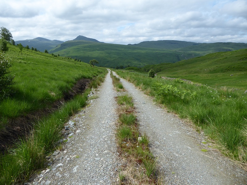
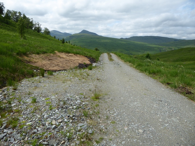
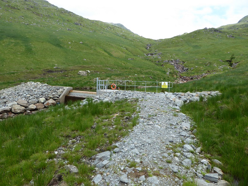
Close up, the track to the three Allt a’ Chuillinn hydro intakes, which form part of the Derrydarroch hydro scheme in Glen Falloch, does not look too bad. Its been significantly narrowed since construction, the sides covered with vegetation and a central strip of vegetation placed down the middle. Its quite a pleasant walking experience which is why I believe the Loch Lomond and Trossachs National Park Authority brought the Mountaineering Council and Ramblers Scotland here last year to demonstrate what the work they were doing to restore the land after the construction of hydro schemes.
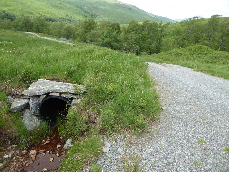
In terms of landscaping, all the culverts have been finished with natural materials and there are none of the protruding plastic pipes so evident in other schemes – which the LLTNPA excuses on the grounds that those schemes have not yet been “finished”.
There is even evidence of use of specialised restoration techniques in areas where insufficient vegetation was saved and stored properly for replacing over peat and other soils. The passing place in the foreground, however, is an eyesore which is completely unnecessary on a track which is barred by locked gates (see here) while its edges are poorly restored. At each passing place on the track, the vegetated strip down the centre has failed to take, presumably from vehicles swerving onto the passing place, thus increasing the visual impact.
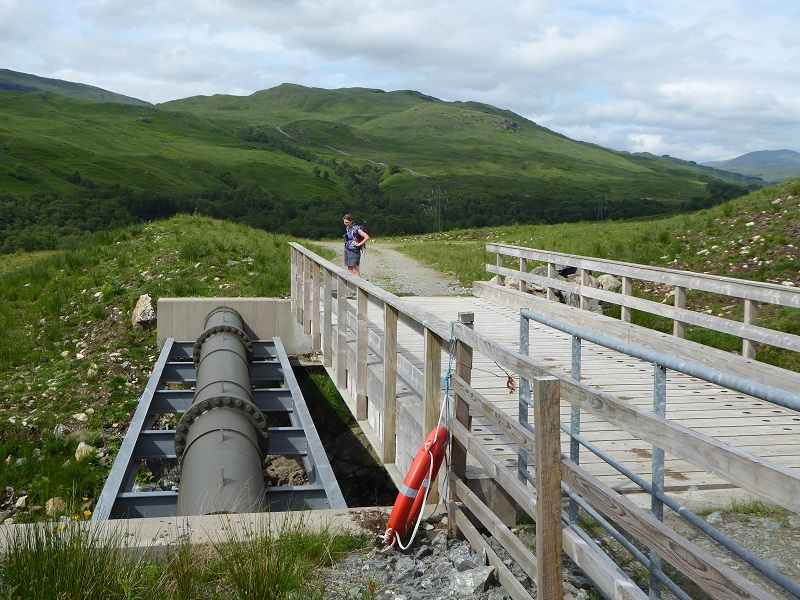
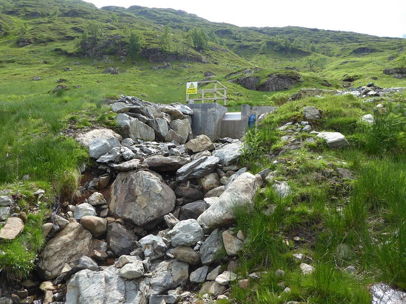
Although I was pleased to see the bright blue penstock has been painted (see here), its still an eyesore and its hard to understand why it would not have been hidden under the new road bridge as the LLTNPA’s own good practice guidance recommends.
The finishing at the intakes is another matter – the ugliness jars against the wild land behind.
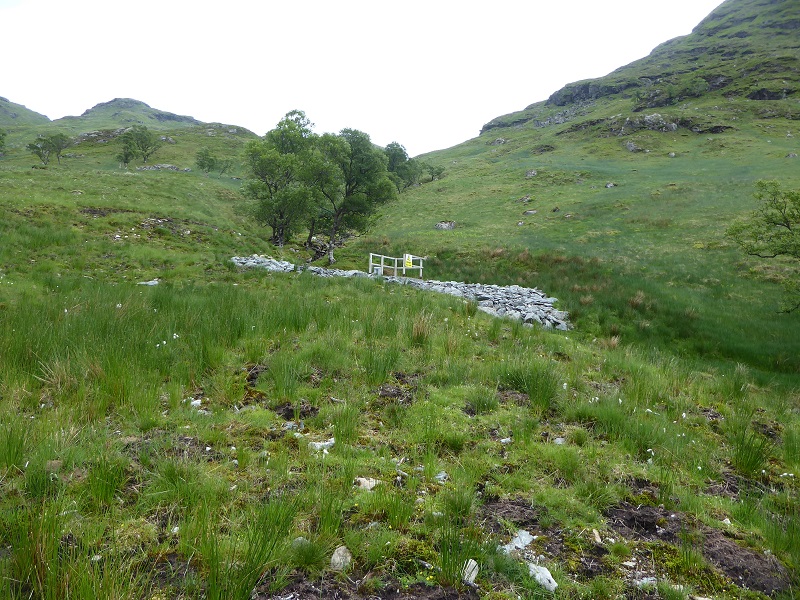
 While there is no track up the second intake and the ground above the pipe is recovering quite well, its location is all too evident from the spill of boulders which contrasts with the surrounding grassland. Why wooden restraining rails were used here and not at the main intake, as per the LLTNPA own good practice guidance, is unclear and the penstock has been left bright blue. The equally bright yellow danger signs warn people of the danger of pools, health and safety gone mad, when most of the side burns and the Allt a’Chuillin itself contain similar pools.
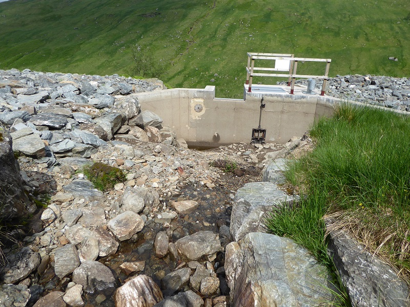
At the third intake, I was surprised by the complete lack of water. At first I thought this was due to the very dry period – I visited 10 days ago – but above the intake the burn was running before disappearing into the ground a few metres above the intake……………..
………..and then re-appearing a few metres below it. This looks like a pretty significant engineering failure and I suspect the intake pool will only fill when the burn is in spate. If Glen Falloch Estates want to repair this intake bringing in heavy machinery along the track would undo much of the restoration work which has been done there! Because of this, if the estate do want to fix this hydro intake, the LLTNPA should insist that heavy machinery is brought in by a large helicopter.
I am sure the Director of Planning at the LLTNPA, Stuart Mearns, would argue that all these defects illustrate that he was not being selective when he brought Mountaineering Scotland and Ramblers Scotland to view this scheme. While I believe there are dozens of finishing/landscaping issues with the hydro schemes which have been completed in the Loch Lomond and Trossachs National Park over the last ten years – and by drawing attention to these as I have done in this post that helps put pressure on the LLTNPA to address them – the much bigger issue is the wider landscape impact of the new hydro schemes and more specifically the tracks that have been created. You don’t see these if your site visit is confined to a trip up the track.
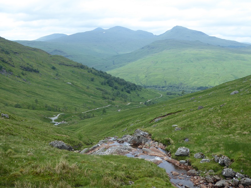
The wider landscape impact of the Allt a’ Chuillinnn hydo scheme
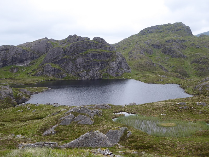
Last Autumn I blogged on the impact of the Glen Falloch hydro schemes on wild land (see here) and featured a fine photo from Tom Prentice of the Allt a’ Chuillinn hydo track from the head of the glen. If you walk along the wonderful ridge from Ben Glas, above the Ben Glas campsite and Eagle Falls, to Beinn Chabhair and then down Coire a’ Chuillinn the destructive impact of this scheme, both on the landscape and wild land experience is only too evident.
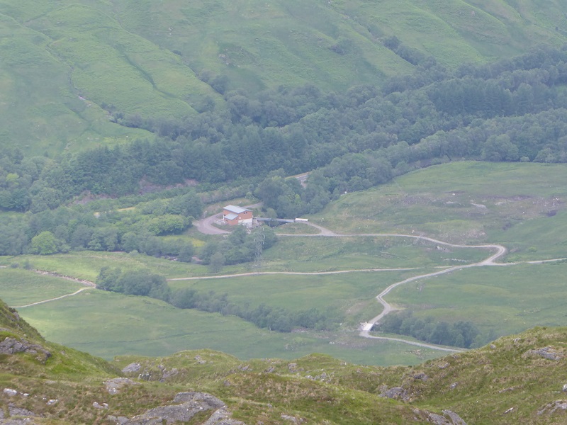
While the A82 and West Highland line are hidden in trees, the new tracks provide a stark contrast to the surrounding landscape.
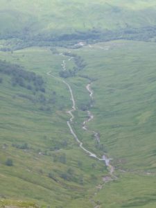 The sense, high up, of being in an uninterrupted area of wild land – not a windfarm in sight – has been severely damaged.
“The Wild Land Area lies adjacent to Ben Lui (06) and Breadalbane – Schiehallion (10) WLAs and from some of its upper slopes and tops the wild land qualities appear to extend uninterrupted into these areas, especially where intervening settled glens or forests are screened from view”
(Extract from Scottish Natural Heritage Wild Land Area assessment Consultation-response-Description-of-Wild-Land-Ben-More-Ben-Ledi)
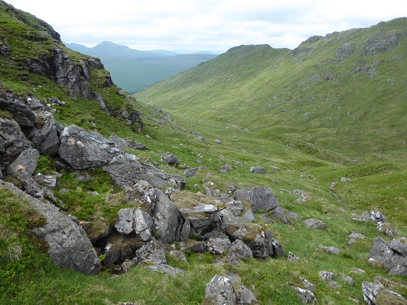
Descending east from Beinn Chabhair toward the bealach with An Caisteal and Beinn a Chroin there is no path although one is visible up the other side.
“Footpaths linking the Munros and popular peaks are generally evident from the erosion caused by walkers. Once away from the well-used routes there are large areas with no paths or tracks, where the rugged, hummocky, often boulder-strewn terrain can be disorientating and tussocky grass with heather and boggy sections can make the going arduous. Burn crossings add to the physical challenge required, increasing the length of time needed to reach the interior and the consequent sense of remoteness and risk.”
(Extract from SNH Wild Land Assessment)
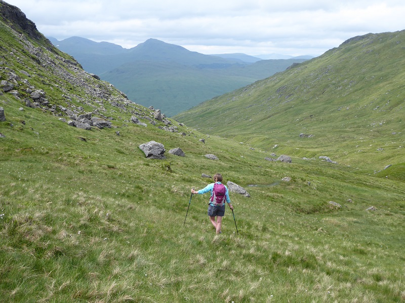
In terms of the sense of wildness, you could be in the remote west or core of the Cairngorms.
“Within the interior, there is a strong sense of sanctuary, especially where the enclosed glens or plateaux allow few views of any human artefacts or contemporary land use. Native woodlands add to the sense of naturalness, although tracks, signs of stock management, deer and stock fencing diminish the wild land attributes in other places.”
(Extract from SNH Wild Land Assessment)
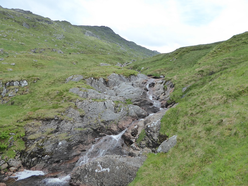
“There are many natural watercourses, several with arresting waterfalls. Patches of native, riparian woodland often highlight the course of burns on valley sides, adding to the sense of naturalness and accentuating the rugged nature of the open moorland. Many of these burns are fast flowing and the sound of rushing water over bedrock enhances the sense of naturalness. Some of those flowing into Glen Falloch and Glen Dochart will be used for hydro power, once schemes currently under construction are completed, introducing obvious human artefacts.”
(Extract from SNH Wild Land Assessment)
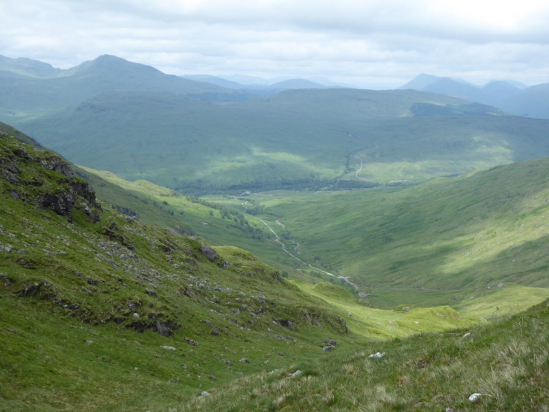
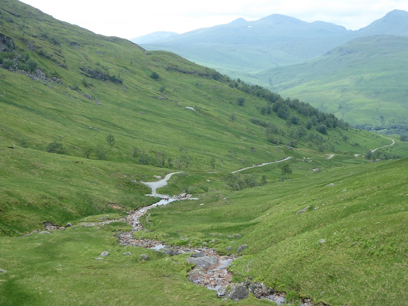
And then, you come over a slight brow and you see this.
Imagine this view without the track – that is how this glen looked before the hydro scheme was installed and would have looked like if the LLTNPA had kept the original planning requirements which were for all the access tracks to the hydro intakes should be removed. These requirements, set by the LLTNPA Board at the time, were reversed by staff when they approved subsequent applications from Glen Falloch estate to retain the main tracks. The removal of the construction track to the third intake shows what the view would have looked like if the track had been removed. Some improved landscaping around the 3rd intake and you would not know it was there although for the present it forms another blot on the landscape.
“there are expansive views in all directions and the eye is drawn by the adjacent hill ranges that form an awe-inspiring succession of rugged mountain ridges. Ben Lui and Breadalbane-Schiehallion WLAs (06 and 10) appear continuous from the northern parts and there is also a strong connection with Lyon – Lochay and Ben Lawers WLAs (11 and 12).
Wild land qualities thus appear to extend well beyond this WLA, contributing to a perception that the area is larger than it is, especially where intervening settled glens and forest plantations that would otherwise demarcate its physical extent are hidden from view by the steep valley landform.”
(Extracts from SNH Wild Land Assessment)
“Several hydro developments on burns flowing into Glen Falloch, Glen Dochart and Glen Finglas are currently under construction. Although the schemes lie mostly outwith the WLA, they are visible from the open slopes within, affecting the sense of remoteness, sanctuary and solitude. Construction tracks are often the most obvious feature prior to restoration, due to the contrast in colour against the subdued tones of the moorland.”
(Extract from SNH Wild Land Assessment).
Unfortunately, the tracks have NOT been restored as originally intended and the Wild Land Area has been permanently damaged. What has SNH said about this? Unfortunately, they defer to the National Park Authorities within our two National Parks – that has been a disaster in the Loch Lomond and Trossachs National Park.
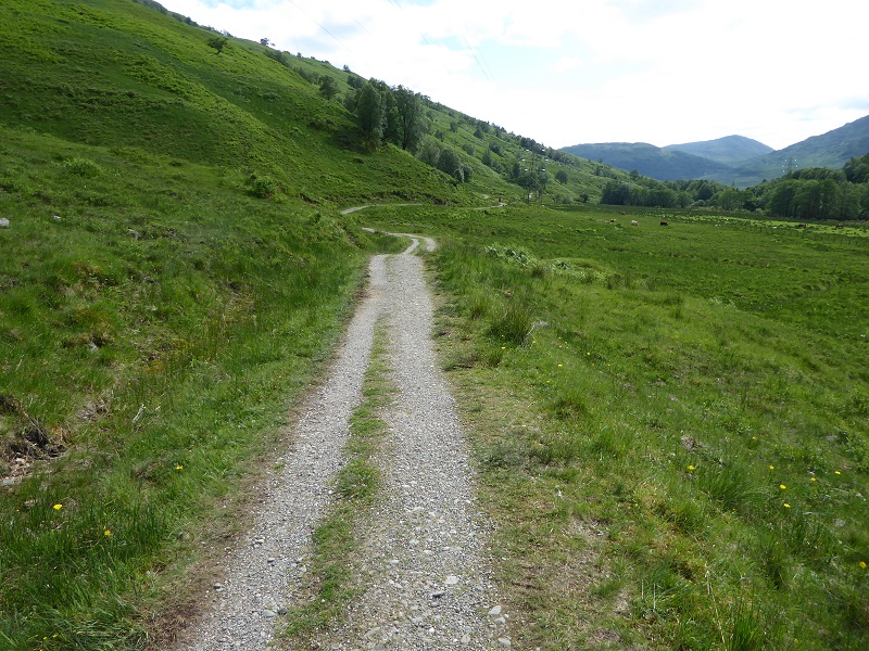
Walking back along the West Highland Way to our start point, I was struck not just by how narrow it is but that it is used by estate vehicles until close to the top of the gorge above the Falls of Falloch.
If the estate can get vehicles along this narrow track what justification is there for the LLTNPA, even on its own logic, approving retention of hydro tracks that are 2.5 to 3m wide in previously unspoilt glens such as along the Allt a’ Chuillin. A 1.5m wide track would be perfectly adequate for a small ATV to service the hydro intakes and would have less landscape impact and could have been presented as an extension to the path network. This National Park however seems incapable of even imposing such standards and just lets landowners do what they want – for “estate management purposes” as the delegated planning report put it.
The LLTNPA have their eyes firmly closed
After the Cononish goldmine hearing (see here), which approved a development within the Ben Lui Wild Land Area, I invited Stuart Mearns, Director of Planning, to accompany me on a visit to some other hydro schemes which had not been restored as well as the Allt a Chuillinn. He refused, choosing to deal with my email as a complaint, though he did say that the penstock across the Allt a Chuillinn would be painted this year as it has been.
Stuart Mearns, The Director of Planning, (see here for full response) went on to claim I was stuck in my views and also wrongly claimed we had been in long correspondence about hydro schemes (my main correspondence with the planners has been about the failure to paint the bright blue penstock as per their guidance most of which has now been belated fixed – the Eas Eonan penstock crossing the West Highland Railway is still Lomond blue).
After this I tried inviting him again but my second invitation was totally ignored.
While there is a debate and learning to be had about restoration techniques – I hope the LLTNPA share learning on the failed Allt a Chuillinn intake and what if anything they intend to do about this – the much bigger issue is the impact these hydro schemes have had on wild land and landscape. The LLTNPA needs to open their eyes to this. I believe they will only do so if they start viewing the schemes as a hill walker does, from the surrounding hills and not from a comfortable seat in a landrover.
What needs to happen
Our National Parks should be setting an example to the rest of Scotland of how to protect wild land and our finest landscapes. Neither National Park to date has a good record in respect to hill tracks with the LLTNPA being particularly culpable in respect of hydro tracks. While I would like to see the LLTNPA doing a lot more done on improving restoration techniques, particularly around hydro intakes, by far the biggest issue is the impact of the new tracks which scar the landscape and destroy the wild land experience. The LLTNPA Board to get a grip on this and I would suggest the following as a start:
- that as many Board Members as possible go and visit the schemes and surrounding land, not in the back of a vehicle, but as walkers
- that the LLTNPA Board, with SNH, commission some independent research on the impact of the Glen Falloch and Glen Dochart hydro schemes on both the landscape and the experience of wild land and then consider what can be done to rectify those impacts
- that the LLTNPA Board changes its scheme of delegation so that any new hydro schemes can no longer be approved by staff and require to be approved by its Planning Committee and after a site visit
- that the LLTNPA asks the Glen Falloch Estate – who earn lots of money from these schemes – to restore one of the hydro tracks to ATV width only in order to evaluate what difference that might make
