School Wood, Nethy Bridge
On Friday (see here), after a long campaign by local conservationists, the Cairngorms National Park Authority Board decided by a vote of 14-2 to reject the recommendations of their planning staff and refuse the application for housing at School Wood. They are to be congratulated. This was a major test for the protection of ancient woodland in the National Park and a small victory for democracy over a planning system designed to promote development.
The two Board Members who voted for the proposal to go ahead were John Kirk and Willie McKenna. Both are directly elected to the Board and represent the parts of the National Park where there is highest demand for affordable housing. That may explain their votes and I would defend their right to disagree. The state of democracy in the Cairngorms National Park, where the Board quite often changes staff recommendations and has split votes, is far healthier in the Loch Lomond and Trossachs National Park where I cannot recall the last time Board Members disagreed either with staff or among themselves.
But it shouldn’t be a choice between conservation and affordable housing. The CNPA is actually doing quite well at present in delivering what fits the official definition of affordable housing, unlike the LLTNPA which last year completely undermined its own policy on affordable housing at Luss (see here). At the meeting last Friday the CNPA approved applications for 22 affordable “apartments” in Kingussie and a further 10 affordable house as part of a development just north at Kincraig. At this rate, there is absolutely no need or justification for the enormous An Camus Mor development (see here) to go ahead and it, like School Wood, could be removed from the Local Development Plan
The underlying housing challenge in the Cairngorms National Park is to increase wage levels in the tourism industry and reduce the numbers of holiday homes that are vacant for much of the year.
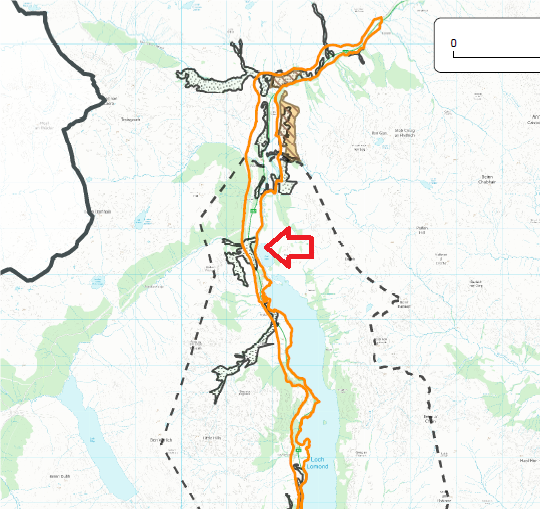
New development proposed at Ardlui at the north end of Loch Lomond
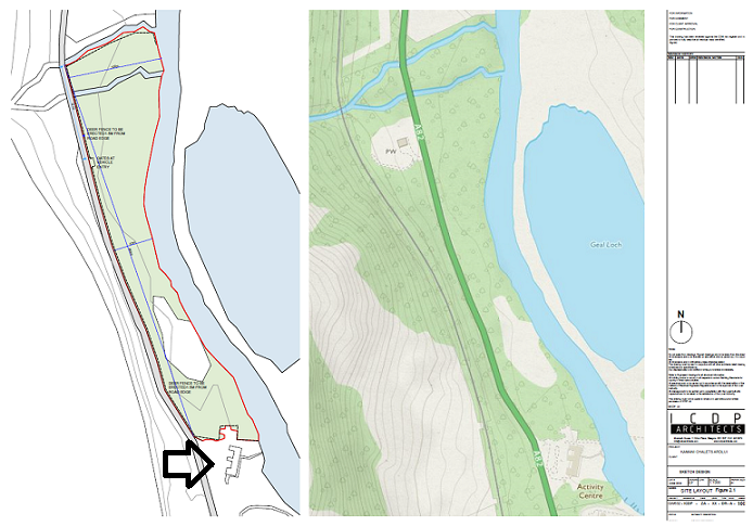
Meantime, down in the Loch Lomond National Park a company want to build to build 33 chalets and a children’s playground just north of Ardlui. SSH Trading Ltd is based in Manchester and according to Companies House has been dormant up until now. It has submitted a formal request to the Loch Lomond and Trossachs National Park Authority on whether an Environmental Impact Assessment is required as part of any planning application (see here). The whole of the 7.73 hectare site, which lies between the A82 and the River Falloch, was, until recently, covered with ancient woodland. The name of the landowner is not revealed.
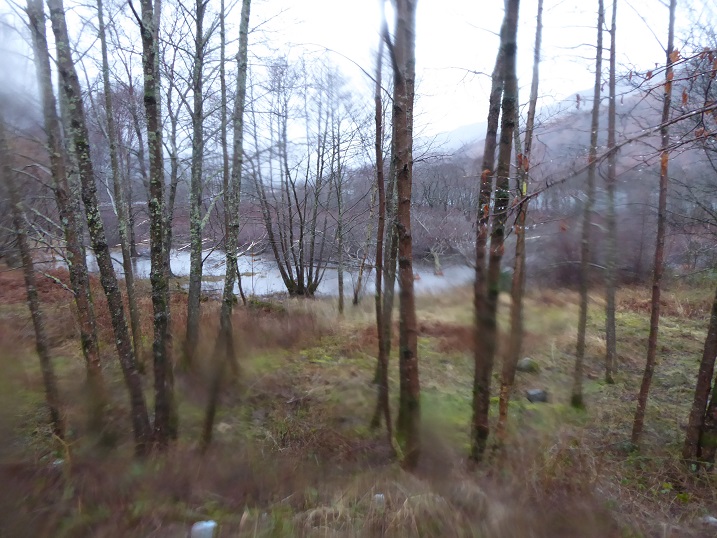
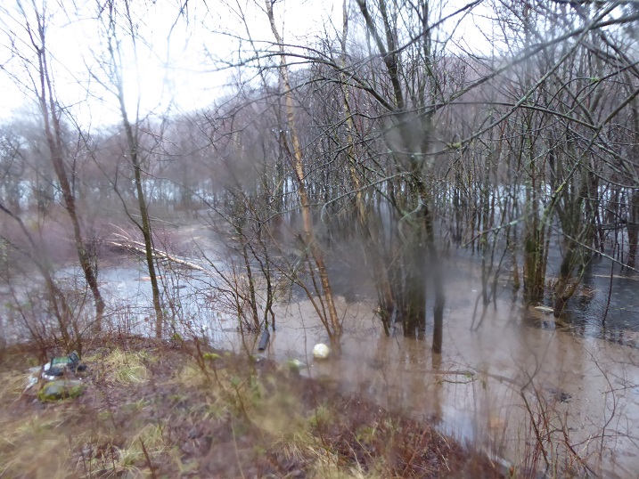
I had actually stopped off at the site in February to look at the fly tipping by the former Ardlui outdoor centre and noticed a large area of felled trees (just beyond the flooding). I then, mea culpa, completely forgot to investigate further until reminded about this by the Screening Report that has been submitted to the LLTNPA:
“The majority of the Site has been felled. Related discussions with Scottish Forestry are ongoing.”
And
“Recent felling activity may have resulted in the loss of much of the woodland feature”
This appears code for saying that a large area of ancient woodland has been destroyed unlawfully prior to the screening opinion being submitted.
How the National Park Authority is even giving this screening opinion the light of day and why the destruction of the ancient woodland here has not been subject to any LLTNPA news release is beyond belief. Perhaps, having learned that the LLTNPA had made no fuss at Ardlui, this is what prompted Moulsdale Properties to fell so many trees at Tarbet during lockdown (see here)? It now appears that developers from all over the UK know the LLTNPA is easy game and will do nothing to defend the principles which led to the creation of the National Park.
This is a National Park that puts photos of abandoned tents and litter all over social media but when a large area of ancient woodland is destroyed, apparently to facilitate a development, does nothing.
 Here are three simple reasons why the LLTNPA should tell these developers and their consultants where to go.
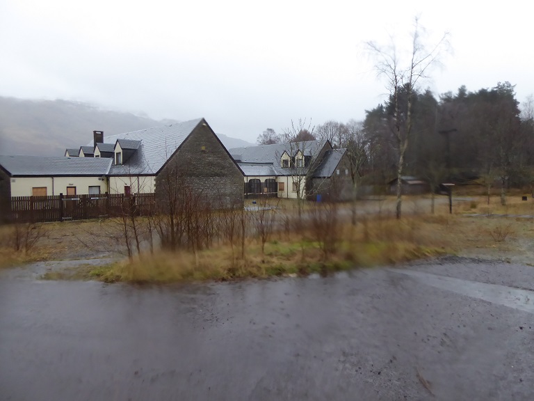
First, Ardlui is already blighted by the outdoor centre that has been empty since 2015. The LLTNPA needs to focus developers on using sites that have already been allocated or are derelict. Rather than destroy a greenfield sites on the south shore of Loch Lomond (see here) the Hunter Foundation could have used this site at Ardlui or the abandoned torpedo range at Arrochar to meet its aspirations for a “world class” leadership centre.
Second, in the justification for the camping byelaws which the LLTNPA sent to the Scottish Government it included a map of all the ancient woodland sites it said needed protecting from campers. That included this site. Now I disagree it needed protecting from campers – almost no-one camped along this stretch of the River Falloch anyway – but having claimed this, if it even contemplates development in the same area it will lose its last shred of credibility. The National Park needs more areas for people to camp, not more chalet parks.
Third, this site is not in the Local Development Plan and contravenes all the Park’s policies on development in rural areas (I am not even going to bother spelling them out). That should be enough.
It’s time the LLTNPA told developers wishing to develop sites of this where to go. Ardlui is as much a test for the LLTNPA as School Wood was for the CNPA. I am not optimistic and predict yet another battle.

Went to south loch earn yesterday to go fishing new signage up saying it’s now a no camping zone ..why have they just shut this area down as it was camping pitches till last week ..what has happened why have they now closed their camping pitches around the south side ..signs are up on trees every where…I pay a season ticket but can no longer stay overnight …
I agree with almost all of this post, and listened carefully to the debate on School Wood, where I felt that both Willie and John needed to show support for the community council’s view, in the certain knowledge, by that point in the debate, that the outcomes already clear. the debates a good one and the decision was, I felt, absolutely correct. The only part of the post that I disagree with totally is the observation that An Camas Mor is not needed. Like or not, the vast bulk of housing need and the vast bulk of future development and economic activity island will continue to be in the immediate area around Aviemore. affordable houses in Kingussie are great Norfolk with a need for a house there, andifthey are working, with a job in the immediate area. And ten in Kincraig are similarly great for Kincraig, though I understand none of those are planned to be social rented homes. People working in the vast hospitality industry around Aviemore often work split shifts, or variable zero hours contracts and in any event can’t afford the drain their low wages that a travel bill would cost. The need is clear for An Camas Mor, the reporters on the new local development plan have been clear on the need and supportive of the existing permission in principle. what they have also been absolutely correct about is that they have sought deletion of the planned allocations at north Aviemore. To see these go ahead rather than An Camas Mor would have been an environmental, social and economic travesty.
Dave, I will take a look at the Reporter’s findings and come back on this. But am I not right that the size of ACM is such that it far exceeds any demand for housing locally?
sorry about the typos folks- sore fingers!
Having tried to explore the woodland at Ardlui a few years ago, I can confirm that regardless of the flooding shown in your photo, the site is naturally very wet and boggy. Its simply not suitable for development. Surely SEPA has a flooding map that rules it out?
Hopefully Forestry Scotland will ensure the trees get replanted.
Thankyou very much for this. I had been wanting to check the whole site because the Screening request report from Land Use Consultants (LUC) claimed there was no flood risk and that defied belief:
“Flood Risk
According to the SEPA Flood Maps5, flood risk from pluvial sources occurs in very small pockets within the Proposed Development with areas of both high likelihood (1 in 10 year)
and medium likelihood (1 in 200 year).
Flood risk from fluvial sources was identified along the riparian corridors on the eastern section and northern fringe of
the Proposed Development with areas of both high likelihood (1 in 10 year) and medium likelihood (1 in 200 year).
No areas are at significant risk of fluvial or pluvial flooding, beyond those confined to the riparian corridors.
As the Proposed Development is situated inland, no risk from coastal flooding was identified.
Flood risk information available indicates there is no mapped likelihood of groundwater flooding identified within or immediately surrounding the Proposed Development”
What you have said confirms my suspicions that LUC appear to have got this very badly wrong.
Perhaps a specialist hydraulic engineer in this field will respond ? Is it not the case that every small scale hydro energy scheme serve to speed up the descent of water from high ground to valleys within that catchment area? The new hydro schemes recently completed within upper Glen Falloch will have accelerated flows from the high ground into the discharge pipes. If this is true then ancient statistics built up over decades for flooding risk to flat lands surrounding the Loch Lomond body of water would now be rendered quite meaningless. Why does no one within SEPA foresee this outcome, instead of furnishing planning inquiries with flood risk predictions that have proved to be “unsafe” ?
Of course those who live and work in the great outdoors already realise that the intensity of rainfall this past decade across the central highlands – as a consequence of climate change – has resulted catchment discharges never equalled within recorded times.
Meanwhile at huge public cost, within another branch of their profession, other engineers rely on similar historic based statistical analysis. A group of highly paid “consultants” skirmish repeatedly in their losing battle to restore the impossible track of the A83 !