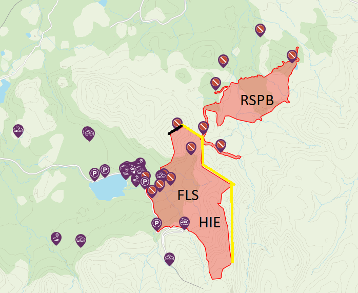
On Friday the Cairngorms National Park Authority (CNPA) reduced the size of Abernethy/Glenmore the “Exclusion Zone” it had created in Glenmore/Abernethy. There is nothing I can find to announce the change on its website, apart from the changes in the map shown on its path closures webpage (see here) and nothing on its Facebook Page. It appears that the CNPA does not want anyone to know that is has reduced the size of its “Exclusion Zone” which, as I explained twelve days ago (see here) has no legal basis under the Land Reform (Scotland) Act 2003.
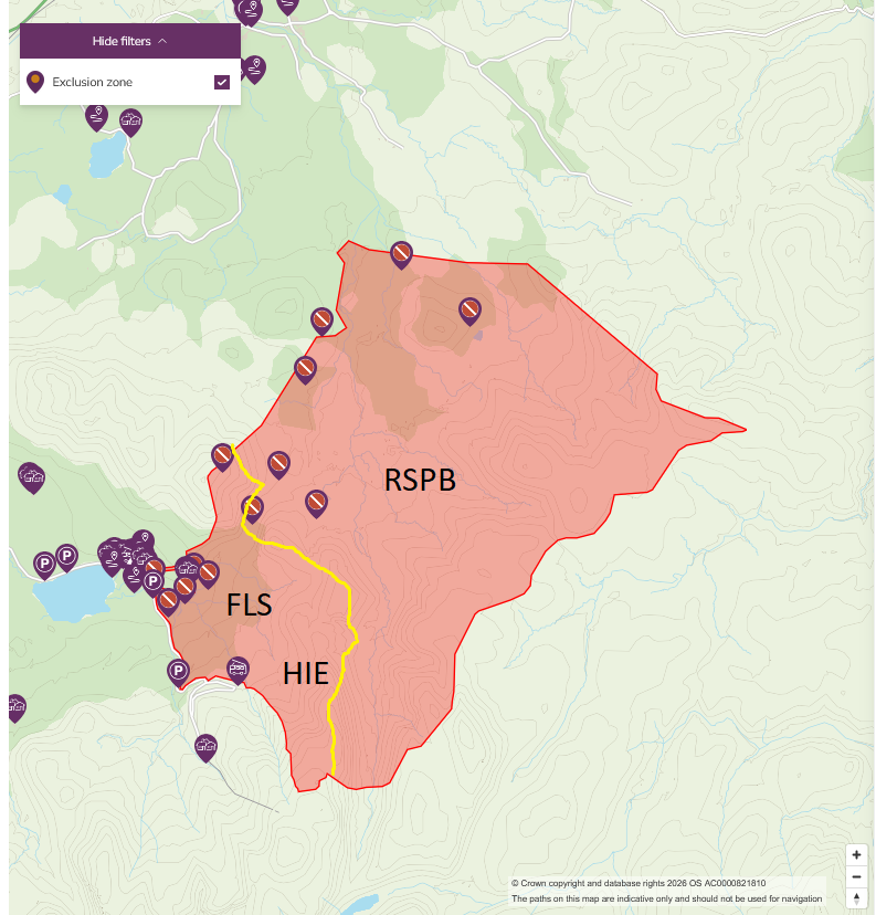
A comparison between the two maps shows that the size of the area at RSPB Abernethy which people are being asked to avoid has reduced dramatically. Effectively the public are being welcomed back to all the moorland areas at Abernethy, with the exception of the tracks to Pass of Ryvoan and into Strath Nethy (where the fire started) and an area above Ryvoan bothy, and all the ground above that. This is extremely welcome.
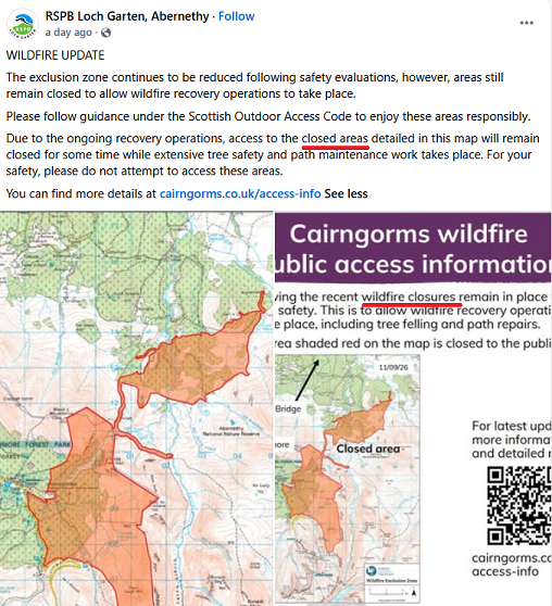
The RSPB also advertised these changes to the access restrictions (which are agreed at weekly meeting with the CNPA) immediately in contrast to the silence from the CNPA. It is notable too that the RSPB have avoided using the draconian language of “Exclusion Zone”, which was appropriate only to the previous statutory closure of the land by the Scottish Fire and Rescue Service (SFRS) for fire fighting purposes, and instead refers to “closed areas”. That is more in line with the Land Reform (Scotland) Act 2003.
While initially I was very concerned what the RSPB meant when they said “areas will remain closed for some time”, it does seem they have been making genuine efforts to “re-open” the closed areas at Abernethy and addressing health and safety concerns as quickly as they can following the wildfire.
The contrast with Forest and Land Scotland (FLS) and Highlands and Islands Enterprise (HIE) is striking. It appears that FLS/HIE have not reduced the size of the area they are asking people not to visit in Glen More and Cairngorm Mountain, since FLS announced that Glenmore Forest Park was open again. FLS they are still trying to claim that the SFRS’ statutory Exclusion Zone is in place despite them leaving the scene several weeks ago:
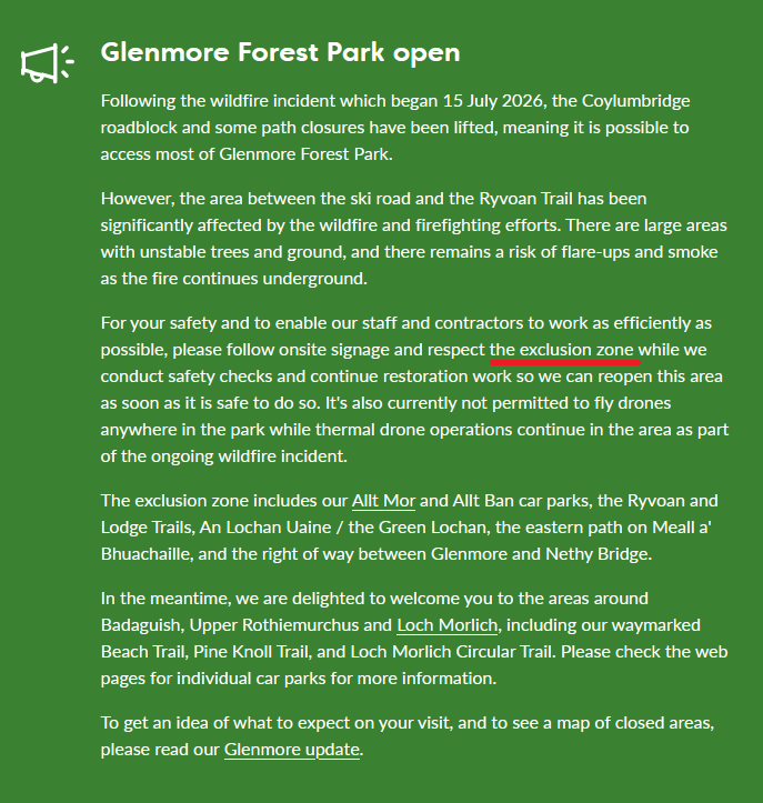
FLS is also still trying, with the endorsement of the CNPA, to stop people using areas that were never affected by the fire (see here for Andy Amphlett’s mapping of the extent of the fire), like the public car parks at the Allt Ban and the Allt Mor:

Both FLS and HIE, whose land at Cairn Gorm is under the aegis of the Cairngorm Estate managed by Cairngorm Mountain, are also continuing to try and stop people from walking over the burned area on Cairn Gorm above the main forest. There is no risk of large trees falling on people in this area and any risk from fire still smouldering below the surface (the main justification for trying to exclude the public from these areas) is minimal to non-existent after all the rain of the last two weeks.
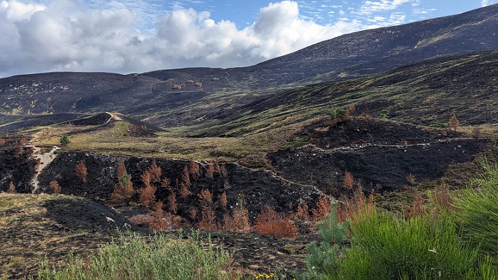
If RSPB can open up the much much larger area of moorland and higher ground at Abernethy because they believe its safe to do so, what is the justification for FLS and HIE/Cairngorm Mountain failing to do so?
The CNPA has, as the access authority for the area, a statutory duty to uphold access rights. In addition it has a further duty as a National Park Authority to promote public enjoyment of the land. It should have challenged both FLS and Cairngorm Mountain on these unjustifiable restrictions but failed to do so.
The only reasonable explanation for why the CNPA has agreed to reduce the restrictions at Abernethy but failed to do so in Glenmore and at Cairn Gorm is that in terms of access, it simply does what landowners ask.
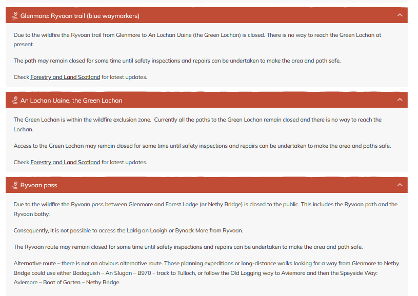
The route from Glenmore Lodge to Ryvoan is one of the most important routes in Glenmore Forest and indeed in the whole of the National Park. In recognition of this importance it is a core path and a right of way to boot. (Rights of Way are supposed to offer additional legal protection against closure). Whatever the risks posed by burned trees in the forest, such as around An Lochan Uaine, the route itself should have been a top priority for re-opening. The evidence from a mate of mine who ran along the track was the risks then were low.(see here). FLS, which has far more resources than the RSPB, has had three weeks since then to make the track safe in its eyes. Its failure to do so is telling..
One wonders too if the explanation for why the RSPB are still advertising the track from the edge of Abernethy forest to Ryvoan pass as being closed is that they have been asked to do so to spare FLS criticism?
What the CNPA, FLS and HIE all have in common is that they are public authorities under the control of Scottish Ministers.

1 Comment on “The CNPA’s reduction in the size of their ‘Exclusion Zone’ in Abernethy/Glenmore”