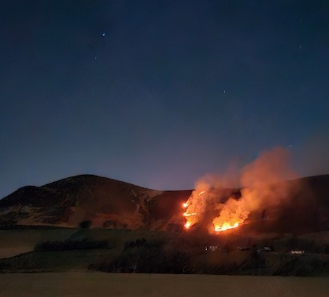
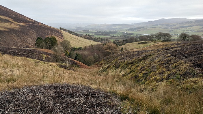
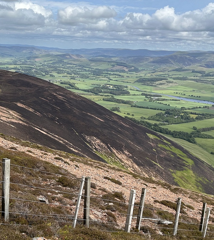
After my two posts on the out of control muirburn on Tinto Hill 9th/10th April 2025 (see here)and (here), I was sent this photo taken by a friend of a friend. I had been meaning to visit the site before blogging about it again all last year but only managed to do so just before New Year. We approached from Wiston but once above the plantation and improved grassland, contoured round the edge of the Site of Special Scientific Interest (SSSI) to below the flames you can see in the photo. We then headed directly up to the summit of Scaut Hill before turning west along the ridge to the summit of Tinto and back down to Wiston.
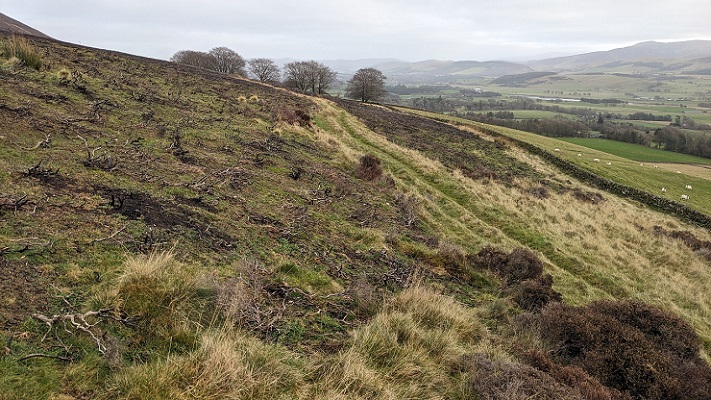
We did not have to go far before coming reaching the edge of a large burned area. Where there was heather on both sides of the track the fire had jumped across it. Also of note was that it was the grassy strip above the wall, rather than the wall itself, which appears to have stopped the fire.
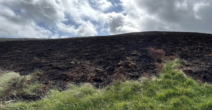
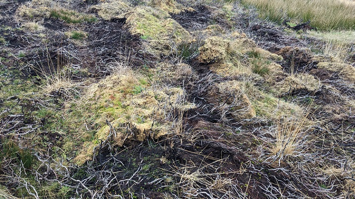
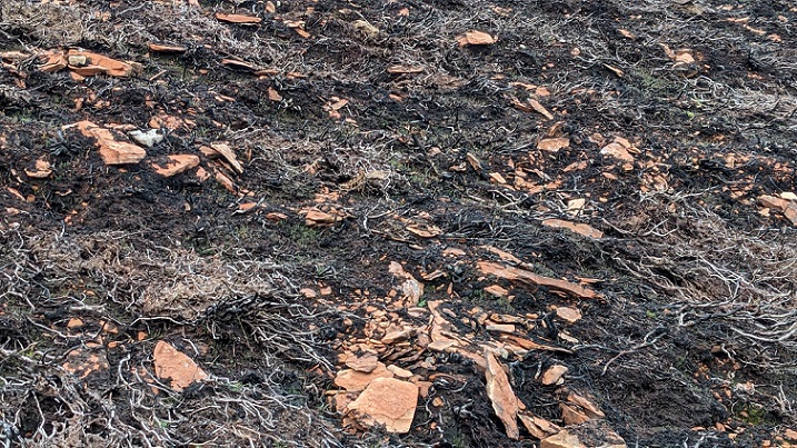
Most of the ground looked less black than it had appeared in photos in June. While that is partly a consequence of vegetation having started to recover, it also appears that some of the sooty carbon deposits left by the fire may have washed away leaving the ground “cleaner” than it had been (see photos below).
As we approached the charred steep south face of Scaut Hill it started to become apparent that the burned area we were on was not “joined up” with it.
Heading round towards the track we skirted a small burn and boggy area where the fire appeared to have jumped from one side of cleuch to the other. It has also left some types of vegetation untouched: the rushes on the left and in the foreground; the mossy clumps on the right bank of the burn which were only singed; and the bracken covered slope just above the wood (where the bracken would only just have been starting to emerge in early April).
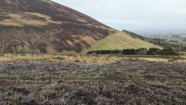
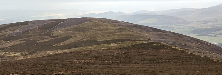
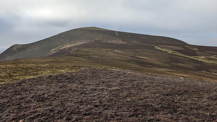
A little further on it became clear that the two burned areas were not continuous but rather separated by a considerable distance. This was best seen when we were descending from the summit of Tinto later:
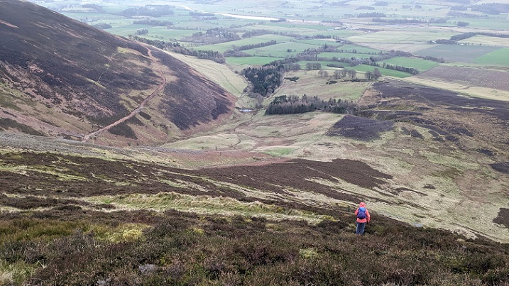
This raises the question whether there were two wildfires or did the flames visible racing down the slope in the top photo jump across the grassy bottom of the small glen where the ruins of Fatlips Castle are located? The two large burned areas are on different landholdings. It appears unlikely that both would be conducting muirburn which got out of control at around the same time which lends some weight to the argument that the fire jumped. Unfortunately, the Scottish Fire and Rescue Service does not report on wildfires caused by muirburn as a result of which there is no official evidence to confirm what happened.
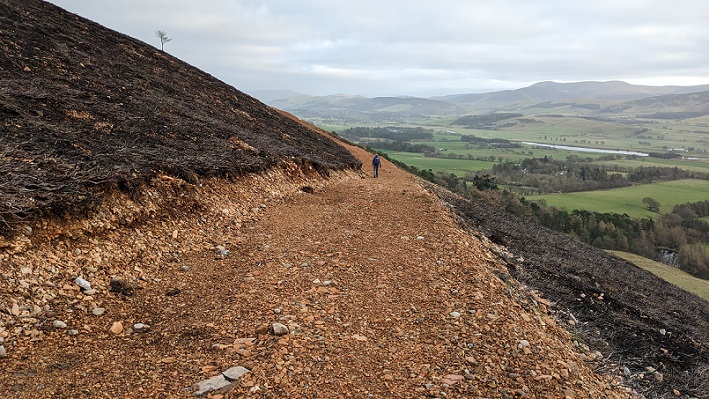
I cannot find the date the ugly new track which contours Scaut Hill was constructed/enlarged and from the lack of burned debris among the stones initially thought it was before the fire. If so this would provide another illustration of just how challenging it is to create firebreaks on heather moorland. Further investigation, however, suggests it was constructed after the fire:
There is no information about this road on the Lanarkshire planning portal, although if the landowner claimed it was needed for farming purposes it would not have required planning permission. Consent from NatureScot, however, should have been required because of its impact on the SSSI. Further investigation continues!
Above the track the thin (peaty) soil which covers the steeper south facing slopes on Scaut Hill may be partly a consequence of repeated fires, with vegetation being converted to CO2 rather than degrading to form soil. What remains is now exposed to further degradation by oxidisation and water erosion.
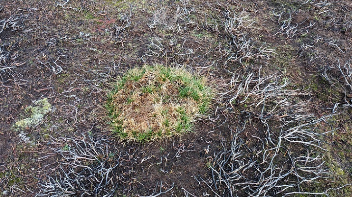
It was notable how this clump of heath rush had survived the fire. Heath rush is one of the most important bog forming plants, colonising thin soils such as this and then trapping water between its long roots. It helps explain how bogs can develop on broad mountain ridges. The wetter conditions it helps create appear to explain why it did not combust unlike the surrounding heather.
The evidence shows that if muirburn is conducted in windy conditions it will jump the mowed edges intended to contain it (there are aerial photos in my first post on Tinto showing this).
The very large burned area extending from below the summit of Tinto diagonally leftwards suggested that the wildfire last year was not the only time in the recent past that muirburn here got out of control. In fact NatureScot’s Site Management Statement for the SSSI (see here), which was last updated in 2008, indicates that large fires on Tinto Hill have had a harmful impact for a considerable period of time:
“The subalpine dry heath is considered to be unfavourable as there has been a decline in the extent of dense heather, some of which is now locally scattered in particular on the upper slopes of Green Hill and Lochlyock Hill. These scattered areas of heath are sensitive to high grazing levels. The vegetation structure due to disturbance from burning has also contributed to the feature’s unfavourable condition. Large fires in 1996 occurred over sensitive areas; the steep slopes at Maurice’s Cleuch and adjacent to Cleuch Burn. However, the vegetation composition including the cover and frequency of dwarf shrubs, bryophytes and lichens have been maintained.”
Discussion
So far there appears to have no report by the police, the Scottish Fire and Rescue Service or NatureScot into the causes of the most recent Tinto Hills SSSI wildfire and the damage it caused nor any attempt to hold anyone responsible. Meantime, land-management lobbies continue to claim that muirburn helps prevent wildfire. They can only do so because of the complete failure of our public agencies to report on all the cases of wildfire caused by muirburn.
My walk up Tinto showed how vulnerable heather moorland is to fire with fire being able to jump from one area of heather to another. It also showed how wetter areas and those with different vegetation broadly escaped the fire. If we wish to reduce the incidence of wildfires the implications should be clear. We need to stop muirburn, which dries out the ground and generally promotes heather, and allow moorland instead to re-wet through natural processes. That would create a more diverse and fire resistant landscape.

Interesting piece. I noticed this track in early summer from the railway and had been pondering when it had been constructed and what for. Quite noticeable from across the glen.
This was not a wild fire. It was prescribed burning by the farmer and burnt itself out on earlier back burn. OK, it shouldn’t have burnt through the night but that is the only issue here.
This was burning of heather for the benefit of sheep. there is no grouse shooting on this land