
After visiting the Upper River Falloch hydro scheme last August, I argued that the scheme was unsustainable on the basis of the evidence that I saw then (see here). Photos sent to me this week show that in the eight months since there have been significant landscape changes and engineering works. These raise further questions about the way land in the Loch Lomond and Trossachs National Park is being managed.

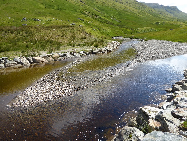
Comparing the photos, you can see:
- there has been a major landslip on the hillside just behind the pool (a secondary eroded patch of hillside behind is evident in the August photo but appears to have deteriorated since then);
- much of the shingle bank that had infilled the pool has disappeared; and
- significant quantities of stony material has been laid on the rip rap bouldering on the far side of the pool and used to form a new bank behind.
What appears to have happened is that the hydro intake pool has been dredged and the material then used to re-engineer the far bank. The lack of any sign of debris from the landslip in the pool suggests that the dredging took place after it occurred and was possibly prompted by it. How long to the next one?
The purpose and management of the engineering works
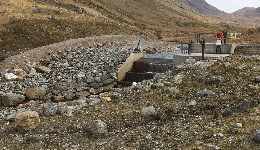
There is no sign of any planning application having been submitted for the works. The last recorded on the Loch Lomond and Trossachs National Park Authority (LLTNPA) planning portal for the Upper Falloch hydro was to enlarge the intake chamber in 2017 (see here). It is not clear therefore whether the LLTNPA were consulted about the works, despite their obvious landscape impact, or what the intention behind the new bank was. Nor whether Glen Falloch Estates was granted consent by the Scottish Environment Protection Agency before dredging the pool (I will contact SEPA to ask)
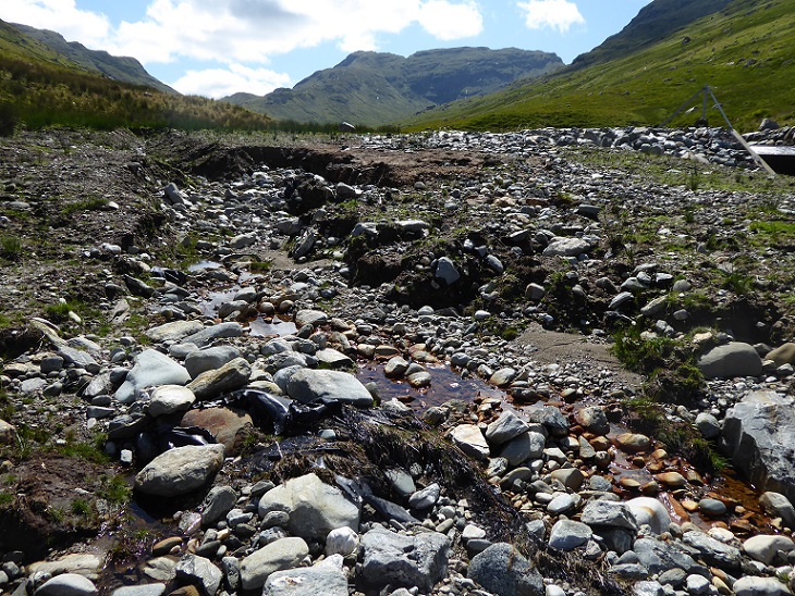
The top photo suggests that, as well as dredging the pool to enable the hydro to operate, the idea behind the creation of the bank was to try and create a defined overflow channel for when the River Falloch floods again and to prevent it diverting round the hydro intake, as almost happened in August 2018:
There are serious questions about whether the works are fit for purpose and why they have not been properly considered through the planning process:

It is possible that the shingle that has been placed on top of the rip rap bouldering will enable the edge of the pool to re-vegetate, which would help it resist erosion. But it appears equally possible that the next flood will wash it all back into the pool! Because there is no planning application, it is impossible for the public to know whether this aspect of the work has been based on expert opinion or a wing and a prayer.
The new bank and bed of the overflow channel, however, appears completely unfit for purpose if intended to channel flood water. There is direct evidence for this from the River Gynack overflow scheme above Kingussie. There, many of the boulders used to form the base of the channel and the earth banks were so severely eroded at the first flood that the scheme itself has been effectively abandoned (see here). Unfortunately, the Cairngorms National Park Authority has not acted on my call for an inquiry into what went wrong there. However embarrassing, that might have helped prevent similar mistakes being repeated across the country. That failure does not, however, excuse this: anyone can that the new bank with its sandy sides is at high risk of being swept away.
Why therefore has the LLTNPA, as the alleged custodian of the National Park, allowed it to be constructed? How is this consistent with the Park’s policy objective of preventing silt entering river systems which it usually implements through imposing planning conditions? How too is this bank compatible with the original planning consent and the claims that the hydro would have minimum impact on the landscape?
The ongoing destruction of landscape and the natural environment in the National Park
There are, I believe, two big messages from the photos.
The first is that the major landslips in Glen Falloch (see here) and at the head of Loch Katrine (see here) caused by the floods in August 2019 were not one-off events but part of an ongoing process. This should require us not just to address the causes of climate change but the way the land is being managed. In terms of the latter, the LLTNPA has done little apart from promoting peatland restoration funded by government. Peatland restoration will do nothing to prevent landslips on steep hillsides such as those around upper Glen Falloch. The fundamental land-management issue in areas like this is overgrazing – try spotting a tree in any of these photos. But LLTNPA has no plan and its Board has not even discussed how this impacts on flooding and landslips, let alone the functioning of hydro schemes.
The second message is that some of the run of river hydro schemes in the National Park – and indeed across Scotland – are likely to need ongoing engineering works, year in, year out, to keep functioning. No-one has considered the long-term impacts of this or whether and how the damage could be mitigated. The LLTNPA, with its statutory duty to promote conservation, should be taking a lead on remedying past mistakes but instead has its head in the sand and is avoiding all responsibility.
The conclusion? Far from acting as a real National Park Authority, the LLTNPA has allowed damaging land management practices to continue and actively promoted damaging developments in the countryside. As a consequence, year in, year out, the landscape and natural environment in the National Park becomes ever more degraded and industrialised.
