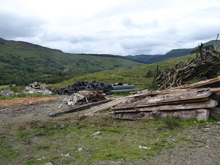
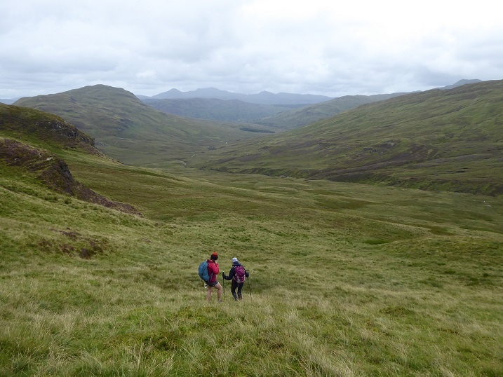
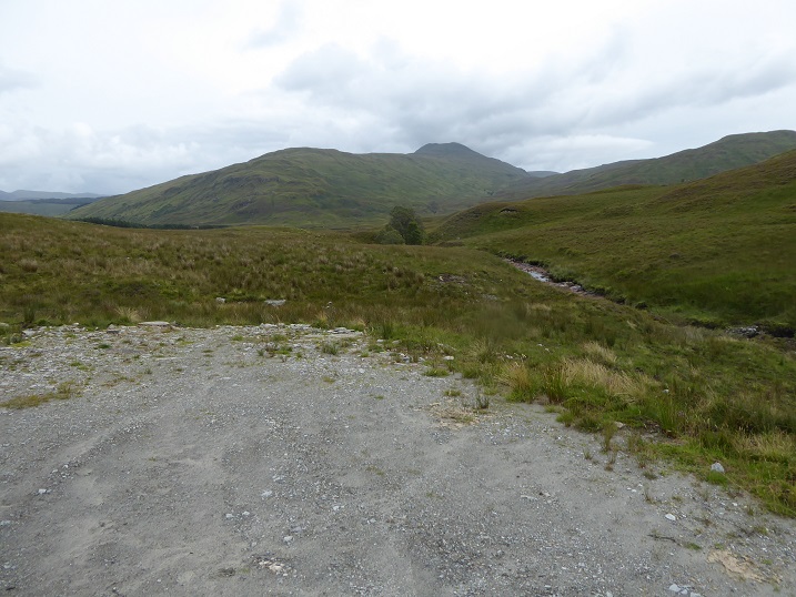
Last Sunday I went for a walk around Ceann na Baintighearna from Glen Buckie which runs south from Loch Voil. We took a slanting track up from north of Ballimore, past this neat farm dump. It had been preceded by piles of equally neatly stacked logs which were slowly rotting. A wasted resource. I don’t blame Ballimore Farm for this, there are huge challenges in disposing of materials, whether valuable or otherwise in rural areas. The neat piles show someone is trying.
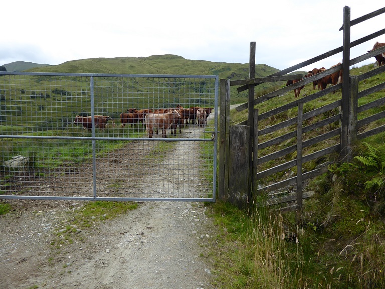
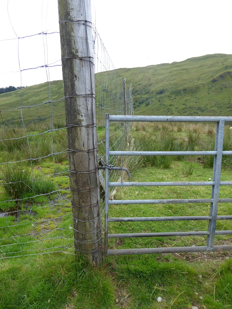
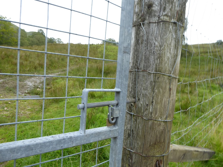
Shortly afterwards we came to a locked gate, the first of four I noted. All are contrary to our access legislation which makes it unlawful to obstruct access and the farm should not have done this. The combination of the locked gate and high deer fencing creates a barrier to access which many people would not be able to get past. In case you are wondering, there were cattle on both sides of the fence so the purpose of the locked gate is not to prevent rustling.
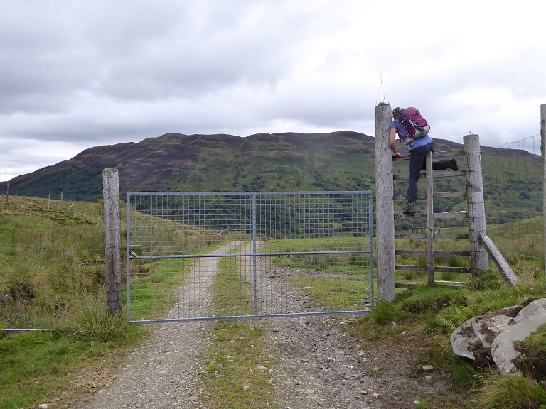
Climbing fences may be ok if you are fit, but people should be able to walk and cycle up this glen – how many members of Loch Lomond and Trossachs National Park Authority could cross the fence with a bike? The LLTNPA as Access Authority has a statutory duty to uphold access rights but is still failing dismally on the ground.
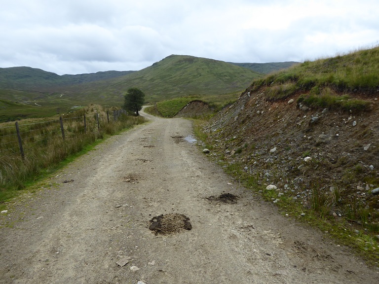
Beyond the second gate the old farm track had been widened for the construction of a hydro scheme, known as the Ballimore hydro, up Gleann Dubh. Its width has not been narrowed subsequently and no attempt has been made to restore the cut banks, all contrary to the LLTNPA good practice guidance on renewables and the Construction Method Statement approved by the planning application:
“The creation or upgrading of permanent tracks provide an opportunity to carry out restoration as the track is being excavated. Most importantly, where a topside drain or cut through a bank on the top side of the track is made, the peat and turf should be re-used within a few hours to cover over the change in land form.”
The Planning Application also contains the usual turf management plan and landscape provisions but all have been ignored.
The pipeline lies behind the gate and the ground above has, as is usual where hydro schemes are constructed on in-bye land, recovered far better than the track. It is now, however, covered in soft rush which is generally avoided by cattle. Hydro schemes are not without their costs to farmers and food production.
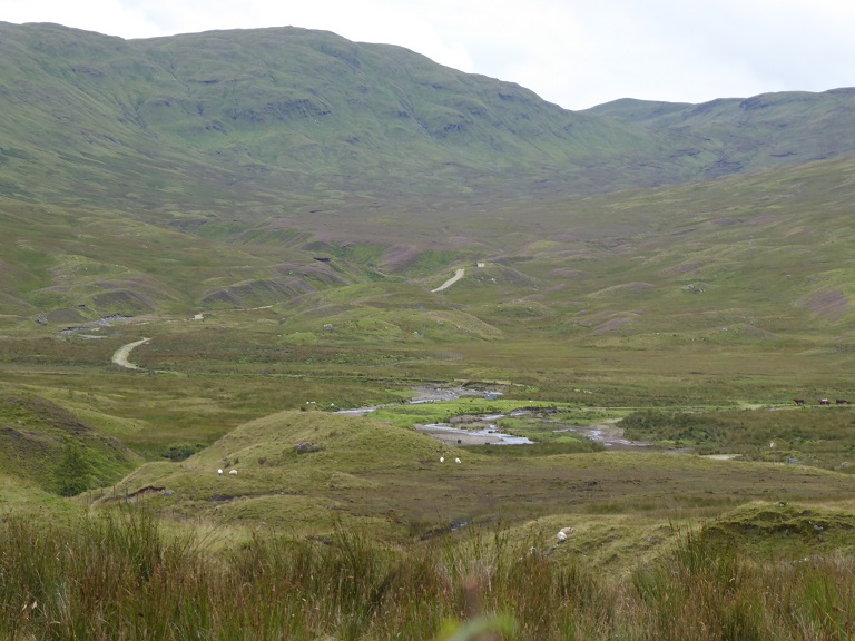
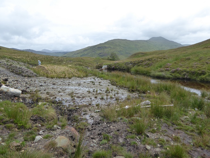
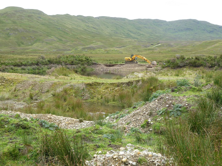
The mid-section of Gleann Dubh is covered by fine hummocky moraine. There are two intakes to the hydro scheme – originally three were planned – and it was agreed a new temporary track should be constructed across the Allt Fathan Glinne to build the first intake:
“A temporary access track leading from an existing farm track (south of the sheepfold) to the south intake. This will be returned to its pre-construction condition following construction.” (Delegated Report April 2015).
I can find no subsequent application to retain the track, as happened with the Glen Falloch schemes, and nothing else in the planning papers (see here) that explains who agreed it should be retained and why. It now forms a prominent landscape scar in an area that was previously pristine and unmarred by development.
This area, on the west side of the Allt Fathan Glinne, lies within the Ben More and Ben Ledi Wild Land Area:
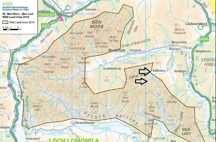
There is NOT A SINGLE REFERENCE TO THE WILD LAND AREA or the importance of wild land qualities in the LLTNPA Report. It is not surprising therefore that this Wild Land Area, identified in 2014, has done nothing to prevent this scar intruding into the coire. The LLTNPA record when it comes to protecting wild land is almost non-existent (think the Cononish goldmine etc).
Reading the delegated report (see here) the LLTNPA’s main concern when determining the planning application in 2015 appears to have been to tick the boxes when it came to protecting the Forth Valley Special Area of Conservation. (It is worth reading just to appreciate the convoluted reasoning that enabled the LLTNPA, SNH – sorry now NatureNOT! – and the Scottish Environment Protection Agency to decide that while the scheme would have a significant adversely effect on the Calair Burn that wasn’t a reason for the hydro not to go ahead.
Walking down the glen drained by the Allt Fathan it is easy to appreciate why this was included in the Wild Land Area. But lower down at the boundary of the wild land area you reach the second hydro intake:
The documents in the Planning Application describing how the area would be restored are sweet nothings.
One wonders how any LLTNPA Planning Officer could, for one moment, have thought this was acceptable What is the point of imposing planning conditions to protect peat (“minimise disturbance and exposure of peat during construction”) mea and stop sediment flowing into rivers if they are ignored and this is allowed to happen? But perhaps the LLTNPA Planning Officer was not allowed to visit by their bosses?
Light touch regulatory regimes don’t work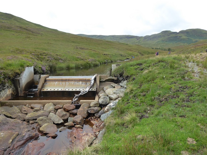
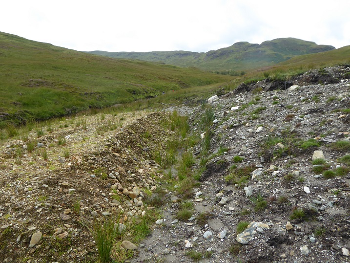
Restoration has taken place on the banks by the intake – so why not on the ground above and around the track?
There is no justification for leaving large areas like this used to store materials as turning circles:
“Where tracks are to be narrowed post construction, the down hill side of the road surface will be broken up to relieve compaction and top soil / top peat material stockpiled adjacent to the tracks will be used to narrow the track to the agreed width.” (Extract Construction Method Statement).
But if developers can get away with not doing what they say they will do it adds to their profits (and means less people are employed in the countryside). 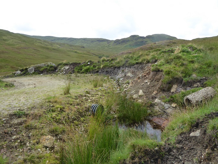
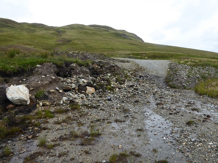
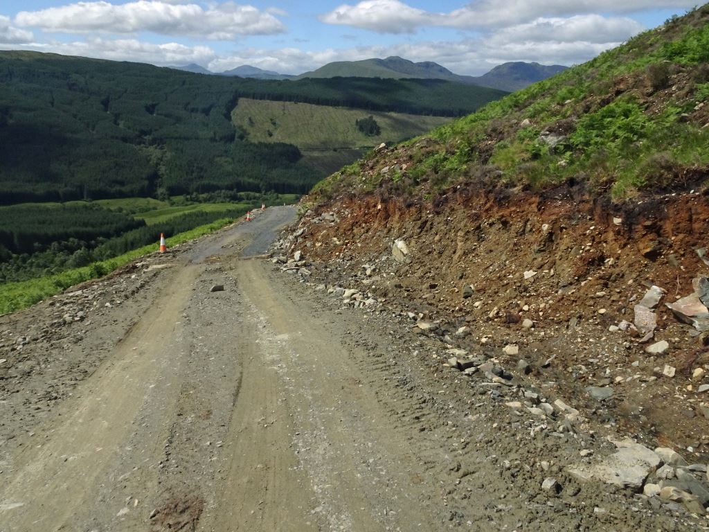
The abandoned concrete pipe indicates that the track reached here before the hydro was constructed but has subseqently been upgraded, with little attempt at restoration, and extended down to the site if the intake on the river.
“In most cases and where cross slope is not steep [but clearly not always], the corridor width will be kept to the minimum. Where tracks are to be cut into steep cross slopes or widening at corners is required, consideration will be given to widening the construction corridor to avoid side slopes that are too steep to allow soiling and re-establishment of vegetation and to allow integration of slopes into the adjoining landform.” (Extract from Construction Method Statement)
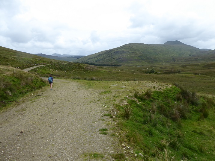
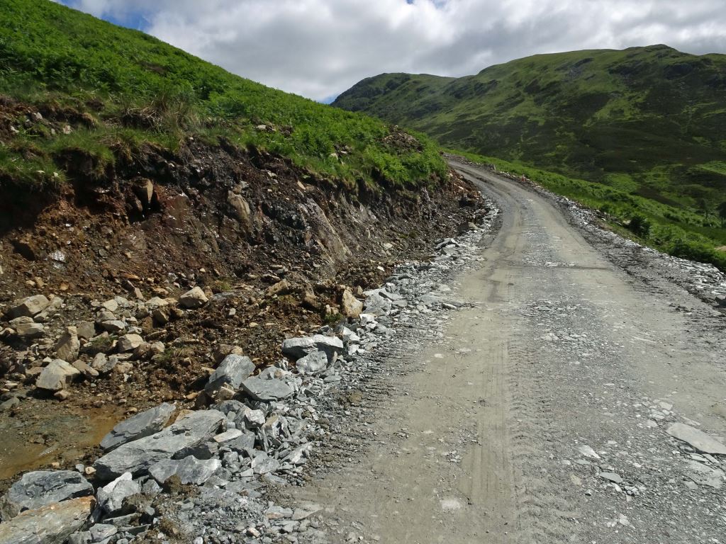
The upgraded track is in many places 4m or more wide, much broader than the LLTNPA’s recommended maximum of 2.5m.
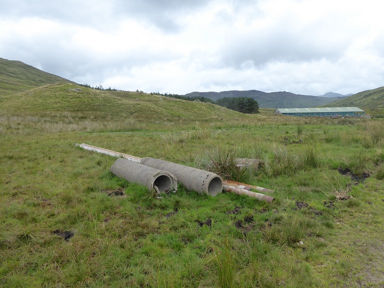
In the vicinity of the large farm building there were two more collections of concrete pipes that appear to have been replaced by plastic ones when the track was widened. What’s worse for the environment, concrete or plastic?
The LLTNPA could have used its planning powers to at least ensure that all the detritus created by the hydro scheme was removed. There is so much profit being made out of hydro that developers could easily afford to dispose of waste properly. Ensuring even that, however, seems to be completely beyond the LLTNPA.
We also came across a lot more non-hydro waste. Rather than condemning visitors for litter (see here), LLTNPA would be far better working with Zero Waste Scotland to work out a plan for how ALL waste in the National Park, from farm waste to litter, could be disposed of without blighting the countryside.
The borrow pits in the moraine still appear to be being worked with no attempt at restoration.
In the past when I have raised issues like this with the LLTNPA they have tended to respond “we were going to address the issues but we have five years to do so”. This scheme was approved in 2015, there is no obvious ongoing restoration work (the digger looks as if it might be adding to the destruction not reducing it) and time now appears to be running out.
The LLTNPA planners appear to work on two principles. The first is out of sight, out of mind. The second is unless people complain, there is no need to act. These attitudes have helped bring the entire planning system in the National Park into disrepute.
Glen Ample hydro scheme
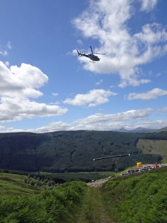
On the basis that if you don’t complain, the LLTNPA will never address the issues, I have asked the LLTNPA Planners to go and check now whether they are satisfied that their planning conditions are being met for the new hydro scheme in Glen Ample. I was sent some photos from a reader just after lockdown that show that it has already caused serious damage to the landscape and unless the LLTNPA takes appropriate action this is likely to be long-lasting.
 The vertical cutting of the slope has created a bench running across the hillside that is contrary to the Park’s best practice guidelines. There is no sign of any of the turf that has been removed to create this and, as a consequence, effective restoration will be even more difficult.
 It is not the fault of the people who do the work, they need an income like everyone else and just do what they are told. But it is the responsibility of the National Park Authority, once it has agreed to development going ahead, to ensure the staff overseeing these projects do the right thing.
If you see things that look bad when out walking, please complain. Unless people make a stand, in thirty years time very little of what made the Loch Lomond and Trossachs such a special place will be left for us to enjoy.

These gates south of Balquhidder have been locked for years. The LLTNP have known about this for a long time but appear to have done nothing to solve the situation. They have been too busy in the Balquhidder area persecuting campers with their byelaws than to spend time dealing with access infringements. Their priorities are all wrong.So the best solution is probably to suspend all forms of public subsidy or grant which might be available to the farmer until all these gates are unlocked or replaced with new gates which are easily accessible for walkers, runners, cyclists and horseriders. Giving public money to landowners who fail to meet their obligations under the Land Reform (Scotland) Act 2003 must cease.
This is a tremendous piece of work, Nick. Your point about complaining is well made. Could you provide some kind of flow chart for effective complaining? Or maybe a template for such complaints with examples of types of planning infringements, documents that could be requested using Freedom of Information etc?
Thanks Mike I will give a flow chart and templates idea some thought – along maybe with my experience of trying to use the LLTNPA complaint processes. Submitting complaints as an individual is a thankless task but if we could get dozens of complaints on particular issues, like poorly restored hydro developments, or access problems that could make a big difference. In my experience the LLTNPA access team are far better at addressing complaints than the planning team………….Nick