
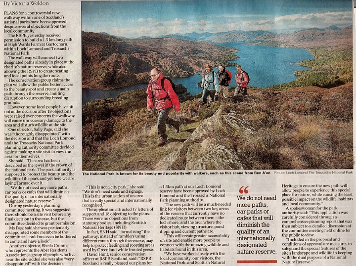
 In late 2018 the RSPB submitted a planning application to construct a new footpath at Ward’s Farm, part of the National Nature Reserve (NNR) at the south east corner of Loch Lomond (see here for the planning papers that remain public). Over 18 months later, on 25th May, the Loch Lomond and Trossachs National Park Authority Planning Committee approved the application, after significant local opposition:
I have been in two minds about the application, not so much because of the path itself but because of the wider issues it illustrates. These involve countryside mis-management and the approach taken by both the RSPB and the LLTNPA to access rights and paths. This post takes a look at the issues.
Access to the Loch Lomond National Nature Reserve
The Loch Lomond NNR, is a reserve in several parts, four islands, including Inchcailloch, and land on either side of the River Endrick. It is protected by a host of nature conservation designations.
It’s never been easy to access as I discovered when on the Board of Scottish Natural Heritage, the body responsible for our NNRs, 20 years ago (see here for SNH info on how to visit including maps). At the time I tried to visit a number of Scotland’s NNRs so I could speak with first hand experience. The main access route to the southern part of the reserve was from the car park in Gartocharn via a path that took one down to the shore of Loch Lomond. The path along the shore, while very pleasant, left one frustratingly distant from the waterfowl on the loch and ended just as the marsh – and the interesting habitat – started. This was about the time that SNH decided that the NNRs should be opened up to people and I recommended then that a lot more could be done to improve access at Loch Lomond.
Since then, SNH has done a lot of good work to open up the island of Inchcailloch to the public. The infrastructure they installed there, including composting toilets at the camping area, are now managed by the Loch Lomond and Trossachs National Park Authority on their behalf.
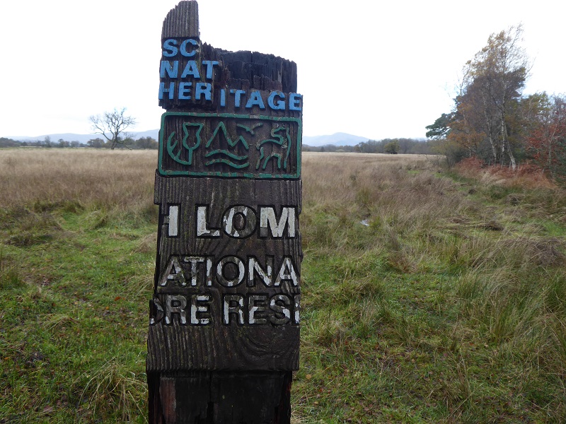
The Endrick part of the NNR, however, has remained inaccessible. On the north bank of the river access from the east is blocked by the Burn of Mar, while direct access from Balmaha involves crossing what is often very boggy ground and burn hopping. There is easy access, via the track to Gartfairn Farm and beyond, but this is not signposted or promoted in any way. Nor is there any parking near the start of that track so, if you have come by car or bus you need to start from Balmaha. I have more recently raised this with SNH staff who told me there is no money for new signs or to repair old decaying ones:
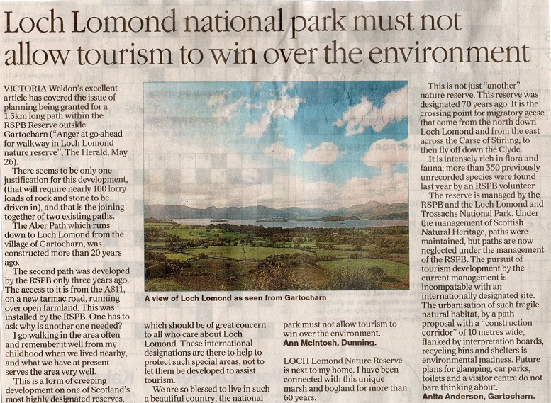
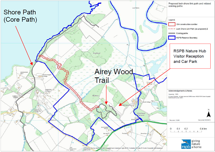
In 2012 RPSB purchased Ward’s Farm on the south side of the Endrick and, after a couple of years, embarked on a programme of creating new visitor infrastructure, including a new parking and reception area.
They also created a new path, now called the Airey Wood Trail, which avoided the main parts of the reserve. The plan to build a new 1.3km path along the western edge of their land connects that trail to the Shore Wood Path along the edge of Loch Lomond.
So why, having argued for improved access to the NNR for 20 years, do I have reservations about this new path?
Concerns about the path, how it will be managed and plans for the NNR as a whole
Local People have ably expressed concerns that the path is just part of much wider plans to develop a tourist facility at Ward’s Farm. There are arguments for and against that – including the need to enable people with disabilities to access our NNRs – but in planning terms this is another example of planning creep. Instead of a masterplan, which includes all the proposed developments on the site, this is just one in a series of piecemeal applications (the eighth so far in my reckoning). The RSPB appears to be acting no differently to private developers or Highlands and Islands Enterprise at Cairn Gorm (see here for example).
The LLTNPA has been complicit in this. The report to the Planning Committee claimed that whatever planning applications may be in the pipeline are not a “material consideration”- i.e relevant – to the decision on this path. It appears the RSPB site requires a masterplan just as much as Cairn Gorm.
Indeed, the path needs to be considered within the context of all the other developments being proposed for the unspoilt, till now, south-east corner of Loch Lomond. Local people are right that the whole area risks being suburbanised, with the Wards Estate Planning Application last year (see here) being closely followed by the Hunter Foundation’s proposal to develop Ross Priory (see here). (I intend to cover that Planning Application soon).
RSPB’s case for the new path included the argument that it would help connect the Airey Wood trail with the Shore Wood path which is a core path. RSPB submitted their Planning Application during the LLTNPA’s consultation on its inadequate and unambitious revised core paths plan (see here). A perfect opportunity one might have thought to ADD a significant section of new core path to the network. Indeed it would require less than 1km of new path along the dangerous A811 to connect the RSPB reserve with the track down to Woodend Lodge which provides the only crossing of the River Endrick downstream of Drymen Bridge.
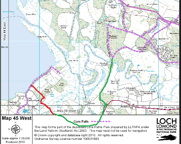
By connecting these paths and tracks, the LLTNPA could – for the cost of a kilometre of new path along the road – created an off-road route from Balloch, using the John Muir Way to Gartocharn, on to Drymen and Balmaha. A massive recreational opportunity once again missed.
Access Authorities, however, have special obligations to keep core paths open. Adding the proposed new path to the core path network would have made it much more difficult for the RSPB to manage the new path as they wished: ‘
“The proposals for ongoing monitoring of activities during the operational phase and measures such as seasonal path closure if necessary mean that the effects on the landscape can be controlled”.
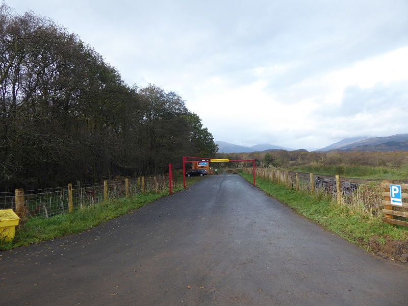
That the RSPB were likely to do this, is illustrated by how they recently “closed” Ward Farm NNR to the public during the lockdown:
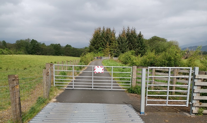
This was unlawful. Access Rights were not suspended by the lockdown and government advice was that the provisions of the Land Reform Act continue as normal. Locking gates, and causing an obstruction to access, is against the law and sadly therefore the RSPB has acted no better than the many other private landowners who have tried to close down access during the crisis. The people most affected by this live locally. It’s hardly surprising therefore that many of them are distrustful of the RSPB’s motives, places they had walked for years shut off unlawfully.
Indeed, looking at the justifications for the new path, it appears that it’s purpose is not so much as to enable people to enjoy the NNR but to steer people away from it:
“Create a ‘funnelling effect’ for visitors reducing the likelihood of them roaming into other areas (thereby reducing disturbance potential)”;
Hence why the path runs along the south west boundary of the reserve. While the path includes provision for new interpretation shelters, there are no wildlife hides. That is because the path doesn’t go near the places where you might see the Reserve’s fantastic wildlife. Indeed the RSPB plan to plant thickets – and the LLTNPA has made this a condition of the planning consent – to prevent people from disturbing the Greenland White Fronted Geese that sometimes graze in the fields next to sections of the path. How much better it might have been to install a hide!
This path appears appears to be part of a wider hidden agenda to exclude people from the NNR. During the consultation on the camping byelaws, the RSPB asked for the east Loch Lomond camping management zone to be extended south of Balmaha:
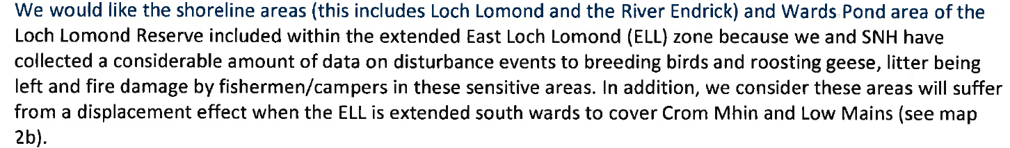
SNH and the LLTNPA agreed and the camping management zone was extended south preventing anglers from fishing at the mouth of the River Endrick. That was arguably the best place for fishing on the whole of Loch Lomond. The area on the north side of the River Endrick is indeed important for roosting Greenland White Fronted goose but they are only present in the winter while the camping byelaws are seasonal and by and large cover the period when the geese are absent!
While our NNRs are meant to be for people, the RSPB, SNH and the LLTNPA all appear to be secretly trying to keep people out of most of the reserve by the River Endrick. Within this context, the real purpose of the path appears to be about making people believe that they are being offered something special when visiting Ward’s Farm Reserve when in reality they are being offered an ersatz experience. The path is fake tourism. Hence my unease.
The way forward
Instead of the drip drip of planing planning and a piecemeal approach to visitor infrastructure, the LLTNPA should develop a coherent plan for the area around Ward’s farm, including the NNR, as a whole. That should be simple as the area is one of the few unspoilt corners of Loch Lomond. Because of this there should be a ban on any on further new build developments.
There could then be consultation on how to create a coherent network of paths through the area, that connected settlements and enabled more people to experience the fantastic wildlife without disturbing it. Other RSPB reserves have hides at their heart and there is no reason why that should not happen at Ward’s Farm or why there shouldn’t be a core path running through the reserve and also signposted access on the north side.
[Footnote: I have been a member of RSPB for something like 30 years].
