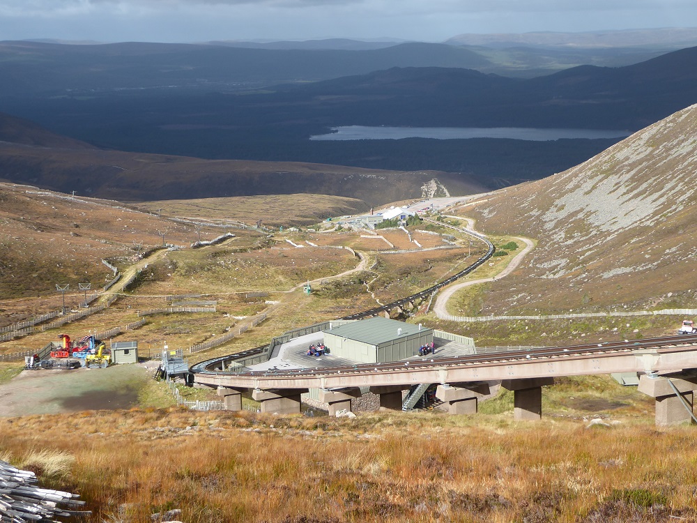
This post takes a look at the scope of Highlands and Islands Enterprise’s planning application (see here for papers) to repair the funicular, its proposals for accessing the areas where they say work is required and the impact that this will have on the natural environment.
The scope of the Planning Application
Graham Garfoot’s post (see here) drew attention to how the Planning Application is for work on 65 separate rectangular areas around the piers supporting the funicular and how the estimated total size of these areas, 0.98 hectares, did not add up. The Planning Statement explains this as follows:
“this application site boundary has been defined to enclose only areas where development requiring planning permission will take place”
This, I believe, is fundamentally wrong in terms of planning law. It is clear from the Planning Application that a far far wider area will be affected. Moreover, surrounding areas affected by works have been included in previous planning applications at Cairn Gorm AND subject to planning conditions set by the Cairngorms National Park Authority.
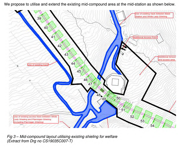
The working area – where vegetation and soils may be affected and machinery may be driven – is clearly much larger than the 0.98 hectares around the pillars included in the Planning Application.
What’s more, besides the area marked in black, the application states that “existing access tracks will be heavily used………upgraded where necessary and maintained in the current condition” and that “additional temporary” tracks will be constructed to connect the existing access tracks to the working area. To take the example of the Shieling track:

What this means is that HIE is claiming that they don’t need planning permission either to upgrade the Shieling track or to install three new temporary tracks to connect it to the working area.

No evidence has been provided to suggest that the Shieling Hill track, which was granted retrospective planning permission in 2017 (see here), can withstand “heavy use” while being maintained in its current condition. The history of this “track” is that it was not constructed as a track at all, but created after the Shieling Rope tow had been installed because Natural Retreats had failed to retain sufficient vegetation to restore the area as originally required. To adapt it for heavy use will require significant upgrading work. In similar cases elsewhere, the CNPA has for the last couple of years been rightly forcing the landowners to apply for retrospective planning permission, as in Glen Banchor (see here) and Glen Clova. So why has the CNPA now allowed HIE to lodge this application without the tracks being included?
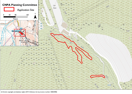
It’s just four months since the CNPA approved HIE’s Planning Application to create a new beginner’s ski area above the Day Lodge (see here). The boundary for that planning application included ALL the land that would be affected by the works, not just that which HIE wanted to “smooth”:
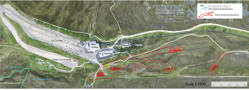
The planning boundary for the beginner’s ski area covered ALL the land between the areas to be developed (the red patches) and the access roads that might be subject to vehicular use. So why is CNPA not requiring this for the funicular repair?
Theargument that the working areas and connecting tracks should have been included in the funicular application is reinforced by the fact that the CNPA, when granting consent for the beginner’s area groundworks, set a number of condition that covered the WHOLE area, eg:

This condition was designed to protect the natural environment across the site, ie the whole area within the planning application boundary. The converse of this is that if CNPA accepts the planning application boundary as proposed for the funicular, i.e limits it to 65 area around the piers, it won’t be able to impose conditions that covers the land round about.
It’s as if a housing developer put in a planning application for a house that omitted the drives, gardens, utilities and drainage and said all they needed to apply for was permission for the house itself. That would deemed completely unacceptable and so should this Planning Application from HIE.
Absence of proper plans for creating and restoring the access tracks
Having claimed that planning permission was not needed for the access points and surrounding land, its hardly surprising that the Construction Method Statement that HIE has submitted with the Application says very little about how the tracks will be created or restored.

Key points here are:
- There are no plans for how existing tracks will be upgraded. Note how, having stated they would use the Shieling Track to access piers 33-47, under this summary the track has suddenly turned into the “poma lift track corridor“
- Its not clear how many “temporary” tracks are proposed. The summary talks about ONE track to links piers 33-47 but the detail (as quoted above) refers to THREE such tracks.
- The routes of each temporary track has not been worked out. HIE are proposing the old future construction track should be uncovered – without indicating where this is (does anyone in the planning application team know?) or what remains of it (I thought it had been restored) – and that other bits of track should be “microsited” when the works starts.
- The Methodology Statement refers to a number of different types of temporary track but does not indicate what type of track will be used where:
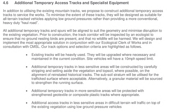
- Nowhere in the Application does it set out WHERE the sensitive areas are and therefore there is no way of telling what type of track will be used where (i.e a track created by removal of vegetation or by putting down matting). Its relevant to note here that the conclusion of the baseline habitat survey, accompanying the application, was that ALL vegetation types were of conservation interest:

- Note how in the last bullet point above, that in addition to the temporary tracks, it’s proposed that in the less sensitive areas, wherever these might be, that low ground pressure vehicles will drive over the ground. If low pressure vehicles are driven over a piece of ground enough times, it will erode. So what is HIE proposing to do to limit this? Err…………nothing. In effect vehicles will be driven willy nilly everywhere.
- Nor does HIE explain WHERE and WHAT TYPE of material it will source “to strengthen the running surface”.
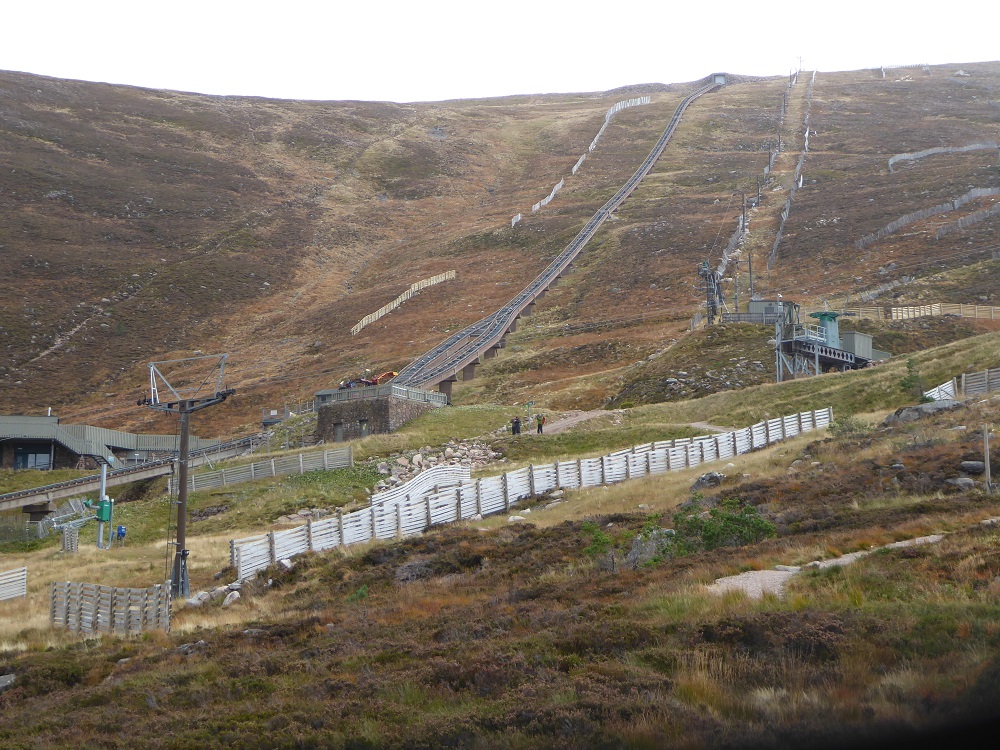
- And lastly NO consider or explanation is given as to how the access tracks will be designed to deal with the gradient above the shieling (apart from the very top where HIE admits the ground is too steep and proposes to use helicopters to bring in materials).
The steep ground above the half way station
Any excavated track on steep ground such as that above the Shieling is likely to be at risk of being severely eroded in heavy rainfall and end up washing material down into watercourses.
Having failed to explain what works are actually required, its hardly unsurprising that there are NO proposals for how these tracks will be restored and no proposals for monitoring this. As worded, the Planning Application would allow a repeat of the Shieling track disaster (see here) but five times the amount of ground would be affected.
Helicopter hypocrisy
Regular readers may recall the Planning Application for the Ptarmigan just under a year ago (see here). In that application HIE argued that materials needed to be brought up to the site by road rather than helicopter because of the risk helicopters posed to protected birds. That was a new one for Cairn Gorm, with helicopters having been used previously to prevent ground damage. It appeared to me an argument driven not by science but a wish to cut costs, with birds were being used to justify widening the access track up Coire Cas even further.
That I was right on this is suggested by the fact that HIE are now proposing to use helicopters to bring in all materials for the top section just below below the funicular tunnel. By my reckoning that is just 250m away! This should give the CNPA every reason they need to reject the current application because no breeding bird survey has been conducted and they made it a condition of the Ptarmigan application that there should be no helicopter transport of materials:

Perhaps the CNPA should go back to SNH, who have stated they have no comment to make on the application, and ask for their advice?
What needs to happen
Itswrong that the CNPA has pressed full steam ahead with the planning application to repair the funicular during the COVID-19 crisis, when planning processes cannot work as normal, and before HIE has submitted a new masterplan for Cairn Gorm (see here).
While its important anyone commenting on the application objects to HIE’s failure to submit the masterplan, its also important that people submit further material reasons for rejecting the planning application (you can do so here). In this post, I have identified a number of such reasons, most importantly that the boundary of the Planning Application does not cover MOST of the ground that will be affected by the development. In that respect its worth noting that the CNPA has legal duties, under its statutory conservation objectives and the conservation policies set out in its Local Development Plan to protect the natural environment, including at Cairn Gorm.
The other key points I have raised here are the lack of proper plans for access tracks, either inside or outwith the “working area” – which clearly should be subject to planning permission – and associated with this the absence of any plans to restore the area. Parkswatch hopes to put out a further post tomorrow, before the deadline for comments, identifying further reason to object to this Planning Application.

Some good work to demonstrate that access roads need to be included in the site boundary. I commented more fully in the associated Cairngorms National Park The Planning Application to repair the funicular (2) April 16, 2020. Using your evidence, Nick, the applicant has in my view incorrectly completed the application form under the checklist at the end of the application form as this application meets the legal definition of a Major Development. A Major Development requires:
– a pre-application consultation report. No such public consultation has taken place
– a design and access statement. No such document has been included in the application.
If I am correct, then legally, CNPA has not other option but to reject this application. It should not even go to Committee.
Thanks very much Gordon and I would suggest anyone objecting to the application today should make these points, Nick
good to see number of objections now lodged along the lines of this post. There is something distinctly unseemly in the apparent ducking and diving that this oddly restricted redline area suggests. I seem to recollect the great care with which the initial build removed surface vegetation and relaid it carefully when the temporary access track alongside the piers was buried … this application seems to suggest the old tracks will be exhumed; dug up; exposed!
I stand by my own objection of grounds of prematurity due to lack of masterplan, because to approve thie application without full development of all the options and a clear future direction is to turn both HIE and CNPA into laughing stocks, but the technical inadequacies of the application are wildly exposed by this dodgery, somehow reminiscent of Private Walker out of Dad’s Army.