I was sent this photo from David Lintern, the fine outdoor writer and photographer (see here), last night and it prompted further thoughts about the Climate Emergency and the connections between what happening on opposite sides of the world in Scotland and Australia (see here for most recent post on lessons from the Australian crisis).
Over 500,000 hectares of the Wollemi National Park have burned since October (see here for NSW fires details) and over 10 million hectares in Australia as a whole. (The BBC has assembled some good facts) That’s a lot of forest. It rather puts into perspective Scotland’s woodland expansion targets which are continually being promoted as ambitious and a major contribution towards tackling carbon emissions:
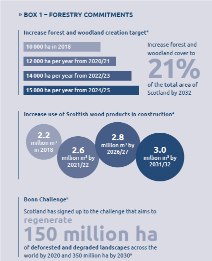
Even with the more ambitious targets which start from 2020 it would take us thirty years to regenerate an area the size of the the Cairngorms National Park (450,000 ha). And young forest won’t contain nearly as much wood and carbon as what has been burned in Australia.
Scotland of course is tiny compared to Australia, but the figures illustrate that in working towards carbon neutral emissions, we should treat planting trees in Scotland as re-absorbing carbon that has been released by the historic destruction of woodland – our denuded “deer forests” and grouse moors – rather than as compensation for the fossil fuels which we continue to extract at pace from the North Sea. Its the extraction of carbon from beneath the earth’s surface which is the fundamental problem and which needs to be addressed worldwide.
The Scottish Government is not even fiddling on this while Australia burns and we are deluged. Last month saw the highest December temperature ever recorded in Scotland, 18.3 degrees. What used to fall as snow, which was then released gradually in our rivers, now pours off the hill thanks to Australian coal, north sea oil and the rest.
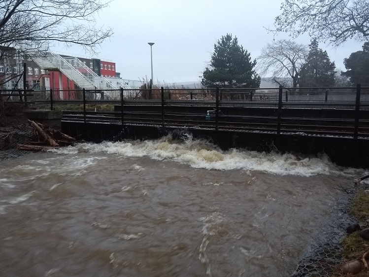
Yesterday afternoon the latest downpours closed the railway between Kingussie and Inverness (see here). While its still to be revealed what role the very high levels of the River Gynack played in this, that a stretch of railway in the Cairngorms National Park has been affected, like the unprecedented destruction caused by torrential rail to the West Highland Land in the Loch Lomond and Trossachs National Park in August (see here), is not just an accident of fate.
The poorly designed Gynack flood diversion channel (see here) which was granted planning permission by the Cairngorms National Park Authority, partially funded by Highland Council and intended to alleviate the flood risk to the village of Kingussie is still not operational (as another Kingussie resident confirmed to me yesterday evening). Part of its justification was to protect the railway. Reason enough for the CNPA Board to conduct its own min–public inquiry into what’s gone wrong.
At the same time the land mis-management practices which continue to blight much of the National Park will have also played a role:
Scrub vegetation and trees could play a significant role in slowing down the rate water enters the River Gynack but unfortunately the regenerating juniper is, like much other land managed as grouse moor, now subject to muirburn.
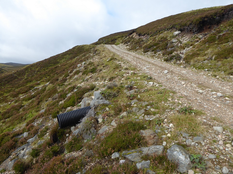
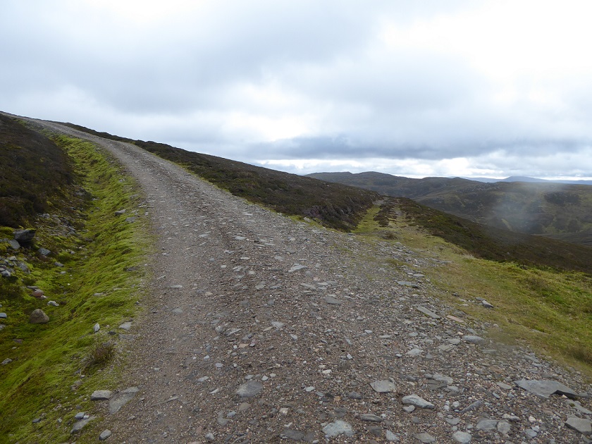
The roads that have been constructed by the Pitmain Estate in the catchment of the River Gynack as “permitted developments” also serve to channel water more quickily off the hill causing water levels in the river below to rise more than they otherwise would.
So how much of the railway chaos reported by the Strathy yesterday has been created by muirburn and these roads?
What needs to happen before the Scottish Government and our public authorities treat the declaration of a “climate emergency” as a real emergency and start to take action?
The answer, I suspect, is that no natural disaster, however large – think of Scott Morrison the Australian Prime Minister denying any link between increased temperatures and increased fires – will on its own persuade government at whatever level of the need to take the type of comprehensive action needed to address the climate emergency. There will of course be some token actions – expect lots more publicity about tree planting across Scotland designed to make people feel good (about which more anon) – but until people demand action from government at all levels in a way that cannot be ignored, human created “natural” disasters will only increase.
I am optimistic that that could happen in Scotland in 2020 with the world climate change conference which coming to Glasgow in November providing plenty of additional opportunities for people to put pressure on our public authorities and the Scottish Government to act.

I agree with what you say about muirburn, tree planting and consideration of how all actions impinge on climate change. But I think the immediate problem of flooding in Kingussie and disruption to railways will not be addressed by such actions. We have to insist on doing the right things for the planet but not link that to short or medium term improvements for our local situations.
Highland Councils, in whatever form, used to have the wherewithal to act to prevent flooding.
The high water at the rail bridge at Kingussie was in large part due to the accumulation of boulders and smaller stones at the bridge. A high? proportion of that material would have been deposited as lately as a month ago. When there was more money to spare that material would have been removed .That`s what I`ve seen happening over the near 50 years I`ve been in Kingussie. Now it seems dredging is done after a damaging incident.
Pitmain Estate makes a substantial income from this water power. I remember being told that for a one and a half million pound investment their upper half megawatt scheme would bring in a quarter of a million a year .One might have thought that the management of the estate would see their way to using some of this good fortune to protecting the fundamentals of the local community .
But I won’t hold my breath.
The truth about hydro schemes as above is that they have only one function. To transfer money from ordinary ie not rich people, into the pockets of wealthy people. They do approximately the square root of b****r all in mitigating carbon usage, and delaying climate chanege. And they also do damage to an environment already destroyed by the same people who are receiving the grants to build hydros, wind farms, and to plant trees.
I love how you censored the word bugger. 😀
I do it in advance in case the mediators do it Susan. I am normally quite foul mouthed. I enjoyed my year in Australia. Are the two linked??
Regarding the Australian fires I think its important to note that the Australian Government has over a number of years, redirected water courses, dammed river systems, extracted water for bottling and fracking, underfunded fire fighting services and traditional land management practices. Practices that controlled the understory to limit the fuel available to fires whilst recognising that fire was a vital part of the ecology. Then you have the narrative given to MS Media of arson eg “114 Queensland fires attributed to arson”, though how the authorities were so quick to come up with these figures so is odd.
According to the stats on the global fire data website analysis (see link) the 4.9 million hectares (according to a Guardian Newspaper Report ) is by no means the largest fire in Australia’s history (line graph analysis). It was however, if you go from the graph representation to the map representation, unusual for the fires to be so concentrated into the S.W of the country. So should we be so quick to conclude this is a consequence of “Man Made Climate Change” or as some people call it “Mann Made” after the author of the IPCC report that introduced the “hockey stick” graph of “average global temperature”
http://www.globalfiredata.org/analysis.html?fbclid=IwAR2CE-BIemaFq6SQSEIwbfO03LLXVMKHhQu7IeDeM04nqys4WxjoAVSciqE