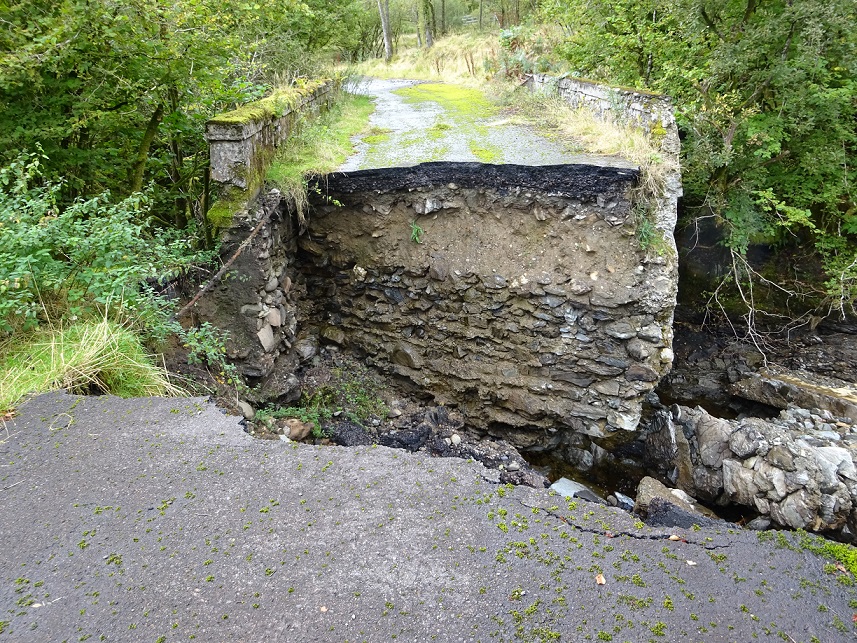
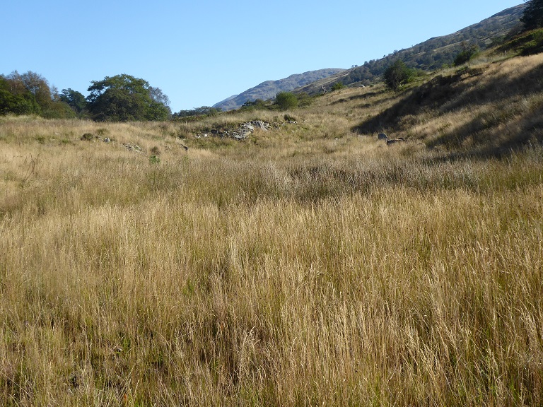
Following the great rainstorm of 5th August, which swept away part of the West Highland Line, I was expecting to find significant damage to the seven hydro roads in Glen Falloch when I visited at the end of September. In the event found that the damage which the storm caused to the hillsides, in the form of landslips (see here), and the hydro intakes (see here) and (here) was particularly dramatic so covered these first.
The damage done to the new hydro hill roads is, however, still considerable. It raises serious concern about their impact on the wider natural environment in the glen and adds to the other concerns about the sustainability of hydro schemes which I have raised in previous posts.
Under the terms of the original planning consent granted by the Scottish Government for the Falloch hydro schemes all the construction roads were to be completely restored. Access was to be by “green tracks”. Once the construction roads were in place the Glen Falloch estate then submitted new planning applications to retain all the roads for access to the schemes and for “estate management purposes”. By doing so they saved a small fortune in restoration costs. The Loch Lomond and Trossachs National Park Authority then approved all these applications without giving any proper consideration to their landscape or environmental impacts.
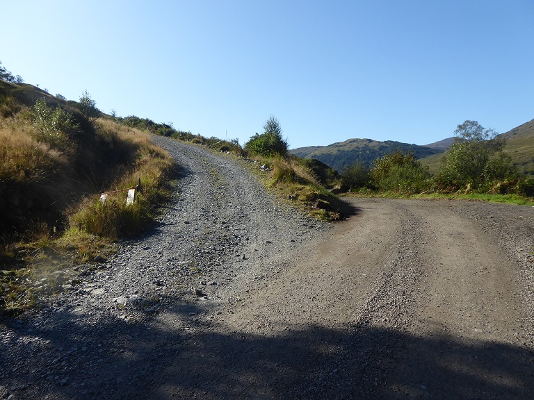
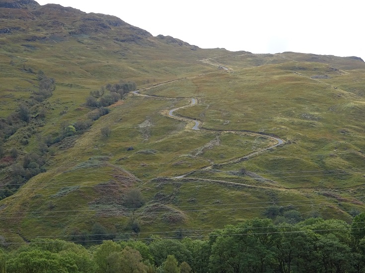
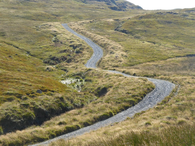
Arguably, of all the Glen Falloch hydro roads the one with the greatest landscape impact and the most flawed in terms of design is that up to the two Ben Glas hydro intakes above the Eagle Falls. I walked up that road first.
The design flaws are evident from the start. It is too steep and the LLTNPA’s Best Practice Guidance on Renewables states that say that hill tracks should not be cut through banks like this (because they are impossible to restore). Why then has the LLTNPA allowed Glen Falloch Estate to leave this in place?
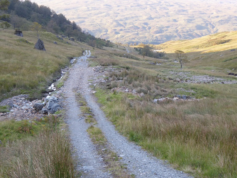
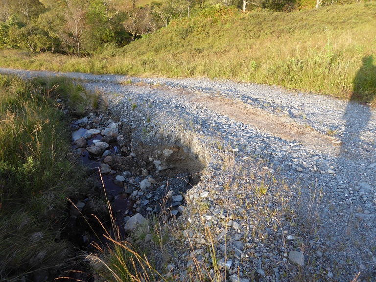
While there had previously been a much smaller landrover track up this slope, which had been followed by the old drove road, the new road forms a great landscape scar. It is also too steep, too wide and has been badly restored.
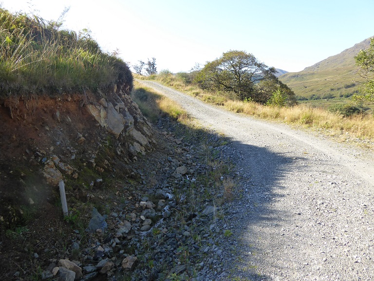
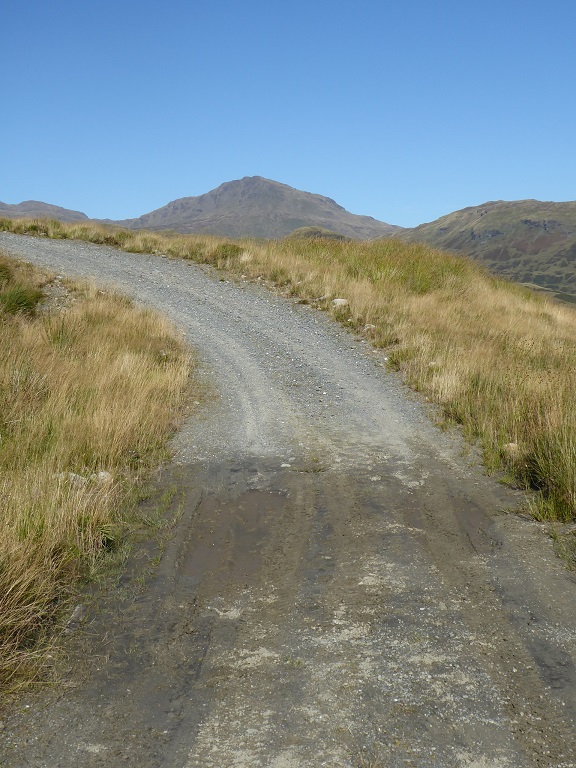
Scottish Natural Heritage’s Best Practice Guidance on Constructed Tracks in the Scottish Uplands states that unsurfaced hill roads should not be steeper than 14 degrees. This is because more than that and they are at severe risk of erosion. The LLTNPA’s own Best Practice Guidance endorses SNH’s guidance, yet their planners have allowed this road, with several very steep sections, to remain. The consequence is that it is eroding badly and the estate will sooner or later need to bring in more material to repair the surface, material which in its turn will then get washed away.
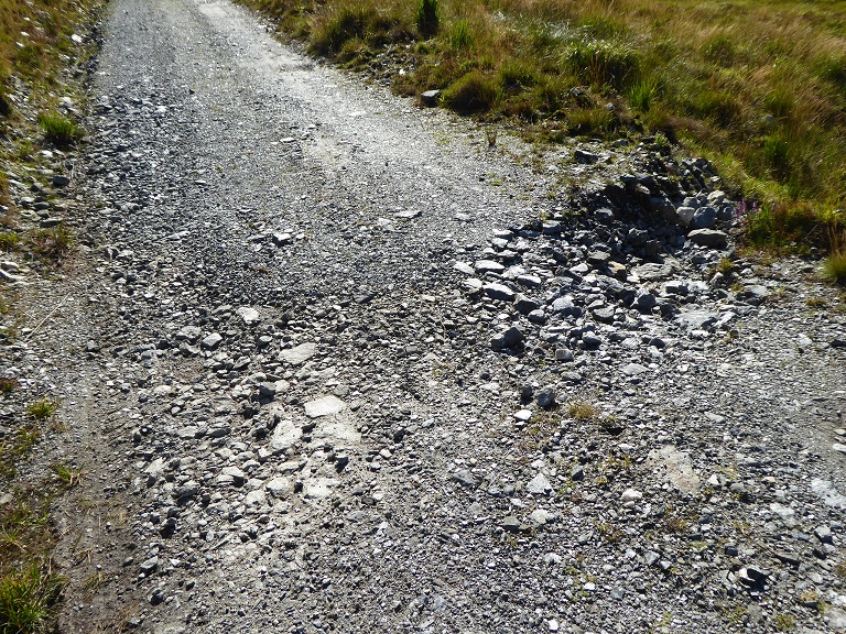
While the borrow pit itself is low down, which has helped vegetation recolonise the site, much of the material taken from it up the mountain is now washing back down the hillside:
I have now for three years been trying to get the LLTNPA to require the Glen Falloch Estate to restore the new hydro roads in the glen according to SNH’s and their own Good Practice Guidance (see here). Both the Park’s Director of Planning, Stuart Mearns, and the Park’s Convener, James Stuart, have refused to meet me to discuss the issues and James Stuart has refused my requests to address his Board about what has gone wrong. I have asked several times and the answer is always no.
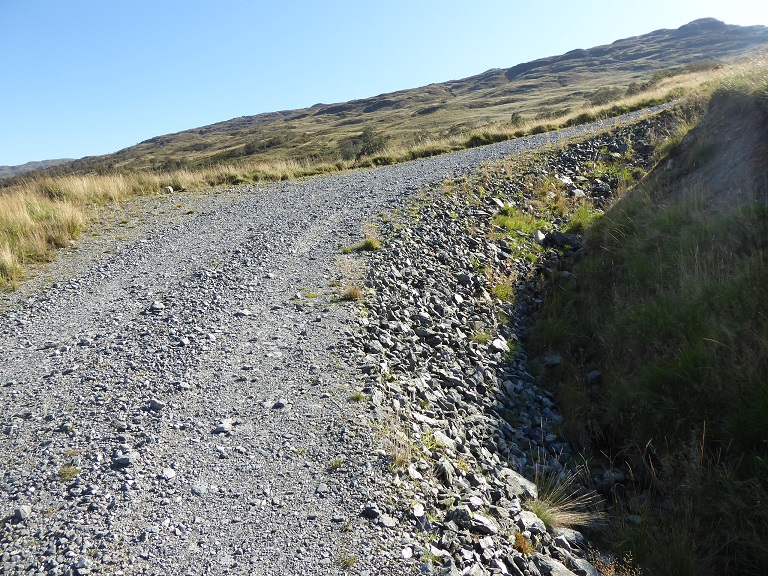
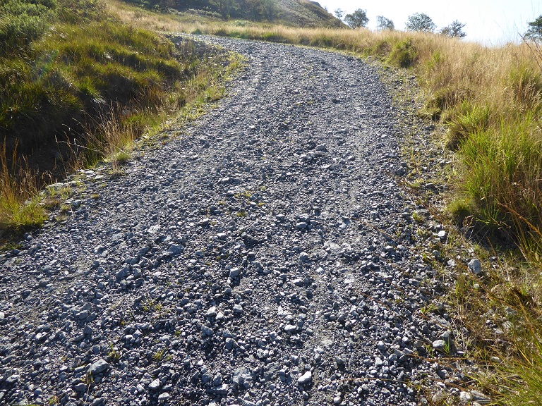
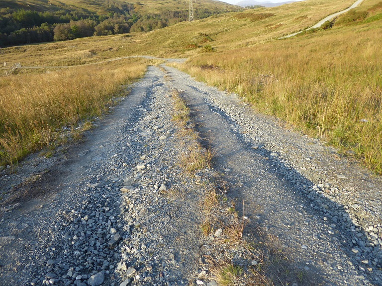
Besides their landscape impact, the new roads and their ditches allow water to flow down the hill far more quickly than previously. The significant sections of bare bank, which are very difficult to vegetate because they are also too steep, adds to the problem. The LLTNPA’s Guidance states that access roads to renewable energy developments should be a maximum of 2.5 metres broad (3m at the bends). Much of this road and others in the glen are far wider than this.
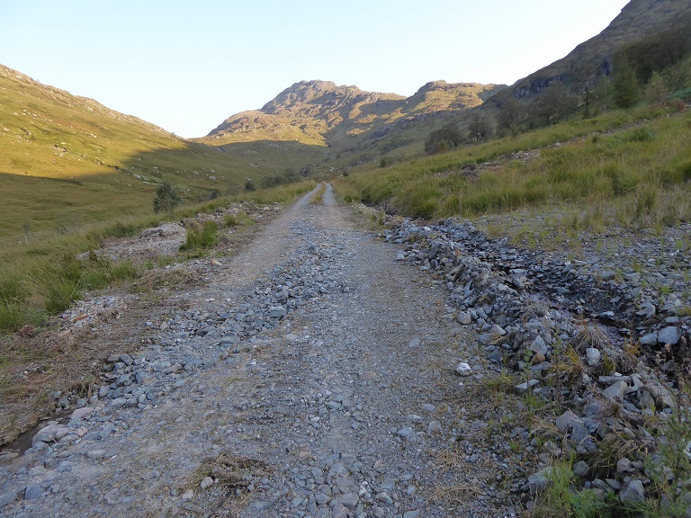
The road up to the Ben Glas hydro also lacks any vegetated central strip which might have reduced the landscape impact, helped prevent erosion and retained some water.
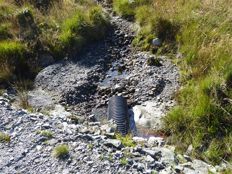
The LLTNPA has effectively created a new course for water to flow down the hillside in times of heavy rain. On footpaths this steep the standard practice is to install water bars to channel water off the path in order to prevent erosion. On the Glen Falloch roads there is nothing, adding to the watercourse effect.
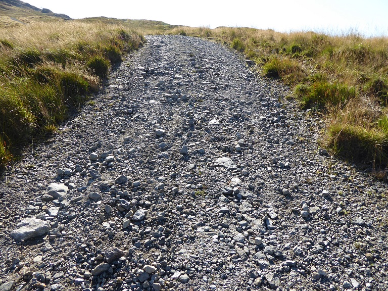
During construction, the Scottish Environment Protection Agency required the contractors to install silt traps to stop fine material flowing into rivers below. That now appears to have been a waste of time because the fine material from the road surface has mostly been washed out leaving a pebbly surface.
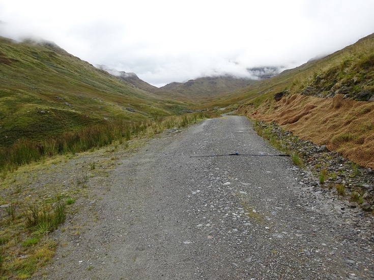
Nowhere yet is the damage what I would call catastrophic but it provides plenty of warnings about what is to come. Having created a course for water to follow this will, with intervention, start eroding like a watercourse. The LLTNPA should have anticipated this and refused planning permission. Instead it has created not only a landscape scar but a permanent erosion problem.
The lack of finishing, betrays a lack of concern about both the landscape and the environmental consequences of these roads.
There was one place on the Ben Glas hydro road where its edge had completely collapsed. There are many other sections where this is likely to happen in future. Without remedial action the road risks becoming unusable just a couple of years after it was “finished”. This is not good either for the National Park or for the Estate who will need to fix the damage. The LLTNPA needs to ensure repaires are done properly and address the causes of the problems rather than allowing the estate to take the cheap option of bringing more material up the hill to fill in holes which will then erode again.
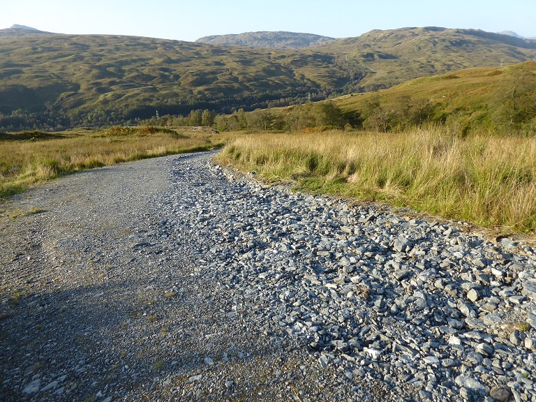
The road on other side of Ben Glas appears to have been much better designed and restored, being narrower and having a central grass strip. Indeed its where the LLTNPA Director of Planning, Stuart Mearns, took Mountaineering Scotland and Ramblers Scotland a couple of years ago to show what a good job the LLTNPA was doing restoring hydro schemes (see here). It was interesting therefore to find that this road had been more seriously damaged by the flood event than the Ben Glas intake road. One possible explanation is that there was more rainfall on the Allt a Chuillinn side of the hill.
Another explanation is that this road, sitting as it does below the slope on the right, was exposed to debris and water coming down the hillside for far more of its length while the absence of zig zags, as on the Ben Glas road, meant there was little to interrupt the flow of the water once it reached the road.
That water was channelled down the road is supported by evidence of increasing levels of damage lower down.
This section of eroded track side was below a well vegetated and restored section of ditch. It would appear that having vegetated ditches is not in itself sufficient to prevent damaging amounts of water being channelled down them during a storm event.
All this provides evidence that these hydro roads, besides being prone to erosion and likely to cause a constant problem to the estate, have also served to increase the rate of water flow down the hill. The consequences of that are greater flooding and greater flood damage below.

Returning to the first photo in this post, could flow of water down the new Eas Eonan hydro road have been what triggered destruction of the bridge over the burn?
Assuming the Eas Eonan hydro continued to function during the storm, some of the water that would have descended the burn would have gone through the pipe avoiding the bridge and lessening the flow there. One could argue therefore that by reducing the amount of water flowing down the burn the hydro pipes delayed the destruction of the bridge.
At the same time, however, the new track, its bare banks and associated ditches have served to drain and channel water and debris off the hill far more quickly than previously and, in the case of the Eas Eonan track, all the drainage ditches feed water into the main burn above the former bridge.
We will never know whether this is what caused the road bridge to fail. What we can be fairly certain of, however, is that hydro schemes do speed the rate of water run-off from the hill, both because of the pipes – which take a direct and unimpeded course compared to the burns – and the hill roads. They have therefore added to the flood damage caused further down the glen (see here).
Perhaps the hydro scheme owners in Glen Falloch should now be made liable for the damage to the bridge over to Ben Glas Farm and any consequent losses incurred by that business? That would create a welcome precedent and make developers think twice before installing poorly conceived and executed run of river hydro schemes and their associated roads.
What needs to happen?
My initial concerns about the LLTNPA granting planning permission to the Glen Falloch estate to retain the hydro construction roads were about the impact this had on landscape and wild land. That was made considerably worse by the LLTNPA’s failure to enforce planning conditions and its own guidance on the design and construction of hill roads. Increasingly, however, I believe that what is bad for the landscape, is also bad for ecoystems, the two are interlinked. Poorly designed and inappropriate hill roads damage both the landscape and the natural environment.
At the same time as the LLTNPA has failed to deliver research into natural flood management – as it agreed to do under the Clyde and Lomond Flood Prevention Plan – its been promoting developments in our hills that increase levels of flooding below. After the Glen Falloch flood event, the LLTNPA no longer has any excuses for not instigating a fundamental review about the impact of hydro schemes and how it has managed this, whether in respect to the impact of the hill roads or the hydro intakes.