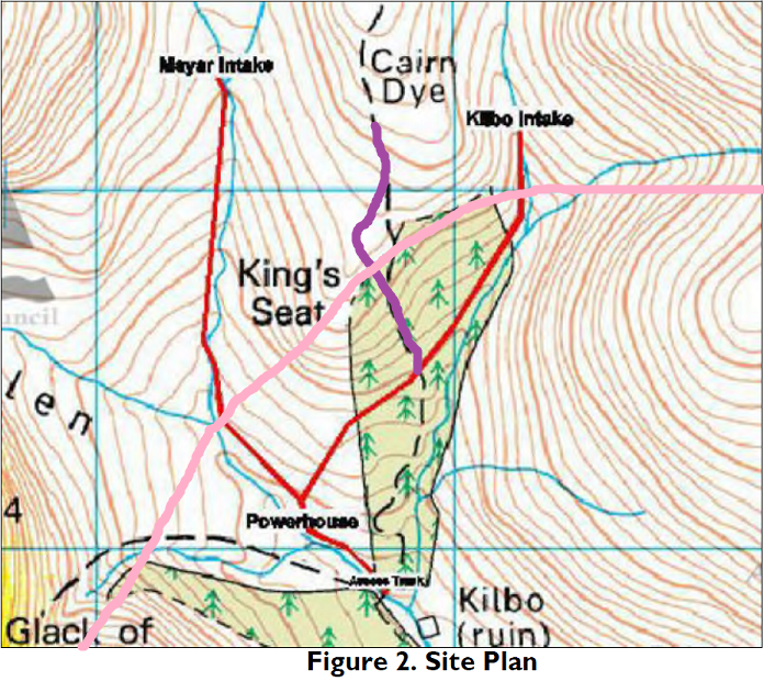
I had walked up Glen Prosen a couple of weeks ago to look at the new roads at the head of the Glen but was prompted by the 26 traps we saw to blog first on wildlife and trapping in the Cairngorms National Park (see here). This post will took at the two new roads associated with hydro schemes and a third new road which has been constructed without planning permission.
First though its worth commenting that the documentation for the Kilbo hydro scheme does help inform the extensive debate created by Helen Todd’s tweet and my post on the Prosen of traps. A couple of commentators defended trapping on the ground it helped such as waders. The evidence from the 2013 wildlife surveys conducted for the Glen Prosen hydro suggests otherwise:
Birds
As part of a Moorland Bird Survey, there was sightings of golden eagle, merlin, buzzard and kestrel however it is considered that no raptor species are breeding within two kilometres of the project site. It is noted that there are no breeding waders in the catchment. (Extract from Construction Method Statement Nov 2013)
Secondly I was struck by this, also from the construction method statement:
So, on the construction site ALL wildlife was being protected from being accidentally trapped in trenches or pipes while round about it is being intensively trapped. This was not about protecting water vole as the wildlife surveys found no evidence for them in the area despite the suitable habitat.
The landscape impact of the two new hydro roads
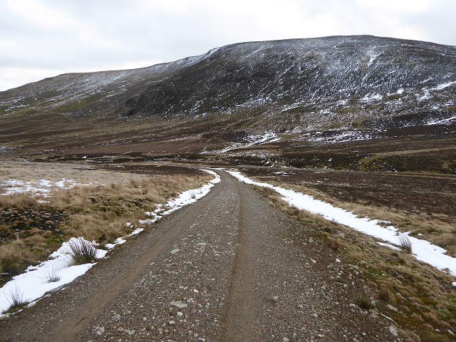
The Planning consent for the hydro schemes required the developer to restore the construction tracks to All Terrain Vehicle width (1m wide):
“Construction phase access tracks running adjacent to the penstock pipeline routes to be reinstated to a reduced width suitable for quad bike use. During their initial construction drainage ditches to be provided along their upper verges to intercept any water flows and culvert pipes provided below the tracks to maintain continuity”
The specification/design for this was set out in the Construction Method Statement:

The specification has been ignored, with more imported material than that originally proposed and far more limited restoration of the track width:
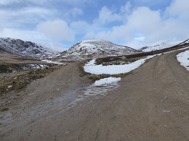
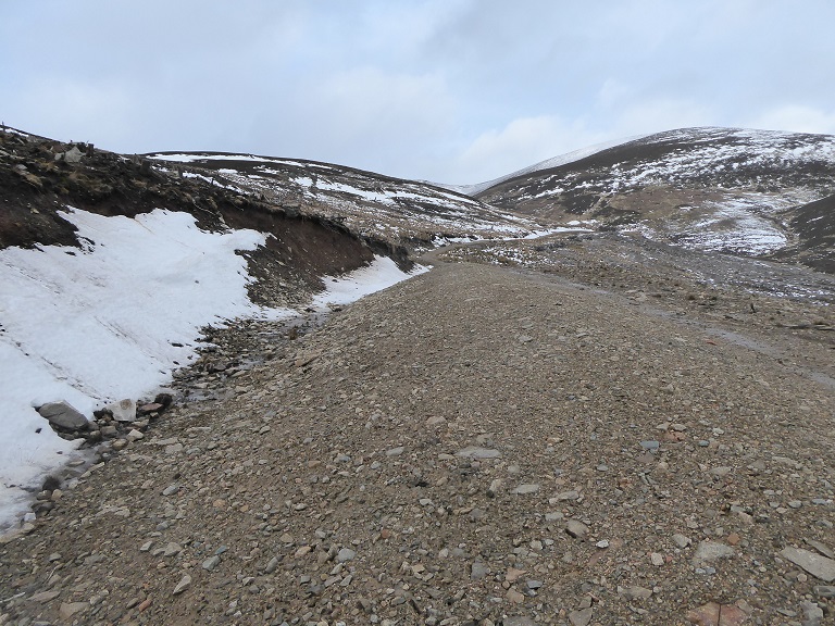
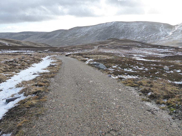
Both roads are far wider than necessary for landrover use – as you can see from the tyre marks – let alone for quad bike or ATV use.
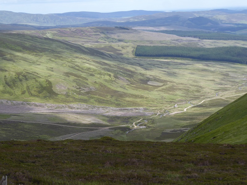
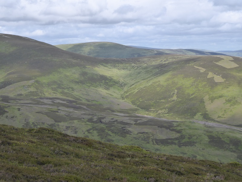
This road is highly visible from various angles. Part of the problem is the excessive width. Had it been reduced to 1m width it would be far less visible. It also however forms a straight cut across the landscape, unlike most footpaths, and this accentuates the impact.
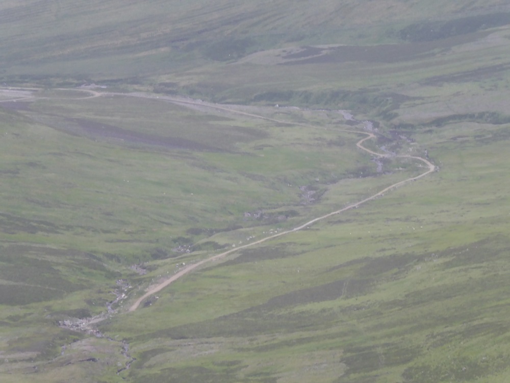
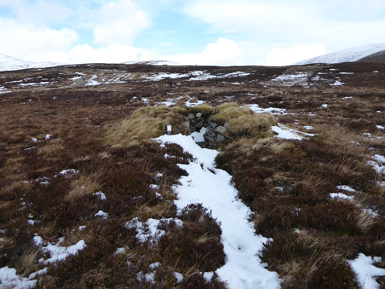
Even in 2016 it was very hard to see the line of the buried pipeline. That has been done very well, including where it crosses back under the burn, and was constructed without using new imported materials. While the vegetation by the road has recovered further since this photo, the problem is that a new road has been created. As the photos shows its far too wide and straight.
The landscape impact has as a result been far far greater than was indicated in the Park’s landscape assessment:
“CNPA Landscape Officer has no objection to the proposal. It was noted that there is potential for a development of this nature and scale to be accommodated in upper Glen Prosen without significant adverse long-term landscape and visual impacts” (Extract from Committee Report)
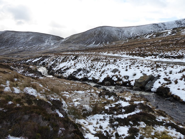
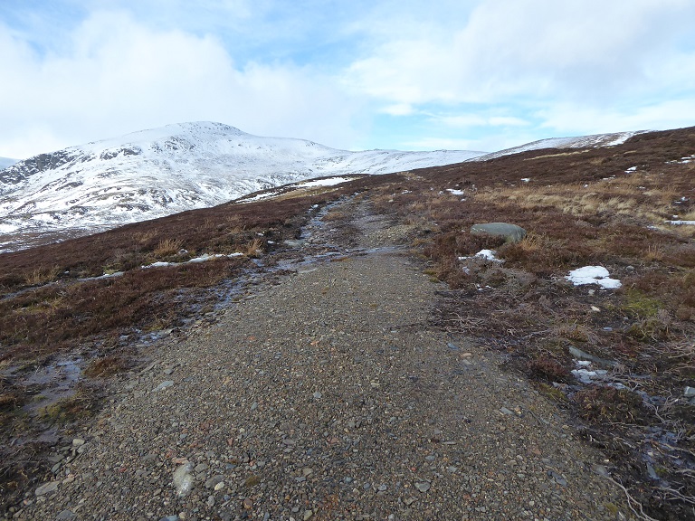
The road to the Kilbo intake is even worse:
Part of the reason the Kilbo road is so visible is it takes a high line across the hillside.
Couple the line with the width of the road and the way its been raised above the surrounding ground and you have a highly prominent landscape scar.
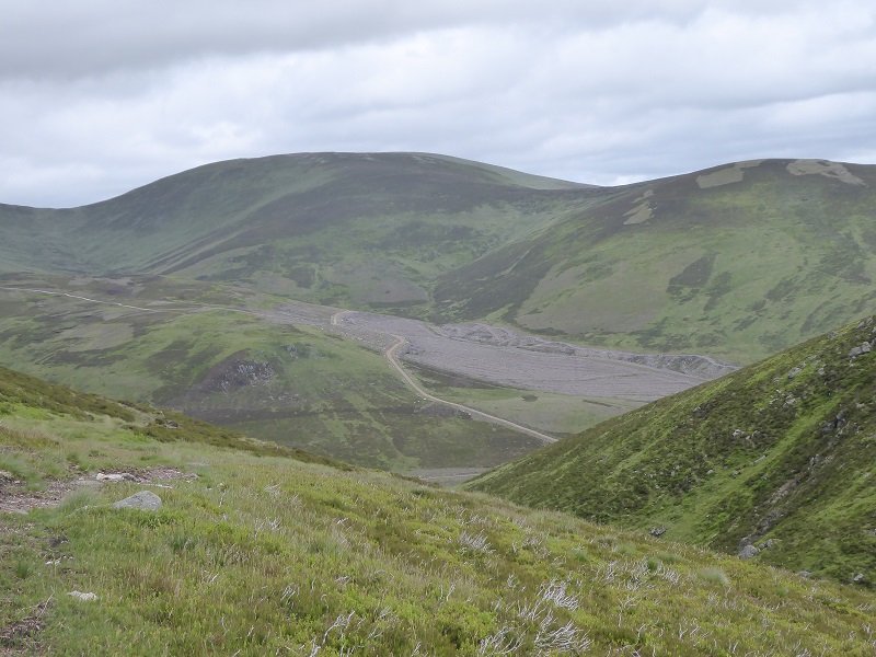
That is nothing however compared to what lies above:
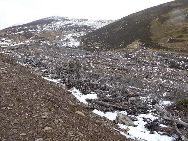
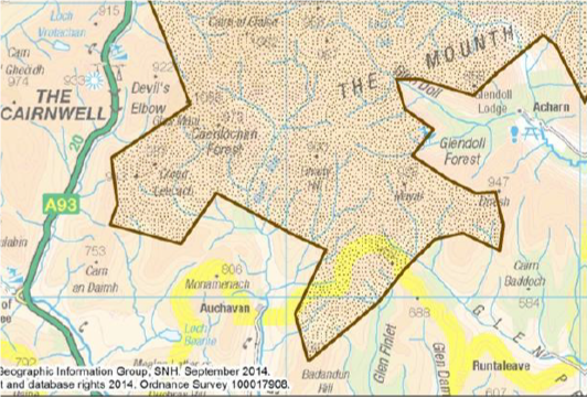
Prior to the construction of the hydro scheme, the King’s Seat forestry planation (as shown on map above) was felled. Forest roads don’t need planning approval but come under the Prior Notification system and part of the reason for this terrible section of track would appear to be that it was constructed to forestry specifications. These allow wider roads for felling than the 4m construction track agreed by the CNPA. However, whatever the origins, this road has been used to construct the hydro scheme and the CNPA required this to be reduce in width to 1m.
One might have hoped that, given the disgraceful state of the upper part of the Kilbo Road that the CNPA would have taken prompt enforcement action. I will now be asking them to do so for both hydro tracks.
The new grouse moor track

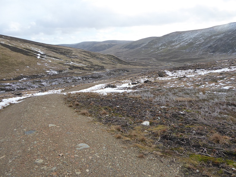
It appears that the Glen Prosen Estate has used the hydro scheme construction tracks as an opportunity to construct a new road up Cairn Dye. This appears to have obliterated the historic Kilbo Path and means that there are now not just two but three hill roads within one small area at the head of the glen. There is no planning application for this and the road is not listed under those that have been developed under the Prior Notification scheme. It therefore appears unlawful.
The first section of the new road, however, is through plantation and the Glen Prosen Estate may try to claim it was constructed to help fell the forest. It should be possible to tell if that is the case from the forest plans. Above however, its clear purpose is grouse moor management and grouse shooting.
Its symptomatic of current inconsistencies in our approach to land-use that the ground here is being damaged by muirburn when along the Kilbo Burn the CNPA made this requirement for the hydro scheme:
No work shall commence on the development hereby approved until the exact specifications and methods for the compensatory creation of riparian montane scrub is submitted to and approved in writing by the CNPA acting as planning authority.
Unfortunately, I was not aware of this requirement at the time of my visit and did not therefore go and check if has been met, but planting one place while burning the land next door makes no sense.
The estate appears to have driven vehicles here for many years but they took a different less steep route up onto Cairn Dye and that old route had far less landscape impact.
The road is far far wider than that consented for the hydro roads and there is now no sign of the green central strip that the CNPA now regards as good practice for landrover tracks.
The road runs along a line of refurbished grouse butts suggesting that one reason it was creation was to avoid grouse shooters having to walk up the hill along the former historic Kilbo path (maybe half an hour from the Kilbo Bothy)
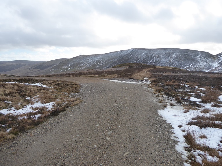
The new road ends near where the grouse butts end but a landrover track continues:
The landscape impact of the landrover track is far less than the new road because it is narrower and restricted to tyre lines so effectively has a vegetated strip down the middle:
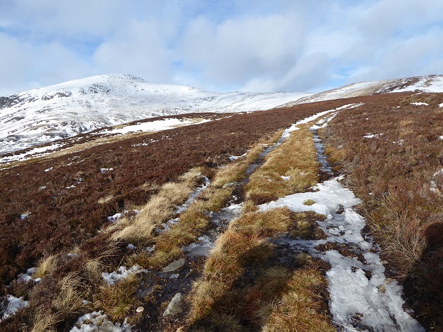 The vehicle use has however clearly impacted on the vegetation, converting heather to grasses, thus former a line across the landscape. This illustrates why footpaths generally have less landscape impact and are preferable to roads with green strips down the middle. If the Glen Prosen Estate accepted 1m wide tracks for quad bike use below its hard to see how they can justify using any other vehicles here.
The consequences for the landscape have been significant and the track is highly visible from the high ground around the head of the glen. With two hydro roads in place on either side there can be no justification for this road. The upper part is also within the Lochnagar-Mt Keen Wild Land Area and seems likely to have been constructed after SNH’s maps and descriptions of Wild Land Areas were published in 2014:
What’s gone wrong and what needs to happen
I am afraid that the CNPA had badly underestimated the landscape sensitivity of upper Glen Prosen in the way it has managed these two hydro applications:
The landscape impacts of this proposal are minor, given the scale of the development and the location in the upper Glen Prosen. Conditions relating to the construction phase of the development have been proposed to minimise any short term impact. In addition, the set of mitigation measures
proposed are likely to have a positive impact on the development site in the long term.
Part of the problem appears to be that the CNPA failed to monitor the construction of the hydro schemes. Had they done so, they would never have allowed the contractors to leave the site without restoring the construction tracks. Had they done so too, they could hardly have failed to notice that a further new road was being constructed without planning permission and stepped in to halt this.
The CNPA has also, however, failed to take any effective action since I first reported these roads (along with the ones on the plateau) to them in 2016. I suspect part of this is lack of resources, added to which all staff are now based in Grantown which means that it takes someone a whole day just to go and check what’s happening in the Angus Glens.
If the CNPA, however, wants its expressed concerns about the landscape impact of hill roads to be taken seriously it needs to take action here.
To end on a more positive note………………………..
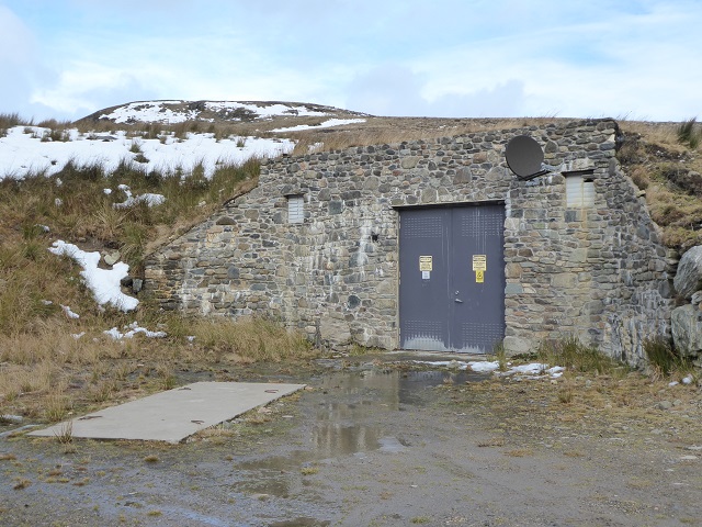
Apart from the new roads, the other elements of the Glen Prosen hydro scheme have been well done. The 3.2 km powerline from the powerhouse to Old Craig has been buried and the line of this barely discernible. The powerhouse itself has also been buried and is one of the best examples of this I have seen.
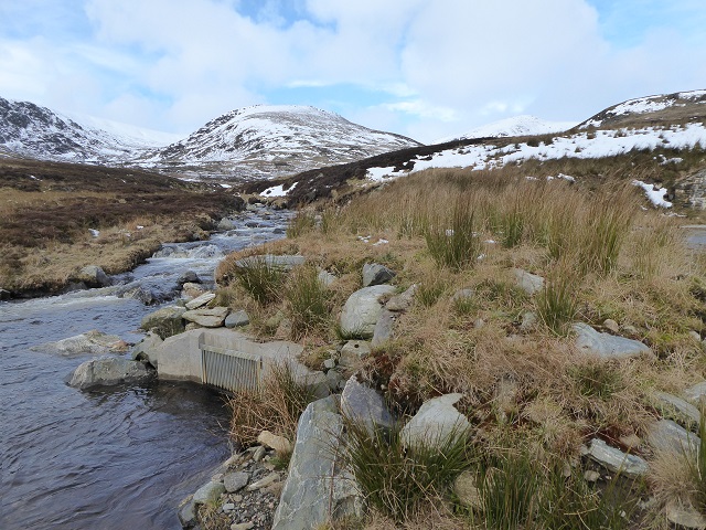
The outrace has been very sensitively landscaped
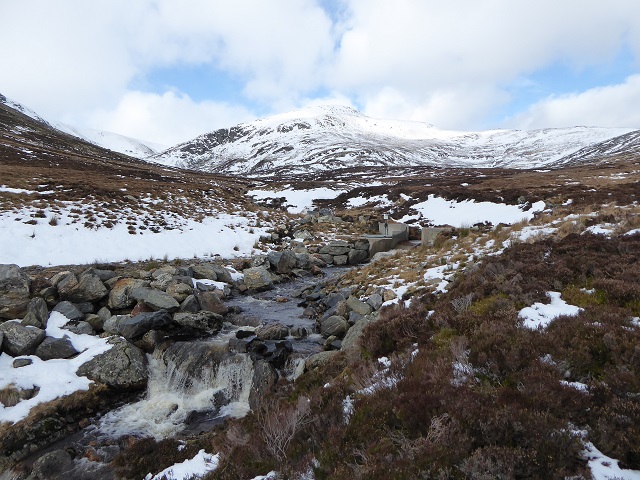
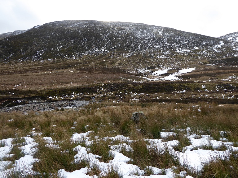
The Mayar intake is not just well located, it shows how rip rap bouldering to reinforce the sides of streams can be done sensitively so it appears almost natural (unlike the dreadful examples in Glen Falloch in the Loch Lomond and Trossachs National Park (see here for example)).
All of this, however, reinforces the argument that the new hill roads in upper Glen Prosen are unacceptable and the CNPA needs to address the issues. It also provides further evidence to my view that normally – with some important exceptions – it is hydro access tracks which are the problem, rather than the hydro schemes themselves. Glen Prosen provides an opportunity for the CNPA and Glen Prosen Estate to show how if construction tracks are reduced to footpath width (and take a winding course) that that need not be the case. This needs to be combined with a decision and public acknowledgement that three such tracks on one small area of hillside would be completely unacceptable.

Good illustration of how intrusive tracks on this scale can be. Well evidenced. They have demonstrated by the way they have fitted the power house, the inlet and outlet into to landscape so well that there is no need to leave the roads in such a state. Do landowners really want tracks capable of carrrying an HGV criss-crossing the hillsides ? JT