On 6th May, during the very dry spell, I went for another walk over An Caisteal and Ben a Chroin, almost a year to the day after a similar round The Glen Falloch hydro schemes (2) (with several visits in-between). The walk provided yet more evidence of why Loch Lomond and Trossachs National Park Authority staff should never have approved these tracks (which in the original planning application consented to by the Scottish Government were to be removed) but also about the poor standards of restoration. This is a disaster for a National Park whose 2012-17 Partnership Plan, which is supposed to guide everything it does, starts with the statement that:
“we want the National Park to be an internationally-renowned landscape”.
How does what the LLTNPA have allowed to happen in Glen Falloch contribute to that? In the draft Partnership Plan 2018-23 which is now out for consultation (see here) it is telling that there is no evaluation of how successful the LLTNPA has been in achieving this aim.
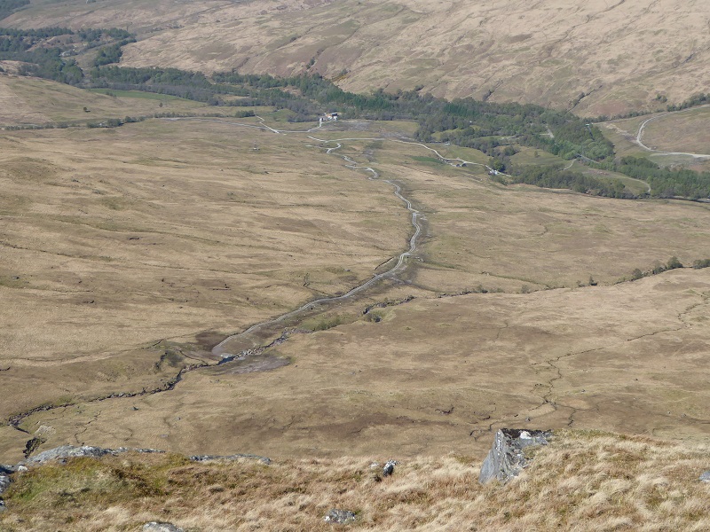
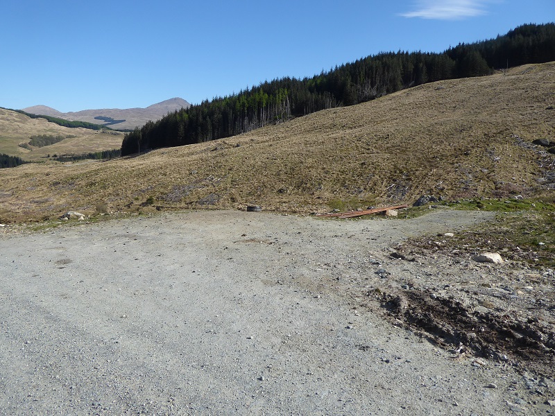
Previously, I have stated that in my view the restoration of the ground in which the pipelines have been buried has generally successful and little cause for concern with it often being quite difficult to make out the line of the pipelines. While I believe that is still sometimes the case, the long dry spell has accentuated the differences in vegetation and its easy to see the landscape scars (above centre). The land may take longer to recover than I had thought.
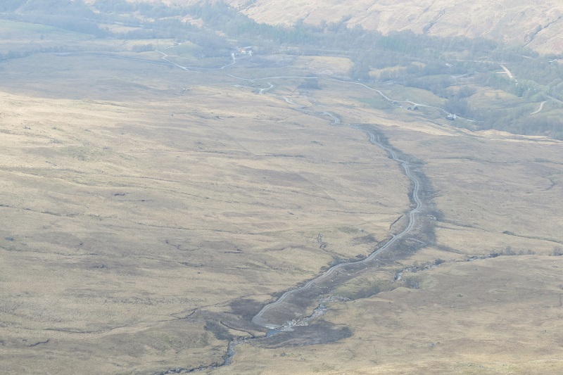
Comparing the photo above (taken a year ago on a day with far less good visibility) with the first photo in the post taken a year later, you can see that the ground above the pipeline has recovered to an extent but has a long way to go. The track itself, despite the vegetation down the middle, looks little different and forms a permanent landscape scar.
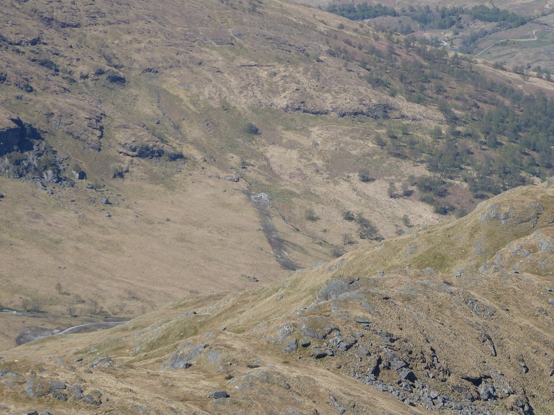
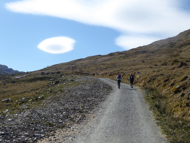
The Eas Eonan hydro track leads into an area of core wild land. The new draft Park Plan states:
“The National Park provides opportunities for anyone to have their first experience of the ‘wild outdoors”
There is nothing in the plan about how the National Park, through all the developments it has approved, has eroded that experience in the last five years. Perhaps the National Park Board and senior management team believe walking up a bulldozed track is a wild experience? Its becoming harder and harder to have a wild experience in the National Park because of decisions made by the LLTNPA. Removal of the tracks, as originally planned, would have preserved some of that.
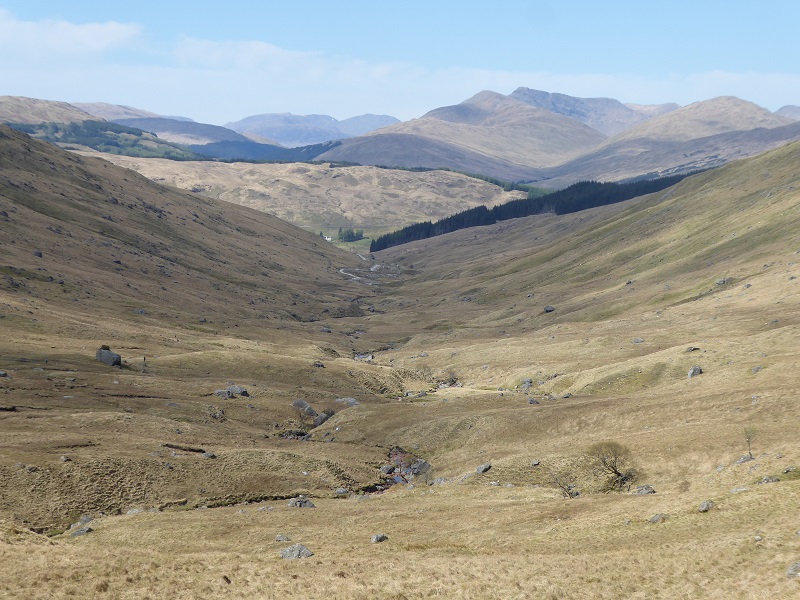
Coire Earb is wild, and indeed falls within a core wild land area. While there was an existing track by the upper reaches of the River Falloch, this ended 1 km before the new hydro dam and formerly was out of sight when you were descending the glen. The decision by LLTNPA staff to allow the track to remain permanently has changed the experience totally.
Would not the hydro here have had far less impact on the landscape if the track has been removed as originally planned?
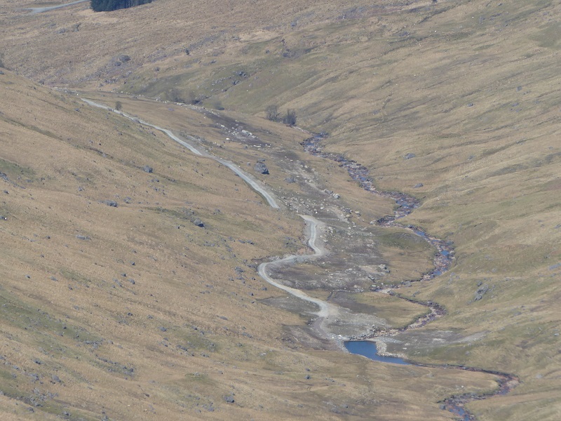
The Upper Glen Falloch hydro close up
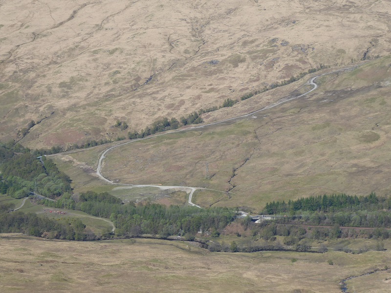
The approval of the LLTNPA to the track extension to the hydro being retained has made it easier for the Glen Falloch Estate to drive vehicles off-road further up the glen. A year ago (right) there was no evidence of vehicles being driven beyond the intake, now there are vehicle tracks beside it which are destroying the ground that was restored.
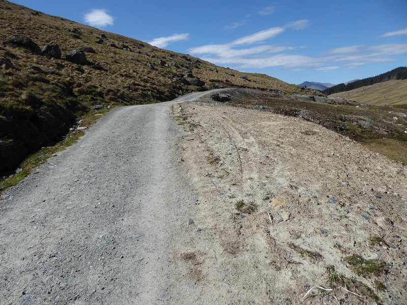
Vehicles are also being driven off the track with no regard for soil or vegetation. The consequence is the track is in places likely to end up being 5-7m wide instead of the 2.5m (and 3m on steep hills and bends) which the LLTNPA recommends in its “award winning” good practice guidance which it has never enforced.
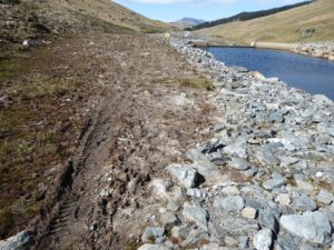
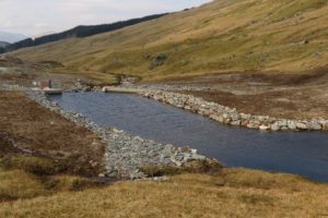
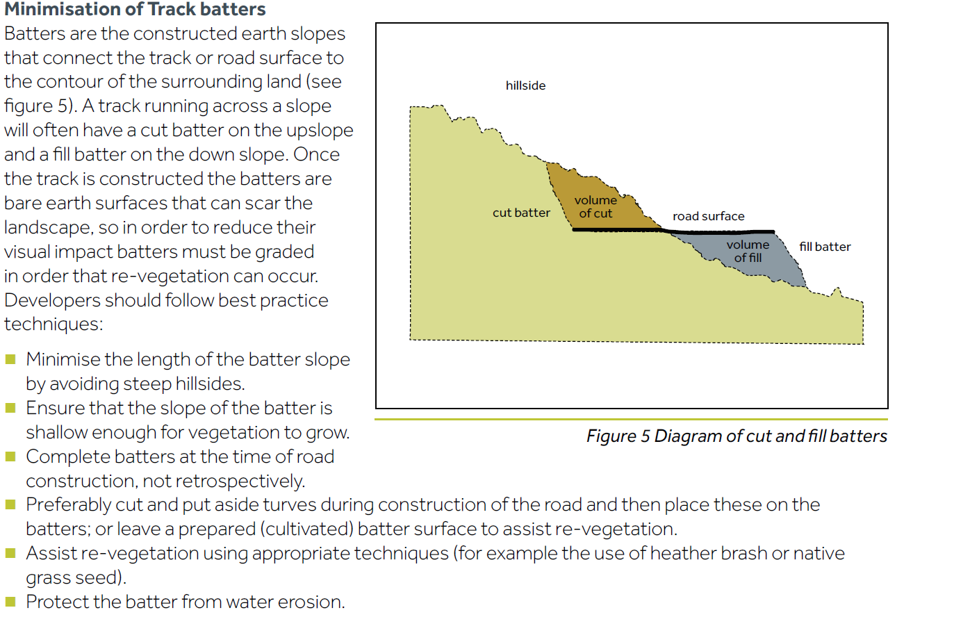
The reason for this is that the LLTNPA has basically allowed a new wide track to be created to construct the hydro scheme but then allowed the batters (see diagram below) to remain in place with minimum attempts to re-landscape the flat surface of the track (a little bit of soil and peat has just been added to the outside edge of the track). The result is that its very easy for vehicles to drive off the track while in landscape terms the track is still effectively 5-7m broad in most places.
The design of the track together with the erosion caused by vehicles and cattle have had the result that in most places there is actually now less peaty soil by the track than there was a year ago (see above).
 The failure to re-landscape the former road surface so that the remaining track moulds into the contours of the land has also made it easy for the estate to create new parking or working areas which add considerably to the visual impact of the track.
There little attempt (photo above) to shape the the fill so it merges into the contours of the land. The result is a broad bench cutting across the hillside. In landscape terms, the track here is in effect still 5-7m wide rather than the 2.5-3m recommended by the National Park.
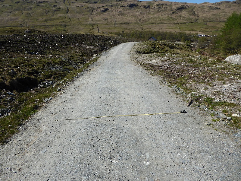
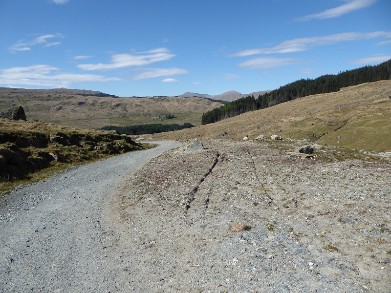
Even on the better sections, the track is far wider than the LLTNPA requires. I took my 3m tape which is here fully extended on a section of track which slopes gently downhill. I think a 2.5m track would have been more than adequate here (and probably less as you can see from the vehicle marks) but the actual track is more like 3.5m wide. What is the LLTNPA going to do to address this? The wider the track of course, the more it will stand out from a distance. There is no evidence of the central grass strips which grace the Allt Andoran track (top photo).

If there was any serious intention to narrow the upper Falloch construction track this double gate would have been removed – another illustration of just how wide this track is.
Readers who have driven up the Glen Falloch or walked there will know that the construction compound is still in place and, during my walk, there was some evidence that some further work had been undertaken to restore the destruction caused by the hydro scheme.
The restored sections however are few in comparison to those that still need attention and at this rate the track is going to take years to restore to anything like an acceptable state. That is unacceptable in a National Park whose current Plan incidentally states (and rightly so):
What needs to happen
The LLTNPA needs both to learn from the Glen Falloch disaster but also find ways to reduce the impact of what has happened. This is not just about Glen Falloch, but the forty odd other hydro schemes in the National Park, many of which have similar impacts. Here is my first go at a list of actions that are needed:
- Planning decisions that have significant landscape implications should no longer be delegated to staff but considered by the Planning Committee, as in the Cairngorms National Park Authority.
- The LLTNPA should commission an independent report into the Glen Falloch hydro schemes which should fully involve those who are concerned about the protection of Scotland’s landscape, which should look both at the mistakes that have been made and how they can be reversed.
- The new Partnership Plan needs to incorporate a meaningful landscape policy which, like the Cairngorms National Park Authority, indicates areas where there will be a presumption against development. Unless the LLTNPA does this, the current destruction of landscape in the National Park will simply continue.
- The LLTNPA Board should engage with the Glen Falloch estate and develop a plan on how to remove the hydro tracks granted consent by staff. Over the next ten years the estate will receive a huge income from the hydro schemes which could still be used, as originally intended, to remove the tracks.
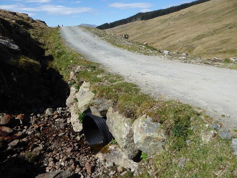
- Where existing tracks were widened, the LLTNPA needs to ensure that all the restoration meets the standards set out in its good practice guidance. Tracks which are broader than the maximum and unfinished culverts for example should not be tolerated.
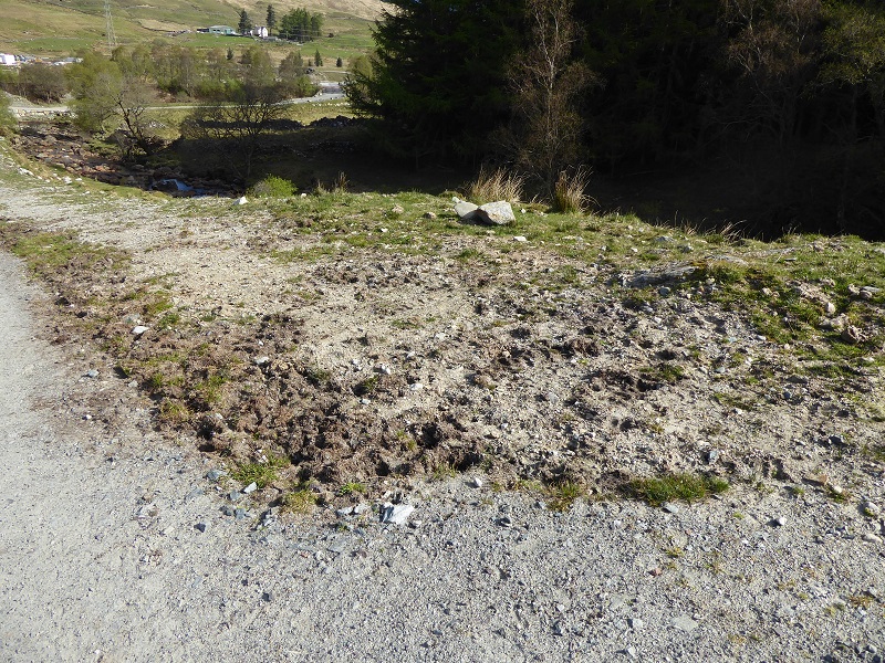
- The LLTNPA should put in place measures to control the off-road use of vehicles, particularly in wild land.
- The LLTNPA Board and senior staff need to get out more and take a look at what is being done in their name.
