A couple of days after going to look at the botched Beauly Denny construction road restoration (see here) while walking north of Carrbridge, I came across a more recent example of SSE’s work to upgrade Scotland’s network of powerlines. Another landscape horror.
In 2018, while visiting the Auchtertipper native woodland creation scheme on the Reforesting Scotland study tour, I had noticed SSE undertaking work to bury new powerlines. Auchtertipper was where 1700 mountain hares were killed out of season under license from NatureScot, the most in Scotland (see here). I had been keen to take a closer look at how the moor above was being managed as, if predators are absent, there is nothing to prevent hare numbers exploding when native woodland is planted but I had not given the powerline further thought.
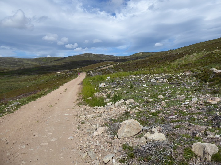
There were signs of ground disturbance that indicated the powerline had been buried alongside the road we took through the plantation but it was only when we reached the boundary fence and emerged onto the open moor that serious problems became apparent.
At first sight, however, it was difficult to distinguish the damage caused by the burying of the powerline from that caused by other management of the land. What might have been a beautiful hillside covered with native woodland has instead been burned and criss-crossed with roads. We did not go close enough to ascertain what had caused the eroded strip down the hill top just right of centre, nor was it possible to tell if the large heap of stones below was associated with SSE’s work on the powerline or other work that Cawdor Estates, the landowner, might have been doing.

The extent of the track upgrade associated with the powerline construction, necessary to bring in heavy machinery, was also not obvious low down unlike the “restoration” of the ground above the powerline some of which was appallingly bad. All this land is within the Cairngorms National Park boundary.
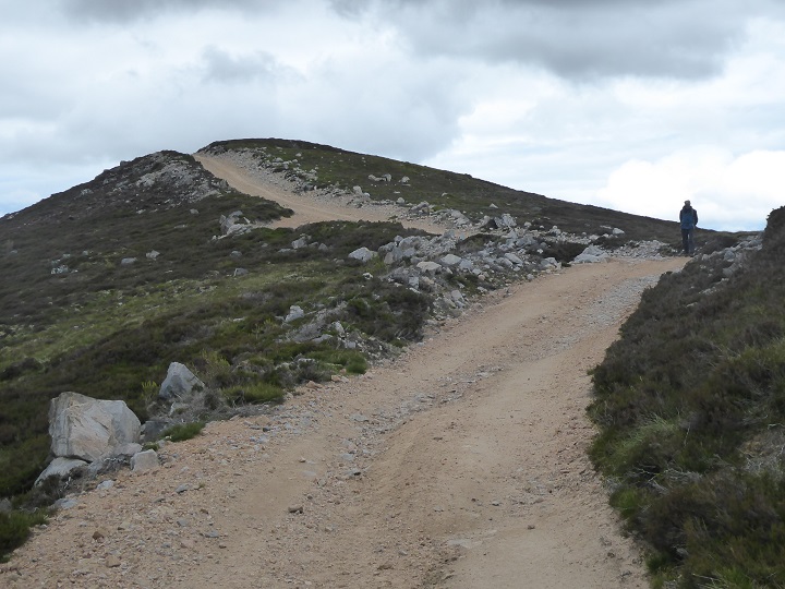
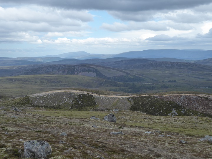
After the powerline headed up the hill on the right, we took the road that is just visible on the left of the photo to Carn Glas-choire. From there we decided to walk back along the National Park boundary, as it headed north and east and loop back down to the road in this photo..

To the north west, a windfarm and further examples of intensive grouse moor management were evident.
[A reader emailed me following publication of this post to say I am wrong about the intensive grouse moor management and the rectangular shapes are in fact “redundant peat banks cut for fuel”. I must confess that I did not have my glasses on at the time and did not look through the binoculars and even by magnifying the full sized photo I cannot see exactly what is going on. I accept it is possible some of these areas may have been worked for peat in the past but why then bother to mow strips of heather around their perimeter, a practice associated with intensive grouse moor management, besides which within some of the rectangular shapes the vegetation appears intact which would not be the case if the peat had been cut for fuel. Any close up photos would be gratefully received.].

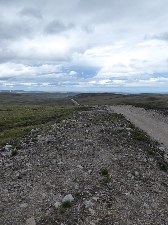
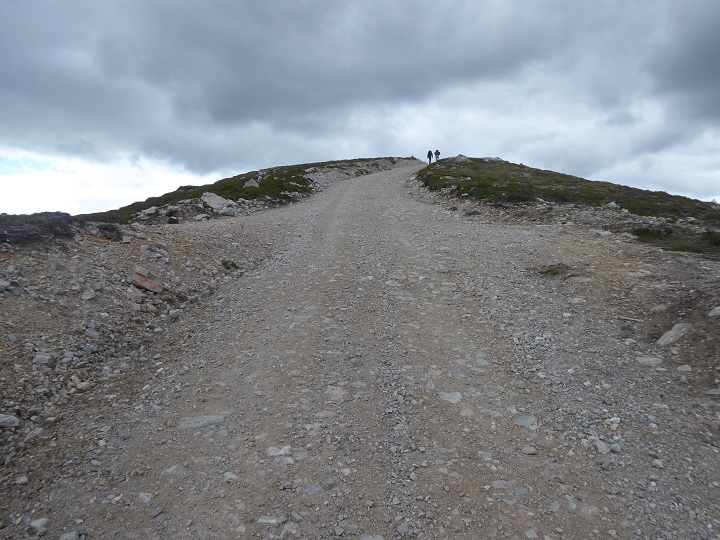
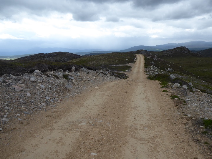
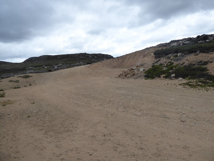
Then we saw this fresh scar on the landscape, heading north from the Cairngorms National Park boundary as far as the eye could see.
How, we thought, had the Cairngorms National Park Authority (CNPA) allowed to happen?

While the CNPA has no direct say over planning matters outwith its boundary it has, to its credit, often strongly objected to windfarm developments that are visible from the National Park on landscape grounds.
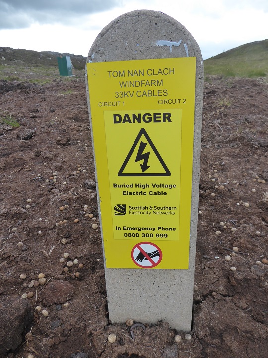
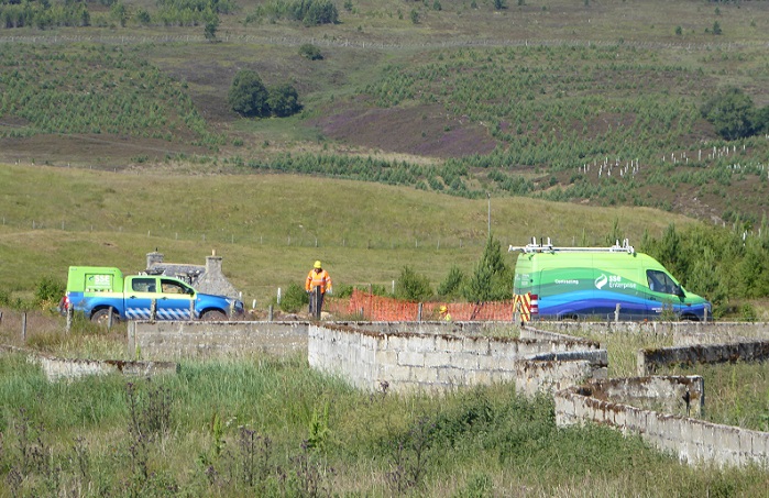
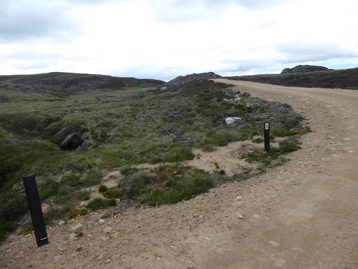
That the work was associated with a windfarm and the responsibility of SSE was confirmed by this marker post close to the road.
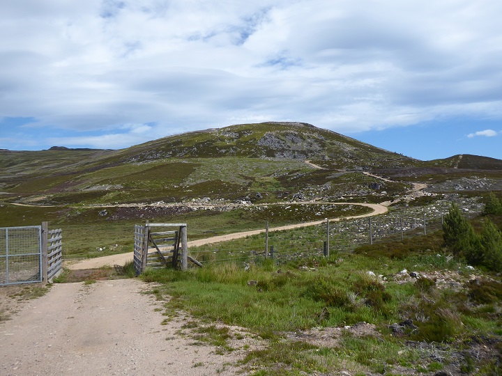
My 2011 edition of the 1:50,000 OS map shows that there was a road here at that time but it has clearly been “upgraded” recently. On returning home, there was nothing on either the CNPA or Highland Planning portals about this road being upgraded which should have happened if Cawdor Estates was responsible. It appears therefore that either this road work has been classed as a permitted development by a utility company or else dealt with by the Scottish Government Energy Consents Unit as part of the Tom nan Clach windfarm development. It appears almost certain, therefore, that SSE are responsible for both the burial of the powerline and the road upgrade.
Unfortunately, finding the papers associated with energy consents granted by the Scottish Government is no easy matter, there appears to be no map based search facility and a search on Tom nan Clach came up with one planning application that was later withdrawn.
I also searched for Tom nan Clach on the CNPA website and came up with one useful result which showed the CNPA objected (see here) to the original application in 2009 and from that discovered that Highland Council had also objected but both authorities were then overruled by the Scottish Government.
There were dozens of other results which linked to planning meetings, 116 in all, which would have taken hours to sift through so, a week ago, I contacted the CNPA to ask if they had made representations more recently about the powerline burial and were aware of the impact this has had on the landscape. So far, I have not had an answer but it is the holiday period that can wait. The main purpose of this post is to illustrate damage that should never have been allowed to happen in a National Park and argue that someone in government needs to take action to hold SSE to account.

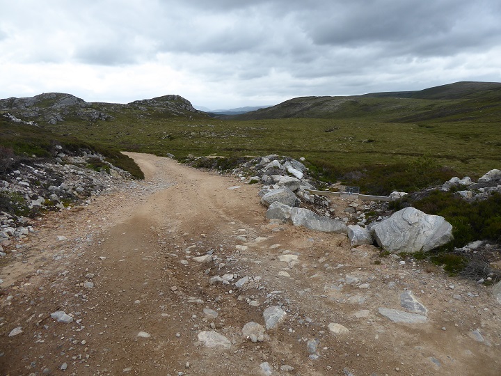
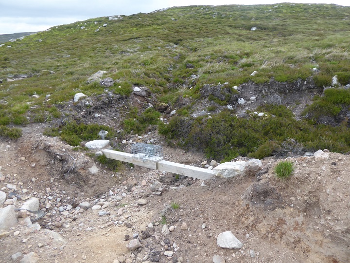
Similar to the case of buried hydro pipelines, the visual impact of the buried powerline was less than the associated construction tracks. Even so, the lack of care taken during the construction was all too apparent, as illustrated above where newly exposed rocks have been dumped on peat.
Traps had been sited among the new rubble created by the upgrading work. This helped confirm my suspicions that the large number of licenses issued to shoot mountain hares in the Auchtertipper woodland was linked to the intensive management of the moorland above. Meddle with nature and there are always consequences. Creag na h-Iolaire, round which the upgraded road winds, means eagle crag, an indication that in the past there was more wildlife here. These roads are good for neither landscape nor wildlife and play a major role in undermining the CNPA’s statutory purpose to put conservation first.
Generally the work that had been undertaken to restore the ground above the pipeline was better than that to restore the ground by the road. It made me wonder if different contractors were involved?
We saw no sign of any vehicles or equipment that might suggest SSE is planning at present to undertake further restoration work. The photos in this post appear to be the finished job as far as SSE and whoever is responsible for overseeing the work is concerned – unless of course they are forced to act.
We followed the upgraded road back down the hill. All along there were signs of poor construction and that it is already eroding away.

While there were places where some attempt had been made to restore the vegetation alongside the road this helps highlight how poor the rest of the work was and how much unnecessary damage has been done.
The need for effective oversight over work to bury powerlines
SSEN (networks), a subsidiary of SSE, is responsible for the upgrading and creation of new powerlines in the north of Scotland (Scottish Power covers the south). This is a huge job driven by the shift from electricity generated by fossil fuels to electricity generated by renewables. Whereas once power was generated in and around the central belt,where most people live, now it is generated into remoter areas and has to be brought into the towns and cities. For that to happen, a completely new electricity network is required.
It does not seem so long ago since SSE was arguing, in justification of the Beauly Denny upgrade that runs through the Drumochter, that power cables needed to be above ground and could not go under the sea. Now they are in the process of installing a network of sub-sea cables while over the land they are burying powerlines as often as they are erecting new pylons. That shift in approach should, in theory, be welcomed on landscape grounds. Moreover, hopefully government will soon end the anomaly that the public, as consumers, are paying SSE to bury pre-existing powerlines in some places through the VISTA project while continuing to allow them to erect pylons in others.
The risk, however, as I hope this post has shown, is that if we are not careful, we could end up with as many damaging landscape and ecological impacts from burying powerlines as we have from erecting them above ground. That is exactly what has happened with the construction of run of river hydro schemes, where the Scottish Government promoted a market free for all uninformed by any research, without any national standards for construction or restoration and without adequate or properly trained staff to provide effective oversight.
We should learn from that. Having met SSE staff involved in the burial of the Glen Falloch pipeline last year (at their invitation for which I am very thankful), I am aware that SSEN now have a dedicated environmental team which they did not have at the time of the Beauly Denny construction. That is a positive step in the right direction. But without the application of research (such as what has been learned by the CNPA through various peat bog restoration schemes), national standards for restoration work developed independently of the industry and effective means of taking enforcement action, the need for which is clearly beyond the ken of the Scottish Government, the disasters will continue.
I hope that the CNPA and others might use what has happened with the Tom nan Clach powerline to make the case for such reforms both to the Scottish Government and more widely.
