Background to the planning application
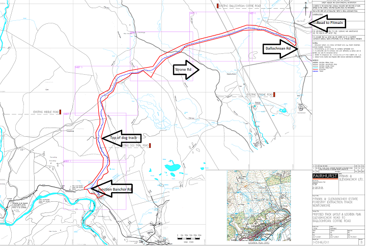
A planning application (see here) has been submitted on behalf of the Pitmain Estate by Caledonian Building Surveyors Ltd for a new 4.83 “forest track” around the back of Newtonmore. This would would provide a direct road link between the single track public road up Glen Banchor and Pitmain Lodge over three miles to the east.
At the end of October I blogged about the proposal from Savills, on behalf of the Pitmain Estate, to erect a radio mast on Carn an Fhreiceadian, in the Monadhliath Wild Land Area (see here). The site is about a metre outwith the Cairngorms National Park boundary so the responsibility of Highland Council to decide. Seven objections – including my own – have been submitted but still no decision has been made despite the justification for the proposed radio mast, the health and safety of gamekeepers, being baseless because of satellite phone technology. The rationale for this new road appears equally spurious.
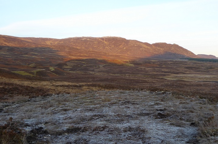
A planning application has been on the cards ever since Pitmain bought the Glenbanchor estate from the Lindt family in 2017 and then, without planning permission, bulldozed a new road along the top of the beautiful esker that runs up from the Glen Banchor road towards Creag an Loin This route had previously been occasionally used for sheep dog trials and as a consequence is known as the dog track. At the time I remarked on how ATVs were being driven from beyond the top of the dog track over to the “Strone Road” -which was also upgraded without planning permission that same year (see here).
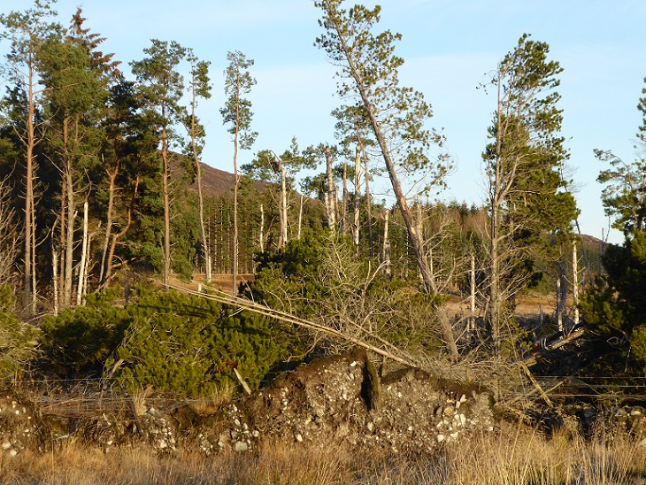
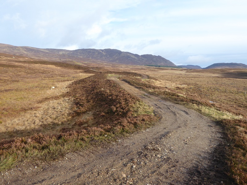
After I brought the unlawful works to the CNPA’s attention, the Pitmain/Glenbanchor estate was required to submit a retrospective planning application and to undertake remedial works to the dog track but not the extension above used by ATVs (see here). Having been allowed to get away with it, the estate then quietly upgraded the first section of the ATV track leading from the dog track to the turning circle in the first photo:
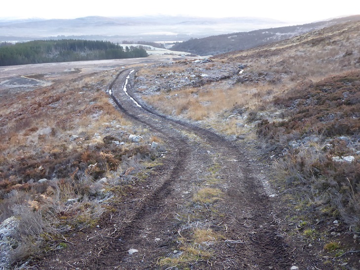
In other words the estate has been incrementally extending the dog track further for some time. The new planning application effectively proposes to change the ATV route into a fully constructed permanent road, but then extend it beyond the Strone Road to what is known as the Ballochroan Road.
The justification for the new road – a forestry conservation project?
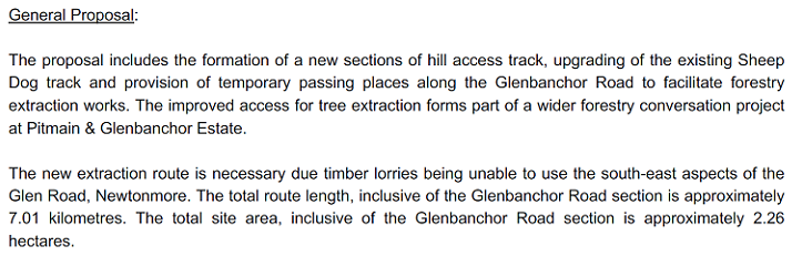
The alleged purpose of the new hill road is to extract forest timber and it is part of a wider proposal – not part of the planning application – which includes widening Glen Road, the single track road that runs from Newtonmore into Glen Banchor:
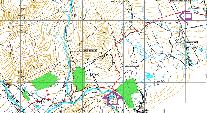
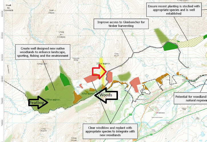
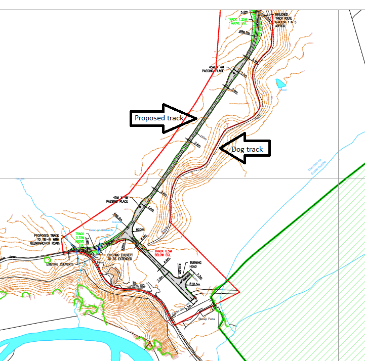
The term forestry “conversation” project was new to me and, while no doubt a typo, does capture the vagaries of the estate’s conservation proposals (see below). But first, this map shows how the new track fits into the wider proposal:
Glen Road, the public road into Glen Banchor, runs up from Newtonmore alongside the plantation on the lower right and ends at the walker’s car park just to the left of the second plantation. The road is fairly narrow and has two sharp bends in the village which are too tight for large timber trucks. I have been reliably informed that smaller timber lorries could negotiate the bends but there is NO explanation in the planning application as to why such vehicles couldn’t be used, as has been happening elsewhere like Glen Feshie. The extra cost of using smaller vehicles would be minor compared to the costs of constructing a new 4.83 km road over to Kingussie.
Moreover, if the argument was about a perceived need to avoid the main village, there is no explanation given as to why timber trucks couldn’t drive down the Strone Rd, avoiding the need to extend the proposed new road to the Ballochroan Rd (as marked on the first map above).
In terms of assessing the potential impact of timber trucks on the village, it’s important to consider how much timber is likely to be extracted – this is not explained in the application. Anyone who has visited Glen Banchor over the last ten years will know that most of the blocks of plantation forestry have been affected by wind-throw.
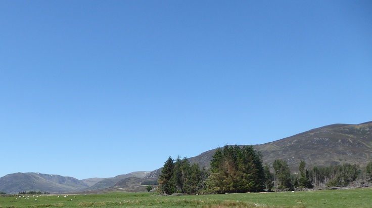
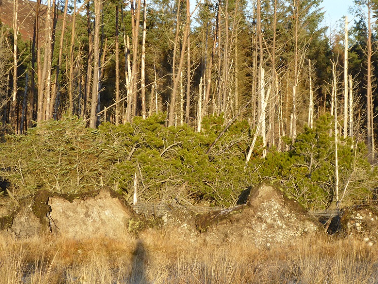
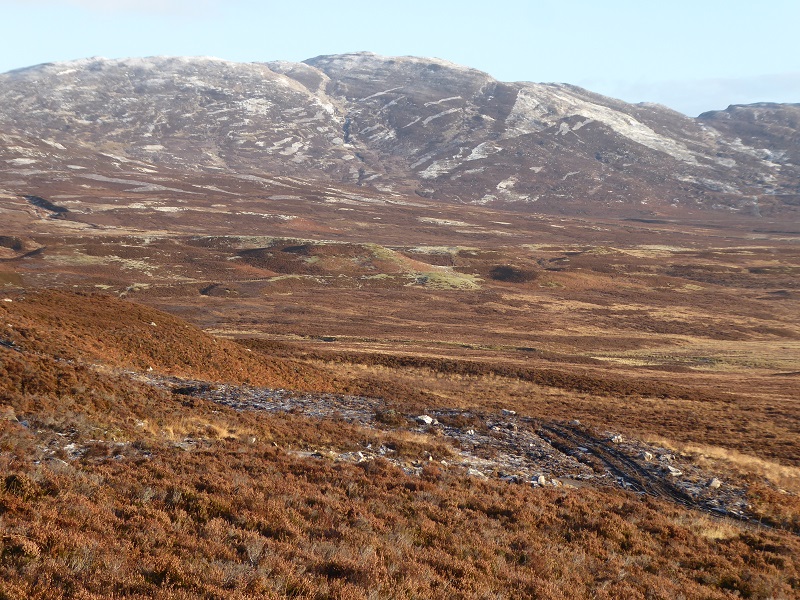
The residual value of most of the plantations appears likely to be low. The main exception isthe westernmost plantation, not shown on the map above shown but pictured on the left of the photo below:
These observations are confirmed by the map from the woodland management plan:
The CNPA should be asking how it could be financially worthwhile to construct a new 4.83 km road over difficult ground for so little timber. And if the purpose of removing the wind throw is to burn it as biomass, why not chop it up on site and use smaller vehicles?
Other elements of the map show little resemblance to reality. The westernmost section of the timber extraction road , marked by the red arrow, follows a totally different line to the proposals in the planning application by-passing the dog track completely. The large block of native woodland that is proposed on the left side of the map covers a significant area that was recently restored as peatbog (see here)! And, even if the intention was to expand the new fenced blocks of native woodland (marked by arrow) which were paid for by NatureScot and Woodland Trust, those blocks were created without any need for a new access road.
All the evidence therefore suggests that the new road is NOT needed for forestry purposes.
The purpose of the new hill road and the planning implications
As explained above the proposed new road would extend beyond the Strone Rd to the the Ballochroan Rd, which connects to the roads around Loch Gynack. If consented, it would enable Abdul Majid Jafar, the owner of the estate, and his guests to drive over to Glen Banchor without having to drive through Kingussie and Newtonmore.
The new road would also provide gamekeepers with easier access for the purposes of muirburn, predator control and other activities associated with intensive grouse moor management. That this is likely to be the case is suggested by the amount of muirburn that is currently go along by the proposed route and the lack of any proposals to create new areas of native woodland in the area of the new road
It appears therefore that the attempt to justify the new road as being a forest track is just as spurious as the justification that was made for the radio mast on top of Carn na Fhreiceadain. This is important because in planning terms forestry roads come under the permitted development system and cannot be refused by planning authorities. However, hill roads do require full planning consent and, in the case of the CNPA, their Local Development Plan (see here) “starts from the position that there should be a presumption against new tracks constructed in open moorland areas”.
That policy is subject to two qualifications. The first that “there will be instances where the existing and extensive network of tracks does not provide the vehicle access required for management” – to which the response is estate staff can use the public road system to get from Pitmain to Glen Banchor. The second is that a track is needed for a conservation initiative that would enhance the National Park – that is clearly not applicable in this case.
This proposal, therefore, presents a good opportunity for the CNPA to demonstrate their commitment to use the planning system to stop the proliferation of hill tracks.
Other reasons to refuse the planning application
To cater for the large timber trucks, the public road and new track require to be 3.4 metres wide. As well as destroying the character of public road up the glen, this has serious implications for the landscape above.
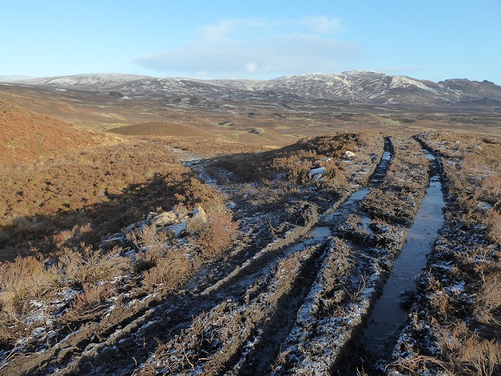
The road along the top of the esker could not be widened without damaging it even further so the proposal is to create a second road alongside it over ground that is mostly bog:
There is no assessment of the impact that the new road will have on peat or the amount of carbon that will be released into the atmosphere as a result of its construction.
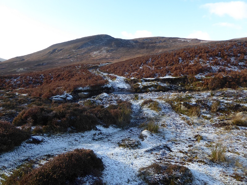
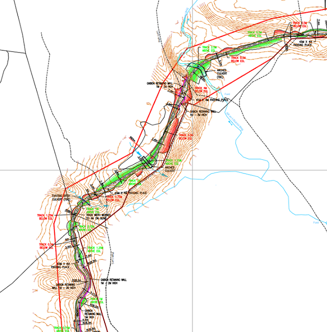
The proposed road would then join the dog track where the top of the esker merges into the hillside. After that it traverses steep ground and over glacial moraine:
Creating a road through this terrain will require considerable use of cut and fill construction techniques which are shown in the detailed plans for sections of the new road:
The single surest way of increasing the visual impact of hill roads is to route them across ground where cut and fill techniques are required. This road will create an enormous scar. There has been NO landscape impact assessment. That may be because Highland Council responded to the application when it was lodged with them stating that no Environmental Impact Assessment was required – not even for a track 4.83m long through terrain such as this!
Besides the road itself, the application states “Initial calculations reckon on approximately 1000m3 of introduced materials being required” from local borrow pits – there is nothing in the application about their location or impact. So much for caring for the National Park’s landscape.
Although the moor behind Newtonmore, which would be circumvented by this road, is not protected by any designation it is a wonderful place for nesting waders. If you want to watch nesting lapwing, oyster catcher and curlew in the Cairngorms National Park Spring there is no better place to go. There is a reason for this, it is managed as rough grazing – with wet and grassy places – rather than as intensive grouse moor. It’s a natural refuge in the midst of intensive estate management, with land across the Pitmain and Glenbanchor estates now being micro-managed to maximise its potential for field sports. This wildlife refuge will be threatened by the new road which will provide easy access for gamekeepers to shoot and trap the birds and mammals that prey on game birds but are also attracted by the wader population. That is another good reason why the CNPA should reject the proposal, the proliferation of estate tracks is intricately bound up with the persecution of predator in the National Park.
Lessons for forestry land-management
The planning application for this new road is of poor quality, will damage the landscape, will have adverse consequences for wildlife and there is every reason therefore for the CNPA to refuse it. If you are concerned, you can lodge an objection here.
The planning application provides yet another example of poor land-management on the Glen Banchor and Pitmain Estates which I have commented on over the last years (see links above). The CNPA and the public should not be having to waste time and effort on responding to such ill-considered and ill-judged planning applications such as this. The application illustrates the need to implement proposals that every large estate in the Cairngorms should produce a single coherent plan, which is subject to public consultation, setting out how it intends to promote landscape scale conservation. Instead the current system is characterised by incremental and ad-hoc changes in land-use (a block of forestry here, a block of peatland restoration there) and opportunistic developments.
The whole proposal, however, also provides a good illustration of the failures of Scotland’s forestry system over the last fifty years. Significant grants have been – and continue to be – disbursed to landowners to plant trees with little consideration about whether this represents value for money or about the wider implications. Most of the plantations in Glen Banchor do not represent value for money as so much of them has blown down! It appears public subsidy was abused to plant the wrong wood in the wrong place.
But, equally as negligent, when planting the forestry, no consideration was given as to how the timber might be extracted in future: what’s happening on Wildland Ltd’s land at Glen Feshie is they have been constructing new forestry roads – only 2.4m or so wide – before planting. As the woodland develops, the roads disappear. The CNPA should be using all its powers and influence to force estates like Pitmain and Glenbanchor to do the same. Where forestry roads are needed to extract timber, smaller trucks should be used, the roads should be narrow and plans should be in place to allow woodland to develop – preferably through natural regeneration – around the roads minimising the impact they have on the landscape.

I have just tried to comment on the planning portal, only to be ” timed out” through “inactivity”, so they obviously dont want you to think about what you are writing, what a load of shite.
I will try again after i have had my tea.
put this on FB too and you’ll get 1000s of witnesses to your comment. I’m just about to share this with Rewilding Scotland which has circa 20,000 members alone.
If you have problems lodging comment/objections on the public comments section of the National Park’s planning portal, you can email them directly to-
Planning@cairngorms.co.uk
Thanks George
Thank you for yet another highly detailed report. I have registered my objections to the proposal.
The last storm “corrie” has taken one of the trees on the last tight corner before the walkers carpark, sadly almost half the narrow road came away with the roots,, what’s left of the road is barely a cars width now
I was also looking to lodge an ‘objection’ comment but when looking on the planning portal I couldn’t seem to see any other public comments. Does anyone know if such comments can indeed be viewed openly?
I have just tried to submit an objection via the online form and it eventually returns ‘page not found’. I have sent an email instead. Andy, public comments should be visible but there are none showing, even though previous commenters have said they’ve submitted one. Perhaps it would be an idea for anyone who has previously objected to re-send by email?
Iris, if you visit the site again , and click on documents, a list of respondents appears, i assume it is you dated 4th feb.
However i was unable to open any of the comments to read them, i lodged an objection on 15th, which has not yet appeared, there have apparently been only sixteen objections it just makes you wonder.
Many thanks Iris. I too have sent an e-mail to the planners enquiring if the site is working okay.
Sorry I should have said, I too tried reporting the issues last Friday and the portal was back up working this Monday. If you have had trouble making a submission you can email it to the CNPA and if they say its late just say it was not possible to use the planning portal when you tried. Nick