Wherever possible I try to visit sites before blogging about how they are being managed or the likely impacts of developments but sometimes that is not possible. I had only made one fleeting visit to Glen Falloch this year – to look at the project to remove the overhead powerlines – and had not re-visited the Ben Glas hydro scheme before blogging about the proposal to extend it two days ago (see here). By chance, however, my partner had decided to walk with a friend up Beinn Chabhair a few days before and I asked her to take some photos of the existing hydro scheme.
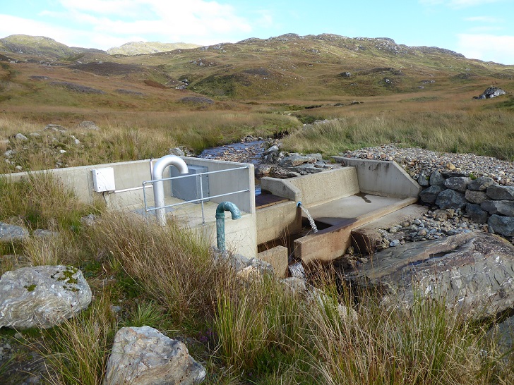
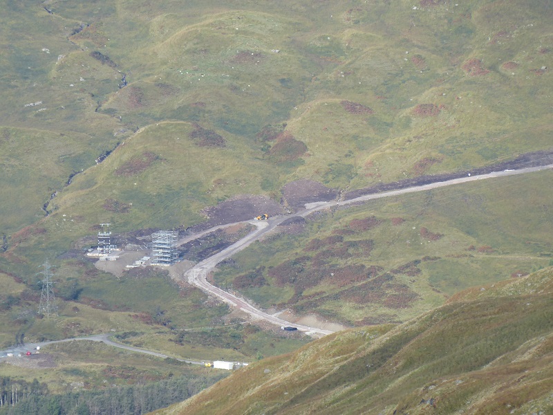
Five years after construction, the Ben Glas hydro intakes remain ugly structures, an insensitive human imposition of a wild landscape. Both the Ben Glas hydro intakes are situated in what is now the Ben More and Ben Ledi Wild Land Area (WLA) but were granted consent in 2009, five years before the WLA came into existence.
Designations, whatever the degree of protection they offer, aren’t everything. The Loch Lomond and Trossachs National Park Authority Planners should have looked at the land above Eagle Falls and either decided that development was inappropriate or alternatively insisted that the development was designed to a standard appropriate for the area.
Instead, they allowed significant quantities of climate polluting concrete, with barely a token attempt at disguise: a couple of once blue pipes painted; the pile of boulders placed in front of part of the wing wall on the left. It is too late now for the LLTNPA to force the people hiding behind the complex company structure which owns this highly profitable scheme to do anything to improve it. The time-limit for Planning Authorities to take action after a development has been completed is generally limited to four years.
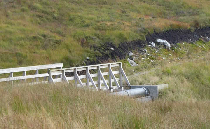
Further failures of the planning system under the LLTNPA are illustrated by this photo. The LLTNPA’s own guidance on renewable developments stated pipes should be concealed below bridges where possible. Why not here? Five years later the edge of the peat bog above remains exposed DESPITE the LLTNPA having, with the assistance of the Scottish Government, paid out undisclosed sums to restore exposed surfaces of peat in the damaged bog above. If it wasn’t true, it would be hard to make up.
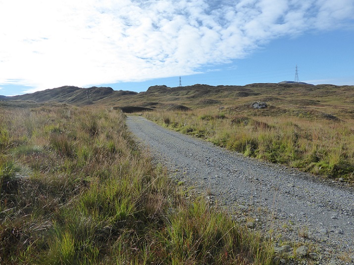
Prior to the hydro scheme the main detractor in this part of the Wild Land Area, referred to in NatureScot’s Wild Land Assessment (see here), was the powerline running from Inverarnan, at the head of Loch Lomond, over to Loch Katrine. Under the original Scottish Government planning consent, the track was to be fully restored, but then the LLTNPA granted Glen Falloch Estate planning permission to retain it. It’s unnecessarily wide but returning the aggregate to the quarry from which it was excavated would have been expensive. If these schemes were really about a greener world, electric trucks powered by the hydro might have done the job.
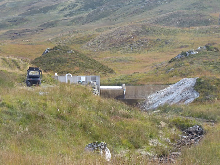
Having allowed the wide tracks to remain in place, the LLTNPA has made it easy for the hydro developers to come back with proposals to bring in further machinery and extend existing schemes. The upper intake in the proposed extension (see previous post for a map), which proposes to put a pipeline through an area of peat bog, appears to be within what is now the Wild Land Area. Another good reason for the LLTNPA planners to say no.
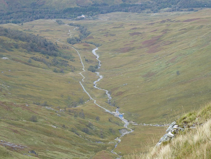
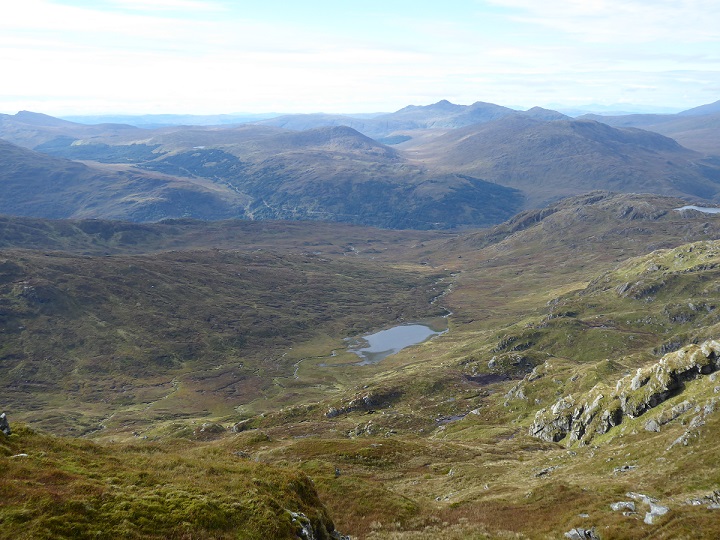
People walking up from Inverarnan by the Eagle Falls miss the steep and ugly scar created by the lower section of the Ben Glas hydro track. But the visual impact of other hydro tracks off Glen Falloch is all too obvious once you get to the summit ridge and look down the other side.
Glen Falloch is sandwiched between the Ben Lui and Ben More Wild Land Areas and provides the main through route north from Loch Lomond but it is the hydro tracks that dominate the view from the hill.
Across Glen Falloch from the Allt a Chuilinn, the Eas Eonan hydro track runs up to the Ben Lui Wild Area, with the Cononish Goldmine know gnawing into it from the far side. Looking at the photo I was shocked by the visual impact of the new track just to its right. This has been constructed as part of Scottish and Southern Energy (SSE)’s VISTA project intended to reduce the visual impact of overhead powerlines by burying them.
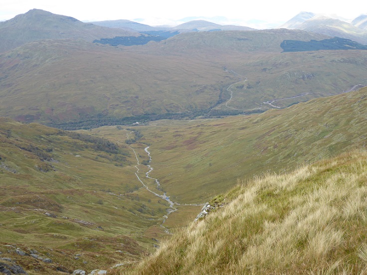
The track was granted temporary planning permission by the LLTNPA this year (see here) to enable 13 towers and 4.26km of overhead powerline to be undergrounded. While the powerline up Glen Falloch is scarcely visible from the Wild Land Area, it does blight the West Highland Way. In principle, I was therefore supportive of undergrounding the powerline in what should be a beautiful glen.
Unfortunately, however, the towers are only being removed from half the glen, while there are serious questions about whether the new wooden towers that are being constructed at either end of the undergrounded cable will be any less visible than the existing steel towers. Unless the track restoration is perfect, the undergrounding of the powerline could actually do more damage than it restores.
The contractors, Morgan Sindall, were kind enough to invite me to visit the site earlier in the summer before planning permission for the temporary track was granted. At that time they were using trackway panels, laid over the ground, to access the site and bury the new cable. This appeared to be working well but I had wanted to re-visit the site before blogging about it. Having seen the photo of the track, I am now much more concerned. A visit and time will tell, but I hope LLTNPA staff are keeping a close eye on what is happening and not leaving it to trust, as they did with the hydro tracks.
The view from Beinn Chabhair illustrates the contradictory and incoherent approach of the LLTNPA to landscape within Glen Falloch. On the one hand, it has allowed hydro tracks to proliferate up the side glens, paid for by the public through our electricity bills, with no regard to landscape. On the other hand, it has gone along with the removal of a section of powerline, again paid for by the public out of our electricity bills, ostensibly to improve the landscape.
On the one hand peat bog restoration, on the other peatbog destruction.
Does the LLTNPA stand for anything?

https://www.dw.com/en/germany-slashes-renewable-energy-tax-due-to-soaring-prices/a-59517333?maca=en-rss-en-all-1573-rdf