Twelve days ago I went with Dave Morris for a walk around Beinn Ghuilbin on the Kinveachy Estate, south of Carrbridge, after a reader had reported seeing some dire new forest tracks there. I had never walked around this part of the estate before but had been keen to visit for many years because it contains a large area of Caledonian Pine forest which has several nature conservation designations including that of Special Protection Area for capercaillie and scottish crossbill.
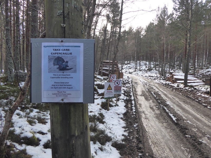
Evidence of forest operations appeared on a side road soon after we started up the Wade Military Road which goes from near Kinveachy over the hill to Sluggan Bridge on the river Dulnain. The first sign provoked a thought. Fair enough, in one of the last remaining strongholds for the capercaillie, to keep dogs on a lead during the breeding season but what is the impact of these forest operations on that species? Do we know? The part of the forest though where timber cutting was taking place, between Beinn Guilbin and the A9, is outside the boundary of the nature conservation sites and therefore outwith the control of Scottish Natural Heritage.
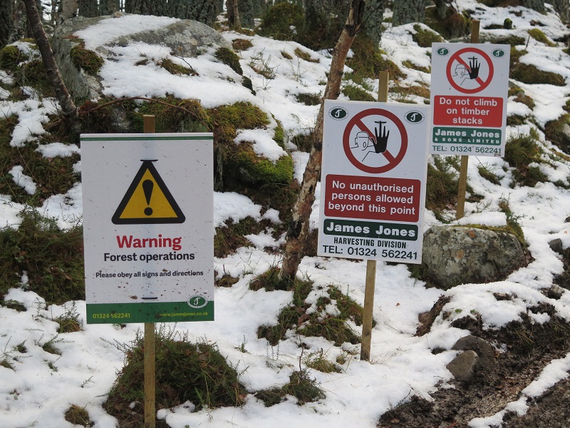
The middle sign beyond provoked disbelief. Yet another sign in our National Parks that contravenes the Scottish Outdoor Access Code. Signs on land management operations are meant to be specific and offer alternatives (see here for SOAC sign_template_-_woodland_management). We reported it to the Cairngorms National Park Authority after our visit and received an immediate acknowledgement and assurance they would investigate. (I have still had no acknowledgement from the Loch Lomond and Trossachs National Park Authority to High Velocity Rifles in use Keep Out signs south of Ardlui which I reported on 4th December (see here) whereas the CNPA has stated they will refer the “Welcome to the Moor” signs, which featured in that post, to the Cairngorms Local Access Forum for consideration).
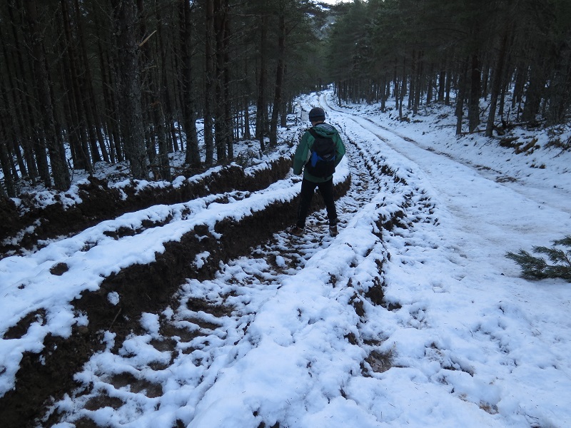
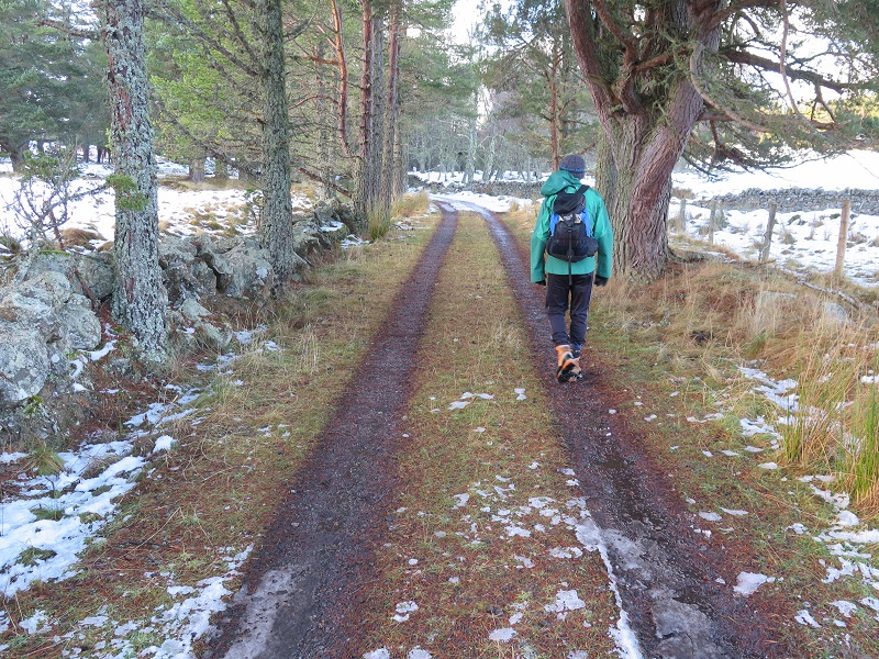 The former Wade Military Road, which forms the northern boundary to the protected nature sites, provided a good walking experience and an example of how tracks should be.
Over the hill we turned south and first followed a track which was even more minimalistic than the one above: just two landrover wheel ruts but after a couple of kilometres it had been subjected to more extensive engineering works.
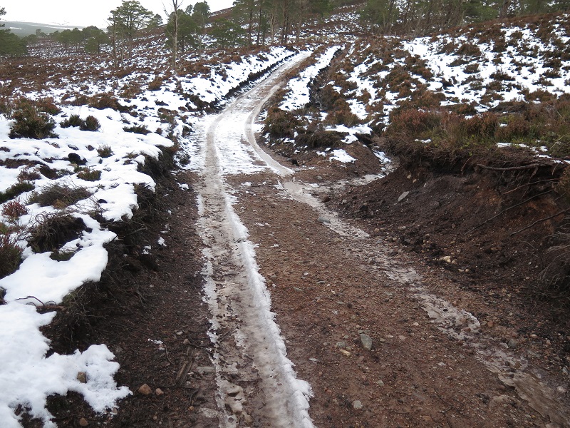
The track was still narrow and had very little impact at the landscape scale, being sunken and weaving through the old trees and areas of regenerating woodland (there was lots of signs of recent regeneration – welcome when ten years ago, when this site was last assessed according to information on SNH sitelink, it was in unfavourable condition due to lack of regeneration).
Where the track ended we cut up over the south ridge of Beinn Ghuilbin heading for the forestry tracks marked on my old OS map. Once outside the Special Protection Area we found the tracks and a quagmire.
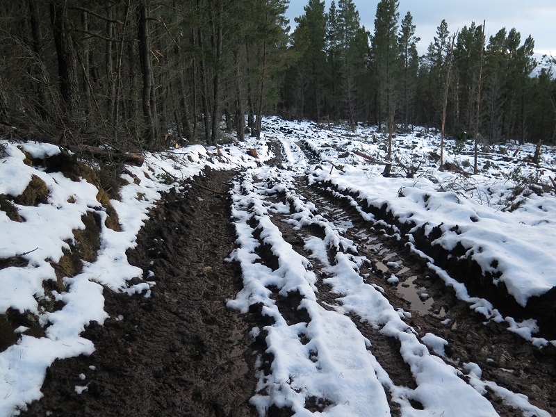
This was only walkable because partially frozen.
On one section of the track network there had been an attempt to preserve the former track (right) by creating a new track alongside which illustrates the impact that these forest operations have had on the rest of the track network – obliterated! Unfortunately my photos did not come out but all along the main tracks, side tracks had been created through the trees for thinning operations, leaving huge ruts everywhere.
While the area of forest operations is not designated, it is right next door to the designated sites and with a bit of vision would offer a fantastic opportunity to extend the area of “natural” forest. That would probably require tree felling but without the use of heavy forest machinery which has had such a major impact on the soil and vegetation here. Why can’t our National Parks promote use of horses or smaller machinery to remove trees in areas such as this which incidentally would provide employment for far longer periods? I have been unable to find the Forest Plan for Kinveachy on the Forestry Commission Scotland website (most plans are still not published ) to ascertain if this has been considered.
The main reason though our public authorities are able to get away with allowing work such as this in a National Park is that at present relatively few people walk or cycle in the area. We saw nobody in five hours. If the area had been better used – and if for example the tracks had been included on the core path network (they are not) – far more care would need to have been taken. There are some very good examples of forest practice in the Cairngorms National Park – the challenge for the CNPA is to ensure that best forestry practice applies everywhere.
