This is my second post on the Bruar Hydro Scheme (see here) which I visited at the end of August. I am fairly confident that few of the issues identified in this post will have been remedied since my visit but would welcome more up to date photos from anyone who is in the area.
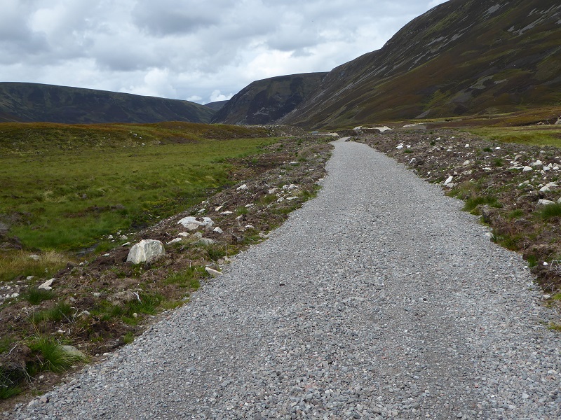
The Glen Bruar Hydro track is about 12k in length in all. While prior to the installation of the Bruar Hydro scheme there was already a track from Calvine to Bruar Lodge, most of the track appears to have been “upgraded” to enable heavy construction machinery to be brought in. It has been extended in two main places (there is also a short section of new track close to the A9 which I have not looked at), the first a new spur off the existing track down to the powerhouse, the second from opposite Bruar Lodge up the west side of Bruar Water to the dam.
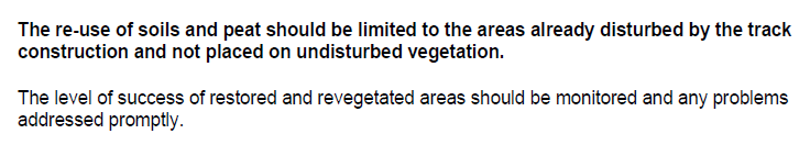
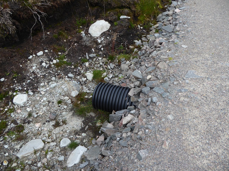
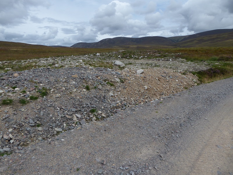
All along the track the remains of piles of aggregrate, that have been dumped on vegetation, are clearly evident. The SNH Guidance on hill tracks snh.org.uk/pdfs/publications/heritagemanagement/cons.. does not say anything explicitly about storage of track materials – my guess is that this is because it assumed track constructors would never dump materials in this. Other parts of the guidance make it very clear it expected the verges of hill tracks to be properly restored:
The Environmental Statement from the developer (ultimately Atholl Estates) stated they would follow SNH’s guidance, so the question is why has this not been observed?
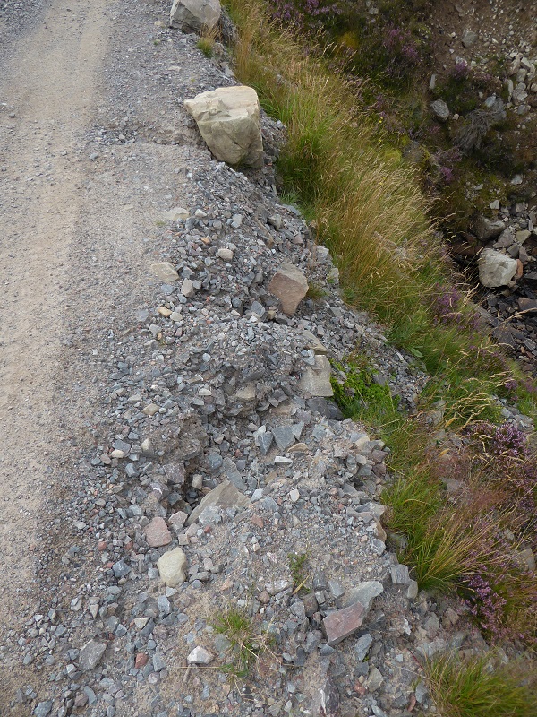
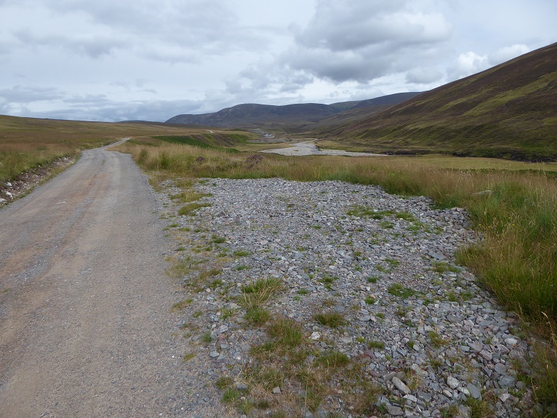
The side of the track here is eroding away and into the burn below. The SNH Guidance is very strong on the need to prevent track materials being washed into burns.
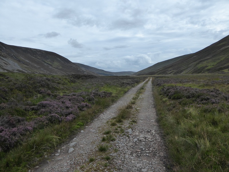
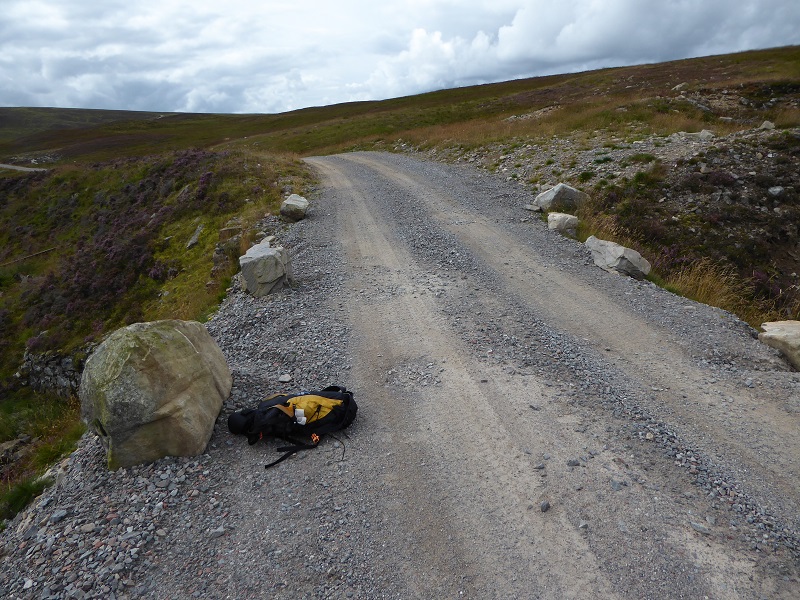 Another view of the eroding track edge. Note the boulders placed to prevent vehicles driving off the edge and the width of the track. Its c4m wide at this point. According to SNH Guidance the maximum required for 4 wheeled drive vehicles – all that is required here – is 3m and Lomond and Trossachs National Park Guidance indicates a maximum width of 2.5m on straight lengths of track. This track should have been reduced in width once the construction had finished. There is no sign there has been any attempt to do this.
Another view of the same section of track. Contrast the finishing of the original track here – the stone facing – with the latest work which appears to have consisted of dumping aggregate on and alongside the old track without any attempt at finishing.
The SNH Guidance clearly states track developers should restore/finish the edges of new tracks as construction progesses:
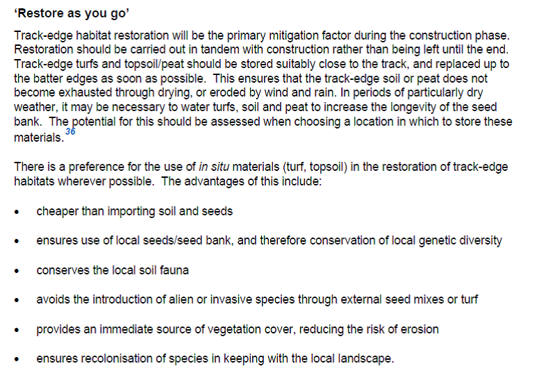
So much for the developer (Atholl Estates) providing an “immediate source of vegetation cover” to reduce the risk of erosion. I have looked through the planning documentation and part of the problem is that while the developer said they would follow SNH guidance, there is no documentation I can find in the planning application documents on the Cairngorms National Park Authority webite setting out how they intended to do this. Moreover, while the CNPA attached a large number of conditions to the planning permission (some of which were not observed and have never been enforced – see first post) very few of these concerned the track. Indeed the main requirements were for the short new section of track by the A9.
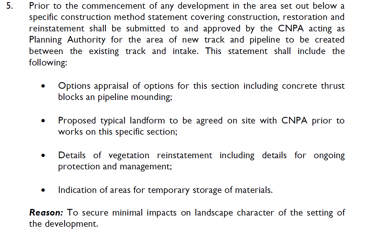
 No requirements were made for the new section of track to the powerhouse. While there have been attempts made to revegetate the verges of the new sections of track, the track here is far wider than it need be.
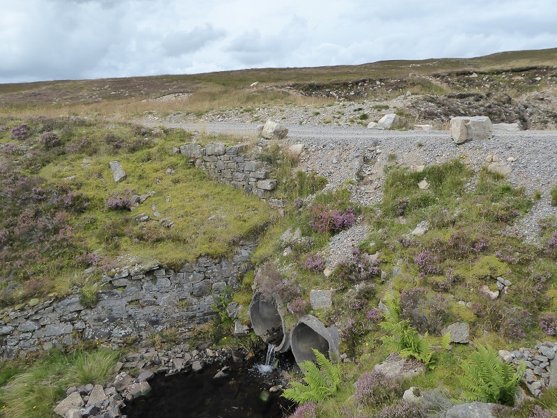
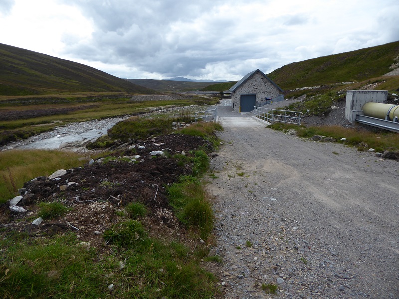
 Contrast the way this culvert has been constructed – which is typical of the culverts along the new sections of track – with what the SNH Guidance says on how it should be done:

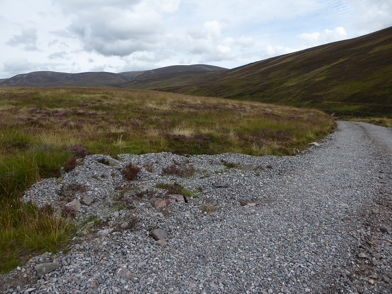
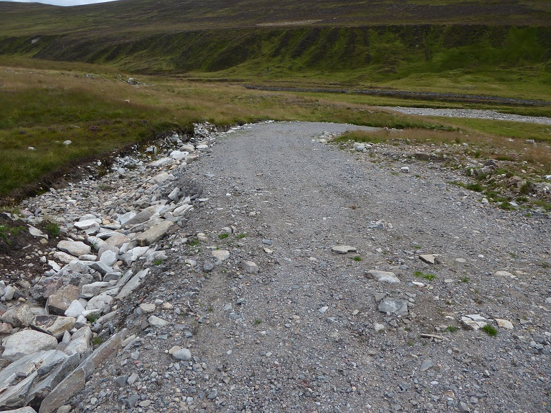 A new drainage ditch has been dug along this section of upgraded track, its unfinished ditches and edge of track on left is unfinished – there has been no attempt to revegetate it, either with turfs or re-seeding.
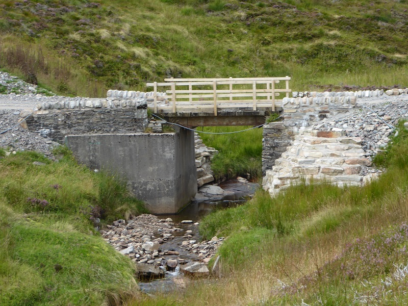 Among the kilometres of upgrade track where there has been little or no attempt to mitigate the landscapes or environmental impacts of the work, this bridge stands out as an exception. Note the new retaining buttress on the right. Unfortunately it appears the work has never been finished as material is still spilling down round the edges of the stone work on either side of the bridge.
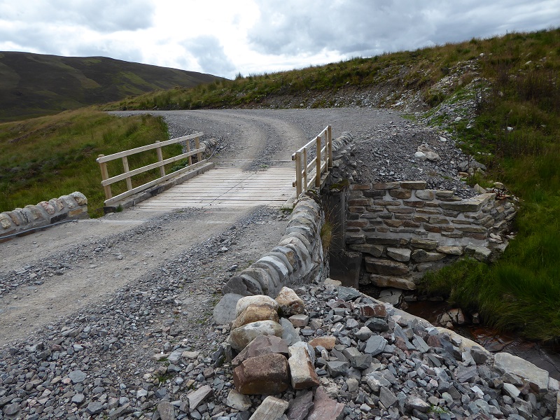 Another view of the not quite finished bridge
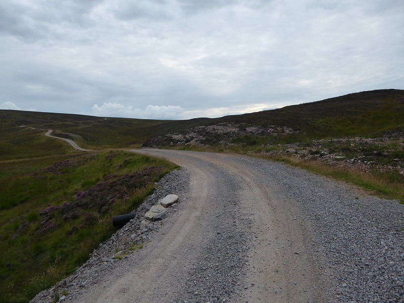
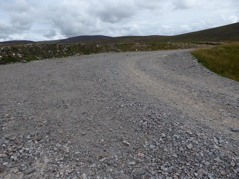 While the SNH Guidance allows for passing places this corner would be more suited to a race track. Large areas of vegetation have been destroyed and never restored. How can this be allowed in a National Park?
 Here aggregate appears to have been dumped on the edge of the area excavated for the pipeline. The Developer claimed the poor restoration of the pipeline was because the organic material was too shallow but said nothing about how they had dumped other materials onto the line of the pipeline. This could only have happened after the pipeline had been “restored” as the road aggregate sits on top of the “pipeline restoration”.
The track is not even good for the people who live or work at Bruar Lodge. Here staff have had to mark the holes that have eroded out of the track. Its not clear to me why Atholl estates would have tolerated such poor work.
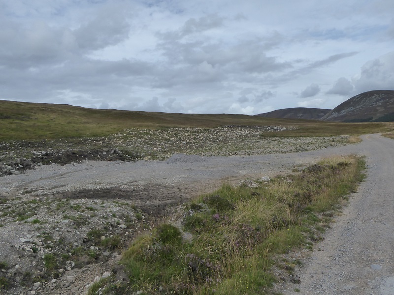 While there was mention of temporary areas of tracks and laydown areas in the planning application all were meant to be restored. Why has this vehicle area been left in the midst of the scar left by the pipeline? Its hard to imagine how restoration of a hydro pipe and track could be worse than this (do send in your photos).
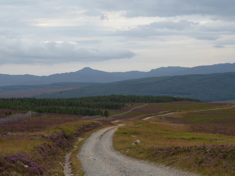
 By contrast the work on the new section of track beyond Bruar Lodge appears to have been constructed with far more care. It is much narrower than the section of upgraded track and restoration work has taken place along the verges. This is less than 2k though out of a total track length of 12k. The reason for this appears to be that the CNPA did set out conditions:
I have been unable to find the specific construction method statement among the planning papers on the CNPA website (I need to check again in case I missed them) but it does appear the CNPA has followed up this planning requirement and this has had positive outcomes. However, since there was also a track up to the dam on the east side of the river, there are now two tracks to the dam rather than one. Why was this necessary?
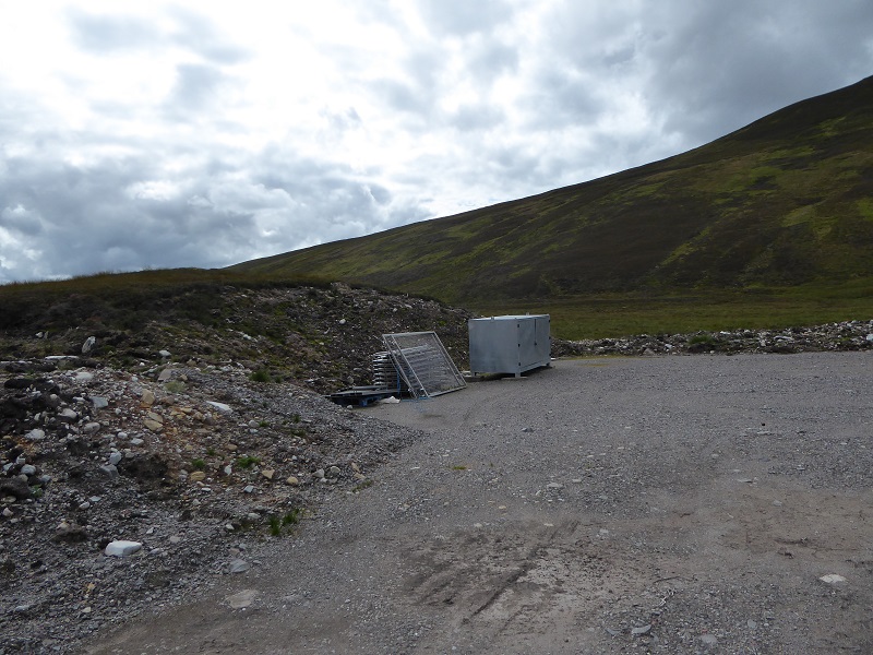
The turning/storage area by the dam however has not been restored or properly cleared up. Again note the track aggregate dumped on the bank on the left.
This is the section of the old track north of the dam, ie beyond the hydro scheme. It illustrates a number of features that the CNPA should ensure are applied to the 12k of track to the dam, namely its narrow, the sides are vegetated and a narrow vegetated strip runs down the centre of the track (as recommended in guidance by the Lomond and Trossachs National Park Authority on hydro tracks). While this track penetrates a prime area of wild land, in design terms it illustrates the standards our National Park should be aspiring too where tracks are agreed.
The section of track linking Glen Bruar to Calvine appears to have been subject to far less upgrading work than that in Glen Bruar itself. If construction vehicles could access the Glen by this track, which is far steeper and narrower than any of the track along the glen, it begs the question of why the Bruar track needed to be upgraded. Possibly it was in poor condition but simply dumping tons of extra aggregate on top of the existing track as a quick fix, which is what appears to have happened, should never have been allowed.
What needs to happen
In my last post I made suggestions about what the CNPA needs to do to ensure proper restoration of the hydro infrastructure apart from hill tracks. In relation to the hill track, I believe the CNPA needs:
- to commission an independent survey of the track along with options for restoring it so that at the very least it meets the standards set out in the SNH guidance on hill tracks
- take appropriate enforcement action
- learn from the experience of this and other tracks and adopt a clear set of standards for all hill tracks (it has guidance for hydro schemes but not for hill tracks as such)
