Following my critique of the proposed Allt Mheuran hydro scheme, this post takes a look at a further three of the hydro schemes proposed for Glen Etive which I walked around on 21st December.
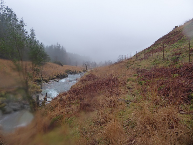
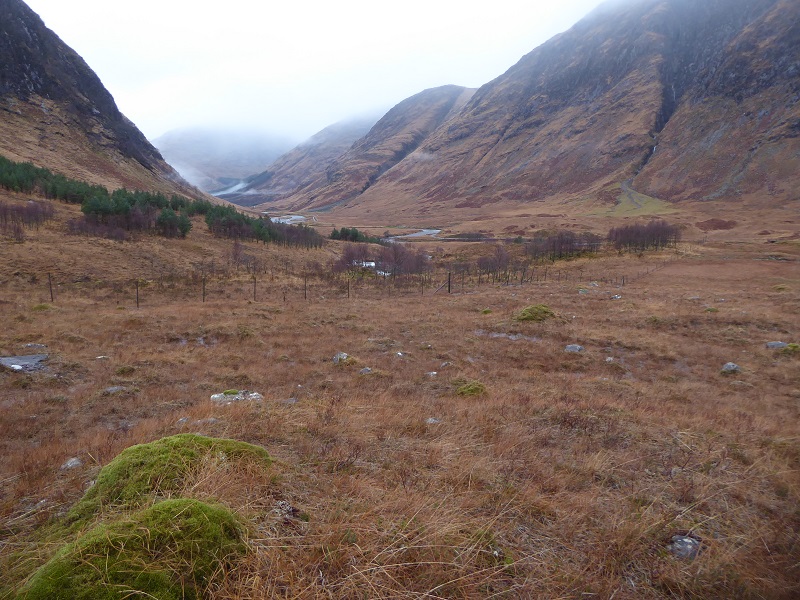
Allt Fhaolain
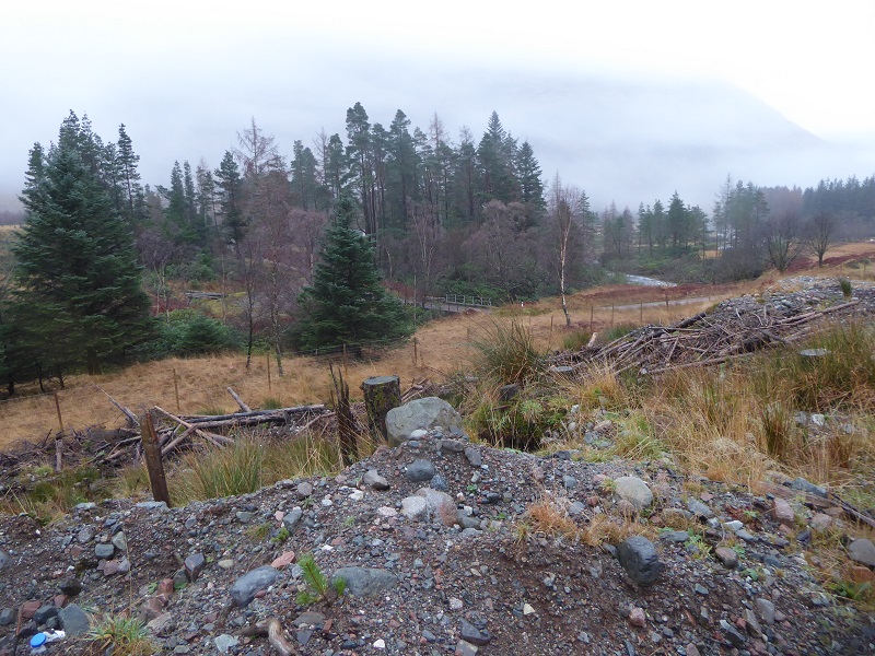
The Allt Fhaolain is the second hydro scheme in Glen Etive where Highland Council required the developer to submit a completely new planning application (see here). The issue that prompted a large number of objections was not the landscape but rather the impact that the original scheme would have had on the amenity of the Grampian Club Hut at Inbhirfhaolain. As a consequence the changes to the scheme are very different in character to those proposed for the Allt Mheuran. The powerhouse will be moved upstream, so it impacts less on the amenity of the hut, and a temporary water supply will be provided to the hut..
Because its a new planning application, objections to the last one no longer apply but there is therefore a further opportunity to comment on the scheme as a whole.
Tne entire scheme will now run between two blocks of conifer plantation, one of which is in the process of being felled. Given the level of destruction here it might seem that a run of river hydro will make little difference.
That I believe is the wrong way of looking at it. This is a National Scenic Area, a statutory designation unlike Wild Land Areas which are advisory. It may have been badly damaged by industrial forestry practices but there is enormous potential for landscape restoration. And that potential is best demonstrated by the river which at present is almost pristine, unlike the land about it, even if the quality of its water will have been affected by water run-off from the forestry plantation. Replace the conifers by native woodland and the glen along the Allt Fhaolain could add rather than detract from the landscape in Glen Etive.
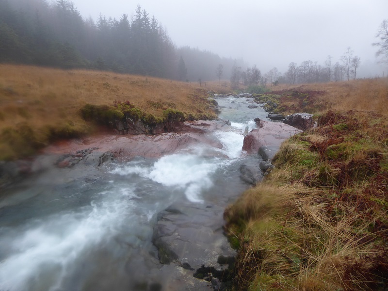
The Planning Application pays no attention to the form or landscape value of the river. The water is something to be abstracted for power and anything that is not visible from a distance appears to be given no value. The problem at present is there is no debate, whether about the value of Highland rivers (hydro developers should be required to submit photos of the entire length of the rivers they are affecting) or about appearance of schemes once the forestry is all felled or about how land and water in Glen Etive should be used in the long-term. What would a real National Park decide in these circumstances?
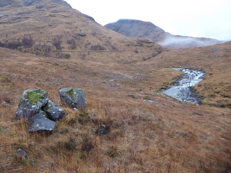
While people need to start making the wider arguments about enhancing landscape and land-use, there are also “technical” objections which can be made to Allt Fhaolain scheme including for example the impact on salmon. I will highlight two here.
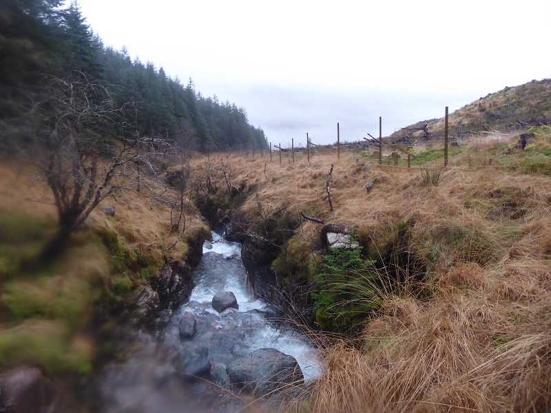
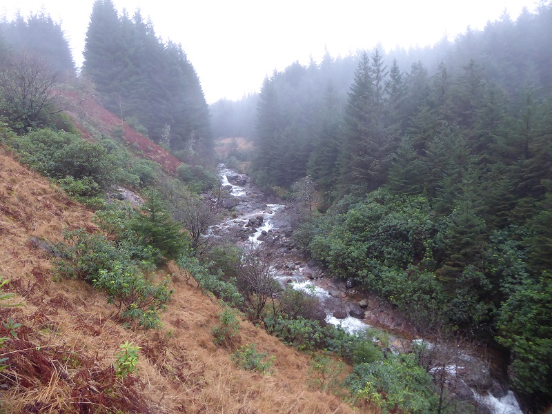
The first is about construction of the pipeline. Its proposed the pipeline will be buried in the bank on the west side of the river. In the case of the Allt Fhaolain, for much of the way the bank is broad with plenty of space to dig a pipeline but in one place it narrows (above). The Construction Method Statement talks about 20m working corridors. That appears impossible where the bank narrows. The Planning Application appears to say nothing about this challenge, how they would avoid destabilising the slope above or how they would prevent excavated material from washing into the river. The Planning Authority needs to request detailed plans for how Dickins Hydro proposes to overcome this challenge before proceeding further with the Application.
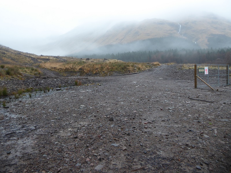
The second reason to object is the proposed new road linking the forestry road to the intake. This is only a couple of hundred metres and not necessary. Dickins Hydro have said they can manage the Allt Mheuran without a road to the intake and so should be able to do this for all schemes. Tne new road will start close to where the current forestry felling finishes and go through the top part of the plantation. Once that is felled it will be highly visible.
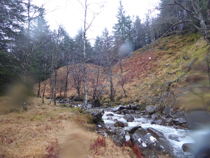
Allt Charnan
 Of the four schemes I visited (see here for Planning Application), this is most the most difficult of access, buried as it is in plantation forestry and rhododendron which has colonised much of the open ground. I went up the south side of the river and was forced away from the bank in many places.
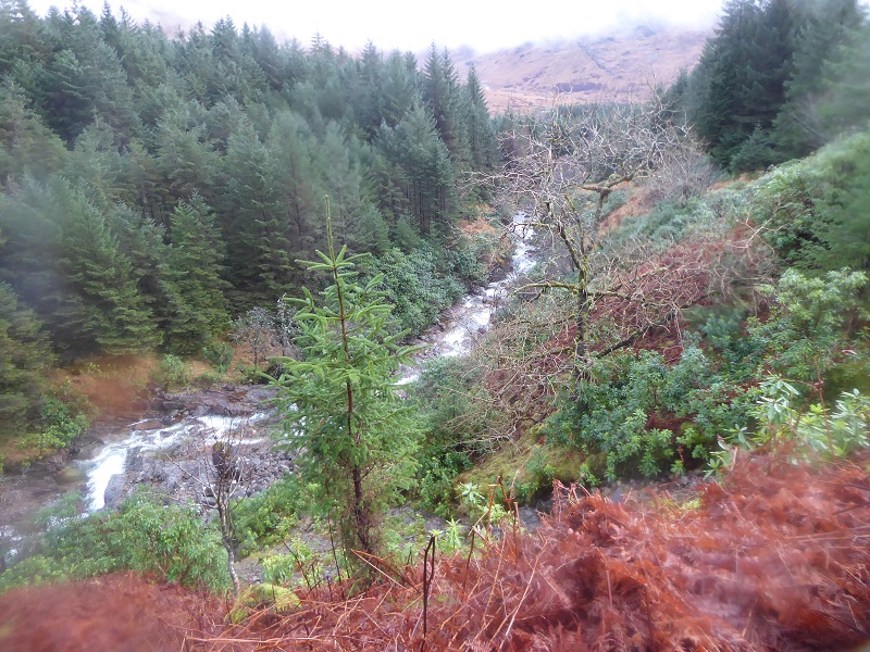
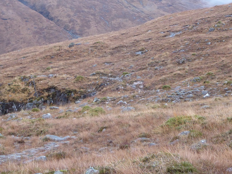
There was an old forestry road running above the bank which appears almost never used and is now in places blocked by thickets of rhododendron. It provides a salutary reminder to the planners about what can go wrong if construction fails to take account of topography:

As you approach the location of the proposed Allt Charnan intake ancient woodland is marked on the map. Most of this has been subsumed in the forestry – again think of the potential if the conifers were removed as happened in other places – but there were some larger trees along and on the bank approaching the intake. What’s more, the proposed pipeline would appear to cut right across this bank:
I don’t believe that is feasible. The problem is the location of the intake is above a section of the river where the banks on either side are very steep and there is no alternative to the pipeline cutting across these. This is likely to create a massive scar, as diggers cannot cross slopes like this without destroying them, which will then be almost impossible to restore. Any failure in restoration would mean silt and other debris entering the watercourse, something that planners and the Scottish Environment Protection Agency take most seriously. It would also have a massive landscape impact once the conifer plantation is felled.
Just as with the Allt Fhaolain therefore Highland Council need to demand far more detailed plans before allowing this application to go any further. Technically the consultation on this scheme has now closed but until its ready to be determined there is nothing to prevent people submitting further comments.
Allt Chaorainn

The Allt Chaorainn scheme has not been revised (see here) but shares many of the failings of the revised Allt Mheuran scheme. The first is the location of the powerhouse which is in an even more open location and is now likely to be the first building that comes into view to anyone driving down Glen Etive. It will also be visible from parts of the Buachaille Etive Mor ridge.
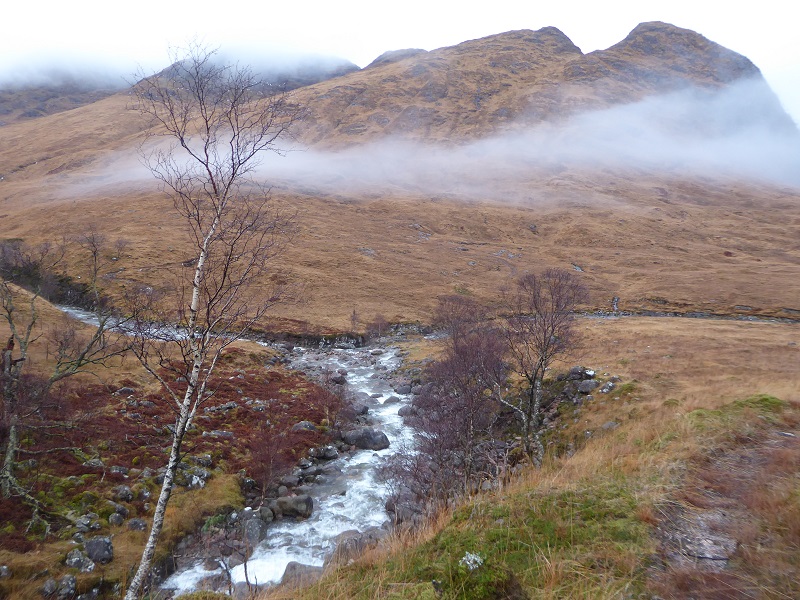
The proposed route of the pipeline is around the native woodland plantation that runs alongside the north bank of the river. This keeps the pipeline well away from the river, in contrast to the Allt Mheuran, and through terrain which is more suitable:
The problems come above the top of the fencing where the pipeline has to connect with the river:
That might be possible once the pipe has reached the river – you can see the bank is far less boulderly than the slopes above – but to get there the track and pipeline need to cross thin soils and bare slabs:
Just as with the Allt Mheuran scheme, there appears to be no proper survey of the surface bedrock and no proposals for how a pipeline and track will be constructed here without causing permanent damage to the landscape.
The area of the proposed intakes is beautiful, like the river itself, and raises questions about why we should ever contemplate constructing a hydro scheme here.
Imagine two intakes and a pipebridge below where the tributaries meet to carry water from the second intake back across the river. The landscape impact, even with perfect restoration, will be immense. Now consider whether it will be possible to restore the boulders on the right bank of the tributary in front of you to the state they are now. There is nothing in the Method Statement explaining how this will be done. Again, I don’t this it can and if this scheme is allowed to go ahead the natural landscape here will be irreparably damaged.
What needs to happen
Apart from their landscape impacts, all four of the proposed hydro schemes I visited on 21st December appear to me to pose major challenges in terms of construction and restoration. For the Allt Mheuran and Allt Chaorainn schemes these challenge involves laying a pipeline over bouldery and rocky ground. For the Allt Charnan and Allt Fhaolain they concern how tracks and pipes can be constructed along steep sided or narrow river banks. I suspect had I had time to take a detailed look at the three other proposed schemes in Glen Etive they might well have shown similar problems.
This is all wrong. It should not be the job of members of the public, campaigners or organisations like Mountaineering Scotland to check whether developers have submitted adequate documentation about the challenges their scheme faces and how they propose to deal with these. Unfortunately, however, the whole planning system relies on trust and our public agencies respond to applications through desk top exercises rather site visits. Its time our public authorities were resourced properly to take a critical look at Planning Applications. Were this to happen, I suspect most of the Etive hydro schemes would have been rejected some time ago.
Under our current planning system, however, its up to the public to raise concerns, so please consider doing so by lodging objections to the new applications for the Allt Fhaolain and Allt Mheuran Schemes and sending in comments on the other schemes. Even better, if you photos of the ground covered for any of the schemes, please check them agains the plan and send them in with comments.

Nick, the deadline for public representations is January 6th, there is still officialy time for people to submit comments. To anyone reading this, please do send in even the briefest of comments. Nick’s posts provide more than enough material for you to raise concerns in a serious manner. There is a real risk that planners will look no further than the developer’s written exercise in wishful thinking, so the more attention can be drawn to planning application inadequacies the better.
All of Scotland should stand against this official VANDALISM. Visitors past,present and future from around the globe will be aghast that the Scottish Government would contemplate such wanton destruction to this beautiful glen. Can you imagine this happening in Yosemite ? no never.