On Sunday, hoping to have missed the worst of the thunderstorms, I set with my daughter for a two day round of the ring of Tarff as training for her first mountain marathon. I had not thought of checking the state of the Bruar hydro restoration (see here) and (here) and had planned to approach Beinn Dearg via the Allt Slanaidh track. However, as luck would have it we came across a sign at the Glen Tilt car park.
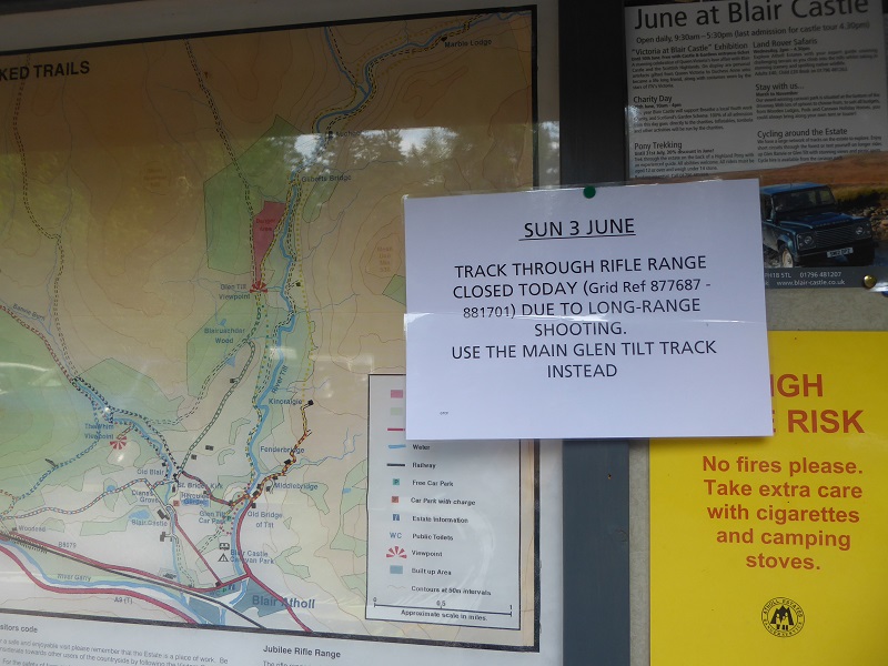
Would that Forestry industry signage in our National Parks and elsewhere, which parkswatch has commented on recently (see here) and (here), followed this example. A specific restriction, clearly explained and alternative route suggested. As someone who routinely ignores signs with blanket access bans, which in my experience are never warranted, I was quite happy to change our intended route and we took the Allt Sheicheachan track instead.
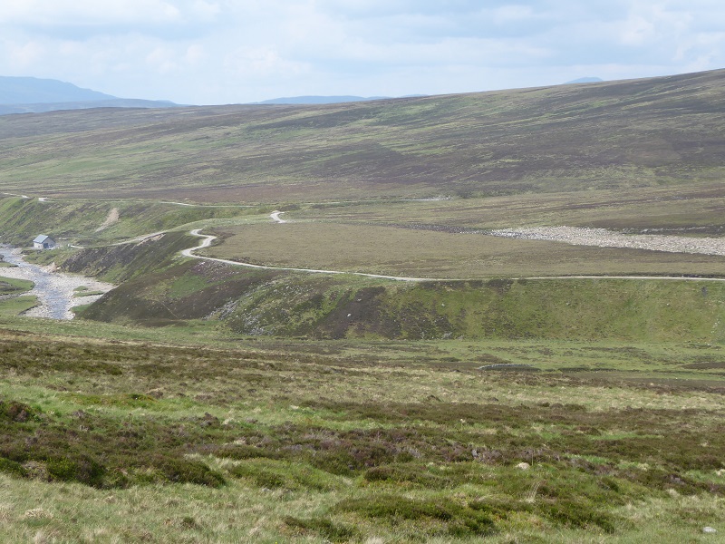
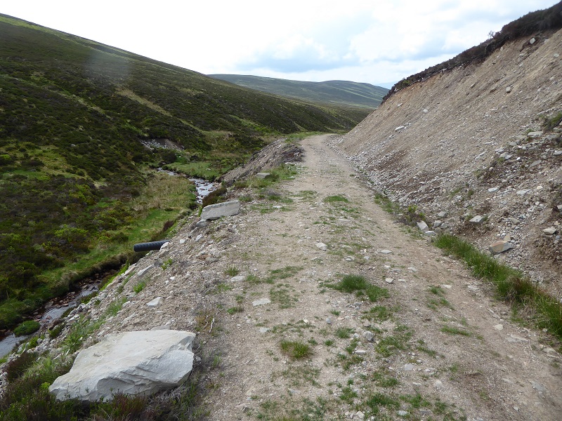
Where the track runs parallel to the Allt an-t Seapail a section had been recently resurfaced. No attempt had been made to keep the vegetation running down the centre of the old track – it could have been lifted and placed back instead of being covered over/ripped up – and the extraction of material from the borrow pit has created a scar. There has been some attempt to restore this – you can see dried out heather and peat on the left side of the it nearest the track – but it is a job half done. A relatively small issue in itself but an indicator of things to come.
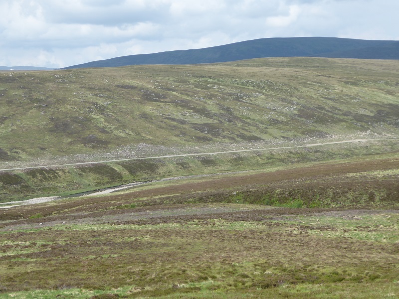
The Glen Bruar Hydro restoration
Apart from the thunderstorms of the previous day, it had been very dry and I was not that surprised that the vegetation above the Bruar track which covers the pipeline still differs markedly from the moor above. The vegetation here will probably take several years to recover, a period that could have been much shorter – as I have argued previously – had the original construction and restoration work been properly supervised.
The “restoration” of the section of pipeline below this and above the power house is a different matter:
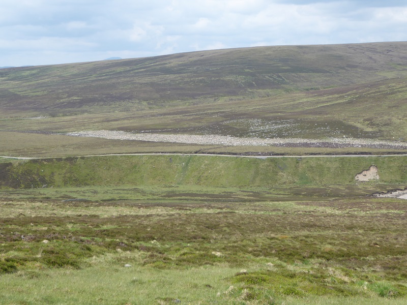
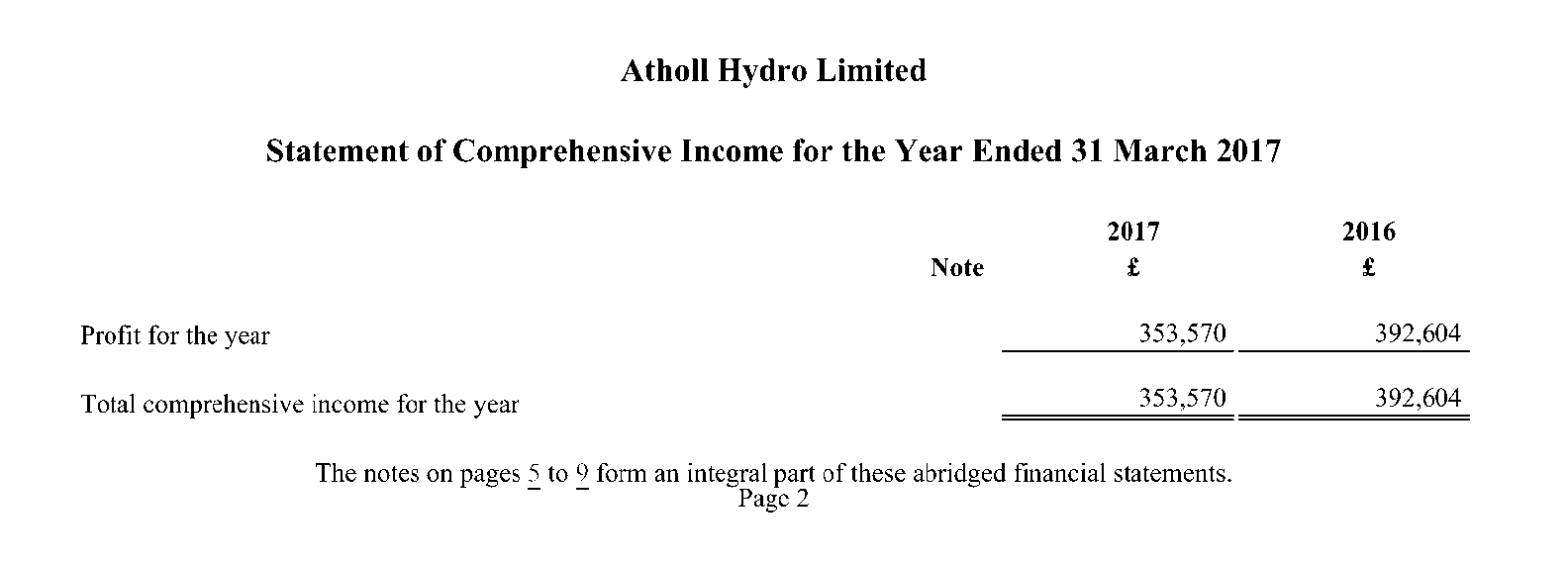
The Cairngorms National Park Authority has done a good job in disaster recovery in Glen Bruar but this scar will be a major test of its determination to protect the landscape from destruction caused by development. They should not be deterred. Atholl Estates, just like other hydro owners, is making significant amounts of money from the hydro scheme, which comes from what the public pay for fuel:
Atholl Estates can afford to pay for whatever it takes to restore this mess and its in the public interest they should do so.
Track “maintenance” and our National Parks
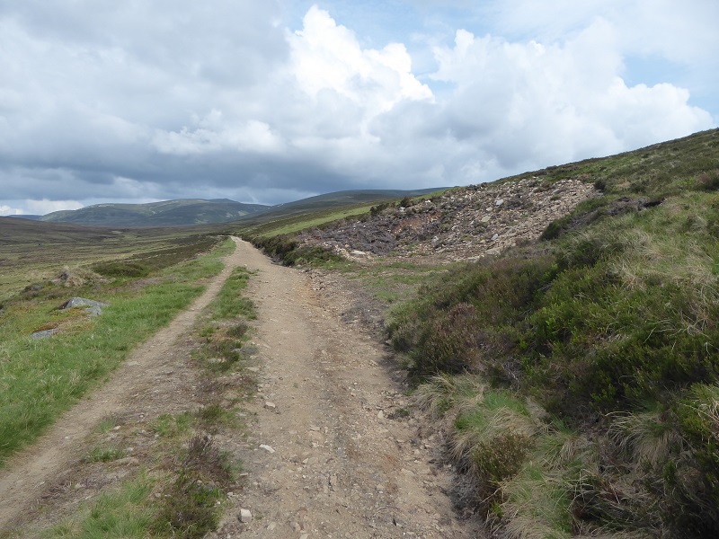
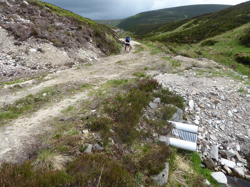
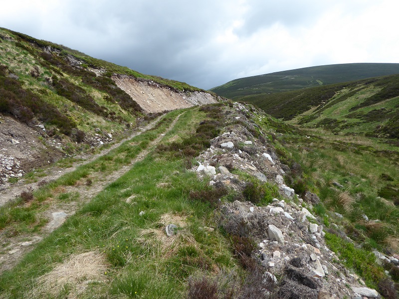
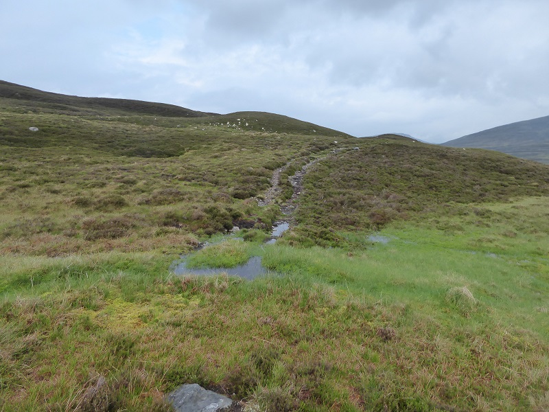
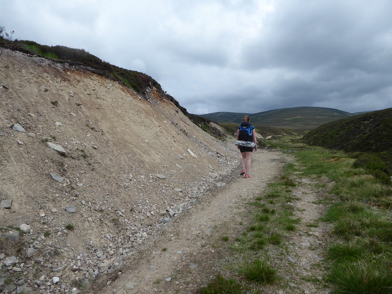 On my old map the track used to stop at the Allt Sheicheachan bothy and stalking paths continued to Bruar Lodge and up the burn. There has long been a track up the Allt Sheichachan but sections of this have has recently been worked on creating yet more landscape scars.
There has been no planning application for these works but as far as I could tell, the purpose of much of the work has been to reinforce the bank above the burn and this has been done by scraping vegetation and moraine material off the upside of the track and placing it on the slope below. The batter on the upside is far too steep and is contrary to ALL standards of good practice. Consequently it is unlikely to re-vegetate and has made the existing landscape scar caused by the creation of the track far worse.
There are issues here for both the Cairngorms National Park Authority and the Scottish Environmental Agency. Under our deficient planning system, while new developments are subject to some scrutiny on matters such as restoration of vegetation and protection of watercourses, upgrades of hill tracks appear totally outwith the planning system. Land managers can therefore do what they want, whatever the impact and whether in a National Park or not. That is not right and should be one of the deficiencies in our planning system that the Planning Bill currently going through the Scottish Parliament should rectify. Unfortunately, that Bill is still totally deficient when it comes to environmental issues.
What has happened on the Allt an-t Seapail and Allt Sheicheachan tracks provides more evidence of why all so called track maintenance needs to be brought within the planning system. In my view this could be done through amending the prior notification system so that land managers had to alert our Planning Authorities where they were planning track upgrade works. This would comprise a short description of the proposed works. Where an estate had previously supplied a detailed specification covering the standards for such works and this had been approved by the Planning Authority – as at Glen Feshie – full planning permission would not be required. However, where an estate had not agreed a specification for works, then full planning permission would be required. This I believe would help stop the examples of terrible practice demonstrated above.
While this would help prevent new problems arising, it would not address the issue of how we remove or address the impacts of historic landscape scars, such as the Allt Slanaidh track which was extended to go up Beinn a Chait:
The other side of Atholl estates
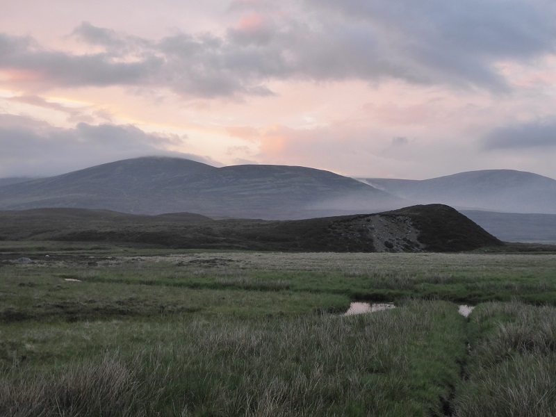
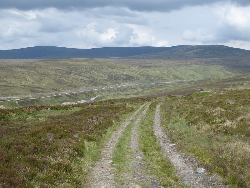
While very critical of Atholl estates for the Bruar Hydro Scheme and Allt Sheicheachan track upgrades, over in the vast area of the Tarff catchment there are NO bulldozed tracks, apart from that coming over the Tilt, and almost no signs of ATV use. We went from Beinn Dearg to Beinn Bhreac and then over Carn Ealar and An Scarsoch – admittedly in cloud and rain with only intermittent views and none to the north – and saw just one ATV track:
Next day there was no sign of any vehicle use until we got close to the summit of Carn a Chlamain and then none at all over Beinn Mheadhonach. This is incredibly unusual and means that the Tarff catchment is one of the few areas left in Scotland that does feel really wild. Atholl Estates deserve credit for this and we need the National Park to ensure it stays that way.
And as a further example of good access practice we came across this sign on the northern edge of the firing range the next day:
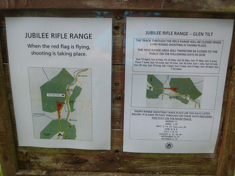
Advertising the dates that dangerous activities are taking place (or not) helps provide confidence that access restrictions really are justified.

And having run by the firing range and seen just how easy it would be for a stray bullet to hit someone or something on the track, I have no hesitation in saying this is one place in Scotland where I think the occasional access restrictions are fully justified.
What does all this show and what needs to happen?
The picture of how land is managed in our National Parks is rarely simple. On Atholl Estates there are examples of really excellent practice – I think people really are made welcome – and the wilder parts of the estate still provide a wonderful wild land experience. Unfortunately, this is spoilt by extremely poor practice in respect of the Glen Bruar hydro scheme – it was and is the primary responsibility of the estate to get this right – and in respect of track construction and maintenance. It demonstrates why we need a powerful National Park Authority which is able to influence and control what estates do and, should they fail to do what is required, step in and take action directly. A test of this will be the CNPA’s enforcement of planning conditions relating to the Glen Bruar hydro and their preparedness to take on Atholl Estates in respect to standards of track “maintenance” on the estate.