I have been meaning for several months to blog about the Bruar hydro scheme but have been prompted to do so by recent praise from the Cairngorms National Park Authority’s for their own planning performance (see here). I am not disputing there may have been improvements in certain aspects of the National Park’s planning performance, but the real question is are these the things that matter? The evidence of what is going on at Cairngorm (see here) and Dinnet (see here), suggests otherwise. In this, the first of three posts, I hope to show why what has happened at Bruar should be of major public concern and another touchstone planning case that the CNPA needs to address.
I first became aware of the Bruar Hydro Scheme in May 2014 when I spotted the construction works from afar when out for a run over Beinn Dearg and surrounding hills. I did not think twice of it then, like most of the population I assumed hydro was “a good thing”. Having become aware of the hydro planning disaster in Glen Falloch (see here for example) I went to have a closer look at Glen Bruar on 27th August 2016 (and I give the date because it is just possible some effective restoration work has taken place since then).
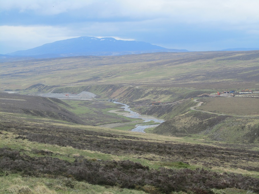
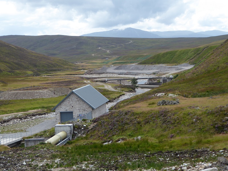
The Bruar Water was already part of a hydro scheme, its waters being channelled 7km through the hill to the Allt Ghlas Choire above Dalnamein and from there eventually to the Errochty power station. The new Bruar Hydro Scheme involved raising the height of an existing dam above Bruar Lodge, construction of a pipeline to a new power station just above the SSE intake pictured above and then burial of a new power line to Calvine.
While the new powerline is over 10k, its impact on the landscape has been relatively slight because not that much material had to be excavated to dig the trench where it was laid. While a lack of care in construction is evident – the photo above suggests that the turf removed to dig the trench was not properly stored as the developer said they would – vegetation is recovering quite quickly and I suspect in another year or so the line of the powerline will not be obvious to the casual observer.
The impact of the hydro scheme on the landscape however changes totally from just south of the new power house to the dam.
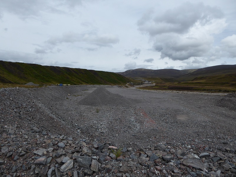
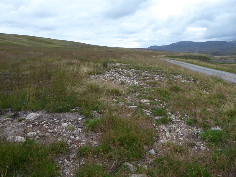
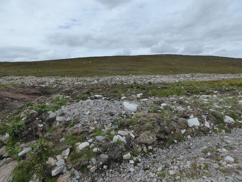
I can find no reference to this bulldozed area in the planning application or Committee report. While it probably dates from the construction of the SSE hydro tunnel it has clearly been used as part of Bruar hydro construction (see piles of aggregate top photo from 2014) possibly as a spoil pit to source aggregates to upgrade the track.
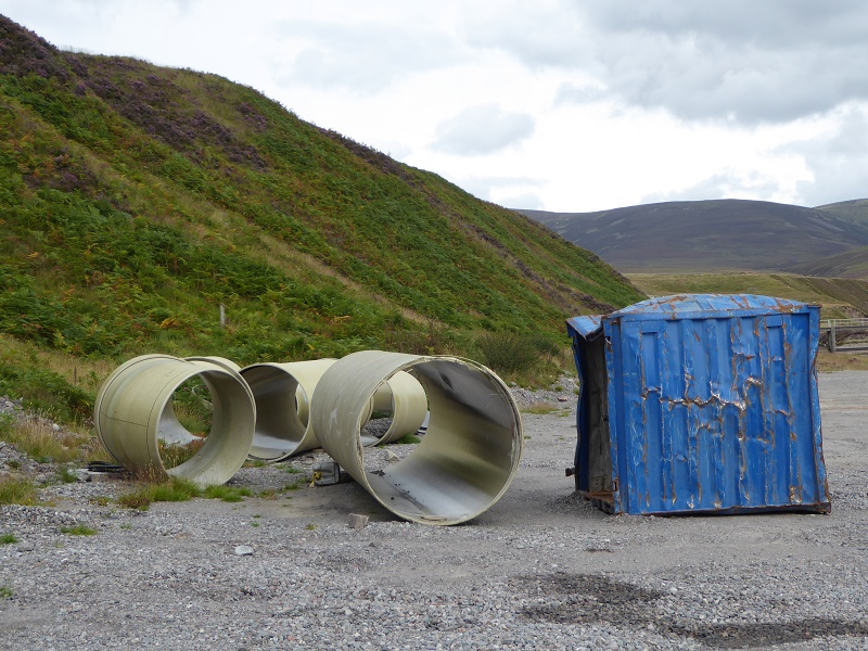 The planning application described two storage areas for pipes, above the power station and at the dam. Broken sections of pipe have still not been cleared away 18 months after construction finished. The CNPA never agreed to a new dump in the planning application. Why is this still here?
Is this acceptable in a National Park? There appears to have been no attempt at restoration. Maybe the Estate is just hoping the river erodes away the flattened area completely but what about all the silt which is being washed into the river system?
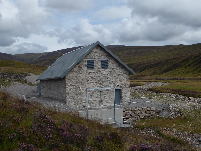
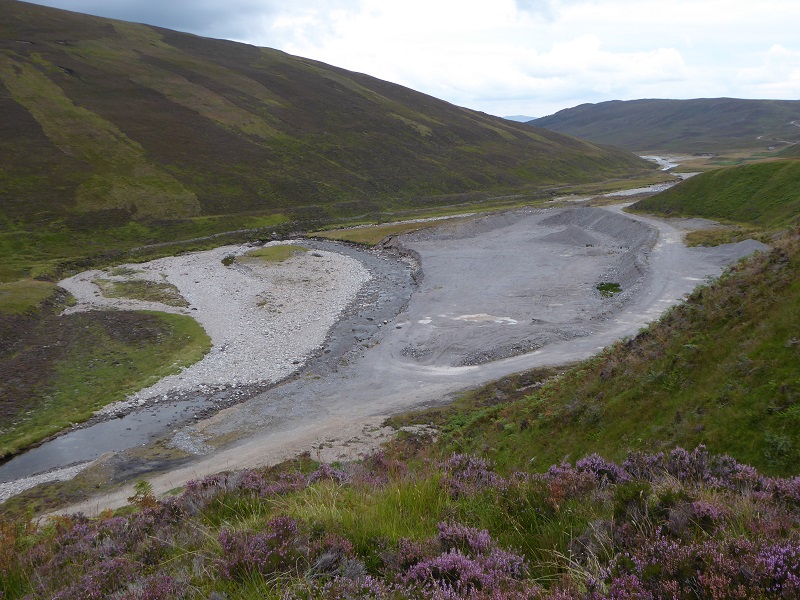
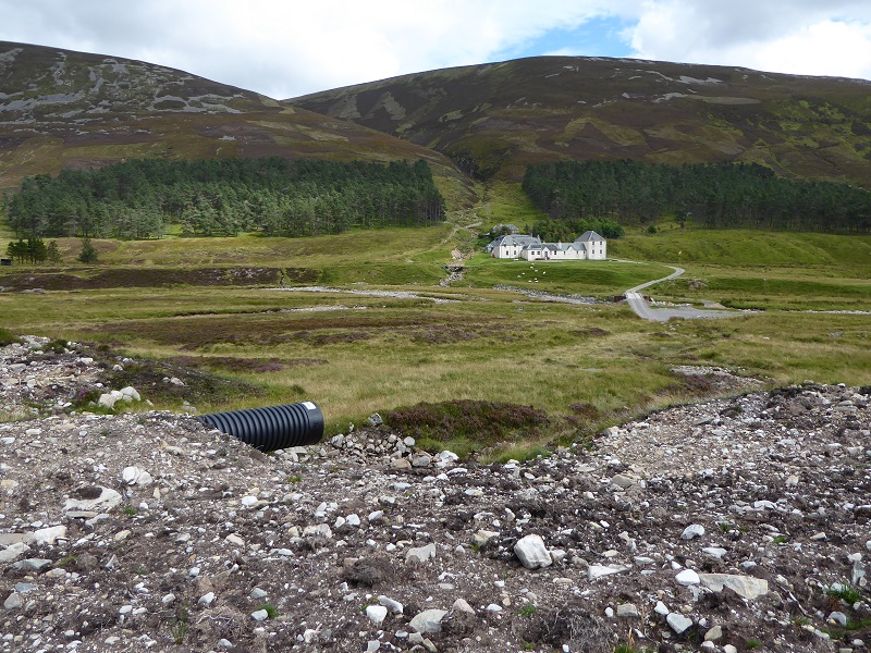
In order to construct the powerhouse in this location, a significant amount of material had to be excavated. The planning statement suggested this should be re-used in track construction but one wonders if it might have been dumped by the SSE intake (see photo above)? The CNPA needs to find out, if it doesn’t know, who was responsible for digging and dumping what and then take appropriate action in public. The planning application stated that the amount of hardstanding around the powerhouse should be minimised – you can judge for yourself from the above photo whether this has been observed. The building itself though in in my view perfectly acceptable: our planners and developers appear much better at ensuring buildings are symathetic to the landscape than they are at looking after the land itself.
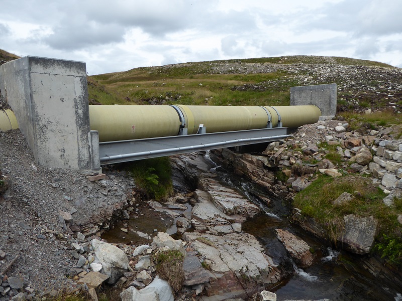
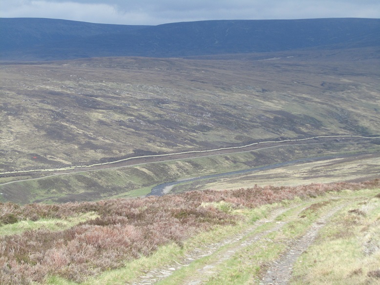
CNPA planning guidance on hydro (see here) states the number of stream crossing should be minimised. This was hard to do on a 4.5k pipeline and at least the colour of the pipe is not bright blue as in Glen Falloch. The poor standard of work is obvious at both the concrete pipe supports and the material on the left is already being eroded away into the burn: its unlikely to survive a spate.
The Planning Report approved by the CNPA suggested the construction should re-use old SSE spoil materials from their tunnel, not create new ones. This has had a significant adverse impact on the landscape, a landscape of grouse moors which at present the Park is committed to conserving. So why has this been allowed to happen? How is it compatible with National Park policy?
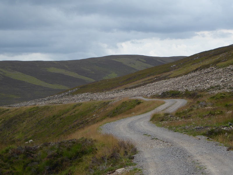
Its the construction of the pipeline however that has had the biggest impact, creating a 4.5km trail of destruction up Glen Bruar.
While I have been very critical of the Glen Falloch hydro schemes, some of which should never have been allowed, in general the restoration of the land around the pipeline has been done well – unlike the tracks there – and it will be very hard to see the line of the pipes in a couple of years (see here). I have never seen such terrible restoration of ground above a pipeline as in Glen Bruar.
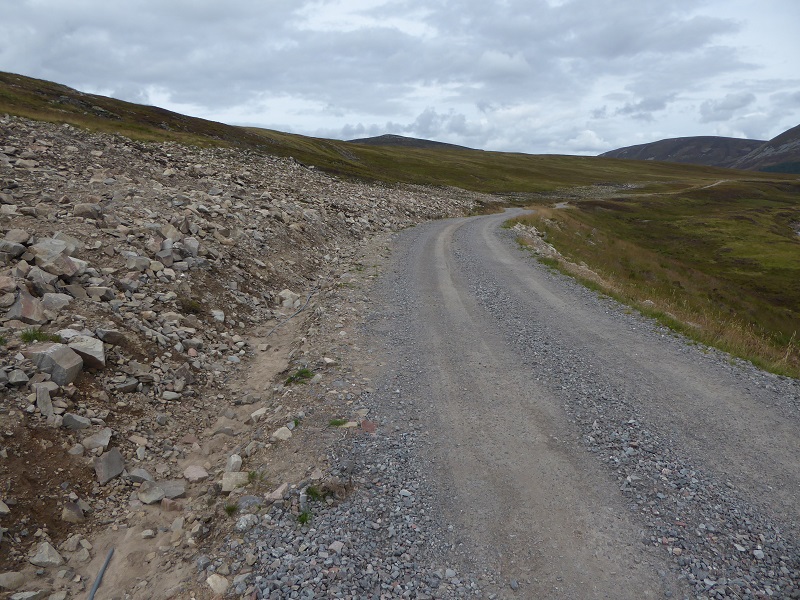
And it goes on for 4.5km.
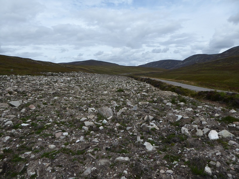
Boulders which were below the surface have been brought to the surface and left there so there is now a 30m wide trail through what was previously peat moorland. According to the method, which set out how the pipeline would be constructed, the vegetation and organic matter would first be removed and stored, the ditch then dug, the pipeline laid on and packed small aggregate (high pressure pipelines need to be well enclosed/supported and then the ground above restored to how it looked before. It did not envisage problems with doing this.
I corresponded with the CNPA about this in September and was sent (which I appreciated, I did not even have to ask under FOI) this reinstatement note from the Developer. Basically they claimed that the boulder trail resulted from the soil being unexpectedly shallow, that they now proposed to remove the boulders and use to shore up the river bank belong the dam and they would “rob turves” from elsewhere on the moor to cover up the mess. By coincidence this is exactly what Natural Retreats tried to do at the Cairngorm Shieling tow after they had failed to store vegetation properly (see here).
While on the steeper banks, as in the photo above, the organic material might have been shallow, if enough care had been taken it could still have been saved and replaced. However, the ecological assessment conducted as part of the planning application clearly stated most of the pipeline was through moorland and peat. If shallow organic matter was present, surely the ecological assessment should have identified this before work ever started?
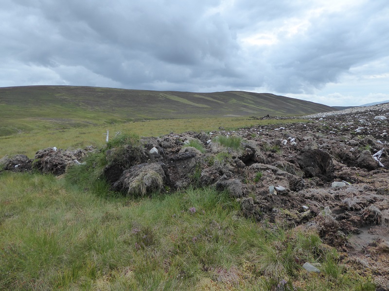
I think the truth is, as this photo shows, is that there was a considerable depth of peat along much of the pipeline and that the developer did make some attempt to store it in places even though where they did so they did not always replace it. The bigger problems was that vegetation and organic matter appears not to have been stored at all, as had been promised in the Method Statement. The fundamental issue is the develop has ignored its own Method Statement and this is therefore another enforcement problem. It demonstrates why our National Parks and other planning authorities should NEVER trust developers to monitor their own work. All that happens without independent monitoring is that the construction companies take shortcuts and ignore what’s in the Method Statements. Where shallow soil was a problem, if it really was so shallow that no turves could be stored, any responsible developer would have contacted the National Park as soon as they discovered this to discuss alternatives. Atholl Estates as far as I am aware never did this.
In fact, there is plenty of evidence that the developers have breached their own method statement. Indeed, there is also lots of evidence of them failing to keep to deadlines: for example, in their “reinstatement note” the developers had said they would remove all the boulders by Spring/early summer 2016. There was no sign of this when I visited at the end of August.
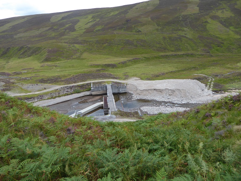
The one area where there does appear to have been an attempt to keep organic matter separate from the soils beneath and restore the ground properly is around the intake dam.
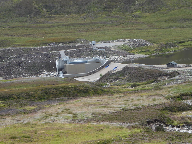
The old dam here has been raised by c1m. The dam wall itself hardly impacts on the landscape, the new intake wall and structures are more prominent from the angle this photos was taken as are the Lomond blue outlets. However, when you are on the floor of the glen these aspects of the development are hardly visible and in landscape terms the intake is well positioned.
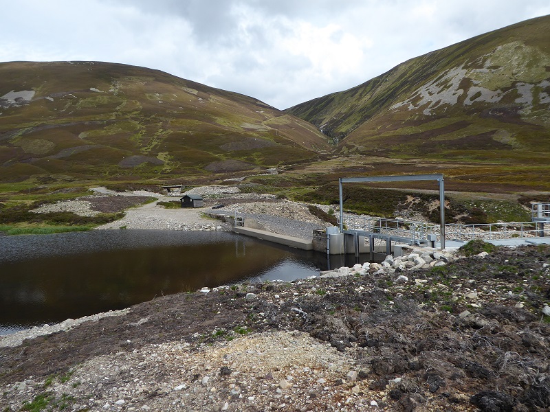
Its clear though that even round the dam the restoration is far from complete. Why has the ground to the right been restored with peat but that in the centre foreground left as it is? When the Park granted planning permission in July 2012 a condition was that all of this area should be hidden within a new area of native woodland which would hide it completely and that plans for this would be provided BEFORE any work started. The plans were provided by Atholl Estates in February this year AFTER all the other work had finished and they then committed to planting in the spring of 2016. The CNPA told me in September the contractor was about to commence work.
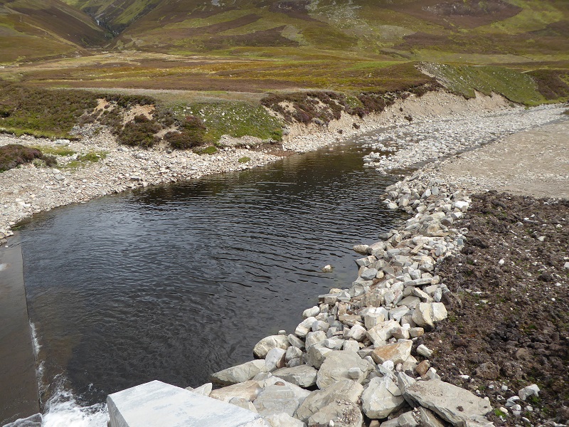
The rip rap bouldering along the edge of the river contrasts with the natural erosion of materials that has taken place on the far bank.
Why has this all happened?
While the issues are not limited to those I have illustrated above (and I will cover the enhanced and extended track in a separate post) I hope I have shown enough to show that the Bruar hydro scheme should be of concern to anyone who cares about our National Parks.
I have read almost all the documentation associated with the planning application (see here) and the Report to the CNPA planning committee (see here) which set out 22 conditions for the development to go ahead. While in retrospect there are probably some gaps in the documentation, for example the working site does not appear to have been clearly limited and this has allowed the developer to work in areas outwith that granted planning, the method statement appears to me generally acceptable apart from the question of whether the soil above the pipeline could be restored. In my view, apart from this issue, the development was probably justifiable, even though in a remote of the National Park, because as the Committee report stated there was already a track up the glen, already a dam in place and already other hydro infrastructure as well as Bruar Lodge. If the work had been done to the highest standard there would have been relatively little impact.
If the soil was too shallow and the boulder scar an inevitable consequence of the works (which there is reason to doubt) in my view the development should not have gone ahead or else the CNPA should have required a proper tunnel linking the power house and dam, a distance of 4.5k. The tunnel connecting Bruar Water with the Allt Choire Glas is at least 7k and that was done I believe over 50 years ago so. What was good enough then should be good enough for a National Park now.
The failures of the National Park have come at the implementation stage through a lack of monitoring and enforcement. Our Planning Authorities to be taken seriously need to take action as soon as planning conditions were breached: in the Bruar case work started before all the required paperwork was in place. The CNPA should have put a halt to it there and then. They might then have been taken seriously. Instead, there is now a major problem, a long glen in the National Park has been seriously scarred for over 5k (not just the length of the pipeline but the areas beyond).