
Parkswatch sometimes gets it wrong and has done so in claiming that with hydro schemes in the Loch Lomond and Trossachs National Park that it is the tracks, not the buried pipelines, which are the main issue. That is not the case at the Burn of Mar hydro scheme, situated at the back of Conic Hill and under the West Highland Way. This is the LLTNPA’s equivalent to the pipeline disaster at the Glen Bruar scheme (see here) in the Cairngorms.
While the lower section of the pipeline has been restored well, the upper part along the burn to the main intake is a disgrace. What is interesting is that the LLTNPA appears to have remained completely silent about it. The new track also raises concerns, both in relation to why it was approved in the first place and because it has not been properly finished

As is their usual practice, NONE of the documents required by the planning consent have been published on the LLTNPA planning portal (see here) so its impossible to tell whether the developer, who at the time of the consent was Hydroplan, submitted the necessary documents or whether the LLTNPA approved them. There is nothing either to indicate whether the LLTNPA has taken any action to remedy what has gone wrong or indeed if they are any way concerned about this. This is all wrong and falls far below the standards we should expect from our National Parks.
The hydro pipeline
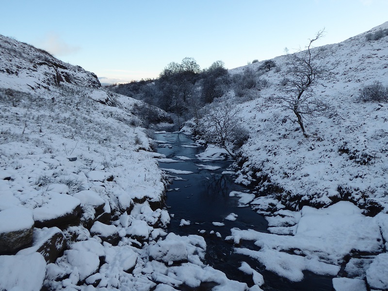
I first visited the Burn of Mar hydro scheme last year when snow concealed the landscape scar and, while meaning to check the view from Conic Hill, was then contacted by a reader who had serious concerns about this scheme. Last weekend I went back to have another look.
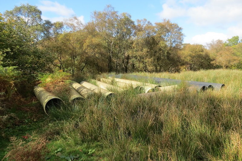
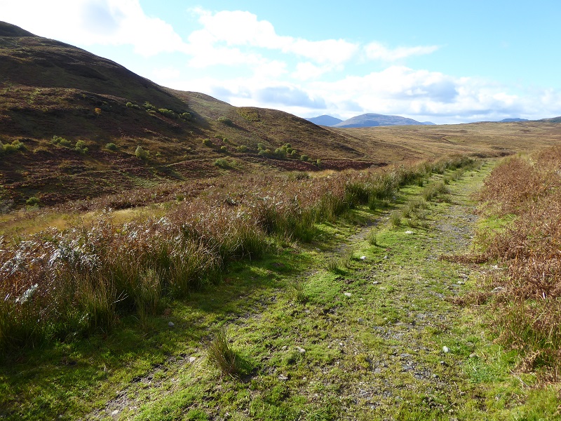
Walking up the track along the Burn of Mar from Milton of Buchanan the first sign that all might not be well is an area of what appear to be abandoned pipes in what the planning application described as a “temporary lay down area”. So why are they here 2 years later? Is the LLTNPA’s planning enforcement strategy simply to hope the pipes will eventually grow over and be concealed from public view?
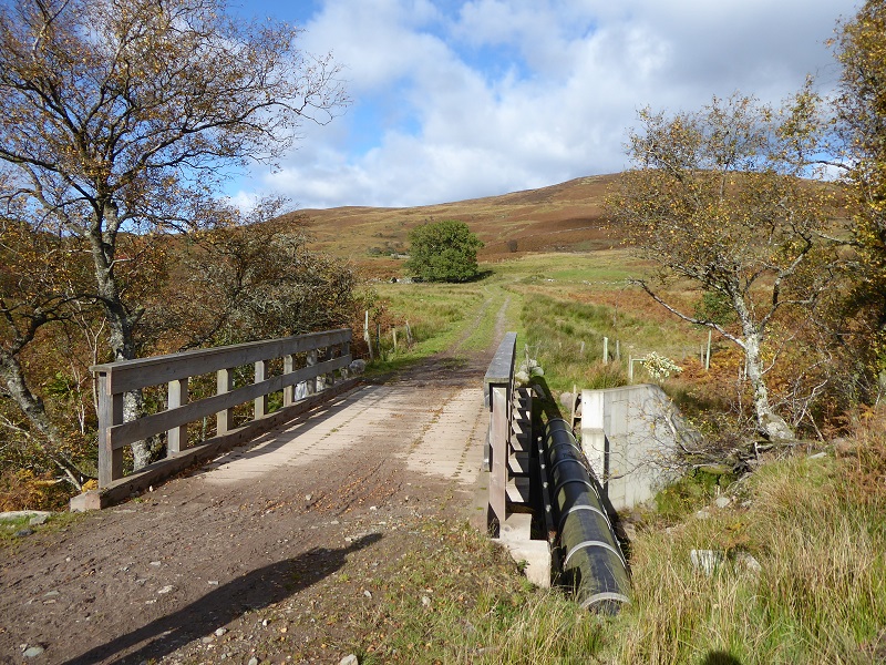
Just a little further up the pipeline has been located next to the bridge instead of beneath it as per the LLTNPA’s award winning guidance on renewables. Why?
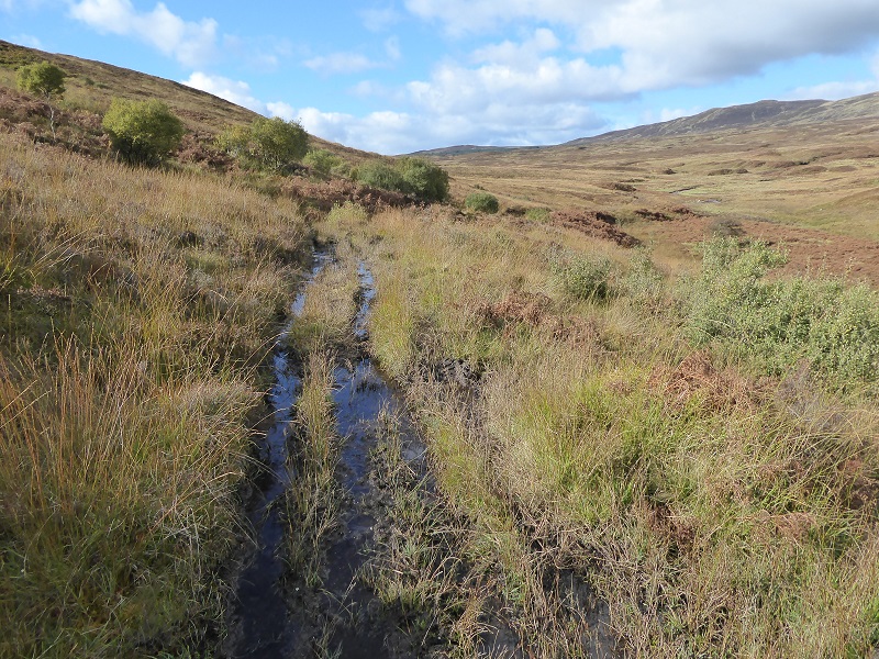
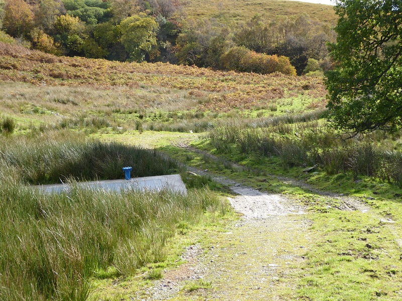 Then at the junction of the two intake pipes – we did not go to look at second intake which appears far less an issue – there was the seemingly inevitable protruding blue pipe. These are contrary to LLTNPA policy. One lower down had been painted green so why has this been allowed to remain?
Two of these photos show issues which could be fixed quite easily given the will. As a reader pointed out a couple of weeks ago, part of the problem is that the LLTNPA has NO quality control system. Until it does, its never going to enforce its own policies or ensure hydro developments meet the standards we should expect in National Parks.
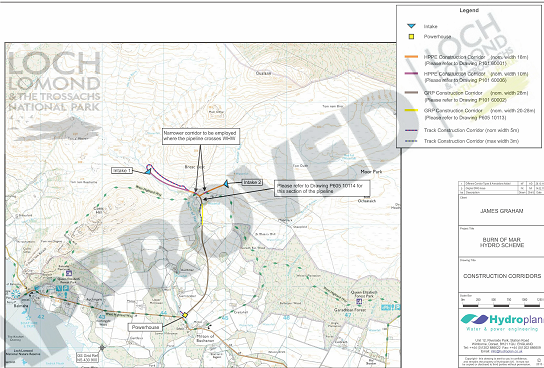
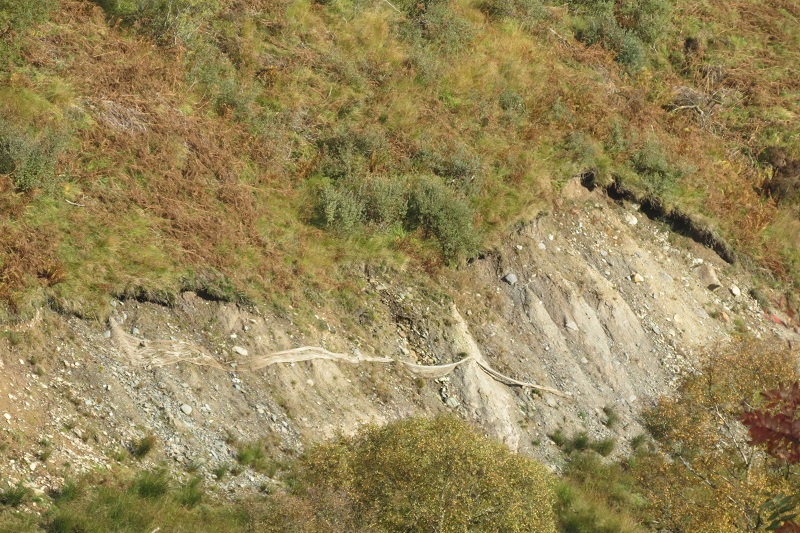
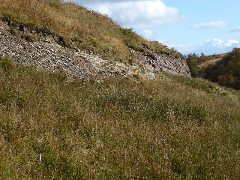
The major landscape impacts start after where the pipeline crosses the West Highland Way and the worst bits of this lie within the Loch Lomond National Scenic Area whose boundary follows the Burn of Mar until 800m or so below the intake where it turns north and takes in the top part of the pipeline and track.
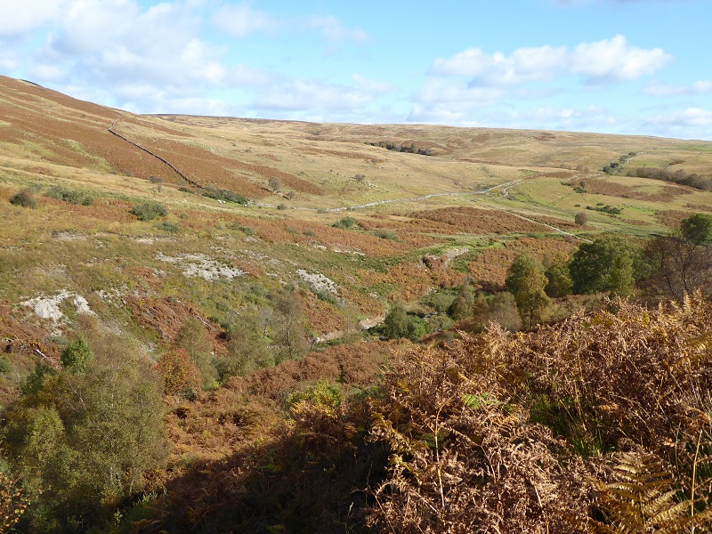
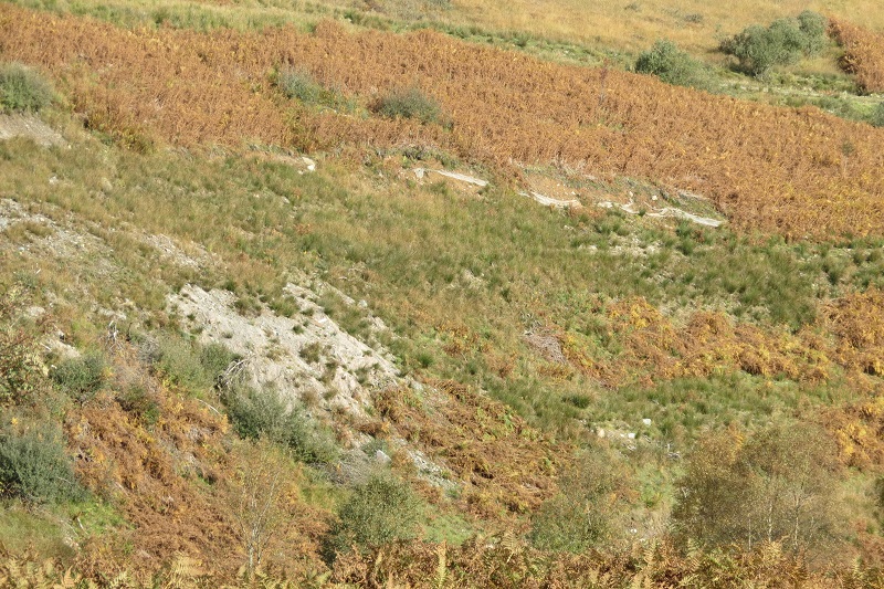
While the restoration of this part of the pipeline, which is highly visible from the West Highland Way as it rises from the Burn of Mar, is far worse than is usual in the Loch Lomond and Trossachs National Park, it could still be restored properly with a bit of care. The section above this, however, which is partly hidden from the West Highland Way but clearly visible from just below it, is another matter.
In the delegated report which approved the hydro scheme the landscape impacts were assessed as follows:
The main landscape and visual impacts will arise from tree removal (although partly compensated by new tree planting and regenerated woodland), intakes, pipebridge, powerhouse/tailrace and construction of tracks. The additional information submitted by the applicant (on 5th November) has provided clearer explanations of minimising overall footprint of the scheme and this will assist and aid monitoring of the development by the planning authority and an LCoW.(Landscape Clerk of Works),
No mention here of the pipeline – clearly, the LLTNPA has got this very very wrong.
Is this what Hydroplan claimed in the Planning Application claimed would be “integration of slopes into the adjoining landform”?
“In most cases and where cross slope is not steep, the corridor width will be kept to the minimum. Where tracks are to be cut into steep cross slopes or widening at corners is required, consideration will be given to widening the construction corridor to avoid side slopes that are too steep to allow soiling and re-establishment of vegetation and to allow integration of slopes into the adjoining landform.”
The original Construction method statement contained all the usual claims about how turf and soils would be separated and stored carefully to enable restoration. Either these were changed or not followed – its impossible to know because of the LLTNPA’s secretive approach to planning in which they try and cover up anything that goes wrong.
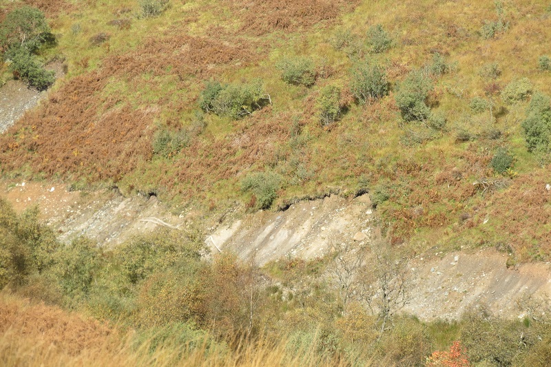
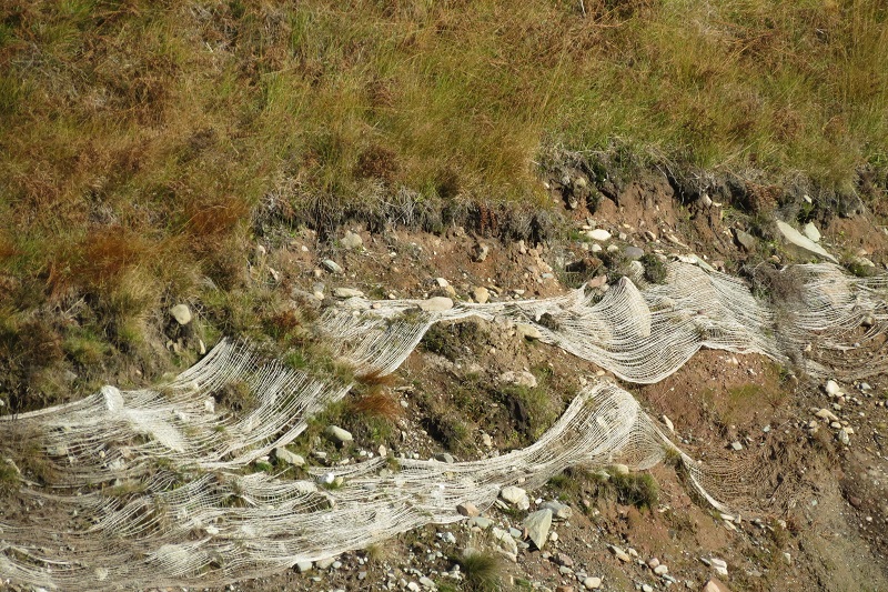
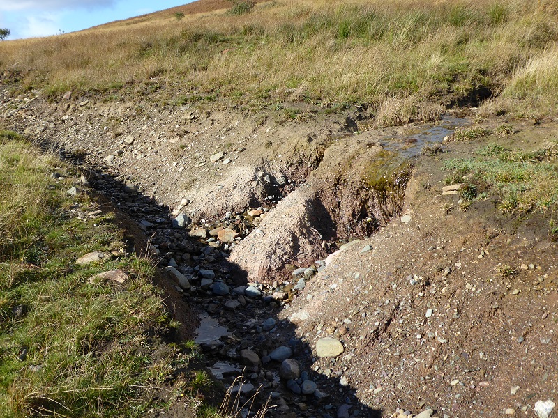
One possible explanation for the destruction here is instead of excavating a proper trench for the pipeline, it has only been partially buried and the developers have then scraped rock and glacial deposits from the hillside to bury it creating the scar. The fundamental thing that the LLTNPA should be determining in the planning process is whether hydro schemes can be created without any significant long-term landscape impacts. In my view, if this section of pipeline could not be constructed without creating bare damaged slopes, the LLTNPA should have refused or withdrawn planning consent. If the pipeline could have been constructed without causing this damage, the LLTNPA should have had systems in place to prevent this damage taking place and now to be taking enforcement action. Either way they have got it wrong and there needs to be an investigation.
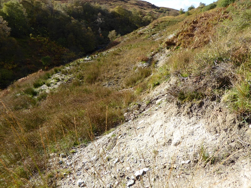
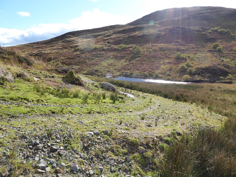
The intake and surrounding area
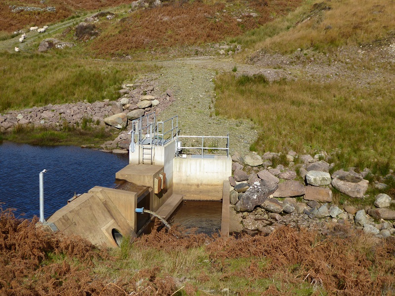
The area around the intake is as bad as the pipeline: large extents of rip rap bouldering which have been poorly landscaped (rip rap bouldering almost never appears in the design plans for intakes); unnecessarily large turning areas with unfinished sides; the extent of the bare concrete walls; and the bank denuded of vegetation (upper right).
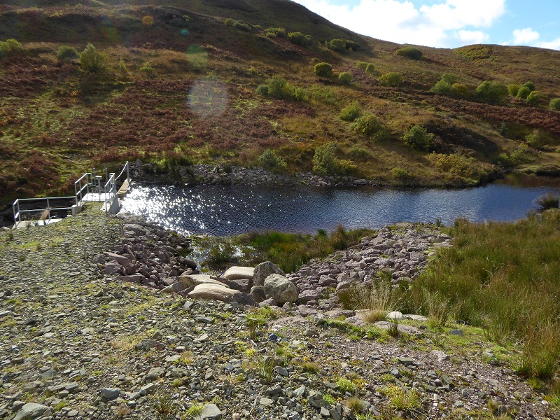
A good yardstick to measure the success of the restoration here is to compare the ground on the nearside of the intake with the land opposite.
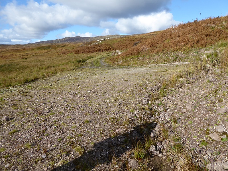
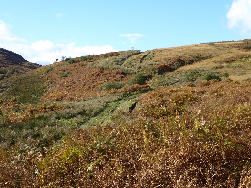
The new access track
The worst section of track is just above the intake where it curves up and round. Its too broad and fails to meet planning requirements. The finishing on the more or less horizontal section of track above which runs parallel to the pipeline and Burn of Mar is a lot better:
Back in 2013, the LLTNPA’s then Landscape Adviser is quoted in the delegated report as recommendingd that there should be NO new permanent access track above the West Highland Way:
The site is very highly sensitive in terms of Special Landscape Qualities, Landscape Character and value in terms of Landscape, Visitor and Recreational Experience. The value of the sequential views, in various directions to and from the WHW and Conic Hill are iconic. The building of high specification access tracks up to the intakes on the parallel ridged and open moorland would result in cumulative residual impacts and should therefore be questioned. On balance, therefore, LLTNP should object to the creation of permanent tracks at this site, north of the West Highland Way. The following alternative options should be considered by the applicant:
- Use helicopters to take materials to the intake site – this would result in a lack of necessity for engineered tracks and would help reduce working corridors;
- Completely remove any permanent tracks from the parallel ridge and open moorland locations down to the Kilandan Burn crossing, thus keeping intact the rural and less man made elements from the foreground of key views to and from the West Highland Way and Conic Hill.
The Planners rejected this excellent recommendation, in contravention of their own policy which is that tracks should be removed where possible, on the grounds that the estate had claimed:
- The lack of a permanent track to the intakes will result in the use of all-terrain vehicles or quad bikes being used for maintenance and cause multiple routes to be taken to the intakes, often damaging vegetation and creating a wider visual scar on the landscape.
- A permanent track would have additional estate benefits for farming and stock control.
What the photos above and the evidence on the ground show is that estate has still continued to drive ATVs all over the place, despite the new track. There are now in effect two tracks, not one. This rather begs the question of why the LLTNPA does not simply refuse all hydro applications where estates refuse to co-operate on use and abuse of ATVs instead of effectively been held to ransom in this way? Our National Parks could also, in their responses to the Planning Bill, have been calling for Planning Authorities to be given new powers to control use of vehicles off-road but said nothing. Unfortunately, our National Parks remain supine in the face of most landowners (the Planning Application shows the ownership boundary and James Graham appears to own the land on both sides of the burn).
What needs to happen
Had the West Highland Way taken a slightly lower line across Conic Hill, the Burn of Mar hydro scheme would have been in the national newspapers long ago – a national tourist disgrace. It remains however mostly out of sight and I can only assume most West Highland Way walkers are too intent on where they are going to go and take a closer look. At the end of the day though, however many people see scars such as these, they should not be acceptable anywhere in a National Park.
The LLTNPA Board are appointed to act as custodians of the landscape in the National Park and therefore should be under a duty to take a look at the destruction which is being carried under them, assess its extent and work out solutions. An open inquiry into what has gone wrong with the Burn of Mar Hydro scheme would be a start but, if the LLTNPA Board fail to act, then the Scottish Parliament should. The LLTNPA is, in its handling of hydro scheme planning applications, allowing the landscape provisions of the National Parks’ Act to be undermined. The case for a national inquiry into the LLTNPA’s mismanagement becomes ever stronger.

What a mess. First, “James Graham” may be my former feudal superior, The Duke of Montrose, and Vice-President of Loch Lomond Angling Improvement Assoc. But you will have to check that. Don’t blame me! Second, “no quality control” is not news. Previously, LLTNP provided for a “Sustainable Development” tick-box survey in the Local Plan. I asked about it and they said they didn’t use it and it was removed. You’d think an NP would be keen to promote a good idea like that. You’d be wrong. Third, the burn flows into the Endrick Water. That’s covered by the Endrick Water SAC for Atlantic Salmon, Management Plan. How much mismanagement and destruction of the spawning habitat has occurred I can’t say from here. It looks bombed out in the pictures. It’s more evidence that there is no “National Park” there. That is just a lie.