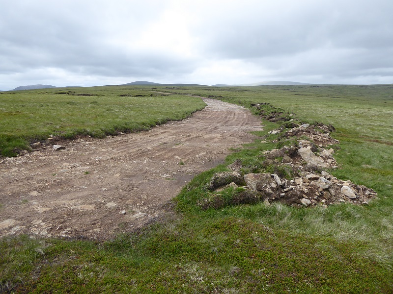
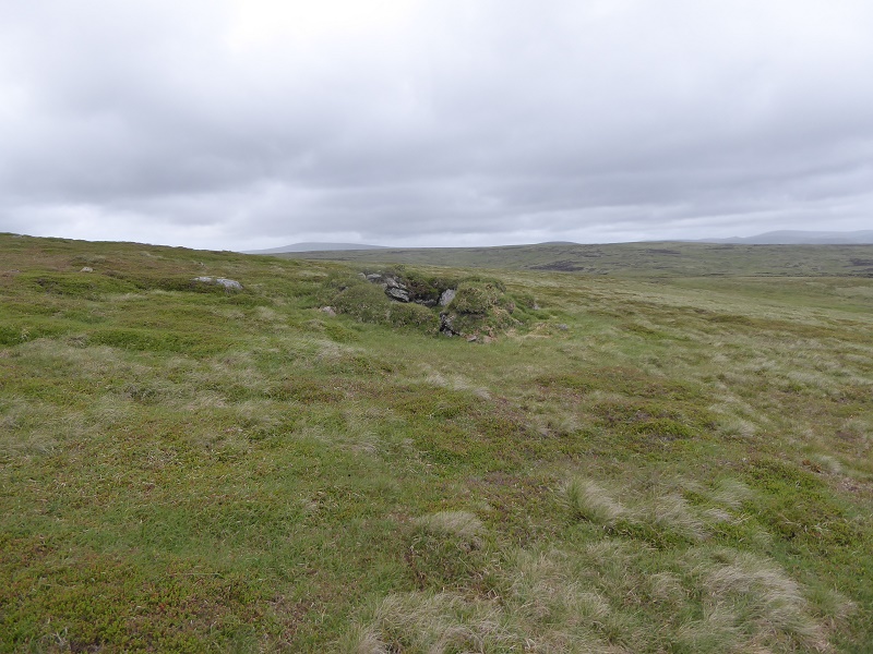
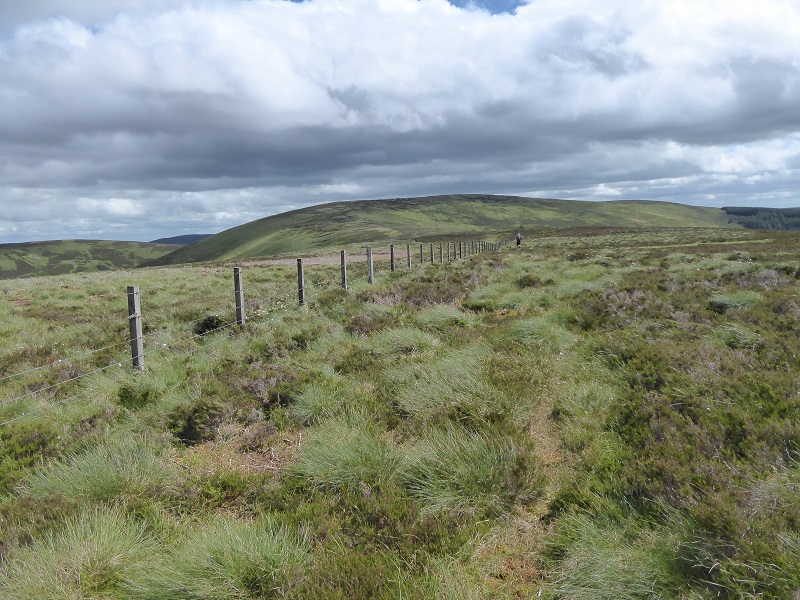
During a round of the Glen Prosen watershed 10 days ago, I came across a bulldozed track on the plateau at the head of the Glen which appears to be just inside the boundary of the Glen Isla Estate and therefore created by that estate. The lack of vegetation on the surface – on what is a relatively fertile soil – and the state of the turves which have been piled by the track suggest the track is relatively recent. There is nothing about this track on the Cairngorms National Park Authority planning portal and it therefore would appear to have been constructed without planning permission.
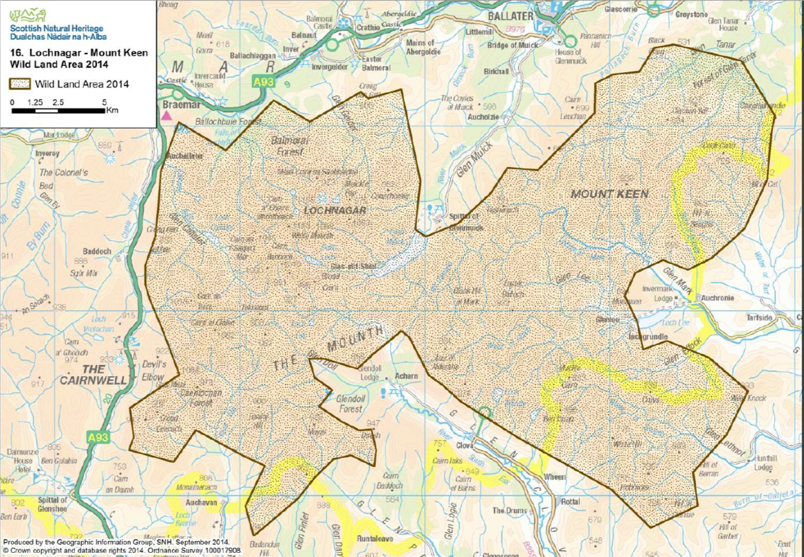
I had not realised when blogging about the Glen Clova and Glen Prosen hydro tracks (see here) that the head of Glen Prosen was within Wild Land Area 16 “Lochnagar and Mount Keen”. There is a presumption against development in wild land areas – even more reason, if more were needed, for the CNPA to taken enforcement action and ensure the “temporary” hydro access tracks are removed.
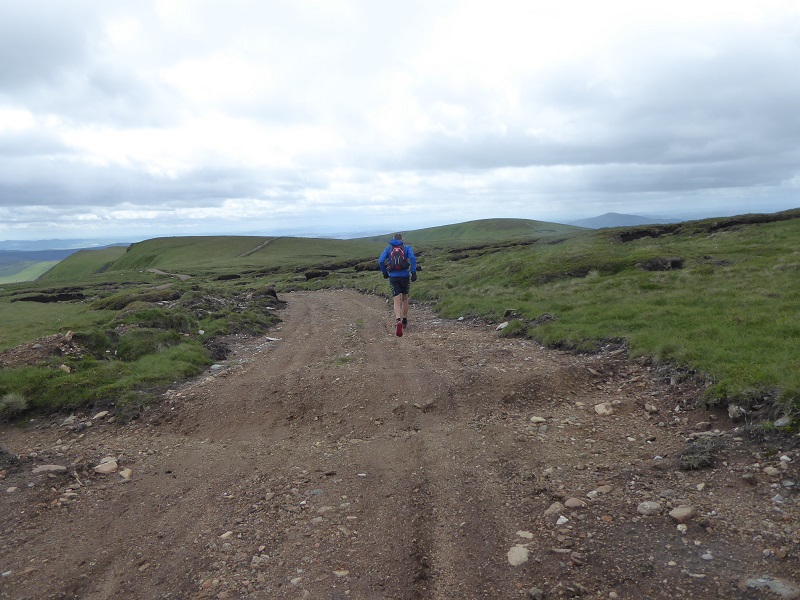
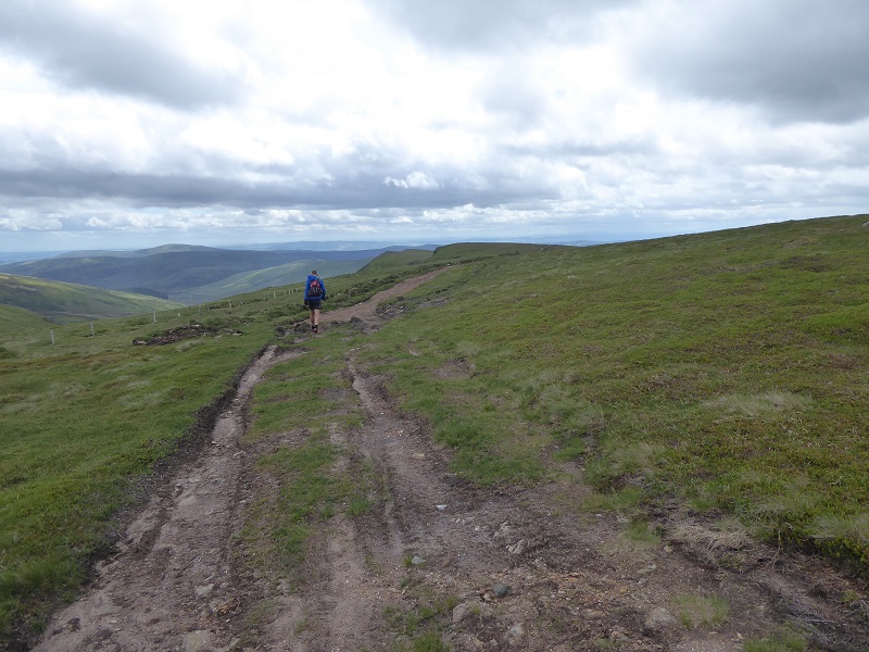
After crossing Driesh and Mayar, we met the track near the Mayar Burn. While I was tempted to follow the northern section towards Dun Hillocks and Finalty Hill, I was not sure my legs would take it (first longer run of the year!). It was difficult to see how far the track goes because of the rolling nature of the landscape here which is well described in the Wild Land Statement (see here) which was published last year:
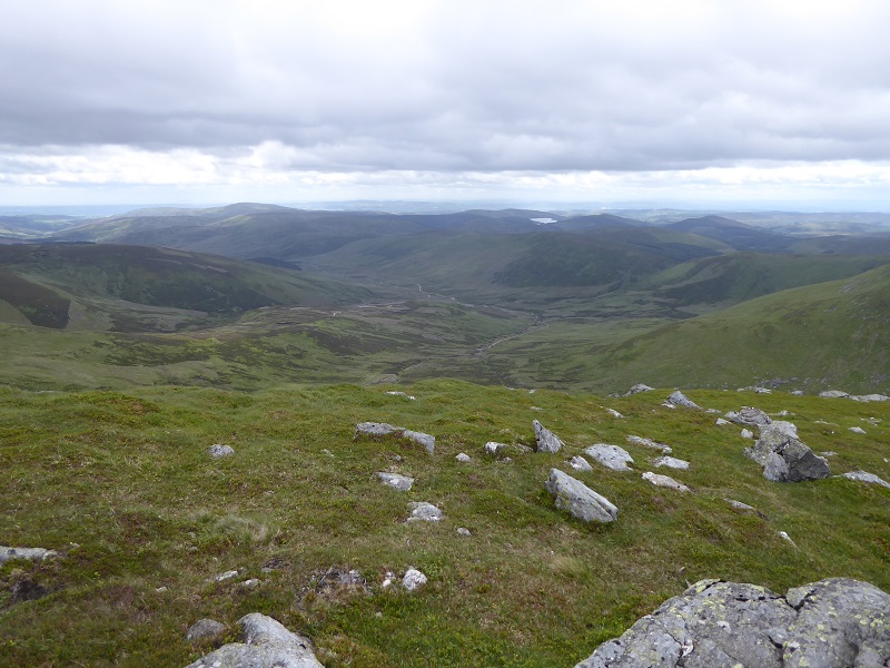
At a broad level, the landform tends to be convex, limiting visibility up and down slopes. This means that, from the hill tops, neighbouring glens are screened and there is a horizontal emphasis of open views directed over successive tiers of ridges and tops extending far into the distance and contributing to a sense of awe.
What is clear is that it penetrates well into the Wild Land area 16. I couldn’t tell either if it enters the Lochnagar and Deeside National Scenic Area, the boundary of which runs in a straight line between Mayar and Finalty Hill (any information on this, particularly photos, would be welcome).
The creation of the track has removed much of the challenge of navigating across what was a featureless area of plateau. If you have ever tried to walk between Tom Buidhe and Mayar in the mist you will know what I mean. This quality of the plateau, so important to adventure, is also well described in the Wild Land statement:
Despite a mixed composition of hills and undulations, the simplicity of the landform and land cover at a broad level means individual peaks do not tend to stand out and it can be difficult to estimate vertical scale or distance within the landscape. This makes navigation challenging upon the hills and plateaux, especially in low cloud, thus increasing risk.
Because its intermittent, although the constructed sections predominate, its possible that the track was not created all at once but over time.
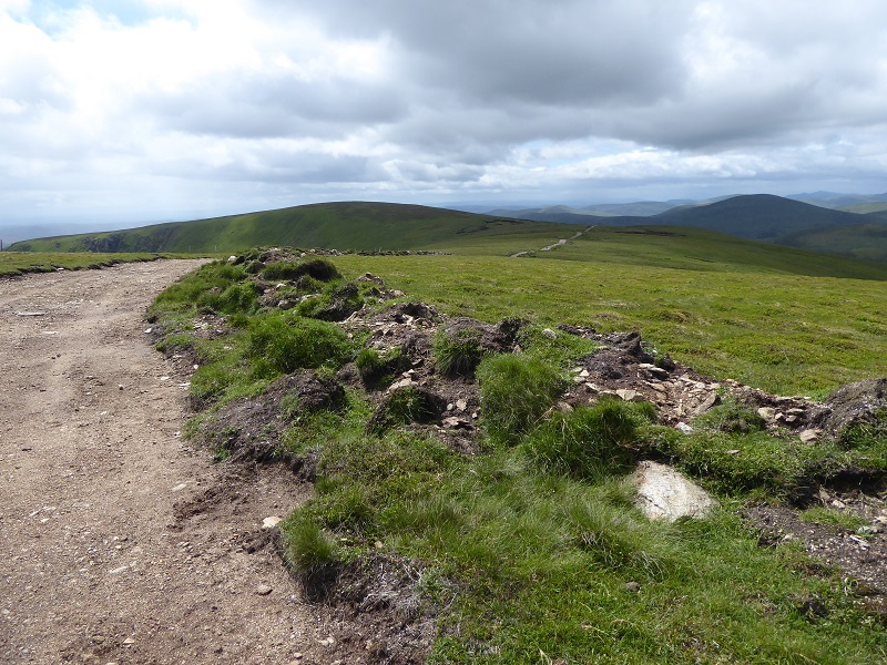 The track has been created by a digger scraping off the turf and dumping it by the side of the new track. The positive thing about this is it should make restoration of the track quite simple. All the estate would have to do is replace the turves and soil onto the bare surface.
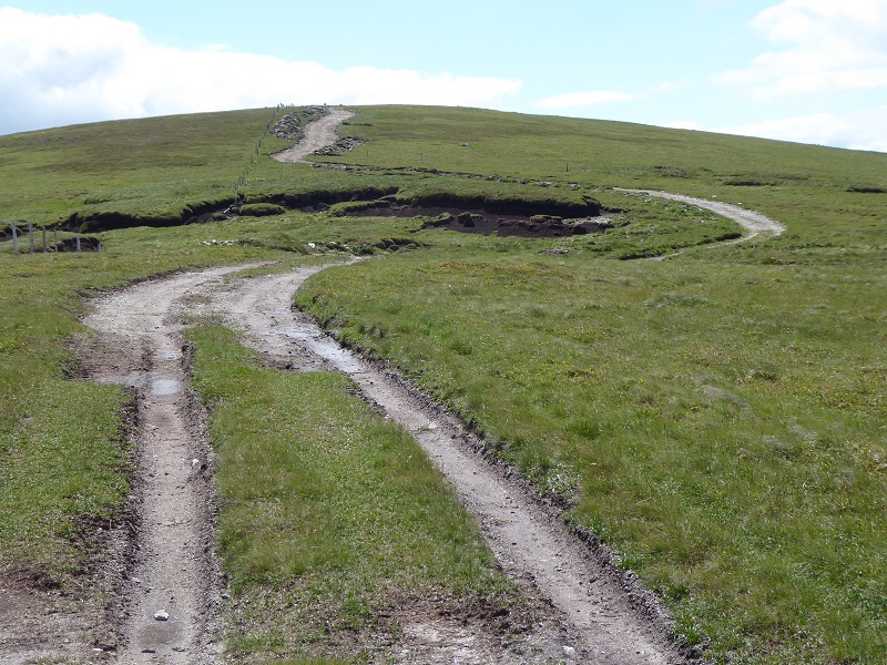
The older vehicle erosion shows that its not just constructed tracks which are the problem – its vehicle use. The CNPA should be addressing the issue of vehicular use on higher ground. A start would be to restrict the type of vehicles that can be used, ban heavier vehicles like landrovers and just allow quad bikes which are much lighter and, if used carefully, cause much less damage to vegetation. This could be done through the creation of conservation byelaws.
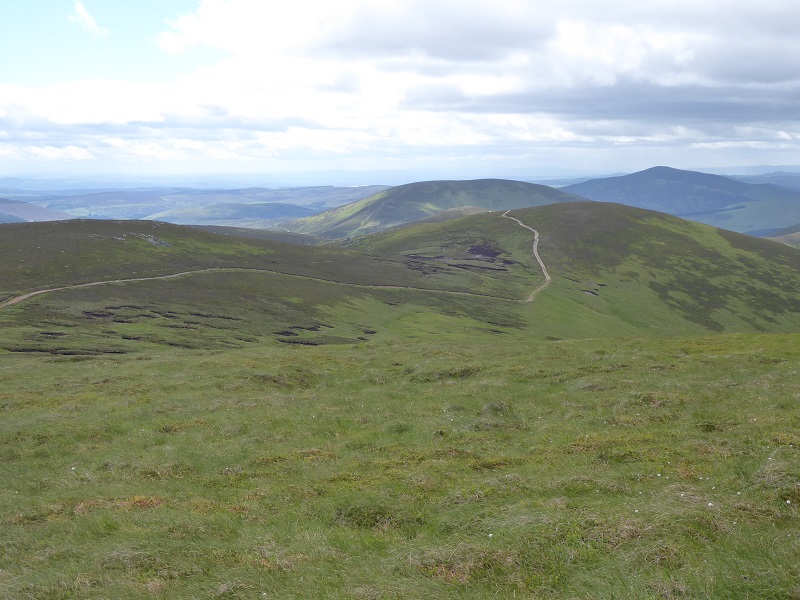
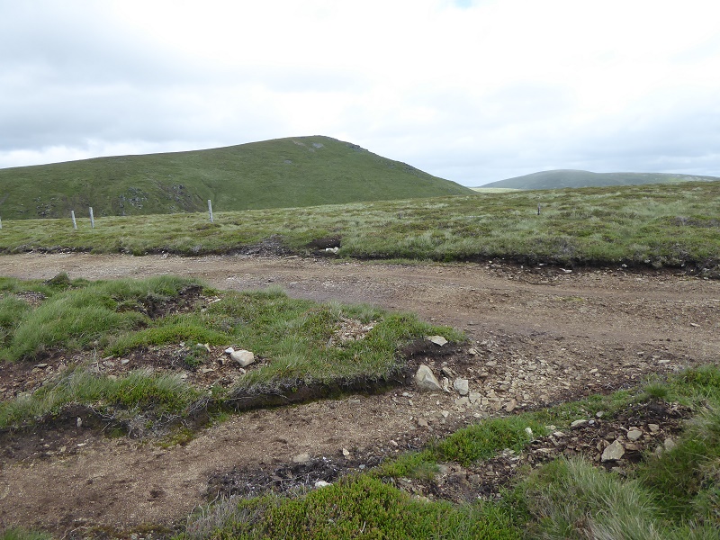
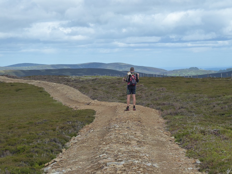
We didn’t follow the track over Mid Hill and so did not ascertain where it started (again photos would be welcome) but it appears most of it lies within the Cairngorms National Park boundary.
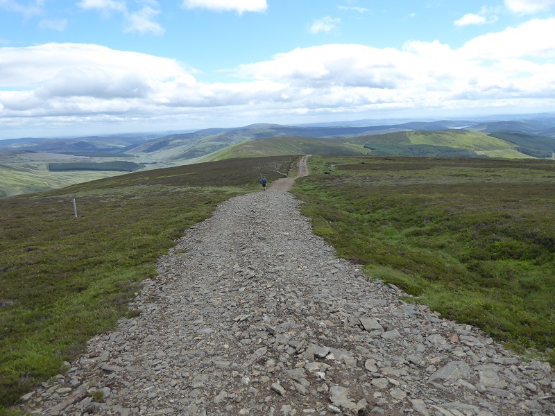
There is a short spur to the track down Broom Hill, which unlike other sections of track has been created by importing aggregate and dumping it on top of vegetation. This section of track will be much harder to restore.
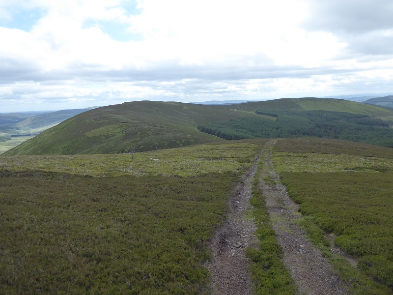
Had I not stopped to take photos, we would have made fast time from the Mayar Burn to the bealach with Craigie Thieves. After that, the going was much slower and although the hills were much lower, they provided a wilder experience even after we had crossed out of the National Park.
 Although there was a fence, the absence of track made a huge difference to the experience, altogether wilder and hard on the legs, and not just because I was forced to play the role of aged deerhound trying to keep within sight of my mate!
Until, that is, we came to this monstrosity on the Hill of Adenaich, well outside the CNPA boundary, and the responsibility of Angus Council to fix. Sadly, whether these tracks are created or not appears to have very little to do with the Planning Authority, its all determined by the landowner: most create tracks, some don’t. It would be good though if our National Parks became exemplars of good practice and the CNPA by its actions inspires Angus Council also to take action.
What needs to happen
I have reported the track featured here to the CNPA, asked them to confirm whether they were aware of it not and stated that it appears to have been constructed for sporting purposes and therefore should have required full planning permission. In my view the track should be removed. The CNPA in their new Partnership Plan, to their credit, have stated that there will be a presumption against new hill tracks within upland areas in the National Park. This one enters a Wild Land area to boot so there is every reason for them to take action. If the CNPA act fast, much of the damage could be restored quite quickly (because the turves removed to create the track are still usable) so I would urge them to do so.
Whether the Glen Isla estate, which straddles the National Park Boundary, will co-operate remains to be seen. While the Glen Isla estate appears on the CNPA map of estates which lie within the National Park (see here) there is no estate management plan. The CNPA initiative to get estates to publish management plans was a good one but has been ignored by many landowners. In my view the publication of management plans for all estates within the National Park should be compulsory and such plans should include maps of all existing tracks (and where they end) as well as a statement from each estate about what vehicles they use off track. This would it much easier for the CNPA to take enforcement action in cases like this.
I live in sight of the “monstrosity on the hill of Adenaich” (it’s not mine, and I don’t use it!) and reckon it is a considerable improvement on the old wheel tracks. But what does the opinion matter of those who struggle to make a living here and use to facilitate their work?