While looking at the Ledcharrie Hydro last Tuesday (see Sunday’s post), members of the Munro Society asked me whether I knew of any well-designed and executed hydro schemes in our National Parks which they could refer to comparison purposes. My immediate response was the Loch Gynack schemes at Kingussie. Asked why? The intakes have been well located and there is very little new access track but the real learning point is that construction methods have been far more sensitive than is normally the case in hydro schemes.
I have been been meaning to blog about them since visiting in February so thanks to the Munro Society for the prompt. There are three schemes on the River Gynack: I will consider the lower two here and the upper one in a further post. While the lower two are atypical, being small, located in woodland and being built on the sites of historic hydro schemes which had fallen into disuse, they still demonstrate.
Gynack Scheme 1 – Kingussie Community Development Company
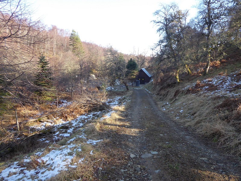
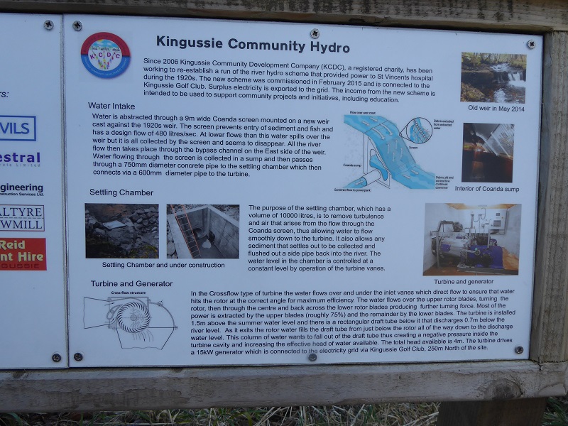 The Community Scheme is tiny, 15 KW, and I almost walked past it after parking by the golf club to walk up the river Gynack – a good sign. The idea behind the scheme was to raise money for the local community and it has been built on a section of river which previously was used to provide hydro electricity back in the 1920s, on land more recently gifted to the community for that purpose. Unlike many hydro planning applications, including the upper Gynack Schemes, the Community Development Company provided a full overview of the scheme in one document, including why an earlier scheme approved in 2011 for an Archimedes Screw had been abandoned (see here). It includes photos of how the area looked previously.
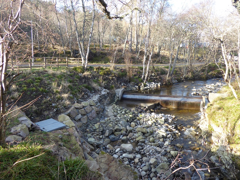
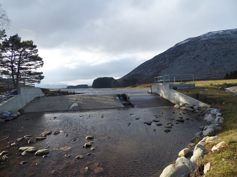
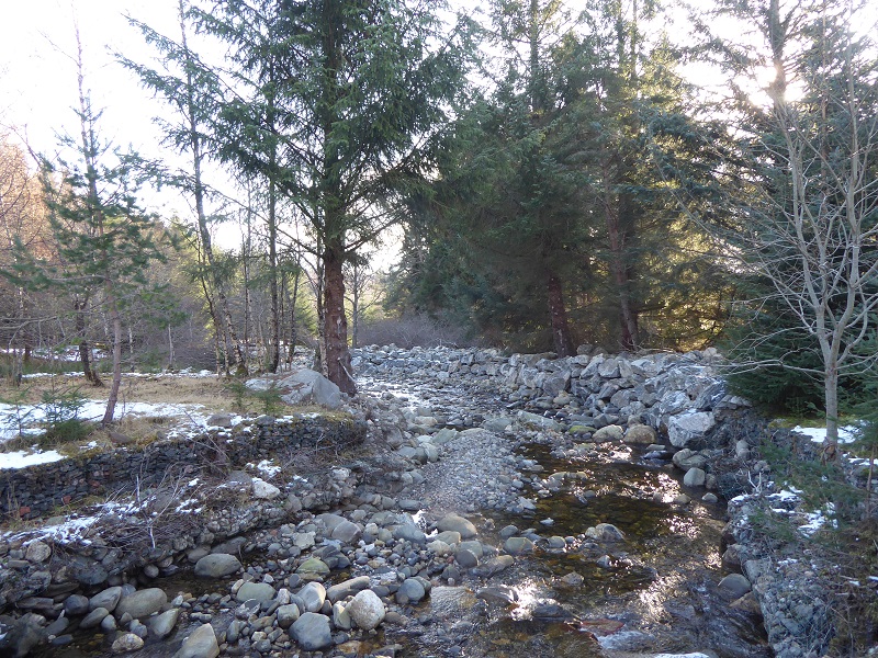
The intake weir has been constructed against the old 1920s intake. The key thing to note is its a true run of river scheme. There has been no significant damming of the river and as a result the intake structure has a very low profile, unlike many of the hydro intakes in the Loch Lomond and Trossachs National Park which have raised water levels and are taller structures as a consequence. There are still exposed section of concrete at the intake, but this is far less than usual and although they have not been faced with natural stone, the Cairngorms National Park Authority, to its credit did require:
“Details of the final finish of all concrete work which shall reflect the requirement to encourage natural weathering and colonisation by algae. (e.g. use of textured formwork) Details for any protective fencing, and railings.”
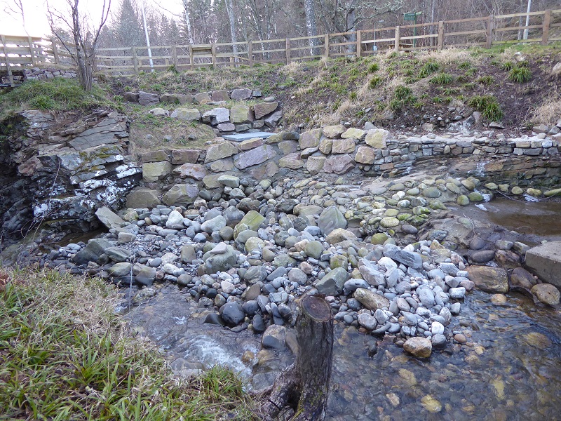
This is probably the worst view of the scheme but positive features include: the edge of the pipe where it exits the dam (top left) has been finished in stone; the work to stabilise the river bed below this has been done by embedding rounded boulders in concrete mirroring the loose boulders in the river bed; and vegetation has been replaced around the rip rap bouldering that has been used to reconstruct the bank.
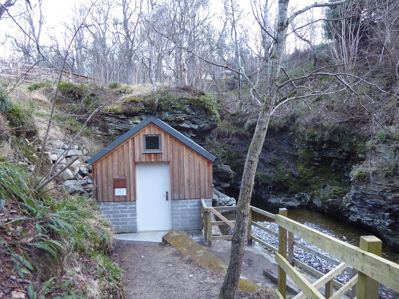
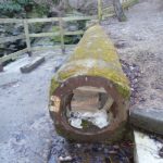
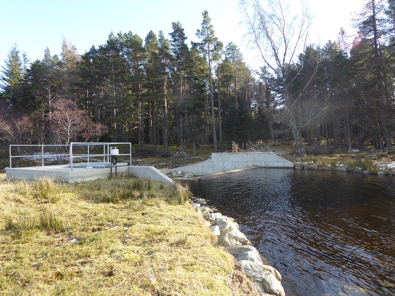
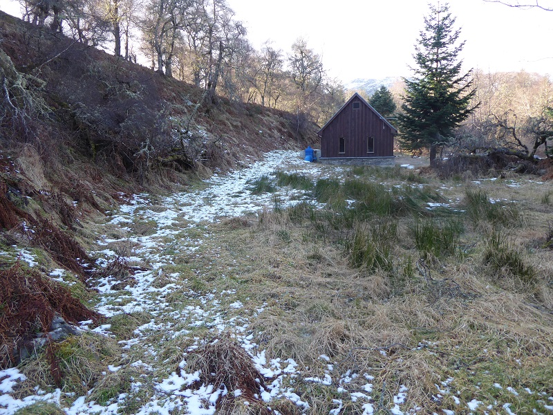
The power house has been constructed just 4m below the intake on a beautiful section of river by the former powerhouse (a remnant of the old pipe can be seen between the tree and powerhouse and there was a concrete base here previously). It is however tucked away and hard to see from above and the finishing, apart from the brick is good. The line of the pipe to the powerhouse is marked by the boulders on the bank on the left. In summer, when the trees are in full leaf, it would be even easier to miss.
Gynack Scheme 2
The mid-Gynack scheme has been constructed by the Pitmain Estate and runs from Loch Gynack to near the top of the golf course. Again its atypical because there was a scheme here constructed in the 1920s to provide electricity to the estate. Loch Gynack was dammed at that time and the old dam had fallen into disrepair and was leaking. The new dam has not raised water levels.
 The profile of the new dam is low, and hardly visible from any distance, but close up the finishing is not good, with concrete wing walls which would be better faced with natural stone and metal railings contrasting with the wooden railings used in the Community Hydro. Why cannot our National Parks enforce a consistent approach which maximises use of natural materials?
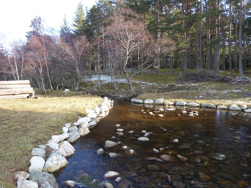
However, and this is a big positive, the use of rip rap bouldering is minimal and may even revegetate in due course. Even better, I had not checked the line of the buried pipe beforehand, but could not see where it went, a sign of very successful restoration.
Lower down, I believe the pipeline runs under the track, although its been done so well it I cannot say this with certainty. The track however has already blended into the landscape, unlike most of the tracks featured on parkswatch. Positive features include: the edges of the track are vegetated and there was no sign of spoil spilling down the bank on left; the track is narrow, forcing vehicles to keep to the same line; and as a consequence the centre of the track is revegetating. This track, while going nowhere (its a dead end) provides a good walking experience.
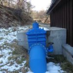
Another photo demonstrating how good the restoration of vegetation has been. The line of the buried pipe that leaves the powerhouse can be seen, mainly due to the lack of rushes, but there is no bare ground at all. The contractor must have saved all the turf removed to bury the pipe and has then replaced it. This is something very rarely seen in hydro developments where failure to store and re-use turves is usually all too evident. The whole is only marred by the blue penstock.
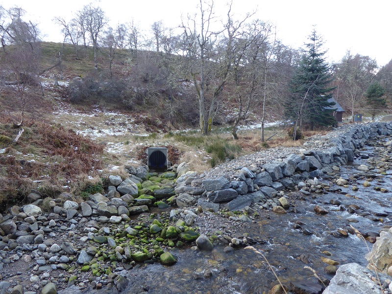
The tailrace has also been well finished and the concrete around the pipe is almost invisible while again the rip rap bouldering between the tailrace and the river has been kept to a minimum. The landscape and ecological issue here is not the hydro scheme, or how it has been constructed, but rather earlier attempts to engineer the River Gynack which can carry huge volumes of water and threatens Kingussie. As part of river engineering, a separate planning application has been approved to construct a flood overflow channel from higher up the river down into Loch Gynack which I will consider in a post on the Upper Gynack hydro scheme. Here, the consequence of the river engineering is to narrow what once would have served as a flood plain, and the construction of a powerhouse here reduces the likelihood that will ever be reversed.
Above the intake, the River Gynack has been extensively engineered and you can see older engineering attempts to contain the river left and newer right.
Lessons and differences between our National Parks
I will consider what our National Parks can learn from all three Gynack hydro schemes in my next post on the upper Gynack scheme.
Meantime, its worth reflecting that while the Cairngorms National Park Authority, unlike the Loch Lomond NPA, does not have specific planning guidance on renewable energy developments (and might therefore be seen to be behind the LLTNPA), its planning committee consider all hydro planning applications (unlike the LLTNPA which delegates these decisions to staff). I believe that this makes a big difference, particularly in areas where Board Members live, where they have to be able to explain and account for these schemes to local communities who, as in the Gynack Schemes, may walk by the hydro on a daily basis. Landowners know this too and are incentivised to follow the highest standards. By contrast the LLTNPA staff who have been delegated powers to decide most hydro schemes are remote from everyone who has an interest in them and are unaccountable. As a consequence their Supplementary Planning Guidance has been all too easy to ignore (as in Glen Falloch).
The CNPA has had hydro disasters of course, including Glen Bruar (see here) and Corriemulzie by Braemar. The Bruar scheme though in a sense reinforces the point because its so remote there is no local residents, apart from estate employees to care about it – this reinforces the need for our National Parks to include as Board Members outdoor recreationists and ecologists who care about what happens in wild land. Meanwhile at Corriemulzie (which I will cover in due course) the local community has recognised things have gone wrong (its a community hydro) and are co-operating with the CNPA to try and restore the damage.