The General Election and National Parks
Had this been been published when originally intended it would have been issued to subscribers at about the same time as the general election was announced yesterday! In the world of newspapers, radio and TV I guess the post would have been scrapped. I will persist! However, its worth saying first that the general election will provide an opportunity to consider why decisions at the UK still matter to Scotland’s National Parks, even though powers to create and manage National Parks belong to the Scottish Parliament.
For Scotland’s National Parks don’t exist in a vacuum but reflect wider changes and conflicts in society. Among the matters at stake in the General Election that will affect our National Parks are:
- wage levels (employment law is controlled by Westminster) – average wage levels in the Cairngorms National Park are below the Scottish average
- levels of public expenditure in our National Parks, which will be determined not just by any future UK Government’s commitment to “austerity” but what is proposed by the political parties proposals for rural expenditure post-Brexit
- ownership of land through complex legal and financial vehicles (which are ultimately aimed at avoiding not just tax but other legislation such as the community right to buy
All these things ultimately impact on our landscape, wildlife and ability to enjoy them. Meantime though, a little more evidence of what appears on the ground.
Ardvorlich estate hydro scheme
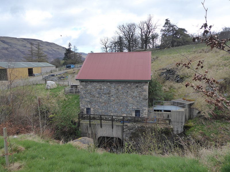
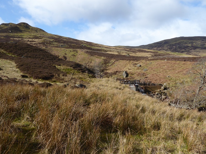
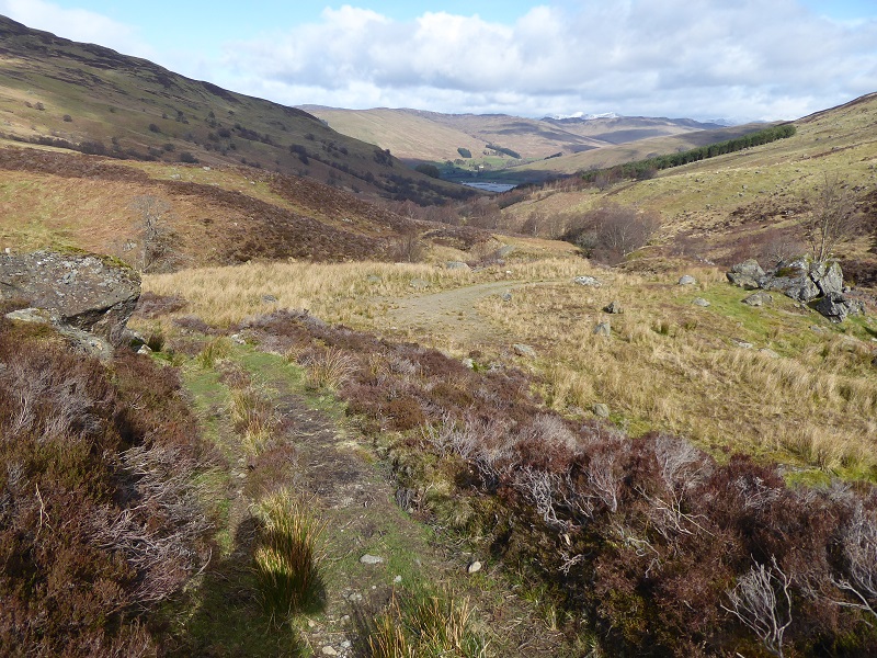
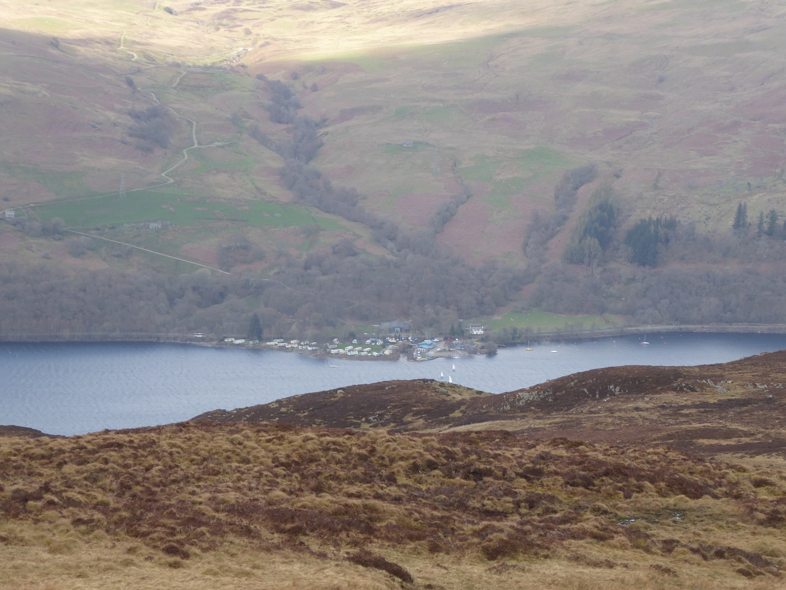
Following my post on the Keltie Water hydro scheme (see here), I was up on the north side of Ben Vorlich and Stuc a Chroin at the weekend (about which more anon) and took the opportunity to have a look at the Ardvorlich hydro scheme. I returned home to find that Jim Robertson of the Munro Society had sent parkswatch photos of the Tarken Glen hydro on the north side of Loch Earn. Both are featured here and, while there are many positive aspects to the way both schemes have been designed and executed, both raise issues about how successfully the Loch Lomond and Trossachs National Park Authority is protecting the landscape.
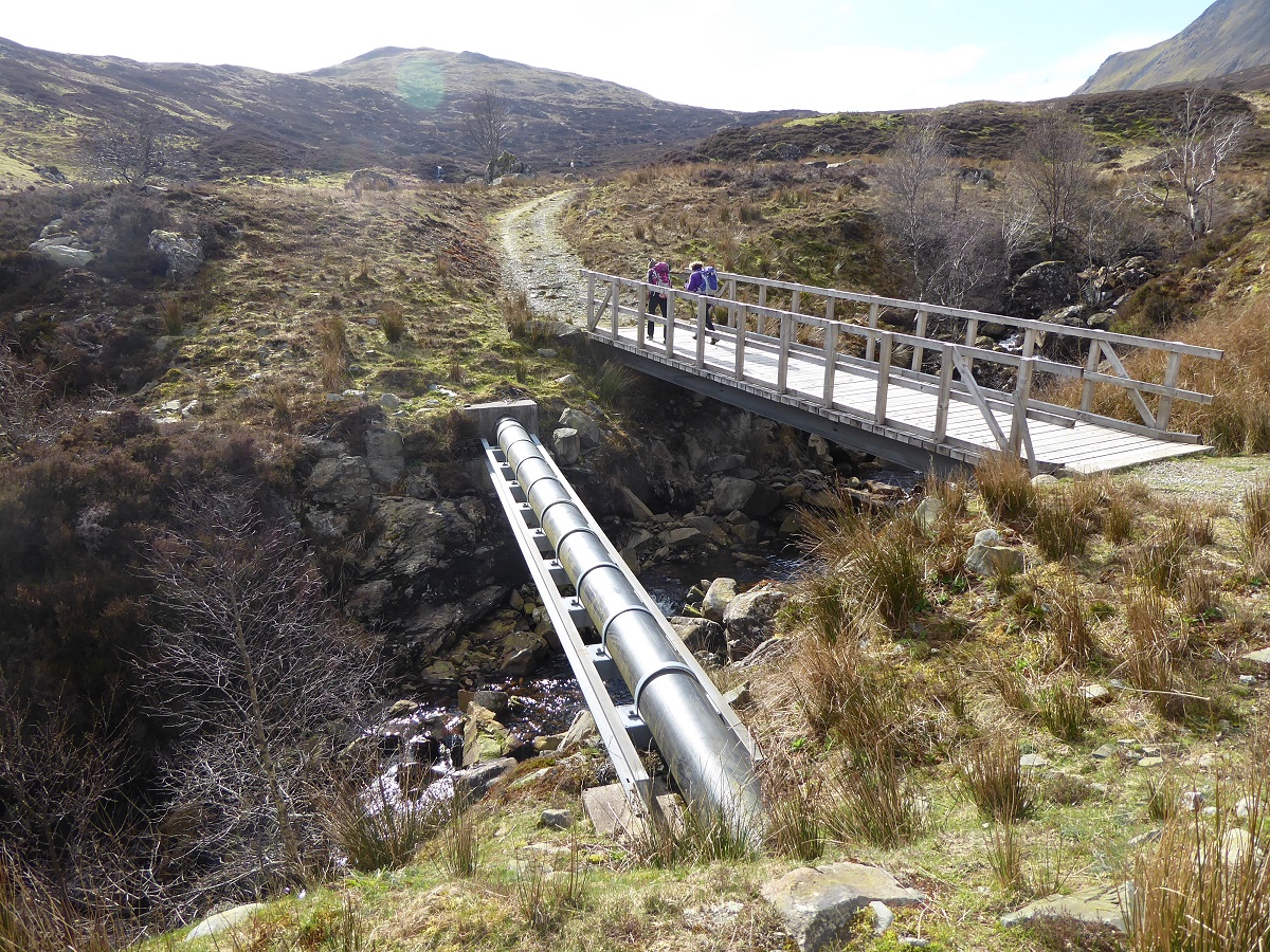
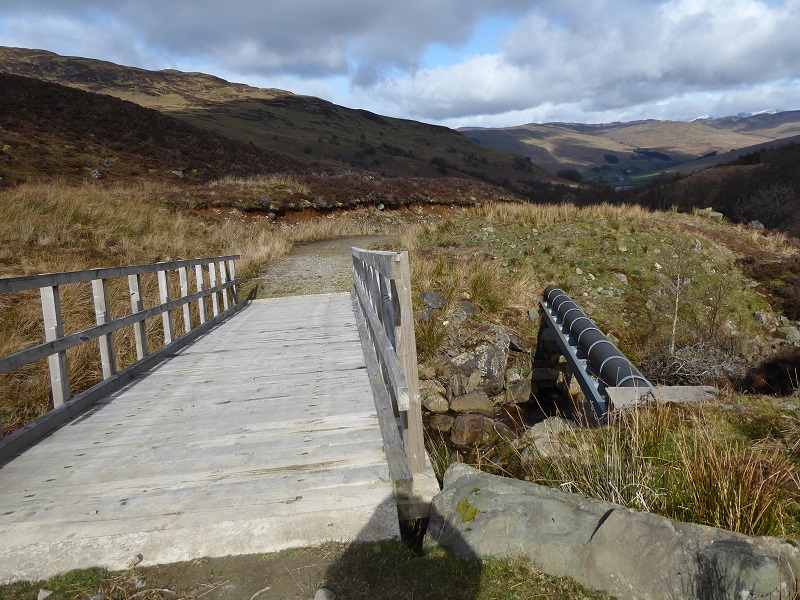
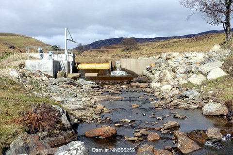
The Ardvorlich hydro was granted planning permission back in 2009, before the LLTNPA published its guidance stating that pipes should wherever possible be placed under bridges and the only paper currently on the planning portal is the decision notice (see here) . Its not possible therefore to what what consideration was given to this pipe across the burn which in my view is the single worst aspect of scheme. It should not have been so difficult to align the pipe with the bridge and track so the pipe was concealed by the bridge as at Keltie Water.
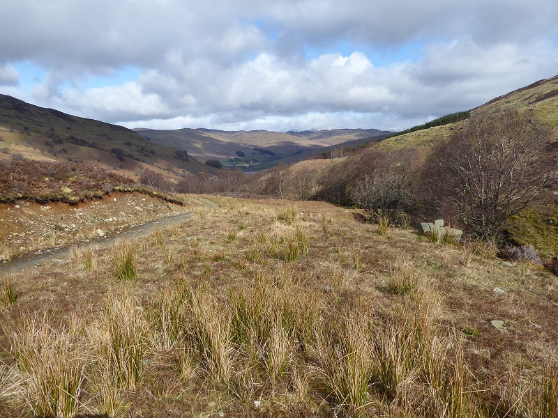
The biggest landscape impact is not where pipe runs underground – the ground above the buried pipe is recovering well – but the steep edge of the track – too steep to regenerate naturally and which is likely to continue eroding for years.
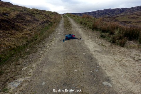
Same view from closer up: a few years and I suspect it will be very difficult, even for vegetation experts, to detect line of the pipeline, quite a contrast to the permanent landscape scar created by the track. According to my old OS Map, dating from 1988, at that time there was just a path up the west side of the burn. Now there is a vehicle track on both sides.
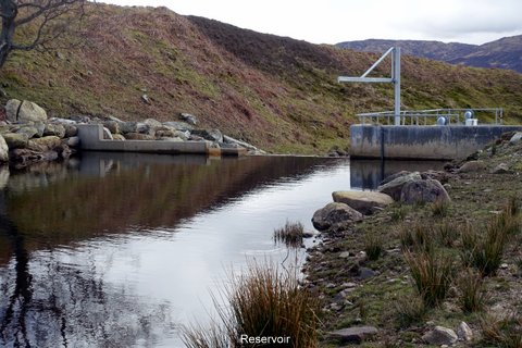
There are two intake to the hydro scheme. The main visual impact of the western intake is the concrete on left side of dam which has not been faced with natural materials. The concrete on the right side appears to have coloured due to water flowing over it regularly so it blends better into the landscape The wooden safety fence is also unobtrusive and fits in Park’s subsequent policy to use natural materials, such as wood for fencing.
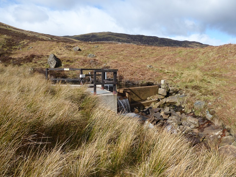
Closer up the main visual impact of the dam remains the grey/white concrete. If our National Parks and other planning authorities required intake structures to be finished in stone, except where likely to be stained by water, their visual impact would reduce considerably. The cost of this would be minimal and it could reduce carbon imprints.
In the past natural stone was used a lot more (see photo below) as it was less easy to import materials and people consequently used whatever was to hand.
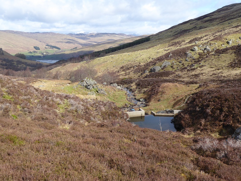
The visual impact of the dam is also reduced because the track does not go right up to the dam, as in most later developments in the Park. There is nothing to draw your eye to it and as a result many people walking up the track probably miss it.
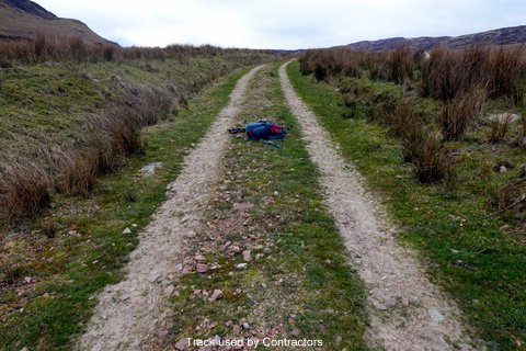
The formal track also ends short of the eastern intake (to right of view in photo) although an ATV eroded track continues up the glen (in place of the old path). What is good about this track is that there is no large turning area which is so common with so many other hydro tracks.
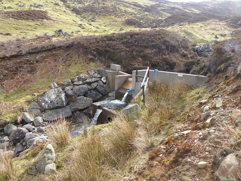
The second intake is closer to the track than the first and more intrusive. While the lower concrete has stained there is a much greater expanse of light grey concrete retaining wall, which is made even more obvious by the Lomond blue piping. Added to this there rip-rap boulder embankment on the far side of the burn and the excavation of the banks on either side of the burn where vegetation has not recovered (its too steep, just like the bank of the track below the bridge). The design of this intake could, in my view, have been considerable improved and the impact on the landscape reduced.
Still, its a small scheme and within the landscape as a whole the impact is not great. In many places this would be judged a good scheme but it still falls short of what I believe we should expect in our National Parks. Its not the location of the scheme that should cause concern, its the execution.
Tarken Glen hydro scheme
The border of the Loch Lomond and Trossachs National Park runs just north of Loch Earn and only the lower part of Tarken Glen, by St Fillans, lies within it. The papers on the LLTNPA planning portal show that LLTNPA staff, in deciding this scheme, worked closely with Perth and Kinross Council.
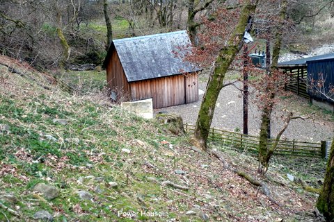
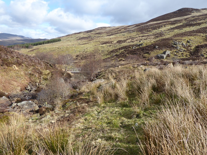
Within the National Park there is a small section of new track to the powerhouse, the powerhouse itself and a very short area of open pipeline behind the powerhouse. This is well concealed and not possible to see from Jim’s photos.
While the intake is outwith the National Park, it is fairly typical of those found within our National Parks, being constructed out of white/grey concrete partially concealed by rip rap tendering. The gantry adds to the visual impact although viewers will note the piping is not bright “Lomond” blue. The location of this dam in a wide open glen makes it more visible than those at Ardvorlich.
The rip-rap bouldering looks as artificial as the concrete dam.
An existing track was used for construction purposes and, because the size of the scheme was relatively small, it appears the track did not require extensive upgrading. Vegetation appears to be recovering well which will give it a more “natural” feel for walkers.
 The track demonstrates what a track looks like from close up where there is a central vegetated strip – as advocated in the LLTNPA’s Best Practice Guidance.
The photo demonstrates once again that the main impact of hydro schemes is not the pipeline, where these are buried, but the access tracks. While in this case the track was already in place, where tracks cut across the grain of the landscape, as in the middle ground of this photos where the track goes diagonally uphill, they are particularly prominent. While the LLTNPA did refer to the visual impact of the scheme from the South Loch Earn road, it made no recommendations about what might be done to mitigate the impact of what can be seen from the National Park.
The Tarken Glen track though is not nearly as bad as the new track (above) you can see from the summit of Meall Rheamhar in Gleann Ghoinean which again lies outwith the National Park boundary to the south.
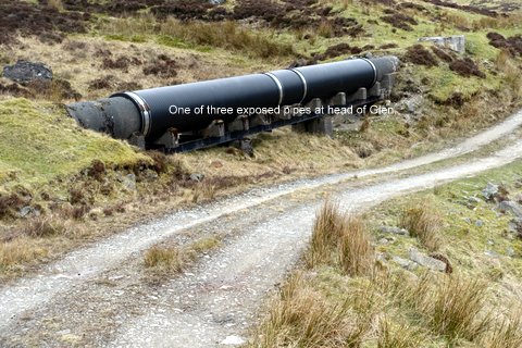
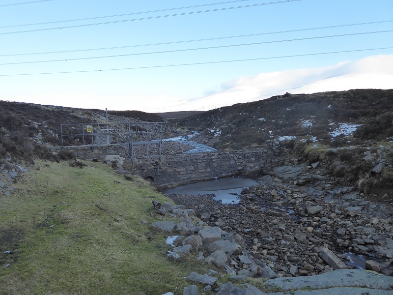
There is a much older hydro scheme at the head of Glen Tarken – part of the extensive Breadalbane hydro scheme – which demonstrates that at least in respect of pipelines, some progress has been made.
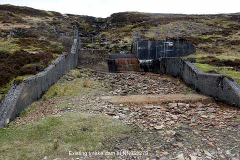
Jim’s photo though raises questions about how much progress has been made in reducing the impact of dams and hydro intakes. In this case, the intake diverts all the normal flow of the burn, which will only flow in spate conditions, whereas intakes are always designed nowadays, due to greater awareness of hydrology and the framework of water catchment plans, to maintain some flow. Are the concrete embankments of the existing hydro intake though any worse than the rip rap tendering shown in Jim’s second photo of the new scheme?

The photos also demonstrate just how long it takes for concrete retaining walls to be colonised by mosses and lichens and to start blending into the landscape. A good reason why theLLTNPA needs to enforce its guidance that concrete dam structures should wherever possible be faced with natural materials.
Parkswatch covers our two National Parks. The Munro Society is trying to survey the impact of hydro schemes across Scotland (see here) as part of its work on measuring change in our hills. This is incredibly important work because it will provide evidence of the impact of hydro developments in mountain areas on the landscape across Scotland. Parkswatch has agreed to share with the Munro Society photographic evidence of hydro schemes gathered within in our National Parks – so if you have photos please send them as Jim and others have done – but if you have photos from outwith the National Parks, do please contact the Munro Society directly (see here) and let them know what you might be able to share with them.
The LINK hill tracks group is doing similar work on hill tracks and also collects photographic evidence of their impact across Scotland and you can submit photos online (see here) .